I heard recently, a piece on the BBC about a pilgrimage taking place annually in Norway, honoring St. Olaf. A local guide opined that in these times of great troubles all over the world, people need the focus and solitude of a pilgrimage. It brings life down to just the quest, as he put it, the getting up each morning, the food to acquire, the travel toward the destination, a place to sleep each night…nothing else intrudes into the small world such a journey creates for oneself.
South Africa
I can see the pull for this type of trip, the inner need it satisfies. It is, at its core, what I am doing with motorcycles and have often done for six decades in the past, either alone or in the company of one or two companions. Unlike a pilgrimage, though, I travel for its own sake, not the end point.
England
The urge to travel is strong in some of us, nearly absent in others, probably spread across the population on the traditional “bell-shaped curve” that describes the distribution of nearly all animal characteristics within species. I’m in the right-hand side of the median, probably nearer to where the curve starts dropping down to the small percentage numbers, but certainly not out there where it almost touches the horizontal line. Those people out there start on a trip and just keep going, without end.
New Zealand
“The Journey is the Destination” is a popular meme, and t-shirt slogan and unlike many of those, it is the truth. Many times on the road, people ask me where I’m going, wanting to fit my experience into a common idea of a trip being going to get to a place. I travel on these trips to travel, to move, and if I have a destination it is often more of a parameter than a fixed location. How far can I get with the time and resources I have available ?
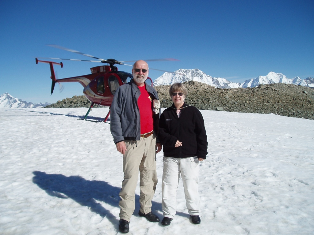
Beartooth Pass
I want to be in the moment, experiencing the sensations offered by a motorcycle moving through space with the kind of motion only that vehicle can offer when one is tethered to the ground. The banking turns, the thousand decisions per mile on a curvy road, the smells, the feeling of the air, the humidity, the heat and cold and always, at some point, the rain. Even that event has its pleasures. The reduced visibility, the slipperiness of wet pavement, the heightened attention one must pay to every variable, all bring a satisfaction when completed successfully.
Nova Scotia
I am a believer in the concept that one should be uncomfortable sometimes to know what a wonderful thing it is to not be.
I am in some ways like a dog I once had, a mix of border collie and probably lab, who when confronted with a pond or creek had to jump in the water and then immediately was horrified at being wet. I want to be constantly on a motorcycle trip, one without end, but I also like being home with family in my familiar comfortable surroundings.
Czechoslovakia
I have traveled by motorcycles, far and wide in my home country and across a fair bit of the world, for much of my long life and in all of those trips I have never found myself wanting one to end. But at the same time, I know it must end and there must be a return to family and home, so there is the point when the pull that way becomes strong, like that dog being drawn to the water in a way she couldn’t resist. And, of course when I’m home, I want to be on a trip. I am able to understand that feeling in ways the dog probably could not, so I know I have to co-exist with the irreconcilable dichotomy inside. Even an endless journey would have compromises to be made, like everything else in the reality of life. Experiences, of all sorts, are what matters, with all the complicated feelings they contain.
One of the many good things about retirement, offsetting somewhat the “getting old” bit, is the ability to get up and go for a ride for a day or two or more when the opportunity presents itself.
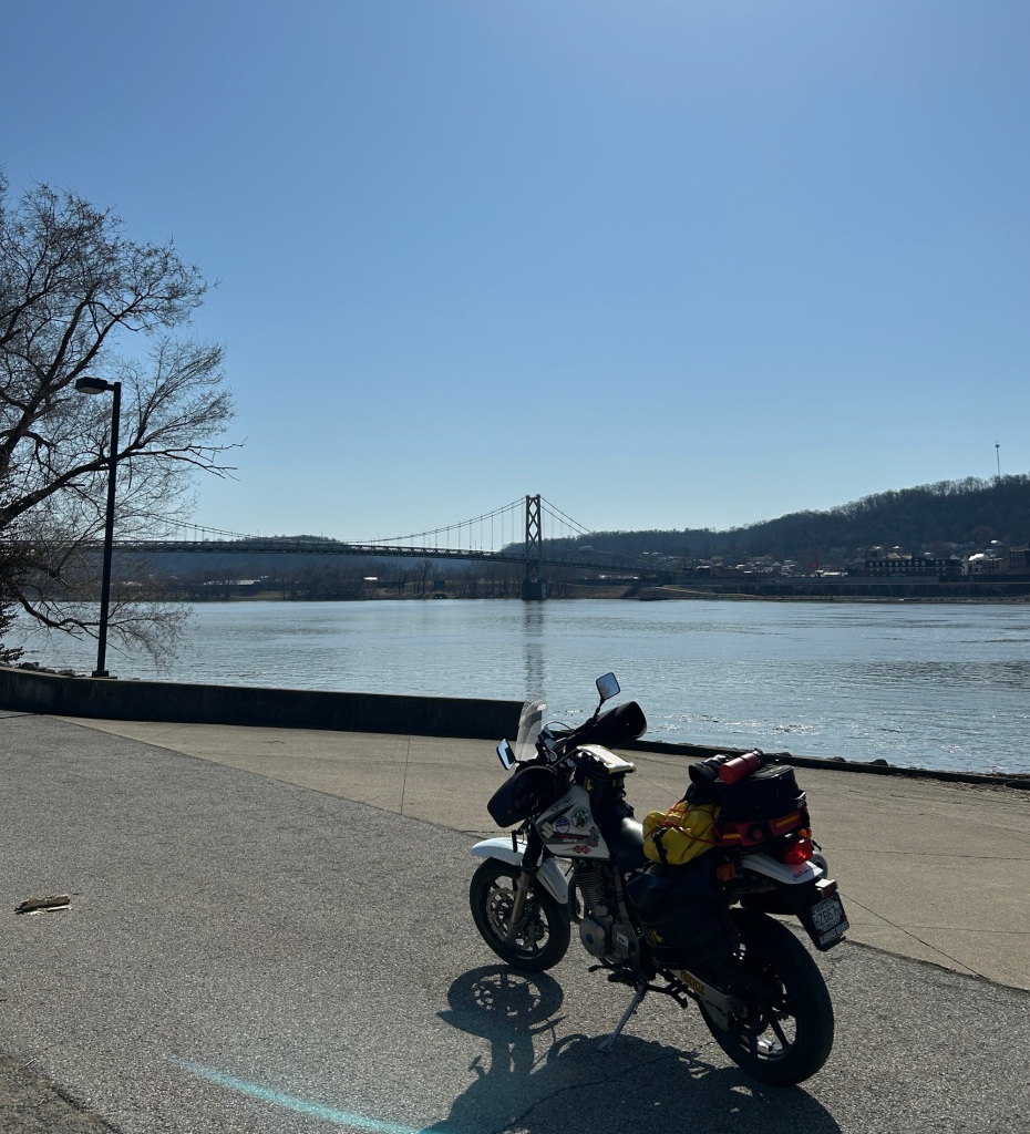
In late February an oncoming storm pushed ahead of itself two relatively warm, sunny days on a Sunday and Monday. I threw a few things in a bag, strapped it on the DR650 and headed north.
In my youth when I was riding in Observed Trials competitions, I often had taken Rt. 125 across southern Ohio to get to events. I recalled saying then that this would be a good road for a street motorcycle so now, long, long past any youth and competitive endeavors, I decided to go have another look. I got out my DeLorme map book and saw a number of little white line roads branching off the main route which looked inviting for some exploration.
Rt. 52 out of Aberdeen follows closely along the Ohio River, always a good thing to do as one can see the leftovers of history in the little towns that once were important parts of the river traffic. Observing such a large river, steadily flowing south, is a calming sort of influence. It touches some part of our atavistic self, the deep down evolutionary piece that led humans to find and follow waterways.
Turning off of 52 onto 125 at Friendship brought back memories of being in a derelict old Chevy van with my trials bike next to the bed in back, trundling down this road in the pre-dawn hours to be at the starting line of an event a hundred or more miles away, the smell of chain oil, gasoline, mingling with fast-food egg sandwiches and coffee. Then I would be coming back this way, in the dark evening hours, worn out and happy, sometimes with a trophy, sometimes with a broken bike and a new collection of bruises to watch the next week as they went through their color spectrum. I seldom ever saw this road in daylight.
It winds through the hills following sometimes the curvature of creeks, curving this way and that often with blind hills that conceal which direction one might need to go at the crest. There is mud on the road in places, courtesy of tractors and trucks getting in and out of soaked fields, some gravel in curves washed out of driveways and once in a while a farmer’s dog challenging the motorcycle for territorial rights. And some chickens, at one farm, who seemed to feel the centerline of the road was a good spot for a congregation, clucking angrily as they ran off when the bike appeared.
Being Sunday in the rural countryside, I found no restaurants open for lunch. At 2 PM, I turned in at the Blue Creek General Store and found an oasis. Inside this nondescript building is everything one could need…groceries, plumbing supplies (I mean to build a system, not just to unclog a toilet), electrical equipment and tools, hardware, alcohol (leaning toward the sweeter wines and flavored whiskeys and one shelf of “Sweet Tea Whiskey”. There were cases of knives of various descriptions ranging from pocket models to sheath knives with blades bordering on being swords. If Jim Bowie had owned one or two of these, that whole Alamo thing might have turned out differently. One could buy medical supplies, candy, gasoline, propane….you name it. And there was a deli which served up for me a truly delicious fried egg and cheese biscuit which far outstripped those we used to eat in the van.
Blue Creek General Store
I explored some side roads, a few that ended up in mud, others that had just enough asphalt here and there to qualify as “paved”, but only just. By 3:30 or so, I knew I needed to be finding someplace to stay for the night and there didn’t seem to be any such establishments out here in the woods, so I headed first for Hillsboro, but found none to my liking, and then on to Washington Court House where I’m typing this now.
The last time I stayed the night in this town, I was 18 years old, sleeping in the front seat of an overloaded pickup truck with one wheel detached from its hub. That is a whole ‘nother story.
Monday, February 26
A slow morning, engendered by overeating last night at supper. There was a restaurant, 62 Street, a few blocks from my motel, with a decent dark draft beer selection and a special of pasta carbonara. When the huge bowl of steaming noodles and creamy goodies arrived, I said to myself that I would only eat half. As often happens, though, I didn’t listen to me and finished every delicious bite and a salad bar helping to boot. At 75 years of age, one would think that experience would have me expecting a restless night, but even now, hope springs eternal in the face of overwhelming evidence to the contrary.
On the road in bright sunshine, the thermometer climbing steadily to the 60’s, I come quickly out of my vest and liners and heavy gloves. The sensation of lightness is wonderful and the breeze coming through my now-opened collar and sleeves is pleasant, not bitter chill. I have perused the map this morning and have a general idea of where I’m heading —south— but still no definite route to get home.
The little white lines on the map take me south east, making my way through the Paint Creek Wildlife area and around Rocky Fork lake. Even though it is a Monday morning, people are gathering at the lakeside, drawn out of their homes and routines by the sunshine. Here and there trees are showing buds, optimistic, defying the calendar. The only wildlife I see are a few groundhogs and some cats coming home from their nocturnal rambles.
Rocky Fork Lake
I make my way into HIllsboro again, noting as I pass the gas station where I filled up yesterday that I’ve managed to put nearly 80 miles into getting back to the same place just a short distance from where I slept last night. Knowing that I travel a fair bit, people often ask me “how far is it ?” to a particular destination and I cannot give them the answer they desire because I seldom take a direct route anywhere on a motorcycle.
My path is meandering, often determined by “wonder where that road goes?” By mid-afternoon I have found myself on route 763, a truly twisted piece of blacktop (mostly) that follows a creek in every twist and turn. Many of the roads I have taken today were thickly painted with salt residue, (my bike looks like one of those sugar-dusted wedding cookies) but this one seems to have been skipped by the county trucks. It has its own patina of mud and gravel, making the blind hills and turns interesting to say the least. Still, it has been paved, there are houses here with residents who want or need to stay on this road. It follows water and probably is a path that was here long before asphalt was a thing. I like those roads the best. The DR 650 is home here, soaking up the imperfections in the surface, making the quick transitions that mimic a woods trail. It is a more competent machine that the rider it now transports, whose information processing and reaction time have long passed into history.
The creek
By the time I get to Aberdeen, Ohio, the sun is getting closer to the horizon and I’m getting tired. I need a nap, but no picnic tables had been seen as yet. Brenda had asked me to pass through Old Washington, just south of Maysville to see if any serious changes had occurred since our last visit. There is construction going on, large machines on the street that could not have been contemplated by the settlers who came here in the 18th century, but it appears the historic flavor is being maintained.
Aberdeen and the bridge over to Kentucky
At Blue Licks State Park, I pull in confident that on a Monday afternoon, there will be some vacant picnic tables for sleeping, but the weather has lured a lot of folks out into the countryside, meaning that an old geezer in bright yellow motorcycle garb stretched out and snoring probably wouldn’t be welcomed.
We, the DR and I, press on, taking the winding old road through Millersburg and into Paris. I often came this way in my working years, before the new four-lane blasted a straight path all the way north. I see that some buildings have disappeared, replaced by vacant lots looking like missing teeth in the main street’s smile.
On 627, almost home now, I have to pull over in the grass to say hi to the pair of camels who live on the farm across the road. As always, they survey me sanguinely, moving their big heads slowly to check me out and then going back to munching grass.
Just a camel , enjoying the sun
I’m home just as the temperature is falling with the sun’s descent, my recliner waiting for me to catch up on the nap I missed.
(With winter still firmly in charge in my part of the country, motorcycle travel is limited to day trips. Here’s an account of a longer trip in 2008)
For years, my brother-in-law Jay Smythe and I had contemplated another western bike trip. After many false starts, thwarted by the Army’s need for Jay to be somewhere else, like Iraq for example, we finally seized our opportunity. I flew out from Kentucky to Washington and on a late summer Sunday morning, Jay on his 1993 BMW R100R Mystic led me, riding his 1983 BMW R100RT out of his temporary home in DuPont, Washington, down through Ft. Lewis where he was stationed.
The fort is a beautiful place, every blade of grass manicured to perfection and all the buildings well maintained. Amazing what one can do with nearly unlimited manpower, most of which has little to say about the tasks to which they are assigned. It is a tranquil setting for young people to learn to do the horrible necessary things that defense requires. Jay took us down some back roads through the woods on post, past many dirt roads that would be tempting on different machines. Finally we made it to a state highway that wound down through what we in Kentucky would call mountains, but here are just foothills. It was cold and a bit foggy here and there, at 7:30 in the morning and we kept a close watch out for animals making their morning forays. I was unfamiliar with the RT, and was having a hard time keeping up with Jay as he made his usual smooth arcs through the curves ahead.
We stopped for a warm-up and to purchase a map at a convenience store about an hour down the road. There we met a rider on an R1150 GS, carrying camping gear and festooned with the electronica that seems to naturally grow from the handlebars of such bikes.. His name was Dave and he was in the middle of a month out on the road, having sold a business in April and thus having both time and money on his hands. We left him there and went on our way down to Highway 12, one of the few east/west connectors in this part of Washington, headed for the Canyon Road near Yakima, which we had taken north to south on another trip and now would do the other way. It’s too good not to do again.
In the little town of Ellensburg, we stopped for gas and again ran into Dave, who asked if he could accompany us for a while. I guess there is for some such a thing as too much solitude. We agreed and the three of us headed up into Yakima Canyon. This road is one not to be missed if ever the occasion arises. It winds along the edge of the canyon, with the Yakima river down below and the ever-rising brown hills on either side. The curves are, like many roads out here, perfect for motorcycling., wide open sweepers easy to see through, with pavement just rippled enough to keep it interesting. On this Sunday in August the river held numerous kayaks, rafts and in places, whole parties of people standing in the shallows drinking beer from floating coolers. At the top of the canyon, we resisted the urge to turn around and do it again, opting instead to keep going toward our goal of Glacier National Park.
Up on the high desert country, a harvest has been going on. Square bales of hay, each the size of a large refrigerator are piled into house-sized masses looking as solidly fitted together as the Pyramids. The fields go on forever, cut stubble the height of a man’s ankle, the color of the crust of the best apple pie you ever ate, as far as one can see and over the horizon from there. The clipped rows are so straight and long, going out of sight, that one wonders if the tractor driver still remembered how to turn the beast when he got to the end.
We stopped briefly in the town of Colton, where we contemplated staying and Dave went on. Before going, he gave me a lesson in the map functions available on the Iphone he was carrying on a handlebar mount. I had one, the older version, but had no idea of such features, being basically a Luddite with tools beyond my comprehension (think of the protohuman in “2001, A Space Odyssey” who picks up the jawbone….he knows what he has in his hand is important, just not yet why). His lessons were to prove quite handy later in the trip.
Jay and I failed to find any accommodations that met even our minimal standards, so pressed on up the forest road toward the border. At the town of Ione, we found a small motel, “rustic” in its features, and there again met up with Dave. The motel clerk told us that the only restaurant in the area closed in 20 minutes, so we mounted up and rode there with gear still on our bikes. As we walked in to the Cabin Grill, the waitress turned over the “Closed” sign to face outside. Dinner there was surprisingly good, perhaps the moreso because we almost didn’t get it.
Jay at the Cabin Grill
Back at the motel, the three of us sat out on a picnic table beside the lake with the proprietor, swapping travel stories and listening to the owner regale us with lists of the animals he’d killed in the area. The next morning Jay and I were ready to go at daylight but there was no sign of life from Dave’s room so we headed out on our own again.
The road down to the only border crossing followed a lakefront, winding in and out of the shoreline. The sun was to our right, coming through the trees like a strobe light making the curves somewhat surreal. At the town of Newport, we found ourselves in Idaho with no formal announcement that the border had been crossed. Breakfast was at the Riverfront Café, oddly enough right on the river, where we learned all about the robbery at the restaurant (“an inside job !”) the waitresses’s impending retirement and her plans for The Big Trip in her camper.
We rode on down route 2 to Sandy Point and picked up 200 south around Lake Pend Oreille into the mountains, then back north on 56 for spectacular views of mountains and lakes and forest. The pine forest came back, though not entirely successfully, with brown hills peeking through.
Leaving Newport we followed Route 2 along the Priest river and a lake down into a low valley. As we neared Montana, the valley opened up into the wide grassy bottom, hemmed in by tall mountains that we’ve all seen in the movies. There should have been a wagon train on the trail, with a tall, square-jawed hero in the saddle of a great brown horse, out in front leading the way. Instead, there were campers and pickups and the occasional motorcycle, going about the rather ordinary business of we modern humans.
Since our bike trip motto is “we ride for pie” we made our first pie stop of the day in Libby Montana, where I also wanted to buy another layer for warmth. Being August, I hadn’t given enough thought to the temperature changes that come with altitude and latitude. We found the imaginatively named Libby Café with a pie case well stocked and a helpful young waitress who told us she had moved there from North Carolina. “I didn’t realize that what we had down there weren’t really mountains until I moved here” she said. A selection of pie slices became our lunch, including Hackleberry, a local delicacy which must be picked wild and reportedly cannot be cultivated.
Also of note in Libby, a business with a large sign advertising its two specialties: “Gifts” and “Irrigation” I was trying to think of the last time I considered giving someone an irrigation system for that special occasion, and if one would, how should it be wrapped?
We made our way up through Kalispell, a name that just seems to have some true western cache about it, to Whitefish where we found a room for the night. Our hotel, the Downtowner, had seen better days a long time ago, but met our requirements of being relatively clean, quite cheap and within walking distance of a restaurant with beer.
Our first stop for the evening was the Great Northern Brewery where we sat at the second floor bar looking out of the glass front over the main street. We tried a flight of samples, each finding some we liked (usually not the same ones, though the Frog Hop Pale Ale was a winner) and definitely agreeing on one neither of us found appealing. For my admittedly non-universal taste, the Pack String Porter was the best on offer. (When asked about the significance of the name, the bartender said “They just made it up”). Thus fortified, we wandered on down the street finally settling on “Lattitude 48″, an eclectic little restaurant with a varied menu. The food was excellent and they also had a decent beer and wine selection. We were sufficiently sated such that even I couldn’t go for dessert.
Back at the motel, we met up with a group of a half dozen or so Harleys and their riders just checking in. They had Illinois plates, but apparently had trucked the bikes to somewhere nearer the west and were riding from there. We talked to some of them about their machines and their travels, and realized later that none of them had expressed any interest in the two old Beemers or where we might be going.
The next morning, Tuesday, we headed out at first light for Glacier National Park, stopping in the town of West Glacier, the gateway to the park, for breakfast. A couple pulled in, each on a motorcycle, with the man of the pair wearing a ventilated jacket. Jay and I looked at the various multiple layers we had on and concluded that either we have become wimps or he was just a mutant impervious to cold. Still no definitive answer to that question.
Into the park, paying heed to all of the signs warning us not to feed, or become food for, the bears, and then onto the “Going to the Sun” road. I had heard about this road all my adult life and was expecting something remarkable. For the first several miles, it was pretty, following the glacial lakes and the stream, high mountains in front of us lit by the rising sun, but it was just a pretty mountain road.
Then it began to climb. And climb. And climb some more. We ran into several spots of construction where the pavement had been stripped down to bare earth and the traffic stop delays gave us a chance to get off the bikes and look around. The road is cut, literally, into the side of the mountains like a goat track circling a hillside. There is a low rock wall, not really enough to keep a car from going over and nothing that would offer much impediment to a bike headed off the edge. And if one did so, the rider would have a lot of time to think about it before hitting anything on the way down.
It is cliche to say that it looked like the view from an airplane, but like many cliches, there is an element of truth.
As we neared the top, nearly 7,000 feet up, the valley below spread out in a wide complicated series of U-shaped glacial excavations, so wide as to be almost impossible to take in at one view. These were “hanging valleys” where intersecting glaciers had cut off the path of the smaller ones, leaving a huge saddle leading to a dropoff of hundreds or thousands of feet.. At the summit, we stopped for a break at the rest area and could see the bare rock peaks still towering above us. Along their sides was the effluvia of erosion, the flaking off of ever-smaller pieces flowing down like melting candle wax. Come back here in 10 million years and this summit will be down in the filled in valley….if another continental plate collision hasn’t started the process all over again.
On the other side of the summit pass, the road was more gentle in its slope and the dropoff not quite so intimidating. We could feel the temperature rise as we descended until by the time we stopped for lunch at Kiowa we had to come out of our layers and switch to the ventilated gear. At the table, we spread out the map and contemplated our next move. The plan had been to go on down to Beartooth Pass and Yellowstone, but, using the new-found electronic mapping skills I had learned from Dave, we determined that such a route would have us over 1,000 miles from DuPont on or about Thursday, necessitating a burn across the high desert to get home, possibly involving the dreaded interstate travel. We decided to change course and head back into Idaho and over into Oregon to explore some mountain roads.
We went on south, along Route 83, eventually heading toward Seeley Lake. By this time I had developed a killer head and chest cold, no doubt the gift of some generous passenger on my flight out. (Sharing the beer sampler in Whitefish included more than we thought. In another day, both of us had a serious cold, one which put a new cast on the trip. It is difficult to concentrate on riding when the wind through the faceshield is spreading nose drippings across one’s face.)
We stopped at a drugstore for various remedies and were soundly warned about watching for deer on the road to Seeley. We did see Bambi and his cousins several times on the route, but thanks to our heightened vigilance, neither deer nor BMW were harmed.
We found the last rooms at the small motel in Seeley Lake, operated by a young man who was from Harlan and at least claimed to know my daughter-in-law’s family.
Dinner was at the Dairy Queen wannabe a few yards down the road., brought back to the picnic table outside our room and washed down with a local Montana wine sourced from the combination Conoco gas station- Ace Hardware-and-wine store a short distance away. What red wine goes best with a crescent wrench, burger and fries?
From Seeley Lake, we headed southwest on Rt. 200, yet another mountain road, down to Missoula for breakfast. Thoroughly filled, we started up into the Lolo Pass area which had been recommended as a road not to be missed, surely something to produce lasting memories. It did, but not entirely of the kind we wanted. We both got “performance awards “ from the Idaho State Police.
We were on route 12 out of Missoula, up over the phenomenal Lolo Pass, enjoying the curves at the Montana speed limit of 70mph. It is a lovely mountain road, with wide sweepers following the iconic rocky stream, with the occasional set of switchbacks for added flavor. Jay said “That is the road I have been looking for all my life”.
The speed limit changes at the Idaho border from 70 mph to 55, a switch that I apparently didn’t take seriously enough. We came up behind a black SUV, sort of the standard vehicle in this part of the country and as I swung out to pass it, I noticed the state police logo on the side. He said it didn’t matter, he had clocked us both coming up behind him at 65 and was reaching for the light switch before I came up beside him. The trooper was polite, efficiently businesslike, and utterly without a sense of humor under the circumstances.
From that point forward we were forced to obey the limit carefully, which changed a formerly very enjoyable bike road into drudgery….beautiful, scenic drudgery, but a chore nonetheless. These were curves that would accommodate a fully loaded schoolbus at 65mph, much less a motorcycle, and we were forced to hold it down to 50.
Not far from the site of our lawbreaking, we pulled into a layby and were quickly joined by a very animated young man on a bicycle.
He was, by his own account, an “Iron Butt” motorcyclist and gave us great detail on how he had prepped his bike, a Concours, for the long hours in the saddle (extra gas tank, various electronics, etc) and himself (a “Stadium Pal” relief device which would, I think, discourage tailgating.) He said that 1000 mile days on a motorcycle weren’t challenging (or masochistic) enough, so he had decided to ride a bicycle 5,000 miles cross country, corner to corner.
He told us about a road called “Whitebird Hill Road” out of the nearby town of Grangeville which had been the old way across the mountain before the new road bypassed it. We took his advice and found one of the best riding experiences of a trip already filled with such. Whitebird Hill Road was empty of vehicles (including those with official logos) and didn’t have a straight stretch more than 50 yards long for about 20 miles. Jay was on the Mystic and I was doing my best to keep him in sight. The best part was that with the twistiness of the road, neither of us was breaking the speed limit of 55 mph while testing the limits of the tires and our nerves (not always the same limit). The road eventually connected to Rt. 95 right at the top of the Hells’s Canyon entrance where 95 began its descent in a long series of sweepers along the rim of an enormous valley.
For lodging that evening we found a small motel/B&B in New Meadows, Idaho, operated by a charming woman named JoBeth Mehen and her husband Steve , a plant scientist who had, she said, done some consulting work at our alma mater, University of Kentucky. The motel part was in two blocks of rooms arranged around a courtyard behind the large 4-square, end-of-the-19th century house. Inside the house was the motel office and a bar in what had been the front parlor. Her husband had constructed it from a single piece of wood, about eight feet long, three feet wide and at least 4 inches thick. He had embedded in the bar geographic markers from the highest summits around. There were tap handles for draft beer and a cooler case behind the bar with some interesting local brews. Jay and I thought that a full bar in the front parlor seemed like an excellent decorating idea, but on further reflection realized that, in our households, this may be a minority opinion.
The next morning, we went into the Hell’s Canyon park and crossed over into Oregon at the Browning Dam. From there we found the road up to the overlook where we could see across the 10 mile wide canyon, which is one and a half miles deep. The sign at the overlook says this is the “largest gorge in North America” which is either a case of semantics or an argument for them to sort out with the Grand Canyon folks. One way or the other, it is big.
Jay contemplates whether this Canyon is Hell’s or Grand
We were advised by some riders we met up there to take the unmarked road from the Canyon access over to 82 and in to Joseph, Oregon. This turned out to be a marvelous road, skirting around the edges of Pete’s Point (elevation 9,700 feet) and down into a picturesque town spread out in the valley, again like in a classic western movie. No gunfights on the main street, though, just tourist stores and excellent restaurants for weary travelers. We ate lunch on the deck of a local brewpub and coffee house (no beer for us on a riding day).
Saddling up (though not quite as dramatic as in the westerns) we continued west on 82 down to LaGrand and then to North Powder (don’t these just sound like Shane and Rooster Cogburn must live there?) where we took off on a “white road” (unmarked and un-named roads on the Oregon map) across the Wallowa and Whitman National Forests and into the Anthony Lakes Ski area. The lodge was abandoned at this time of year, and that was the only sign of “civilization” we saw for nearly 100 miles.
Riding across the top of the pass, just over 7,000 feet, we could see in the far distance a huge column of smoke rising from the horizon, resembling those iconic photos you have seen of the mushroom cloud from a nuclear explosion. We later learned it was a massive forest fire in the Columbia River Basin, a couple hundred miles from us, but we briefly contemplated our options if while we were up here, “they’d dropped the Big One” ending it all. Our conclusion was, if so, then the heck with the speed limit ! But, figuring that wasn’t the most likely explanation for what we saw, we proceeded on our law-abiding way.
Our berth for the night turned out to be the Antlers Inn in Ukiah, Oregon, a town of about 300 souls. The only other choice was an RV park with “cabins” consisting of four wooden walls and bunk beds, facilities outside. The Antlers was a wooden two story structure, festooned on the outside (and inside) with horns of various creatures screwed to the walls.
Antlers Inn…as if that wasn’t obvious
It appears to have been constructed in the 19th century, I think, as a rooming house for miners and loggers with a minimum of fuss and attention to comforts. The rooms were all on the second floor, small, hardly large enough for two beds, requiring that some of our gear be stowed on the bed as there wasn’t room on the floor to walk around it
Compared to Jay’s shipping container lodgings in Iraq, this looked pretty good
The bathroom facilities were at the end of the hall, shared with the other guests, who were on this occasion government bat census workers who didn’t come in from their labors until about 3am. The “lobby” was small, maybe 8 x 10 with a secured window for check in and again, more antlers. Our check-in clerk was also the waitress at the bar nearby, the only eating establishment in town. We walked down there and took our seats at one of the bar tables and were given our choice of entrees….a burger or a burger & fries. The beer selection leaned heavily toward made in St. Louis, but there were a few local brews, enough to get us through dinner satisfactorily. We listened with rapt attention while the waitress described in great detail to some of the regulars how much better things were now that she had gotten her new teeth.
From Ukiah we took another white road over to Heppner, going across Black Mountain ( a mere 5,900 feet up) following Willow Creek to its reservoir. The mountains here are smoothly rounded, farther along in the erosion process, and shaded in various hues from the brown side of the crayon box. This is what that “Burnt Sienna” was made to color. Vegetation is low, scrub trees and bushes, just enough to provide shelter and food for some very hardy critters who live here. Along the banks of Willow Creek there are trees, looking almost like a planted lane for a park, but really just reflecting that this is the only place where there is enough water for anything more than a few feet high.
The town of Heppner is arranged along the valley floor, like all the others, and is supported by the vacationers who come for boating at the reservoir. Apparently that recreational paradigm does not include breakfast, for there was no establishment serving such and the young attendant at the gas station gave me a quizzical look when I inquired, as if she had never given that option any prior consideration.
Up the valley road another 20 miles was the town of Ione (yes, another one) with one restaurant. There the waitress informed us that she liked cooking pancakes, but sometimes got “carried away” on the size. We accepted the challenge and were rewarded with wonderful hotcakes that overflowed the large plates meant to contain them. It took a while, but we managed to get most of them eaten while perusing the map to figure out where we were going from here.
Folks at the café gave us directions to another white road (“just past the school”….as if we, first time here, would know where that was) which turned out to be exactly what we wanted. The rough pavement wound around some low hills then climbed quickly to a plateau. As we topped the rise, suddenly there was nothing but golden grass in ocean-like waves spread out before us as far as we could see in any direction, broken only by the thin black ribbon snaking off into nothing out in front. I tried to picture what it would have been like to be on horseback, before this road existed, coming upon such a sight. A horseman would have known that he could ride in any direction for days and it would still look just the same.
We had just a bit more traveling capacity, so before too long we were back on a “real” (i.e. marked) road toward Condon and then Fossil, through the John Day Fossil beds. These canyon roads are laid out along the erosion paths of the high desert, formed when the volcanic activity and sediment filled in the ancestral mountain valleys, then millions of years of rain and wind tried to take it all back. Layer upon layer of earth is exposed, along with the various fossils, etc. contained therein, like a written timeline if only one has the information to understand it. For the motorcyclist, however, the interpretation is much simpler. Water eroding earth makes some really interesting curves.
Nature’s highway engineer does good work
At Antelope we stopped for a pie break (well, actually “marionberry cobbler” to be precise) at the only commercial establishment in town.
On the wall were newspaper stories about a religious leader from India who had created a ranch nearby, with a fabulous mansion, then started bussing in homeless people from around the state to dominate local elections in a “takeover” attempt. The coup failed, the leader was exiled, leaving the mansion and ranch in the hands of a single caretaker (who had answered a “help wanted” ad without knowing what he would be caretaking) for years until another religious-based organization bought it for presumably less nefarious purposes.
We found another white road coming out of Maupin, Oregon into the Tygh Valley, that purported to be the Barlow Trail, part of the Lewis & Clark route. It wiggled its way around the base of Mount Hood which would appear suddenly around a turn, standing enormous, snow on its flanks, then disappear again like some supernatural thing popping in and out of existence at will. At each appearance, the temperature would drop immediately, as the cold air from the mountain blew through the opening like heaven’s own air-conditioning vent.
We were alone up there on the Barlow Trail, with the traffic all gravitating to Route 35, the main thoroughfare into Hood River. Eventually we had to join them, heading down (a 26 mile constantly downhill run) to the town where we would spend the night.
Hood River is an excellent motorcycling destination town. It is small enough to be manageable but big enough and “touristy” enough to have all the interesting amenities, We found a room at a decent motel about three blocks from downtown and walked over to explore the restaurant situation. This was a Friday night and the sidewalks were full of people on their way to and from apparently interesting amusements. One group of young folks was wearing masks and/or headgear, bobbing and weaving down the sidewalk to music only they could hear. I suspected chemical enhancement. We selected a place with a huge deck that afforded an excellent view of the river and the downtown frivolity. Over the next couple of hours, the beer selection was sampled, wonderful meals consumed and musings on the general state of the world (and how it would be better if everyone just agreed with us) were mused.
Breakfast the next morning was at the place just down the block from our motel, which specialized in the first meal of the day and we benefited greatly from their expertise. Never let it be said that the possibilities of the egg have been exhausted !
We were on the downhill run now, always an awkward part of any trip. The end is in sight but no one wants it to be over, so we must milk the last bits for all they are worth. We decided to go down the Columbia River on the Washington side to Portland, then head across the hills to the coast, crossing the river at the large bridge at Astoria. Following the Columbia, while not a technically challenging road, holds ones interest because of the sheer enormity of it. They do things big here in the West and this river is a good example. Despite its size, there is surprisingly little commercial development for long stretches, probably because of the mountainous terrain that goes right down to the water, save for this thin band of asphalt.
Getting through Portland is something that just has to be endured, not enjoyed. Finally we reached route 26 which took us away from the urban tangle and off again into the hills. After veering off onto the smaller Rt. 47, we stopped in the small village of Veronia for the morning pastry replenishment, at a Greek bakery . The Mediterranean coffee and baklava were so good that I tried two more of the delicately flavored offerings, even though I could not identify them. They were light, flaky and quite tasty which is all I needed to know.
Not long after Veronia, we took yet another branch road, 202, that promised to go off into the hills away from towns. We were not the only ones who had thought this road would be deserted. There was a curious sort of runner’s event going on. For several miles we saw individual runners, wearing numbers, trudging along the left side of the road. Some were running like the wind, some were plodding and some were not much more than walking. One young woman was running, quite well actually, wearing what appeared to be a red cocktail dress. Ages ranged from teens to folks who looked even older than us. Every few miles there was a station with crowds of people checking in runners, milling about and generally looking like the end of a race….but it wasn’t. Some runners stopped and then left those stations, some ran right on through. This continued for about 20 or more miles, with the road also clogged by minivans, each with the number of a runner, proceeding slowly along the route. Some of the runners we saw many miles from the start didn’t seem to be the sort that would have beaten all competitors to that point, so we surmised they must have started at one of the stations in the middle. We still have no idea what was happening.
We left the runners behind and found our way into the Astoria area to cross the mouth of the Columbia on the high, long bridge over to Washington. I have still not quite recovered from my trip across the Mackinaw Bridge back in 1988, so I was quite pleased to see that this structure didn’t have a metal grate bottom and the rails on the side went all the way to the road surface, not leaving a motorcycle-and- rider sized gap as on the Mackinaw.
On the Washington side we picked up 101 which would lead us along the coast. I had expected this area to be touristy but the target market was not luxury cars with well-heeled sightseers, but SUVs towing boats, seriously seeking fish. It was starting to get late, so we were looking for a potential berth for the night, but accommodation seemed to be more fish camps than motels. At South Bend, we found a small motel, but the young clerk informed us that she had no rooms with more than one bed.
Relying on my new found iPhone skills, (thanks Dave!) I looked up what might be available in the next town up. I called the first number and was told by the woman who answered that it wasn’t a motel. Then her voice dropped to a husky whisper and she said “We have cabins (long, breathy pause)…..fantasy cabins…..(another drop in tone) …..for adults only”. I explained that my brother-in-law and I weren’t exactly in the market for such an experience and tried the next number. It was a Chinese restaurant which had a motel associated with it and that sounded great, if not actually a fantasy fulfillment. Chen’s motel did turn out to be quite acceptable for the evening, located on the highway, just across a field from the coastal waterfront. Breakfast was included in the price, providing us the next morning with what the menu described as “Happy Pancakes”….and, actually, they were.
Our morning path took us through the town where the “fantasy cabins” were located. Despite the mental image that the overwrought clerk’s description might have engendered, they turned out to be very small wooden structures with rather amateurish paintings on the sides depicting such scenes as a knight in shabby armor on his way to rescue a somewhat bored looking damsel from some unspecified distress. Not sure how they would get the horse, much less the armored knight in that small cabin, but I will leave that to the intended participants.
The highway along the coast is usually separated by residences and fields enough to hide the ocean for much of its run up the southern portion. On the inland side, we saw several areas where it appeared that large swaths of trees had been felled, but not by saw or even bulldozed. It looked as if something, storm or similar force, had jumbled the trunks, roots and all, like an enormous tree salad in a 20 acre bowl. One of these had a sign sprouting incongruously from the middle that announced an 18 hole golf course for sale. I looked to see if there was fine print at the bottom saying “some assembly required”
Jay had been this way earlier in the summer and wanted to show me a beach he had found. On the rocky surface of this beach were logs easily twice the size of the trees we’d passed. The woods here have been clear cut numerous times (as announced by signs in front of the woods along the road) but these logs demonstrated what the old trees must have been like. Since riding motorcycles does tend to make one forget, at least for a while, how old one actually happens to be, I had to climb up on the log and walk its length.
At the root end, there was a sort of saddle in the wood which seemed like a perfect place for me to sit for a moment. As in many aspects of politics, war and life in general, one should never lose sight of the need for an exit strategy. I lowered myself into the saddle and immediately realized that modern nylon riding clothes and age-polished driftwood have a friction coefficient somewhat less than grease on a doorknob.
It was all going well until I tried to sit down…..
I began to slide forward and nothing I grabbed was any help in slowing my progress. I had a few seconds to try to pick a better (not good) place to fall off the end into the pile of smaller logs below. Fortunately Jay did not have the camera at the ready when I ingloriously sprawled out on the woodpile upside down and backwards. The phrase “easy as falling off a log” now has a more personal meaning.
We had intended to deviate off our route to go out to the furthest northwestern point in Washington, but by the time we got to the turnoff, the fog had set in such that visibility was down to zero over the ocean. We headed east, to Port Angeles, with lunch on our mind. We picked a detour off 101 that went somewhat inland, avoiding most of the fog, looping in and out of the foothills with gentle curves lined by tall trees. We noticed signs informing us of the names of the creeks we passed over, including “Uptha Creek”, “Itsa Creek” and one of my favorites, (I am not making these up) Pschidt Creek. We did not have a paddle.
At Port Angeles, we wandered around the waterfront development for a bit before selecting a restaurant with a balcony overlooking the sea. Our young waitress seemed puzzled by the two oddly dressed old men in the midst of the after-church lunch crowd, but she kept her professionalism and didn’t ask any questions.
Our last meal-on-the-road behind us, we set out on 101 south toward home. This route is gorgeous, following the Sound through small villages and wonderful shady curves….but this was tempered by our knowledge that the trip was ending and we had to get to DuPont before dark. As we neared the city environs, traffic picked up in volume and slowed down in progress until within just a few miles of Jay’s apartment, we joined I-5 and were at a standstill. Creeping on the last miles, a last stop for gas, then suddenly the turnoff for the subdivision and it was over, just that quick.
We put our gear away, then went for the last meal out at my favorite place, Jakes Restaurant & Grille on the Sound, about 5 miles or so from the apartment. We sat out on the deck overlooking the water with the mountains on the opposite shore. New beers were tried, an excellent dinner eaten and then there was nothing to do but watch the sun go down over the peaks and head for home….and start thinking about the next trip.
(In 2010, Brenda and I took our first, and so far only, organized motorcycle tour after winning it at a rally. See the previous post, 2010 African Tour
At 7 AM on Sunday morning, February 14th, Darrel and his wife Ann came to the Marloot house in their SUV to guide us to the train station for the second part of the trip. It’s about 35 miles, mostly N-Road (“interstate” to us) and on an early Sunday morning, traffic was only slightly chaotic. Think about going into Cincinnati from northern Kentucky, but more cars, going faster and on the left side of the road.
Coming into Johannesburg we see a typical modern city, tall buildings with glass and steel, mixed with the degradation of disuse and vandalism, typical when there is a wide disparity of prosperity. I recall having the same sensation in other large cities in my own country and others we have visited. We arrived at the train station at about 8 AM, weaving our way through the narrow corridors leading down to the platform where Darrel steered the large car quickly through the bollards, leaving barely enough clearance to avoid trading paint. For him, just another day at the office.
Once on the platform, we quickly lined up with the bikes of the other participants and met our guide for the second half of the tour. Johan Badenhorst is the JB of JB Train Tours, and it was quickly obvious that he’d done this before. With military precision, the group was assembled and my motorcycle was loaded on the boxcar almost before I could process what was happening…and I was the one doing the loading.
The group gathered outside the boxcar for Johann to give us introductions and the first of what would become familiar briefings on the day’s activities. . It was soon evident that many of the members of the group were “regulars” who had made this trip and others with Johann in the past. We were the only Americans in the tour so he gave the lectures in English, not Afrikanns which was everyone else’s first language. We also were about 10 years older than the next nearest couple to us, Ian and Sunny, and then another 10 years or so separated we four oldsters from the rest
In the boxcar
The train’s departure was running a bit late..about two hours…on “African time” which, we were told, is their way of saying that they’ll get to it when they can. I went up into the station to get some snacks for the trip and a cup of coffee. Inside the terminal, it was a beehive of activity with people milling about everywhere, dozens of languages being spoken and nearly every nationality and ethnic group I could imagine hurrying from one place to another on what must have been very important errands. I tried to stay focused on where I was in relation to the platform entrance, but when I started to go back the way I had come, I was met by a station guard who informed me that I must go back around to another entrance on the far side of the station. She was firm in her refusal, so around I went, only to be met by another guard demanding my ticket….which I didn’t yet have. Then I told him I was with J B Tours and he immediately let me through. Yes, I think Johan has done this before !
Back on the platform, the train was still idling, so we sat for some people-watching. An older couple, probably late’s 60’s or thereabouts, arrived on the scene with a flurry of activity and a mountain of assorted luggage on a cart. The man, rather large, was wearing a brilliant white suit and hat, and being pushed in a wheelchair, looking very much like a character from any of the colonial period television dramas we had enjoyed from the BBC. He spoke with a proper British accent and every statement was finished with a broad smile as if he just knew you had been tremendously enlightened by his contribution. His wife was small, slender and exactly as fussy about his welfare as one would expect from watching the aforementioned BBC productions. I wondered for a moment if we had stumbled onto a film set.
The husband arose shakily from his wheelchair and walked stiff-legged with his cane over to talk with us, trailed by the wife who was busily brushing at the linen of his suit for imperfections only she could see. They were from a small town (the only kind in the Little Karoo as opposed to the Great Karoo) and were concluding some visits here in the big city.
At last the call came for us to board and there was the frantic bundling of our gear onto the car, the finding our sleeper unit and settling in before the train finally began moving. Our group had its own car, next in line from the dining car, and our sleeper berth was right in the middle.
I hadn’t been on an overnight train before, but I’d seen several in the movies, and one thing I recalled was that if you had a double room, it was always the murderer who came to stay in the other bunk. I have never seen a film about sleeper trains where at least one passenger didn’t end up dead and someone else, I hoped not me, ended up running across the top of the moving cars, headed for the inevitable tunnel. Fortunately, we had a single berth, so the only potential for murder was if Brenda decided to off me during the trip, which probably wouldn’t happen, at least not until we finished the riding part.
Old man, electronically scribbling this narrative in a sleeper berth, keeping his running-across-the-roof shoes on.
As the train left the station, we moved through the city and past some township areas. Train tracks typically don’t run through the most affluent suburbs and Africa is no exception. Until we were a few miles out of town, the scenery was mainly industrial settings, apartment blocks with wire barriers and garbage, lots and lots of garbage thrown on the tracks and bordering banks. Once out in the countryside, we could stand in the gently swaying corridor outside our room and watch the fields and farms roll by. We stopped at a few stations to pick up and discharge passengers. At one point, as Brenda and I are reading in our little cabin, we hear many voices chattering loudly outside as our train began to slow. We get up and look outside to see the tangled wrecks of other train cars, much like ours, with children playing on the metal carcasses. A woman on our train tells us that this is the aftermath of a recent derailment. How comforting !
Someone else’s train trip didn’t end well
When bedtime arrived, Brenda had decided she wanted the fold down top bunk because it was smaller, less room for me, and because she didn’t want my bulk hanging above her in the night if the hinges failed. However, the distance between the top and bottom bunks proved to be more than she could span, so I got the top by default. I could reach it by stepping gingerly on the little folding table and hoisting myself up backwards onto the deck. Getting down was a bit more precarious, since if I mis-stepped, I would land on Brenda (go back to the part above about me being murdered).
Late in the night, the train stopped on a siding to let another go by, and Brenda woke me to look outside. I have often been in the western American desert at night, but even there I’ve never before been this far away from any source of artificial light. The night sky above us seemed absolutely endless and with more stars than either of us had ever beheld. The blurry smear of the Milky Way was clearly visible spreading across the blackness over our heads. Stars shone brightly all the way to the horizon as far as we could see in any direction. The Southern Cross was hanging there, just like in the pictures. If we’d seen nothing else on this trip, that view alone would have made it worth the effort.
The Great Karoo Desert looks not like the Sahara pictures we’ve all seen, but instead remarkably like Arizona. There are broad expanses of sandy, rocky soil populated by low scrub brush and puckerbushes, even the occasional cactus in some parts, rimmed by mountains that would look perfectly at home in any western movie you’ve seen. Lots of hiding places in the rocks for square-jawed Cowboys (who are always too clean to have been riding the trail for days) and Indians (who sometimes have the tan line from a wristwatch giving away their modern status).
In the Karoo
Monday morning, about 24 hours after boarding the train, we stopped at the station in Worcester, a small village north of Capetown, to unload. Our gear would go on to the hotel in the big city where we would arrive by bike that evening. The bikes were extracted from the car as quickly as they had been loaded. There’s something about riding a motorcycle out of a boxcar and down a metal ramp onto a train platform in a foreign country that just makes one feel adventurous. Not in Ted Simon’s league, perhaps, but exotic nonetheless.
We gathered in a small lot for another of Johan’s lectures before starting out. As would be our usual pattern, we would stop for gas in a few minutes, where everyone would fill up whether they thought they needed to or not, and then proceed through town to Hexriver Pass,
There were 12 motorcycles on this end of the tour, plus Johan and his assistant Piet. Most were European or Japanese sport-touring machines, a few with couples on board and some full-on sportbikes ridden by young men in leathers. We would have today to sort out our position in the group and then we were to keep those positions for the remainder of the tour. Piet, would be the “sweep” position at the end. We would be keeping up a pace consistent with traffic, often above the posted limits so that other vehicles would not be likely to invade our group. Johan looked pointedly at me during the lecture, the reason for which would not become apparent until the end of the tour.
In South Africa, one cannot pump one’s own gas. Uniformed attendants spring to your aid as soon as you stop, filling your tank with your desired fuel and then taking the cash or debit card off to the office for processing. Gas stations don’t take credit cards. We used cash, but most of our group used the debit cards. This procedure works well, unless there are 14 bikes being done at once, which takes a bit of doing and time. As we left the station, I tried to fall into the last spot before Piet, to gauge where I should be in the lineup. After initially trying to stay in the back, I realized that some of the riders were less comfortable with the pace, so I moved up behind the young couple on BMW K1300GT, mainly because she was wearing a yellow helmet that I thought would be easy to keep track of. They rode easily and quickly, as did most of the others at the front of the line. I was impressed by the confidence and skill of the riders. The mountains down here in the south were more rugged than those in the first part of the tour up north, not as tamed by time and weather. Brown, not green, was the predominant color in the first few days. The hillsides were rocky and the passes more jagged, reminding me more of the Rockies than the Blue Ridge.
In the group
For the first few hours we ascended and descended mountain roads that seemed to have no straight pieces at all. I later looked at the map and saw that we hadn’t covered much linear distance, but had been making ever wider circles through the hills. As was to become common in this Cape portion, we stopped at overlooks for views that seemed only possible from an airplane, then moments later we were in that valley looking up at the peaks from which we had just come. At each turnoff, as promised, the group pulled over and waited for Piet’s yellow headlight to appear, signaling that the end of the convoy was approaching, then moved on.
In a few minutes, we will be down there
Around noon, we went down into a wine-growing valley to the Slanhoek ( Afrikaans for “Snake Hook” describing the curves of the river and the road in the valley) for lunch. We crossed the river on a single lane concrete bridge, more a path really, that showed evidence of the water having crossed over it about as often as under it, then up the drive to the resort. Off the bikes, we walked up a leafy path to an outdoor shelter where a buffet was laid out for us, including baboti, (a spiced mixture of ground meat) my new-found favorite food. After eating, we took a quick stroll through the vines, then with military precision, we were rounded up and back on the bikes for the afternoon.
The highlight of this portion of the day was the Bainskloof Pass ( many of these passes bear the suffix “kloof” which is, as near as I could tell, what we would call a canyon in the west and a valley here in the east. The word seems to have common roots with our “cleft” and refers to the kind of deep, meandering split usually formed by flowing water.) This pass twisted back on itself following the path of a river that had really, really worked for its passage through rock that was so white it seemed painted. There wasn’t a fifty yard stretch where the bike wasn’t canted to one side or the other. I couldn’t see as much of the scenery as Brenda, since too long a look would have us over the side and inspecting the water a bit too closely. The towering sides of the canyon were populated by square-cut rocks ranging from car-size to house-size, only feet apart, looking as if some celestial hand had sprinkled them like seasoning on a mounded plate. On the other side of the pass, we emerged on a road cut into the side of a mountain, brown and uncluttered, as if it wasn’t related to what we’d just come through, winding down and down into another valley headed into the plains toward Capetown.
Rest stop in the amazing Bainskloof Pass
Soon we merged onto the N 1, the main “interstate” that is part of the network of such superhighways one would expect leading into any major metropolitan area. Here we first experienced what would become our common end to the days in the Cape. Johan was adamant that the group stay together on the highway and that we not let any cars slip into our convoy. This was fine with me, since I had no idea where we were or where we were headed, certainly not where the hotel was located, so I was not going to lose sight of the leaders, no matter what.
As we got nearer to the city, the traffic thickened (it was about 6 PM on a Monday night) and got faster. Cars and trucks were moving in and out of the lanes, seeking advantage. Our group kept speeding up to match the traffic and not give anyone reason to invade our line. I looked briefly at the speedometer and saw that 120 KmPH had disappeared behind the needle long ago and we were in the 140 to 160 range, (roughly 86 to 100 mph) routinely. Did I mention that lane-splitting is legal in South Africa?
Down between the rows of cars we’d go, faster than I’d normally travel when I have a whole interstate lane all to myself, thank you very much, in the states, eyes glued to the taillights of the bikes in front of me, telling myself they’ve done this before and they’re still alive…or at least these few are. Brenda was squeezing my hips with her legs, arms wrapped tightly around my waist (not an easy reach these days) so that if we did come off the bike at this speed, we were going as a unit.
Quickly, in every sense of the word, Capetown came into view with the profile of Table Mountain, that icon of the city, filling the horizon. Mercifully, the city-clog of traffic slowed us down and we turned off a series of exits and found ourselves on the surface streets of the big city, pointed at the tall hotel that would be our home for the next four nights. We turned into the cul-de-sac that lead to the parking garage, our last test, where we zoomed up the steep winding internal drive to our second floor parking spots. We found our way up to the room, where our luggage awaited and threw ourselves spread-eagled on the bed to let the motion stop for a moment before going down to supper.
Tuesday morning we gathered with the group at 7 am for breakfast in the hotel restaurant, then met at 8 for our day’s overview lecture. We departed the hotel promptly at 9 into rain….not much rain, but enough to keep my reputation as a weather-magnet intact. The conga line of bikes wound through the city into the suburbs that line the oceanfront along the Twelve Apostles Road (named for the twelve massive peaks that form the rim of the bay). The houses here in this part are huge, perched on the side of the steep hills overlooking the harbor at such an angle that one wonders how they stay put. Some have no flat ground at all, necessitating the building of a deck on the other side of the road, hanging out in space, on which to park a car. We soon pull up at what looks like an old military base….because it is exactly that ….on the top of one of the mountains.
Looking down on Simonstown
This facility contains the gravesite of “Just Nuisance” a Great Dane who became the mascot of the base in WW II. The story goes that the dog was the pet of an officer but, with the class-leveling nature of dogs, decided on his own that he was more comfortable with the sailors in the barracks. He rode the train into town with the troops, departing onto the streets of Simonstown and mingling with the sailors as they partied their leave away. He rode back, always on the last train, and had been known to pull straggling wobbly sailors toward the train as it prepared to depart for the base. At some point it was decided, by the powers that were, that only sailors could be on the base, so the men made a successful application for the dog’s entry into the South African Navy. Since two names were required for the form, “Nuisance” became “Just Nuisance…Able Seaman”.When the dog finally died, he was buried on the base with full military honors with his funeral attended by the Lord Mayor and other such dignitaries. Befitting his status, there is a statue of the legendary sailor-dog prominently displayed on the beachfront promenade.
Brenda with the Big Dog
There is a baboon colony inhabiting the now disused base. They perch on anything elevated so they can watch we human intruders with disapproval as we wander about their territory.
He turned his back on us, pondering evolution and where it went wrong.
From Simonstown, we paraded through Redhill Pass and down to Cape Point. This is the lighthouse site marking the place where ships coming from East or West rounded the end of the African continent either heading into the Indian Ocean, or to the Orient— the last contact with “civilization” before heading out into the Atlantic to the New World.
At the Cape PointThe Point. Over my shoulder , a few thousand miles, is the New World
On Wednesday, after the usual breakfast ritual, we headed east toward the university town of Stellenbosch. Here the streets look more like any Midwestern college town, with leafy trees overhanging the sidewalks which are crowded with students who look like the students everywhere, bustling about doing what college students everywhere do. We passed on through into the mountains, up Helshoogte Pass to the French winelands area, settled by the Huguenots in the late 1600’s. These immigrants, fleeing religious persecution in their own land, brought with them the skills and experience to turn this bit of Africa into a bit of France (hence the Dutch name for the main town, Franschhoek or “French Corner”). There are more than 30 restaurants and cafes in town, offering a variety of cuisine…but we didn’t stop at any of those. Maybe next time. At the end of town, there is the Huguenot Monument for a brief photo opportunity before heading north, up into the mountains again, over Franchhoek Pass.
Monument to the HuguenotsDon’t feed the baboons. Feeding motorcycle riders is encouraged, however
Here it’s easy to see why the French might have felt at home, since this could easily be in the French Alps with tight winding roads switching back and forth above the deep valleys. Down through du Toitskloof Pass into the wine making town of Paarl for a stop at the Nederburg winery, home of the annual Wine Auction where something other than our usual $3 bottles are sold.
In the Nederburg vinyard
After the usual, frantic N 1 run into Capetown (I think I’m getting the hang of this now) Brenda and I decided to get a cab down to the Victoria & Albert (“V&A”) Waterfront for an evening out. Albert was the husband of Queen Victoria and in 1860 he initiated the construction of a breakwater in the stormy waters of Table Bay, where gales had often in the past foundered ships. This resulted in increased shipping volume which later required the building of the Victoria Basin for added capacity.
By the 1960’s the basin and harbor area was getting a bit worn and shabby, so the late 80’s, the Waterfront Company began a process of modernization to combine a working harbor with a tourist-friendly shopping and eating area. One can wander in and out of the branching pathways winding along the waterfront poking into shops offering exotic (well, to us from the West, anyway) items along with the usual souvenirs sold everywhere in the world, stop at a restaurant or bar and meanwhile try to imagine what these passageways were like in the heyday of the tall ships that stopped here on their way to everywhere else in the world. This was the crossroads where literally everyone met no matter where else on the seas they were going. There were no peglegged and be-hooked seafaring men in evidence this night and not a single parrot to be found.. However, but we were still amazed by the polyglot of languages, the different styles of dress (though there is everywhere a standard-issue western tourist costume of ball cap, Nikes, shorts and funny-saying t-shirt with camera hung in front of the punchline.).
Artistic statement
Dinner was in a restaurant along the strand overlooking the harbor where we could watch the lights of the ships while sipping South African wine.
That is the wine list
Thursday morning dawned bright and clear with the temperature still rising. My Darien jacket was getting near the top of its comfort range and I’d taken to wearing it with the sleeves rolled up to mid-wrist and all the vent and sleeve zippers open as far as they’d go to get some air inside. This day we’d be riding through the mountains east of the Cape, heading south toward Cape Agulhas.
We began by climbing up Sir Lowry’s Pass, down still more switchbacks, then up Houhoek Pass to the town of Caledon, where our guide, Johan’s father was born. From there to Napier is the road touted as “the best motorcycling road in South Africa” though I was to learn that this appellation was bestowed not so much for scenic value but for the combination of curves and sparse law enforcement ! Some members of our group decided here to leave the official convoy and take advantage of the chance to go even faster than we’d been traveling.
One of our group, Francois, a large strapping young man who had been expertly piloting a Kawasaki 1200cc sportbike, had apparently taken a shine to the R1200GS we were riding and had, the night before, left his bike at the Capetown BMW dealer and rented one just like it. He joined the speedsters who rocketed off in the distance in this open high-desert-like setting. Brenda and I stayed with the rest of the group, not wanting to engage in a race thousands of miles from home on someone else’s motorcycle. The road was quite good, with wide sweeping turns affording full view of the apex and exit, offering about as good a venue for speed and handling as I’ve seen this trip.
As we got into the town of Napier, where we were to regroup and stop for gas, there was Francois and the new Beemer, on the side of the road, seat off the bike, helmet thrown on the ground and a very disgruntled rider staring deeply into the abyss that is the nest of electronics that make this most sophisticated machine go…or stop. It had cut out at the rev limiter (probably in the vicinity of 130 mph) somewhere on one of the straight stretches and from then on began refusing to take much throttle and then, just as the gas station was in sight, quit altogether. I suppose one can’t ask for a more accommodating failure, but Francois wasn’t really looking at it that way. There were tight-lipped phone calls to the dealer, ending with whatever is the Afrikaans equivalent of “come get the blankety-blank thing” and he climbed on double with his friend on another BMW for the rest of the day. Not exactly what he’d had in mind the night before.
Francois, sans helmet, sans working motorcycle, not happy
Johan had given us the option of skipping the usual lunch stop and making it on down to Cape Agulhas so that we could visit the southernmost point on the African continent, the place where the official divide occurs between the Indian and Atlantic Oceans. The vote was unanimous and off we went, The land became flat and arid and empty with little sign of habitation on either side of the road. As we neared the end of land, the pavement veered toward the Indian Ocean side and we encountered a few fishing villages. We stopped in Struis Bay so that those who wanted could put their toes in the Indian Ocean. Brenda, never one to do things half way, strode on out into the water, raising her arms in triumph.
In the Indian Ocean
Mounting up again, we rode on to the point, ending up on dirt road in a village that looked like it hadn’t changed much in the last 100 years, isolated in both time and space from the turmoil and politics of the “real” world. And so it was here that we got lost. Johan had told us that only bikes and riders comfortable with bad dirt road should go on to the furthest point, so several of the group on sportsbikes opted out, staying at the lighthouse.
Brenda and I headed down the path along the water looking for a sign to the tip of the continent, figuring it would be prominent. I was standing on the pegs, following the dust trail of a bike ahead of me when they pulled over to take a photo of a shipwreck lying in the shallow water just off the shore. I continued on, now with only Piet, our sweep rider, behind me, thinking that the dirt road would eventually end at the point. After all, when you get to the southernmost place, there’s no where else to go, right? Piet passed me, which I thought odd, then pulled into a parking area near a beach. He got out his cell phone and began making a call.
Shipwreck, near Cape Agulhas
We then learned that he hadn’t been here in so many years, that he didn’t know where he was and had been following us with the same assumption that the road would end at our destination. Seems that we’d passed the Point a few miles back and were now heading west around the tip. We hurried back to the Point, where Johan was waiting for us, the rest of the group now gathered at the lighthouse a mile or so back on the paved portion. Johan didn’t want us to miss the Point or the photo opportunity, so he quickly guided us down a path of sand filled with large rocks to the monument marking the tip. If you’ve seen “The Long Way Down”, there’s the shot of McGregor and Boorman at this same place, in the obligatory triumphant pose.
Not Boorman and McGregor
We hustled back to the lighthouse to take our ribbing from the group for straying off course, though most of them seemed glad for the extra time to explore the lighthouse grounds and restaurant.
Our group backtracked rather quickly through Napier (passing the dealer truck carrying Francois’s disabled mount) and turned south toward the coast and the whale-watching town of Hermanus. With our bikes parked in a circle around the town’s central fountain, we walked along the seafront but no whales were to be found this time of year. Hermanus is a very European village, yet another example of the variety to be found in Africa. There was an impromptu band playing on the lawn overlooking the bay and a warren of little shops and tea rooms surrounding the main square. The town sits at the base of a mountain ridge, which we ascended on the bikes for a view, and I’m told that when the whales are “in town for the season”, these ridges and the seafront are packed with tourists wielding binoculars and cameras.
Hermanus city circle
No leviathans for us today, so we moved on up the coast. From here back to Capetown the road is two lane with mountains on the right and pristine blue Atlantic Ocean on the left, looking much like the shots we’ve all seen of the California coastline, but with more turns, higher mountains and we’re on the left side of the road. We soon make the turn around a point and the water to our left is now False Bay, the huge body of water that often fooled sailors into thinking they’d rounded the Horn and were now in the Atlantic. It wouldn’t be until they got to about Strand that they’d figure out they were in a dead end and utter what was, I’m sure, the original name for this bay, the Dutch or Indian version of a two word phrase beginning with “Oh”. That wouldn’t do for a map however, so False Bay it is.
By the time we got to Strand, the sun was getting low and so were we, with the heat and the long day. We breezed through this town, which looked for all the world like the rococo original part of Miami Beach , and then soon joined the N 2 for our last run into Capetown. Like horses heading for the barn at feeding time, the group picked up speed with deliberation and purpose. We were weaving through crowded “interstate-going-into-a -big-city” traffic at speeds seldom below 80 mph and often up and over 100mph. At the very end, as we got into the worst of the traffic, the sun was right in my eyes, meaning the only way I could see the bikes I was meant to be following was to use my left hand as an eyeshade, steering the bike with just the right.
When we reached the spot where we left the highway for the city streets, it felt like the air being let suddenly out of a balloon, much like I feel at the end of a jury trial when the door closes behind the jury and I can sit down at the counsel table to take stock of what just happened. The line of bikes turned into the cul-de-sac and headed up the ramp to our parking spots. Just like that it was over.
Tomorrow we board the train for the return trip across the desert, then only a short ride from the station to Pretoria to turn in the bike. Johan told us to meet at the Chinese bar just outside the hotel entrance for a wrap-up and farewell drink together.
As Brenda and I walked in, Francois, who had been talking with some others in a corner, came over to me and extended his hand. He said he wanted to congratulate me on being the first American who had ever kept up with their group. My first thought was “Now you tell me it was optional !”, but I didn’t say that.
It became clear now why they were a bit cool toward us at first and why Johan’s comments about cruising speed had been so pointedly directed at me. We were about two decades older than most of the group and we were from the land where speed limits were taken seriously. They had thought we’d hold them up. I have to admit that I had thought an organized tour would be so slow and confining that I’d have more than my usual trouble staying awake. Here in a country where prejudice had been, until the last couple of decades, official policy, both of us had pre-judged the other and we’d both been wrong.
The return train ride was a repeat of the one going down, but this time we were feeling the tiredness that the end of a trip brings. We watched the scenery roll by, ate our wonderful meals in the dining car and tried to remember everything that we had experienced.
In the dining car, catching our breath
Just outside of Kimberly, the diamond capitol, we saw the lake that is reportedly one of the two breeding grounds for the pink flamingo. There were hundreds, perhaps thousands of the long-legged pink birds, on the water and in the air. One of our group told us that a developer “gave a backhander” (i.e. bribe) to an official and got the go-ahead to build a development that would have ruined the habitat. Fortunately an investigative reporter got wind of the story and exposed the scheme, stopping it….for now. It seems that greed always prowls the edges of nature, like wolves around a campsite.
Flamingos, safe for a while longer
The ride back to Pretoria from the train station was without incident. I turned the bike in, learning that we had traveled right at 1,900 miles for the 8 days we were on the motorcycle.
Would I go on another organized motorcycle tour ? At my advanced age, probably not. I have always been more of a solitary rider, comfortable with riding alone or in the company of one other motorcycle and of course with the Brenda, the best passenger ever. We like our unstructured journeys with destinations to be determined each night at dinner, changeable on a whim. But, that said, if I were to do such a thing, I don’t think one could go wrong with this African excursion. Darrell and Johan knew their areas well, they showed us the best of the places that could be reached in the limited time we had available and kept us out of places unaware tourists shouldn’t go. They offer a variety of tour opportunities, some as long as a month or more, covering several African countries. If you, or someone you know, has an interest in seeing this part of the world from the seat of a bike, give SAMA Tours a try.
(This took place in 2010, back in those long-ago times when air travel was not so much of a nightmare. Brenda and I have traveled by motorcycle, alone or with her brother, for more than 40 years. This was to be our first—and so far, only—organized tour. )
“You go down there and win me a trip”, she said as I was leaving. Brenda had been perusing the brochure for all of the various tour companies that would be present at the BMW Motorcycle Owners National Rally in June, 2009. I was packed up on my 1993 BMW R100GSPD and ready to head out to meet my nephew Paul for a quick weekend run to the event in Johnson City, Tennessee. After our “once in a lifetime trip” that previous March, a month in New Zealand, (see previous post, https://johngrice.wordpress.com/2023/01/27/new-zealand-2009/) Brenda and I had joked that the only way we’d get another long overseas bike trip was to win it. The humor was predicated on the fact that I never win anything. If there were two tickets in a box for a drawing, mine would stay put.
At the Rally, I did all the usual rally stuff, walking down the rows of vendors, marveling at the gimcracks and gadgets, farkles and sparkles that can be had. I finally made my way to the row where the tour operators had set up shop. I talked briefly to the ones selling tours to New Zealand and Germany and the Italian Alps. At one booth near the end, I had a pleasant conversation with Nicole, the young woman representing SAMA Tours (South African Motorcycle Adventures) in South Africa. She told me that the country wasn’t like the media portrayed Africa to be, showed me photos of the lovely mountain vistas and the obligatory pictures of the lions and elephants. I dropped a card in the box, as I had done with all the others, picked up a brochure and went on to look at more Bike Stuff, never giving it a second thought.
It was a good rally and a wonderful ride to and from (including the encounter with the bear on the Little Shepard Trail on the way back, (see the post on this site, https://johngrice.wordpress.com/2017/09/12/ursa-major/) and soon I had to return to the real world of making a living. About two weeks after the rally, I was at lunch with friends at the little café next to my office. I answered a call on my phone and was told by a vaguely familiar female voice with a South African accent saying, “Congratulations, you’ve won the 10 day Motorcycle/Train tour from SAMA”. I thanked her politely and hung up. It took me several minutes for the realization to sink in that the call had been genuine. I called Brenda to tell her the news. Her squeal at the other end of the phone gave me to believe that perhaps she was interested in going.
The prize included the 10 day tour, use of an R1200GS, all rooms and the train fare across the Karoo Desert for the second half, and many of the meals. What it didn’t include was the air travel to get there & back or the pillion fee for bringing a passenger. Those two items came to about half the cost of the tour, but still a wonderful deal. I picked a date in February because 1) it was the nearest date, and 2) I’ll do almost anything to get out of Kentucky in February which is, contrary to popular belief, the longest month of the year.
As the date drew near, we prepared by reading tour books and in the interest of research, going to see the movie “Invictus” which dealt with Nelson Mandela’s efforts to reunite the country after the end of apartheid by, among other things, promoting the primarily white national rugby team. I watched “The Long Way Down”, the chronicle of a trip by three guys on R1200GS’s down through Africa….with a full support crew and a six million dollar budget. We would be traveling in a more luxurious style than we had ever done before, we thought, but still a bit short of that level.
After a seemingly interminable flight, we made it to Johannesburg, were driven to Pretoria and put up in the Marloot House, a nice B&B where we sat, dazed, pondering what had happened to bring us here.
On February 8th Monday, at 9:00 am , the tour operators came to pick us up at the B &B and take us to their facility (also their home) less than ½ mile away.
By happenstance and luck, it turned out that for this first part of the trip, Brenda and I were the only participants. Our motorcycle for the trip was a 2009 BMW R1200GS, virtually identical to the one we had at home.
For our introductory 1/2 day tour around Pretoria, Darryl, the owner of the company, and his assistant Tamzin rode an identical bike just ahead of us. I had ridden on the left side of the road in other countries several times before, but the added factor here in Pretoria is the minivans, used as taxis whose operators drive much like taxi drivers everywhere would do if they weren’t constrained by pesky traffic laws. They toot their horns (or hoot as the locals call it) constantly to alert passersby that they are available for passengers and if a potential customer is spotted, the, minivan goes to that location whether or not there is a car or motorcycle in the way. If it requires making a U-turn across several lanes of traffic, so much the better.
Darryl and Tamzin led us down through a maze of such traffic and then finally up into the hills above the city. We stopped at an overlook which gave a view of the entire bowl in which Pretoria sits, rimmed by the mountain range that forms the opposite side. This range, according to Tamzin, who is taking a college degree in Adventure Touring, (an option I don’t recall my university advisor ever offering) is the longest range in Africa. Darryl told us that in the proper season the Jacaranda trees all bloom purple at once making the entire valley look like a purple haze. (Do you suppose that Jimmy Hendrix had visited here?)
Down from the overlook we went into the bowl and weaved our way through Pretoria’s downtown traffic to Church Square for lunch. This square marks the spot where the Voortrekkers, South Africa’s version of our Western Settlers, first settled when they came in to the area in the 1800’s. There was a church built there as their first edifice and then the square was built around it. As it developed, the square was designed by an architect who modeled it after Trafalgar Square in London, England with the statue of Lord Nelson replaced by one of Paul Kruger, a hero of the Boer Wars and the first President of South Africa.
Lunch was at the Café Riche an outdoor table overlooking the square. We wandered around among the market stalls surrounding the statue and then followed Tamzin into an old theater (now used as a parking garage!) that harkened back to the elegance and opulence of Pretoria’s past.
Lunch in Pretoria
From Church Square we got back on the bikes and went through the city to the Voortrekker Monument. On our way into the monument, which is arranged like a huge park, we could see herds of Zebra and Wildebeest grazing on the grounds, reminding us that we really were in Africa. The Monument is an enormous granite structure, looking actually a lot like the shape of our old iron furnaces in Kentucky but many times the size, built on top of a hill in such a way that on December 16th, of each year the anniversary of the Battle of Blood River the sun shines thru a small hole in the roof down through the building to a Cenotaph at the bottom which celebrates the unity of the Dutch settlers. The Battle of Blood River (so named because the “river ran red with blood” from casualties) was the decisive battle in which the mostly Dutch settlers repelled the natives and established their hold on this part of the territory. Inside the monument is a plaster relief sculptures which goes around all four walls portraying the events. The display portrays their hardships and their battles against the natives they encountered. Like our Indian wars, the settlers were armed with rifles and moving into areas already occupied by natives whose weapons were hand-carried spears. It is another example of the adage that the winners get to write the history.
At the Voortrekker Monument
Our next stop was the Union Building, South Africa’s seat of executive government. Unlike our maximum security at the White House, we were able to park right in front . The building has an East Wing and a West Wing, identical, with an amphitheater in the space between, because the Afrikaans and the British weren’t getting along so well and it was decided to give each an equivalent space from which to work out their compromises.
All of the street signs here are in English as are the vast majority of the advertising signs one sees on the road or in the shop windows. On the streets you hear mostly English but also a heavy dose of Afrikaans being spoken. There are 11 official languages here but English is sort of the universal default used more or less effectively by everyone.
That evening Darryl and his family hosted us at a barbecue at their home. This time we opted to walk down to the house, against their recommendation, so we could get a little better feel for the place. It was a typical sort of upscale subdivision…except for the the high walls, topped with concertina wire or broken glass, or tall fences around each home, with signs that advised “armed response” would meet any breach of security. Only one house on the half mile walk had nothing visible, no wall, no fence, no sign, just a large open green lawn about 50 yards deep leading up to the house. That one, I told myself, is the one I’d avoid if I were bent on mischief.
On February 9th we got on the road at about 8:00 headed North East. It took about 20 minutes to get out of the downtown Pretoria traffic and out onto open road, long and straight, bordered on both sides by open fields and rolling hills. It looked very much like high desert country in Eastern Oregon or Northern California with maybe a little bit of Florida mixed in. As we got farther from Pretoria we began seeing more people standing on the side of the road waiting for buses. There were buses pulled over and buses coming in both directions but no matter how many buses we saw there still always seemed to be people standing and waiting. We often would see what looked like family groups coming through the high grass headed toward the road. Usually a man dressed in what would be completely normal attire nearly anywhere in the States followed by a woman in long flowing, brightly colored scarves and a robe or caftan type of garment. Following them would be two or three children usually dressed in bright colors as well. Often there were men or women pushing wheelbarrows down the side of the road. We later learned that in the townships of corrugated tin shacks, there is no running water or toilet facilities so residents must take wheelbarrows to the nearby river to get water. We passed by government housing which were very small single family dwellings composed of very simple materials and design. The townships that were not government housing were just “settlements “ with shacks no bigger than the average garden shed in this country, made from corrugated tin strips applied seemingly in random patterns.
There was a heavy police presence on the road with small cars identified by police markings traveling both directions seemingly every few hundred yards. We got pulled over for two traffic stops just to check our papers and license. One officer kept insisting he remembered me—I guess old, bald, bearded guys tend to look alike.
About 10:00 we stopped for coffee at a small shopping center in what seems to be the major town in this part of the territory, Marble Hall. The shopping center is a strip design with different colored awnings for each store. We went to a “Wimpy” for coffee which appeared to be a pretty standard fast food sort of outlet like you would find in the average American mall.
About 40 miles later Darryl pulled over to show us Zion City, a religious enclave in a natural bowl marked by a large star on the side of a mountain that looked very much like a star of David, though Darryl informed us that this was a Christian sect. He said that every year they have a festival where about ½ million people show up. Just like in the USA, at a religious festival, there must be tight security to prevent the bringing in of contraband, such as alcohol and firearms.
Just outside of Polokwane, a troop of baboons crossed the road ahead of us and then we pulled in for gas at a Shell Station that would not have looked out of place on any modern American interstate.
From here the mountains began in earnest, rising suddenly and impressive from the plains. Roads became one curve after another and the rock formations more dramatic. Everywhere one looks, the evidence of past continental collision is apparent. The rock strata are pushed up high and angular, then eroded away to patterns sculpted by eons of wind and water. In this first part of the Limpopo Province, there are enormous hills of reddish-yellow dirt, partially worn away to reveal an interior composed of huge rounded rocks, the size of SUV’s or larger, as if someone had stacked the rocks then coated them with dirt for protection….or, sort of like a collection of those Brazil nut candies with a light colored chocolate coating on the outside….God’s own box of treats. These hills just rise at random places, from flat plains between the mountains with no apparent mechanism for them being there. A few hundred million years of collision and erosion can produce some interesting patterns.
By now we were in the mountains on roads with wide sweeping turns and decent pavement. Darrell was setting a sporting pace, not dangerously fast but definitely not “smelling the roses” either. The 1200GS was, of course, completely in its element carrying the two of us as if it didn’t even notice we were there. Mountain roads like this are the bike’s natural habitat.
The scenery here seemed familiar, yet different enough that it was clear we weren’t at home anymore. There are tall trees lining the roads, like our North Carolina mountain pines, but they aren’t exactly the same. The smaller understory trees are green and leafy and as we zipped by, I could have assumed it was the Georgia mountains…but not quite. Sort of like those old Twilight Zone shows where a man wakes up in a place he doesn’t immediately recognize, where everything seems similar but just not “normal”.
Again, there are small groups along the roads, usually women, standing by plastic bags containing who knows what, sometimes with packages held casually on top of their heads. The women are often in colorful robes or shawls, with bright scarves wrapped expertly about their hair. Sometimes it is a family group, but most often, only women. In other areas, particularly in the morning, there are groups of men, waiting for rides, to work.
About 1:30 in the afternoon we stopped at a restaurant on the side of the road, “The Pot and Plow”. The sign out front advertised pizza (pronounced here as “pit-za”) and other meals. Here in the middle of the country side in South Africa there is an Irish greeting on the door and inside a mixture of things British, Irish, a bit of New Zealand, and African and outside, we ate at a table on the lawn, near a palm tree. After passing through the village of the Rain Queen (a whole story of its own) we dropped our things at the hotel where we will be spending the night, the Magoebaskloof Lodge on top of a mountain.
The lodge
The valley gets its name from Chief Makgoba of the Tlou people who populated the area until the later 1800’s when they were largely displaced by the European settlers.
The chief (not the guy on the right)
We remounted the bikes, now without luggage and rode through the valley of the Rain Queen to visit the largest known Baobab tree, down a dirt and sand road. The dirt part was fun on the GS….the deep sand part got a bit tricky, but going slow enough, a GS will handle just about anything well.
I’d read about this tree before, including a “Ripley’s Believe It or Not” item which mentioned that the tree was big enough to have a pub inside the trunk. There is in fact such a pub, but it’s a bit on the small side.
Brenda and Tamzin inside the tree pubBrenda, Darrell and the tree
It’s also is apparently the oldest known such tree in the world, carbon dated (they don’t have growth rings) at 6,000 years old. The tree is about 60 feet tall and has multiple trunks. The outside looks like elephant skin rather than tree bark. The interior of the trunk is split with a large enough cavity for the small pub constructed inside. Human kind was still in a rather primitive state when this tree was a seedling and , even the Chinese were still primitive without a written culture when this tree was a thousand years into its life. It was 4,000 years old when Christ was born and the Common Era began. Now more than 2,000 years after that event a couple from Winchester, Kentucky is standing at its base marveling at its size and shape. Nearby were some small baobab saplings. I’m going to come back in another 6,000 years to see what they look like.
The Baobab tree, looking pretty good for its age
That night we met Darrell and Tamzin in the bar at the lodge, then joined them for supper in the excellent restaurant. I make it a point to try as many local foods as I can on these trips, so I can’t really tell you what it was that I ate, but it was all good. For dessert there was a buffet bar of various choices, so I tried one of each, just to be sure. Tamzin explained to me what they were, but I’m afraid by that time I wasn’t taking notes.
In the morning, Darrell led us to the memorial for John Buchan, a Scottish writer who settled here in the early years and found the country much to his liking. Standing at the monument, overlooking a lake that could easily have passed for a highland glacial loch, it’s easy to understand why.
Scotland, or South Africa ? Kinda hard to tell from here, really
Our twisting path took us up through a series of tunnels along the edge of a ridge. Darrell pulled in at an overlook just before one tunnel so we could peruse the wares at a roadside market stall. Like typical tourists, we bought souvenirs of African crafts for the folks back home.
Roadside market
We made our way then to the Three Rondavels, a rock formation that looks like columns of stone topped with the traditional round African dwelling houses. They are on the edge of a canyon created by the Blyde River following what must have been a volcanic rift. The rift is bordered by cliffs on either side, separated by about a half mile gap, about 1,000 feet deep. It is easy to see how animals and culture could have developed differently on each side with no real access to the other. It occurred to me that the beginnings of the split between becoming human and another branch remaining something else was at a place like this, where one proto-human creature, a bit different than the rest but not yet knowing just how, looked over the edge and felt the pull to go over there just to see what’s on the other side…not for food or a mate, but just because it wanted to know. That one leads to us.
We followed Darrell down through the canyon roads to Burke’s Luck Potholes, not a monument to bad paving, as we Americans might think, but a park encompassing a wonderful set of rock formations and waterfalls, dedicated to Tom Burke, a miner in the early gold rush days, who staked a claim nearby and accurately predicted that large gold deposits would be found in the area. They were, just not on his claim, hence the reference to his luck (or lack thereof).. The potholes are natural formations, nearly perfect circular holes in the rock, made when smaller rocks get caught in eddy currents and whirl around like grinders over thousands of years.
On the way to see some holesSome of Burke’s potholes…no gold in any of them
At “God’s Window” the four of us hiked up to the overlook above the Window for a look down into the wide valley below. In the distance we could see hills that Darrell told us marked the boundary into Mozambique. There were dirt roads criss-crossing the valley which Darrell told us were great GS rides, but that’s another trip yet to come.
That night our lodging was at the Numbi Lodge in Hazyview, located just on the edge of town near the Kruger National Park. There’s a small shopping center with a bakery and a fine restaurant, Pioneer’s, just outside the compound gate.
Thursday morning, we met Alfred, our Kruger Park guide at 4:45 AM for our 7 hour “safari” into the largest wildlife preserve in Africa. In the pre-dawn darkness we climbed into the back of his safari vehicle, a modified pickup truck with seats in the bed, protected by a framework and canopy and the roof over the driver cut out for access. Alfred took us into the Park just as the sun was coming up.
Not 100 yards into the park, we came upon a small herd of elephants grazing in the tall vegetation under the trees bordering the road. The adults, presumably the parents, continued with their feeding, not even bothering to look up at us. Junior, though, the adolescent male about 2/3 their size, took great umbrage at our vehicle’s presence. He flared his ears, raised his trunk and trumpeted a blast I hadn’t heard since the old Tarzan movies….somehow it’s so much more impressive when the real animal is 75 feet away. He “charged” forward a few steps, then like most teenage boys, looked around to see if anyone else was joining in. Realizing that his siblings and parents weren’t signing on for the event, he suddenly found something very interesting to explore over in another part of the bush away from our truck.
Jumbo deciding whether to chargeGoing back to the herd
Not far down the road, we turned off the pavement and headed deeper into the countryside on a dirt track. Soon we encountered a group of hyenas crossing the road, no doubt to find something to laugh about on the other side. Baboons were a common sight in the park, always trooping across the road, looking around furtively as if they were criminals coming from the scene of the crime, checking out who might have seen them.
The gang
Warthogs were feeding in the tall grass, thin brush–topped tails straight up in the air, much like young toughs looking for trouble. With their exaggerated shoulders and chests, narrow hips and fierce expressions, one could almost imagine them with cigarette packs rolled up in their sleeves and a tattoo reading “Mother” on a massive bicep. When they turned to watch us, I could hear one saying ,”hey…what’re you looking at?”.
Zebras, the traditional horse in striped pajamas, wandered across the road and stood together much like their American cousins are wont to do in the pastures of central Kentucky.
Alfred braked suddenly to a halt then reversed about 50 feet. There on the open plain, a short distance from the track, were three black rhinos sound asleep in a clearing. He told us that there were only about 300 of the great prehistoric beasts left, so seeing three in a group was a rare treat. We watched them for a while, sleeping peacefully unconcerned there in the park. While some of the worlds largest and most formidable predators are also there in Kruger, an armored animal the size of an Escalade, like the black rhino, doesn’t have a lot to be afraid of except for humans.
About another half mile down the track, we paused at a bridge over a mostly dry creek bed. There, a pair of white rhinos, accompanied by some impala, grazed quietly. The white rhino (not really the color white, more of a dull gray….the “white” comes from an Anglicization of the Dutch word for “wide”, distinguishing them from the sharper, narrower face of the black rhino) is larger than the black and is the one you probably think of when and if the term “rhinoceros” comes to mind.
White Rhinos
We continued on, in search of the rest of the “Big Five” (rhino, hippo, lion, cape buffalo and leopard) but the others of them remained in hiding for the day. We did see two species of eagle, one the bardolier black eagle, a stockier cousin of our national symbol without the white head, and another, the martial eagle, a black bird with a feather pattern that makes it appear that he’s wearing white suspenders….or maybe he is.
After returning to Numbi Lodge, we saddled up again and rode to the nearby town of Sabi for a late lunch at a popular motorcyclists restaurant with special bike parking under the deck. Signs there proclaimed spots for “Jap Scrap”, “Colonialist British bikes” (though it must be mainly occupied by the modern Triumphs, for I didn’t see any oil stains over there), a prominent place in the middle for BMW’S, another for “Italian bikes (no Vespas allowed)” and finally a bit on the end for Harleys….that one was marked thoroughly with dark oil spots. Inside the restaurant was decorated with bike posters and memorabilia, including what appeared to be a complete BMW Boxer Cup racer hung from the ceiling.
Lunch on the deck completed, we rode a short way through the mountains to Pilgrim’s Rest, a mining community from the gold mining heyday now preserved as a sort of monument/ tourist center. The old buildings have been preserved as in the early days but now are used as shops and restaurants and museums. Gold is still mined in the area, but using much more modern techniques than the picks and shovels and horse-drawn carts of yesteryear.
On Friday, we headed out at 8 am to visit the Kingdom of Swaziland, one of the world’s few remaining absolute monarchies. The King is an inherited position and the current holder lives an opulent lifestyle, with multiple wives and a collection of expensive cars, in a palace while the majority of his people live in poverty. Shortly before we arrived, there had been the traditional ceremony in which dozens of young virginal women are rounded up and dressed in festive garb to perform a complex dancing routine for the King. He then selects one of the group as his new wife, to add to his others. Not surprisingly, this setup isn’t terribly popular with the much less affluent citizens.
The road leading to the kingdom until recently had been a dirt track, but now was widened and paved for the most part. We stopped at the top of the mountain to look back down from whence we had come. We could see the dirt roads still remaining, going off into the distance. I could easily tell how isolated this place must have been if that was the main route in.
We reached the border crossing and went inside to present our papers and pay the “road tax”. Guards at the border, carrying automatic rifles, inspected our bikes for the proper serial numbers and documents. Then after a few yards from the South African border, we came to the Swazi border post where we had to show our documents again and have our passports stamped. We passed through a small town, on potholed broken pavement and on the other side of this village, were stopped again at a ragged unofficial looking checkpoint. These men, perhaps soldiers or just locals with rifles, again wanted to check the papers for the bikes, but did not demand our passports.
“Your papers, please”
Darrell had asked me if I would mind a dirt road route, about 20 kilometers or so, to avoid a long stretch of straight pavement and town traffic. He said he watches riders for the first day or so of a tour to see if he thinks they can handle this part. Apparently I passed the test. Brenda was game for it, so, after turning off the ABS and traction control, away we went. The unpaved road went up over a mountain, following the edge of a ridge line most of the way, affording spectacular views of the slopes and valleys below. Not many cars joined us on the road, mostly coming the other way, but the ensuing dust cloud did require a bit of holding the breath. The surface was partly graveled for some of the distance and it was much easier riding when the gravel ended and we could be on just the red dirt. In a few spots, there were rocky areas where the dirt surface had worn down to expose some clumps of rock beneath. Brenda wasn’t too happy about these, but they offered a chance to do a little more technical riding… almost too much so, as I felt the precarious loss of balance a time or two. I was standing up most of the way, meaning Brenda’s view of this portion of the trip was mainly of my backside.
At the end of the dirt portion, we filled up at a petrol station in a small town that was having some kind of market day or celebration. There were hawkers selling their wares on the streets, music playing from different directions and a constant din of voices happily yelling across streets in a variety of languages. Our bikes looked as if they had been spray painted with the red dust, which lasted much of the rest of our journey.
Swaziland seems made entirely of mountains, with the roads carved into the sides or running along the ridges at the top. As we reached the top of one such peak, Darrell pulled over and told us there was an overlook above us, up a dirt track, looking down on a newly made lake. We bumped our way up to the top and parked in a grassy area between rows of stalls, only one of which was occupied by a vendor. We walked to the edge and looked down on the new dam and the lake it contained.
For several days now, when we went to restaurants that gave us mints at the end of the meal, Darrell had told us to “save them for the Swazi kids”. On the way out of the overlook, we were met by a group of children who began dancing for us, an enthusiastic if not entirely choreographed performance. We caught on quickly and Brenda began shelling out the collected sweets. As soon as each child had received one, they left us and turned to Darrell.
Off the mountain, we visited an area set aside for entrepreneurial enterprises, including a glass factory and several shops featuring locally produced goods. I am always fascinated by the process of making glass, working the molten material into such amazing shapes. Motorcycle travel isn’t really conducive to carrying fragile souvenirs.
Playing with fire
We reached our lodge for the night, the Mantenan Lodge, high in the hills surrounded by dense forest and the even higher mountains in the near distance. Overlooking the valley is a tall pinnacle called “Execution Rock”, reportedly because this was the spot for dispatching prisoners the rulers felt needed a one way trip.
Darrel advised us to keep our windows and doors locked because the monkeys who lived in the forest around the lodge had learned to open unlocked entrances and they loved to explore inside rooms. As we walked around the grounds, we could see the furry little miscreants watching us carefully, checking us out for any opportunities.
Our room, where the monkeys prowl the trees waiting for us to leave a door or window unlocked
In the towns and villages, in the lodges, everywhere one travels here, there is such diversity of people and cultures. The styles of clothing range from Brooks Brothers to J. Crew to dashikis and multicolored pantsuits on men wearing flat round matching caps while carrying briefcases. Tall elegant men and women with skin the color of the finest dark chocolate, wearing brilliantly colored robes and dresses, people of every ethnic and cultural group you can imagine and a few you can’t, all mingling on the streets and in the shops. English is common, but there is always a current of other languages burbling beside it, wafting through the air . Spanish, Hindi, Portuguese, German, Afrikaans, Japanese, Chinese, etc etc. It brings home quickly the realization of how provincial we are in middle America, isolated in a sea of folks mostly all alike.
In the pool at the lodge I lounged in the water and discussed travel with a couple from Peru. Like us, they had wandered around Europe a bit and told me their country was “the Switzerland of South America”, urging me to visit.
At the border crossing back out of Swaziland, as we waited our turn, I watched the parade of people going in and out. An official limousine , festooned with lights and ribbons, cruised through unbothered by the guards. A tall woman in brilliant robes walked quickly across the parking lot with a full-sized car battery balanced easily on top of her head.
Our path back to Pretoria took us along a stretch often used by heavy trucks, with the pavement seeming only a lace web of black around endless potholes. We stopped once for a brief rest and Darrell showed us the thin blacktop, barely an inch or two, at the edges of the holes. Apparently some companies underbid for paving contracts then skimp on the thickness of the material to make a profit. Sounds familiar, actually.
Darrel picked up the pace as we got nearer to Pretoria. Going down one mountain pass into Nelspruit, I felt the left footpeg scrape the pavement.
We stopped for a quick tour of a Chinese temple complex, begun long ago as a refuge for immigrants from that country who had made their home here. Over time it expanded into a huge area dedicated to a culture far different from the any of the many others that had settled in this land.
Beijing transported to South Africa
Back in Pretoria, we settled in again at the Marloot House, awaiting the next morning when we would load the bike on a train to cross the Karoo Desert for the second half of the tour.
(This tour took place a decade before the horrific invasion of Ukraine, during a brief lull in hostilities between Russia and the western world)
As a child of the Cold War era, I always had this image in my mind of Russia as dark skied, cold and forbidding, bound by secrets and oppression. My wife Brenda has read extensively about Russian history and a visit there has been on her list since I’ve known her. We aren’t getting any younger, so we decided that if we are going to get it done, we’d best get to it. Unlike our typical unscripted free-form trips, we opted this time for an organized tour, through Viking River Cruises.
After an all-night flight, our arrival in St. Petersburg, started with an hour and a half in line to get through passport control (what the French in line with us described as “Le Queue Infernal” ) where the uniformed young lady stared at us, then into a computer screen, then wordlessly buzzed us through. We were met by Viking personnel and quickly bussed to the dock. Our boat is moored on the Neva River, apparently about an hour away from the city center, though one isn’t sure of the distance in miles, since an hour can be used up standing still in traffic.
The boat
St. Petersburg is a relatively new city, being just over 300 years old in a country, a region, where things a thousand years in place are common. Peter The Great was installed on the Russian throne at the age of 10, in 1682, enduring several years as “co-ruler” with his half-sister Sophia after she led a rebellion which killed off many of his mentors and relatives. At age 17, he overthrew Sophia and shared the throne with his half-brother Ivan for five years until Ivan passed away (it’s not clear whether Ivan had any assistance in his passing.) Peter, who stood 6’8″, wanted to Europeanize Russia and after traveling to other capitols, decided to build a new city in conformance with his vision, on the western border of his expanded empire. He began it in 1703 and legend has it that he and his first wife lived simply in a small log cabin here while the new city was under construction. He ordered that the capitol be moved to St. Petersburg from Moscow and decreed that nobles and officials pack up and move there. He also required that they adopt European style in dress and grooming, changing virtually overnight from the traditional garb with long hair and beards. It is, apparently, a good thing to have absolute ruling power….at least for the one wielding it.
Peter’s statue….I doubt he would be pleased by the depiction
On our first full day ,we are up early and out on the bus for the Catherine Palace Tour. Today, May 9, Victory Day, is a major national holiday, roughly equivalent to our 4th of July and Memorial Day combined. It marks the end of WW II (the treaty was signed in Europe on the 8th, but due to the time difference, it was already the 9th in Russia.) Many streets are blocked today, stores are closed and traffic, already a nightmare, is even worse in spots because of the closures. There are old soldiers in their uniforms, resplendent with medals, walking carefully (they are all over 80) in the crowds.
At the Catherine Palace
The Palace is now in the nearby town of Pushkin, named for Russia’s famous poet and writer. The estate once belonged to a Swedish noble, but after Peter’s victory over the Swedes, he gave it to his wife Catherine I, as a present. She began to develop it into a country residence, but it was her daughter, Catherine II (“Catherine the Great”) who had the vision of the grand palatial estate it has become.
On the way to and from the Palace, we passed the monument showing the spot where the Red Army (apparently the word “Red” in Russian translates not only as the color, but also “beautiful”, leading to some occasional confusion as to which was intended) was able to halt the advance of the Germans, preventing St. Petersburg from being taken and sacked. The death toll of the three-year siege is incomprehensible and the misery endured by the citizens, starving by the thousands, cannot be imagined by we well-fed, well protected tourists. That the Red Army was able to hold the invaders off for so long is indeed heroic and worth memorializing. America never has been attacked so viciously and has never endured such hardship (at least not other than that self-inflicted in our Civil War).
Being at the Palace, seeing the grounds and the lakes, gives life to the old isolated drawings I’ve seen and the old black and white staged photos. There is the sense of opulence (the paintings, the copy of the famous Amber Room, the grand staircases) and also a bit of “getting by” (some columns are brick, covered with plaster and then painted to look like marble). A touch of dinginess hangs over some of the castle, as though the hard winter’s grunge hasn’t been cleaned away quite yet. The vision of the architects is obvious as the alignments of the avenues and the settings of the buildings form the desired patterns. I marvel at the scope of that vision when I consider that this all came from swampland, all at the behest of a strong-willed monarch who just wanted it this way.
Later in the day we are stuck in one of Russia’s infamous traffic jams. Our enormous bus, piloted by Viktor, with the same kind of absolute will that built this city, his nerves of steel on constant display, weaves in and out of cars with less than inches to spare, trusting or willing other drivers and pedestrians not to get in his way. Certain collisions loom constantly but never happen. Motorcycles are here, filtering through the traffic, but not in the kind of supply one would expect in a city of more than 5 million. They are an eclectic mix, from Japanese sportbikes (I would think such to be of little use here, in a flat crowded city) and large cruisers, including Harley Davidsons (which must be the cost equivalent of a Porsche here ). I watched one rider negotiate a city corner on a cruiser with a rear tire so wide that the bike rolled around its circumference like a person balancing on a beach ball.
Because I have to get some motorcycle content into everything. (“Pectopah” means “restaurant” in Russian)
Our tour guide for St. Petersburg was Yuri, a middle-aged Russian with the slender profile, shaggy graying hair and general air of a Russian poet. We were told that he was a professor, with advanced degrees in art history. His accent was classic, exactly what one would expect after a lifetime of movies featuring such characters. He had an excellent way of expressing himself with an English vocabulary wonderful in its richness without being overly full. His knowledge of the history was encyclopedic, and I marveled at the ability to produce specific dates and names (and I know he wasn’t, for the most part, making them up since I had my own Russian history scholar, Brenda, sitting beside me for a reality check). Later in the day, as we (well, actually Viktor) were struggling through the traffic to return to the boat, Yuri started fielding questions from the passengers, many of whom were interested in the politics of the transition periods. Yuri’s reflective, circumspect answers were more like those of a college professor than the patter of a guide. He told of how Gorbachev was intensely disliked by the Russian people because of the perception that he gave away too much, but softened it by noting that the end of Communism was, on the whole, a good thing. He had no qualms in saying that Stalin had been a brutal tyrant, but noted that Stalin was a politician of his times, when “the only answer to an argument was a pistol shot” and that if Stalin had given in at any point, he too would have been murdered by his rivals and the repressive regimes would have continued under a replacement. He spoke of the systems now in place, that the Russians have many advantages, free health care, dental, education, etc, but noted that some were more equal than others, that money and political influence still held sway….just as it does here in the West. I never got the impression that he was trying to sell us on his government’s system, nor was he disparaging anyone else’s. He was thoughtful and pragmatic….just an intelligent man fitting the world of politics into the human (i.e. messy and unorganized) condition.
The next day, we went to the Hermitage, an art museum housed mostly in the former Winter Palace of the Czars in St. Petersburg. It is a huge building, spanning several blocks along the banks of the Neva and containing a large courtyard with a triumphal arch . Inside there is the expected grand staircase, which our guide tells us was a political necessity, since each country vied to outdo the others in opulence to establish its place in the pecking order of nations. We travel in our group, following Yuri’s placard and listening to his voice in our earpieces, through a dizzying array of spectacular rooms. The ceilings are high, the “trim” if such a term can be used, is impossibly ornate and complicated and the floors are intricately inlaid patterns of exotic materials. Brenda and I have toured castles of other monarchs, but I cannot recall ever seeing anything so absolutely grand for grand’s own sake. We’ve not been to Versailles, (the one in France, not the one in Woodford County), but there seems to be a common denominator….a poor populace and royalty marked by excess grandeur, inevitably followed by violent revolution.
Inside the HermitageThe fountains at the Peterhof
Saturday morning we bussed our way to Peterhof, which is both the name of the town on the edge of the Baltic Sea and the grand palace built there by Peter the Great to put his stamp on the western edge of his empire. We were told that Peter was greatly influenced by his visits to Versailles and wished to, among other things, replicate a system of fountains to rival or exceed the French display. The Versailles fountains are pump operated, which adds greatly to their expense and maintenance (our guide said that the chief engineer at Versailles told the French king that “the water in your fountains is more expensive than the wine in your cellars”), so Peter had engineers devise a system of piped water from higher elevations about 15 miles away to provide the needed pressure. It’s easy to devise such works when one has a supply of laborers without any choice in the matter. The end result is truly impressive.
By the Baltic Sea
The Peterhof palace was occupied by the German army during WW II and mostly destroyed by the combination of the occupiers and the Russian army shelling of the invaders from a nearby unconquered fort. Much of the contents had been squirreled away as the Germans neared, but a lot was lost. After the war, Stalin decreed that the palace be reconstructed using the original drawings and some photos, The process took 20 years and the first tourists saw the end result in 1965.
We spent Saturday afternoon visiting a Russian who lives in a Kommunalka, a shared apartment. The building was plain-fronted, like most we’ve seen here outside of the city center, but once inside we could see that at one point it had been a rather grand construction. Our host was “Ivan”, whose family once owned the whole floor of this apartment building, before the 1917 Revolution. Through the Communist years, the building was divided among families, but Ivan’s family managed to keep possession of one room, which Ivan has now divided down the middle. The total square footage of his space is about 700 and in that space he lives with his wife and five year old son. The remainder of the floor, probably 4,000 sq. ft in total, is shared by seven families. Each family has one room of its own and they all share the common area of the hallway, the kitchen and the single bathroom. The kitchen contains five stoves, all of what we would consider “apartment sized” and in some cases two families share one. Ivan showed us that in that case, each family got the use of two burners and the oven was divided top and bottom. There were five small washing machines also in the kitchen, each draining into a single free-standing sink. There is one toilet and one bathtub, which has the only hot water available, so must serve also as the spot for dishwashing.
Inside the Kommunalka
Ownership now is a complicated arrangement, not entirely clear according to Ivan. He owns the one room his family occupies and can sell it or pass it on to his child. The state owns the land the building sits on, and is responsible for the common areas of the building. The occupants of building pay a small fee each month supposedly for the overall maintenance, such as a roof, etc, but as Yuri translated, “no one knows where that money goes”. Each family pays for its own utilities and if one is behind, it has no effect on the others.
This serves several families
Ivan is a college professor of Philosophy, a slender, relatively young man with intense dark eyes, a penumbra of wild hair and a dark untrimmed short beard. He spoke through our guide’s translation in response to our questions. He earns a small salary, less than some grade school teachers, and has a not surprising dim view of the future.
He believes, or so he said, that people in America have a biased view of Russia, influenced by our mass media, though he acknowledges that he probably has the same sort of skewed view of us. I thought of an expression I read once, “Spend two weeks in a foreign country and become an expert, spend two years there and realize that you know nothing about it”.
I do not know how common this arrangement is now (we were told that it is no longer the dominant way, as it once was in the early Soviet times) but apparently there are still a lot of folks in this situation. Our local guide, Yuri, said he lived in this fashion for several years in his youth (as did, we were later told, President Putin). His expression suggested that it was not something he remembered fondly or ever wished to repeat.
As we move around Russia, we see monuments to various bad things that happened during WW II. We in America, with our view of the Russians colored by the Cold War, perhaps forget that Russia suffered much more in the two world wars than we did. America lost many soldiers and endured rationing, but nothing to compare with Europe and Russia, where in addition to those killed in battle, millions upon millions starved to death and cities were completely destroyed taking homes and livelihoods. Here in Russia, whole generations were lost. The siege of Leningrad (St. Petersburg’s temporary name) lasted three years and the bodies of the starved had to be stacked in churches because they could not dig in the frozen ground to bury them.
After three days in St. Petersburg, our boat moved on down the Neva River, beginning our journey on the Volga-Baltic waterway to Moscow, about a thousand water miles away. One morning at sunrise, I went up to the sun deck to watch the passing scene as we left Lake Ladoga, and moved into the Svir River with the shoreline close on both sides. We frequently passed waterfront “dachas”, which would not look out of place in a similar setting in the States. The homes are smaller, perhaps a bit less polished, and the architecture is just different enough to tell me I’m not at home. There are several boats and cars at some of them, letting me know that these are people here of some means. I don’t see any (ubiquitous in the States) jet skis, but it may be only because it is so early in the season. There are few birds in evidence, only one or two occasionally flying along the shore. There are no birds on the water, no ducks, geese, terns, waterfowl of any description. The water is dark, and I’ve seen no fish jumping. I suspect that the water is not fit to support much life. We read at one source that the Neva was badly polluted by factory and farm runoff of chemicals and oils. I don’t imagine that there are regulations followed here to limit such fouling of the water.
There are many locks on this waterway, leaving me amazed at how gently and precisely the captain and crew can maneuver this boat. With only a few feet of side clearance and not much front to back, we never felt a bump. Once the boat was inside the lock, we rose quickly, meaning an astonishing amount of water was being brought into the confined space, again without any real sensation of movement. In very short order, we had raised or lowered 30 feet or more and were again on our way.
One morning the passengers were told to report to the Sky Bar for an announcement. Our captain, an imposing, very Russian looking, fellow informed us, through a translator that the portion of the trip up through Lake Onega to Kizhi Island had been canceled. Apparently it has been an unusually cold winter and there still are floating ice sheets in the upper part of the lake. Some of the passengers were complaining, certain in their paranoia that they were being shortchanged in some fashion. Personally, I’ve seen the movie “Titanic” and have no desire to re-enact it here. Just as with airplanes, if the pilot doesn’t want to go there, I don’t either. All tour boat traffic for that area has been canceled and there are other boats now moored near us, probably with passengers making the same complaints. For our captain, the choice is relatively simple: his superiors cannot chastise him for making a decision that preserves the boat and its passengers. The managers of the cruise experience must deal with the grumblings of the participants, but by now I’m sure they’ve heard it all before and know that they will again.
Early the next morning, from the sun deck, I could see in the water several chunks of floating ice, larger in area than the 142 square-foot cabin we occupy. I can imagine that if we were in the upper reaches of the lake, we’d be dodging much larger bits.
We spent the day traveling, sometimes on the river/waterway and then later on the open water of White Lake We have passed what appear to be villages or small towns, with clusters of houses or tiny cabins on the shoreline, but almost never see people. One such place had an ornate, onion-domed church which, as we drew closer, could be seen to be in derelict condition with the roof falling in and doors boarded. There was one house in the village with smoke issuing from the chimney and far in the distance I could hear the sound of a single hammer pounding nails into wood. There was no human in sight, no animals on what appeared to be farmland. All along the waterways, we have seen few birds and no signs of aquatic life. A few small boats with one or two occupants have passed, but no sign that they are actively fishing. There have been docks with cargo boats tied up, sometimes loaded heavily with birch logs (none larger in diameter than a good-sized fencepost) but no sign of anyone working them. We have seen abandoned factory buildings, some with heavy equipment rusting in the yards.
.
Our boat docked at Kusino, to visit the Kirilov monastery It is located in the small town of Kirilov,(a Russian form of the name “Cyril” after the so-named monk who began it when he received a visit from the Virgin Mary, telling him to do so.)
We were bussed to the monastery where our efficient local Russian guide, Natalia, kept up a running commentary about what we were seeing. The monastery is over 1,000 years old, dating back to the time of Prince Michael, the first of the Romanov’s. It became a fortress later in its history, and never was successfully attacked. It still functions as a church for some services, but mostly is a museum of religious icons. We then visited a school in the town, which was interesting in that it looked like any American school from the 50’s and 60’s, except for the bare walls. Pupils here do get training in traditional arts and crafts, as well as more typical subjects, which we do not do at home….I guess because we don’t have 1,000 years of tradition to pass along.
Our boat continued down the Rybinski Reservoir (once the largest man-made body of water in the world) and docked in the afternoon at Yaroslavl, a city of over 600,000 population extending 18 miles along both sides of the river. Founded at the beginning of the 11th Century, by Yaroslav The Wise son of the Viking (Varangian) Grand Prince Vladimir the Great. Yaroslav was sent by his father to Novgorad to be vice-regent there and while he was gone, his father died and the oldest son, Svyatopolk the Accursed (after being on this trip, enjoying the excess of good food on the boat, I shall be proclaimed John the Very Large upon my return to my native land) killed the other three brothers and seized power in the capital of Kiev. Yaroslav gathered some Vikings (as one would do before a war) and eventually defeated his brother and became the ruler, propelling the Kievian Kingdom of the Rus (their tribe and the root of the term “Russia”) to new heights of cultural and military greatness. Among his accomplishments was the founding of a legal code and a court, though I suspect that in such proceedings, he did not need a lawyer for himself. Through both conquest and politics (including marrying off various children to the offspring of other potentates), he greatly expanded his new kingdom and there are now four towns named for him in four different countries (though the names are all different versions of one of his many names.)
Yaroslavl is a prettier town than St. Petersburg, and oddly enough (since it is 700 years older) it looks in better kept shape. The spaces are wider, the buildings in better repair and there are more of what one would term “user-friendly” areas for people to gather and enjoy the scenery. One of our side excursions was to the “Governor’s House”, dating from the Czar Nicholas Era ( built in a hurry when the Gov learned that the Czar was coming to visit). Our guide inside was in character as the Governor’s daughter, in period dress. Our bus-guide, a young woman named Olga, said that her own great grandmother had seen the Czar on his visit to the city, standing as part of the crowd lining the street to watch his approach.
Yaroslavl
There is a beautiful park at the confluence of two rivers with a large floral garden in the shape of the city’s mascot, a bear walking on two legs, with an axe over its shoulder. This commemorates the story of Yaroslav killing a bear on this spot, using an axe, and supposedly then having the idea to found a city here. I’m pretty sure it didn’t happen exactly that way (axing bears wouldn’t seem to be directly related to civic enterprise) and in any event, the bear would rather have skipped the honor. On the bluff overlooking the confluence park, is an elaborate church with a monument in front, a stone dating back to the Ice Age, which brings good luck and grants wishes made while touching it. Since the stone was there through the worst of the times over ten centuries, I’m not sure about its efficacy in wish-granting.
Yaroslava’s bear
Later, on the boat, Brenda went to a lecture on post-Peristroika Russia. The presenter told some jokes that might not have gone over well in Soviet times. “Putin and Medvedev (the nominal president) went to lunch. Putin ordered a steak. The waiter said, ” That is only the meat. What about the vegetable”? Putin replied, “He’ll have a steak too.” “What’s the most permanent thing about the Russian economy? Temporary rationing.” “After Gorbechev came to power, we were all excited because he was young and had potential. Later we decided that he is like a wife…..first you love her, then you fear her, and after a while you want a new one.”
Our next stop was Uglich, which despite its name is quite impressive. The approach to this town reminded me of Germany with the neatly trimmed banks, the well-tended houses and flower gardens (though few are blooming this early). The town was founded in 1148 and flourished during the 13th and 14th centuries, being favored in the the 16th by Ivan the Terrible who used it as a base for his campaigns ( the Russian word for his identifier is “Grozny” which we westerners translate as “the Terrible” , actually translates more as “awe-inspiring” ) Ivan was the son of Vasily Ill Ivanovich, the Grand Duke of Muscovy (the older name for the Moscow area) and was proclaimed Grand Prince at the age of 3 when his father died. His mother became his Regent, but she died when he was 8 and squabbling nobles took over as regents, largely ignoring Ivan except in public appearances. When he was crowned Czar at age 16, he took over with authority and long-held plans to revise the law codes, create an army, opening trade routes, introducing the printing press….in short, he was ready to shake things up. (We think it’s a big deal to turn a 16 year old loose with the family car!) Ivan was an effective leader through much of his reign, but began to deteriorate with age, becoming paranoid, erratic and vindictive, which may have colored our thinking about the “Terrible” translation
In Uglich, we had another home visit with a family, this time in a private home in a street near the town center. This couple, probably in their 50’s, had built this house themselves, with the help of the wife’s father, and owned the land upon which it sat. The home was fairly large, perhaps 1,800 square feet, two story, with an open foyer in the middle for the staircase. The siding was wooden, with some exposed stone (hand laid, with varying patterns showing the different workmen who made it) in the back. The lot was narrow, but deep, and in the back was a mini-farm with vegetable plots, a chicken house (also containing ducks and a piglet) and some very small ponds. The couple, who host these “visits” two or three times per month in the tourist season, seemed justifiably proud of their place. We were served (at 9 AM) small “pies” (more like rolls with a filling), tea and the husband’s home-made “moonshine” (their term). The drink was described at one point as “wine”, but by this I think they were distinguishing it from a distilled spirit. It seemed to be made from rye bread (we were told that one can only get real rye bread in Russia) fermented in water, then “filtered” to produce the final drink. It was strong, tasting a bit like Scotch, with a mouth feel much like red wine. The toasts were poured, repeatedly, and we were told that to leave some in the glass was “to leave tears with the hosts” so we were to drink up at each toast. Not sure if getting loaded at breakfast will become a family tradition for us, but it was an interesting experience.
The garden
The couple told us, through the translator, that they had two children and two very young grandchildren that they saw frequently, but not often enough. The grandchildren “turned the house upside down” on their visits, which brought a chorus of “the same everywhere” from our group. We humans, wherever situated, are more alike than we are different.
Later we went on more guided tours, meandering through the Kremlin of Uglich (all of the old towns had one, which means “fortress”, or the walled portion of the town designed to fend off invaders, even though for the most part, the walls are now gone) containing more old churches, administrative buildings and a “palace” where the prince of this area once lived. For a change (on our tour, but I suppose it’s fairly common in the reality of the ancient times) the palace was more like a brick home, smaller than a modern “McMansion”. At the palace, an old dog was sleeping by a tree, eventually waking up, stretching and making his way over to the crowd, leaning his great body on first one tourist and then another to get petted. Then, sated for the moment, he went back to his tree and fell asleep again. We had a bit more time to wander freely in the town, poking into a few shops, before making our way down the market corridor through the park leading back to the boat. The stalls had the usual wooden dolls, ornaments and textile offerings, along with some t-shirt shops flogging the same stuff we have at home, with Russian text. (There was, of course, the obligatory “Harley-Davidson” shirt, in black.)
Russian dog, doing what dogs everywhere do
At Moscow, we docked at the Terminal Building (an ornate old construction, dating from 1937, unfortunately now closed for renovation) and soon boarded busses for our Moscow Tour. Our local guide was Tatyana, a James Bond vamp’s name but actually a short rather stout lady closer to our age, with a wicked sense of humor even in English. The drive in included the Leningrad Road, the direct route from here to St. Petersburg. It’s several lanes wide on either side and has very few stoplights (meaning that traffic merging from the side streets just shoulders its way in when it can). Tatyana told us that there are no private homes in the limits of Moscow, with everyone living in apartments. Some of these are the Soviet-era “Stalin-style” plain fronted monoliths and some are newer construction with just a bit more flair. When the Soviet period ended, the occupants of the state-supplied apartments suddenly became owners and could sell their property (if they could find and afford somewhere else to live). There is very little parking area within Moscow, for all of the cars (mostly foreign made, Tatyana told us) that the newly capitalistic residents could afford. The solution is, in part, privately funded multi-story parking garages, built by a consortium of the residents of a building. The others seem to park wherever they can, including on the sidewalks. Tatyana told us that this was “illegal” but that the authorities had virtually given up trying to enforce it. They have “black angels”, (which actually are orange,) trucks with cranes that pick up cars onto a flatbed, but they are far overmatched by the number of scofflaws. Cars are parked parallel, sometimes two deep, on the sidewalks, sometimes in at an angle, and if one’s car is blocked in by another, the driver just proceeds on down the sidewalk among the pedestrians until he or she finds an opening back to the street.
The Terminal
The streets, and sidewalks, are thronged with cars of every description, with a lot of expensive makes from every country. Motorcycles weave in and out of traffic, sometimes reminding me of mice in a maze, threading their way through any obstacle to get to the cheese (or in this case, an open bit of pavement). I even saw them cutting perpendicularly across lines of moving traffic. The buildings are not terribly high, as one would expect in a major city of 12 to 15 million (depending upon which source you believe), mostly 10 to 20 stories, leaving Moscow with a rather low and flat skyline as far as I could see. The dizzying array of signs, mostly Cyrillic, but some in English and other languages, include Starbucks, KFC, McDonalds, Sony, Suzuki and nearly any other world brand one can imagine. I guess that people here are, like everywhere else; usually comfortable in a small area, perhaps a mile or so from their home, and venture out into the warren of streets only when necessary for business not found there. I shudder to think of being a cab driver or a police officer here, having to know the entire city well and trying to get from one side to another in a hurry. I’m astonished again, as I have been in other metropolitan areas, that there is not an accident every twenty seconds.
Later we are taken to Red Square for a look around. Tomorrow Brenda and I will come back here on our own for the better part of a day, but for now it’s a reconnoitering run, just getting our bearings. The square is smaller than I expected (knowing that a young German man landed a small plane here years ago), dominated on two sides by the Kremlin wall and by GUM, the huge department store in the 19th century building that looks as if it could have been a royal palace. At one end is St. Basil’s Cathedral, the iconic onion-domed structure that we all have seen in the news and tourist photos taken here. Of course, I take its picture too. Off to one side, in the middle, is Lenin’s Tomb. It’s a low marble building surrounded by railings and a chain of unusual design, meant to keep the crowds at bay. We are told that it’s only open a few hours each day and even now, after all these years, the line to get in typically takes hours.
Inside the GUM store complex
The Square is busy with tourists of every nationality, including Russians, but its late on Friday afternoon and we’re told every Muscovite who can has left the city for a weekend at the dacha, their getaway cottage.
As we try to make our way back to the boat, our bus is in a jam that has us moving forward only occasionally, usually at less than a walking pace, for over an hour. Though there are five painted lanes on our side, at one point I count 10 lines of cars going our direction. “Lanes” are a theoretical construct here, with each vehicle taking whatever space it can bully its way into. Every vehicle is a commando, seeking an advantage, feinting the enemy and surging forward by inches. They slip into the smallest spaces, missing each other by a hair’s breadth (not an exaggeration for literary effect…sometime one can’t see daylight between passing vehicles, but no obvious paint is traded). We see ambulances vainly trying to make their way through, ignored by the cars who won’t give up whatever advantage they think they have gained, even for emergency vehicles. I’m now convinced that the Russian “dash cam” videos we have seen, where cars seemingly aim at one another or are magnetically drawn together, are actually cases of “chicken” where each driver willed the other to yield and neither did.
For our “free day” in Red Square, the bus took us into town, an easy trip at 10 AM on a Saturday, covering the 12 miles in about 20 minutes. We got off in front of the Metropole Hotel, a grand hotel on the inside, but looking a bit shopworn on the outside.
The old KGB headquarters…best seen only from the outsideRed Square…because every story about Russia has to have this shot
Red Square and its surrounding area was festooned with market stalls, colorful “arches” celebrating Victory Day, and of course lots of tourists. Most of the tourists seemed to be either oriental or Russians, or some other Slavic-speaking nationality, with some French, Germans and, English-speakers thrown in for spice. Many people were queued up to stand in the center-marker and throw a coin over their shoulder, supposedly ensuring that they would return to Moscow.
All over the Square are tour groups, their guides holding aloft some symbol or placard, shuffling through the crowds of others similarly situated, listening to earpieces hooked to audio devices. Every other day we’ve been just like them, but today we are unfettered, unguided. We take our lunch at an outdoor café looking out over Red Square, hardly able to believe that we, small town Cold War era Kentuckians actually are here.
On Sunday, our last full day in Russia, we visited the Moscow Kremlin. When we were young, this term stood in for the repressive Communist government of the Soviet Union, giving the word a power far beyond that of just a location. Although it now houses the units of a new government, in theory more democratic, the air of menace still seems to linger. Before we got on the bus, Alexi, our Viking guide, warned us not to take pictures inside the buildings, particularly of any officials. “We have a saying, Siberia is only two steps from the Kremlin”.
The KremlinIn the park outside the Kremlin
Inside the red brick walls (done by Italian masons, to replace the older white walls in the pre-revolution days) there are churches, palatial buildings for the Presidential residence (which Putin doesn’t use as such) and numerous structures from various eras, all once shrouded in mystery. I look up at the windows, thinking of what decisions were made, what actions were taken, in these confines behind the crenellated walls.
Inside the walls of the Kremlin
Later, we decided to skip the afternoon tour of an art gallery. I wanted to wander this large park that extends from the boat terminal (a huge, palace-like building topped with a Red Star, complete with hammer and sickle) over to Leningrad Highway. It turned out to be, for me, the best afternoon of the trip. No historical significance, like the tours, but a chance to be out among “real” Russians, families enjoying a park on a Sunday afternoon, with not a stacking doll seller in sight. There was a small amusement park with rides and inflatables, with kids enjoying them all, young lovers on park benches, older folks (like us) just out for a stroll. We found at the end of the park, a shopping mall and went inside to check it out. If I teleported a Lexingtonian to that mall, unannounced, he or she would think that except for the Cyrillic lettering on most (but not all) of the signs, they were in Fayette Mall. All of the same stores, brands, fast food outlets and of course, bored looking teenagers on cell phones, were exactly the same as here.
Inside the Kremlin walls, Stalin’s old office building
The Soviet Union fell in 1991, if memory serves, meaning that there is a whole generation of people, in their 20’s and early 30’s that have little or no memory of life in those times. Older people can tell them, but it has no reality. Their children will not have any connection, other than dry history books, to that era. We were told that Putin, in his role as political candidate, once said. “Anyone who doesn’t have some fond memories of the Soviet times, has no heart. Anyone who wants it back, has no brain.” My grandchildren will grow up in a world in which Russia holds a very different spot in the overall scheme of things than the one I knew as a young person and even an older man.
If I have any impression to offer, it is that Russia is a bright, sunny and warm place, now a modern society, with all the good and bad things that entails. I’ll probably not be going back, but I’m immensely glad I saw it for myself.
(In May of 1994, Brenda and I flew to London and rented a motorcycle with the intention of riding down into Cornwall and up through the West Country and over to the Isle of Man. A huge “100 year” rain storm changed our plans to going north, basically anywhere away from the rain. See the previous posts, “In the Dales” and “Isle of Man”)
Off the boat from the Isle of Man at the port in Heysham , we go straight to the Gingham Kitchen, where we tucked into some fish and chips for me, and Brenda’s full English breakfast. We rode on out of Heysham and through a string of nondescript, semi-modern towns with numerous roundabouts.
We make our way through Kendal, one of these city-villages that mixes, modern tall, glass and steel buildings with the narrow winding streets lined by 500 year old stone structures We are on a four-lane A-road for a short distance until it feeds down to a three lane busy street and then suddenly into something barely one lane wide. Then we are on the A6, a two lane gently bending route that begins to rise as it crosses Shap Fell, one of the highest mountains in the area. The landscape becomes stark again, treeless and the rock strewn peaks rise on either side.
A few minutes ago we were in a dense population, now there is no one here until the road reaches the top where small towns begin to appear again. At Penrith, we turn toward Ullswater and head down into the Lake District. It is very cold now, probably low 40s to high 30s and the sky is overcast again. Once more of the terrain changes dramatically as we begin going down into an obvious glacial valley with steep sides, and a rounded bottom with lakes, strung along like a chain. The road swings gently from one turn to the next, a low stone wall the only thing between us and the water. The bike is never upright, except to change from one side to the other—not hard, leaning, I am going much too slow for that, trying to see as much as I can, and still stay on the road— just a very nice back and forth swaying ride. The lakes are lined with footpaths, and as we near Glennridding, and Patterdale, there are groups of hikers everywhere. We have come up through Kirkstone Pass which, though “only” 1300 feet high seems as spectacular as those we experienced in the Alps. It is a 20% grade up for what seems like forever, lined with stone fences, and high peaks, dotted with sheep on either side. We descend the long winding path into Windermere, Wordsworth country, and the retirement home of Beatrix Potter. We find a third floor room at the Langdale View B&B, overlooking the medieval Craig’s Walk alley leading into town. We’ve walked around the town, overate at a good restaurant “Quinn’s” and waddled our way back to the room.
At 5:30 AM there is bright sun through patches of cloud. No idea what the weather will be, though rain is always a good possibility here in the British Isles. I went out to walk around Bowness and to see the fabled Lake Windermere. At the lakeshore I meet one of the iconic swans, the beautiful white birds who glide along the surface so serenely. Unlike its companions, however, this one has decided to sit out the morning swim here on a small wooden dock. I go over to commune with the elegant creature and am soundly rebuked by an irritated squawking, the bird then abruptly turning its back to me as if dismissing a disappointing servant.
Not in the mood for company this morning
It occurred to me this morning, that I have left out the colors in this narrative. The fields I have so poorly described here are in the Lake District and the other lower country, the most vivid green, almost glowing from beneath, it seems when hit by the sunlight. Up on the high peaks they are more muted, a light tan mixed with green, and of course, the black and white of the sheep. In the towns, the houses that are all in a solid row, each have their own front – the door, the woodwork, the window frames, – painted,in a panoply of bright colors. The one bit of individualism available I guess. Each yard, called a garden, here, tries to outdo the next in flowers and bright colored plants. Perhaps not as much as in Bavaria, but much more than in our land. Shot through the slopes, especially where the tan holds sway, are bright yellow bursts of flowers from a bush we can’t quite yet identify.
We went down for breakfast this morning to a lovely, bright, sunny garden room overlooking the yard with a ringside seat for watching the two cats stalk leaves and other imaginary prey. Our Full English Breakfast was excellent and has our cholesterol quota fulfilled up through 1999. We shared the room with an elderly couple “recently married” who were the very epitome of what we Americans think of as Brits. The husband described himself as “an Englishman, and better still a Yorkshiremen”. He had been admiring the Honda before we came in and told me he had owned a “P &M” single in his youth. I was stumped for a moment until I realized from his description that it was a “Phelan & Moore” the slanted cylinder 650cc singles sold briefly in the US as a “Panther”. They were made near York. He said as we left that he envied our trip and If not too long in the tooth,” he would love to go himself.
We head out, toward Ambleside, and up into the lakes. The road is nondescript at first, pleasant, but only that. We have become jaded, and expect to be amazed at every turn. We pass Grassmere and head on toward Thirlmere
The view from the breakfast room
There we take the small “public road” recommended by the gentleman at breakfast, and again we are amazed. From this side, Thirlmere is a brilliant deep blue jewel set in a frame of high, sheer rock walls with a trials rider’s paradise of jumbled boulders at the base before the water. There are hiking paths along the lakes edge. It is tempting, but again there is no place wide enough to leave the bike and our stuff. We press on, spilling quickly into Keswick, the market town for the area, its charter as such granted in 13th century. We pass through quickly though, knowing we will be back here on our circle around the Lake District glacial area. Immediately upon leaving Keswick we are on small two lane or actually one and a half lane roads headed down into the valleys toward Borrowdale and Seatroller. All around us are glacial peaks, walling us in and perfect stone villages right along the side of this road.
Then we start up into Honnister Pass, and I am overwhelmed. It is a 25% grade on both sides, and the scenery is at least as dramatic as anything in the Alps. The walls are steep, nearly vertical in places, and thickly coated with scattered rocks. We climb and climb, swinging back-and-forth on the bends, and then finally reach the top. There we pass through a wall, much like a huge gateway right at the summit of the pass and the view, takes one’s breath. It is as if the road has dropped away, and we have taken flight. The road curves and drops steeply away in front. I am gobsmacked such that time seems to stop with the bike’s wheels off the ground as if in a scene from a movie. I regain my senses and take control of the motorcycle again, maneuvering it down the long winding descent. I stopped for a photo at the bottom, but I know it won’t begin to describe it. The wind is so fierce I can barely stand still to shoot a picture. We wind back out of the valley, back into Keswick, where we stop for tea and cakes, and to sputter to each other our impressions of the ride. We have a bit of a wander around town, poking in the stores and buying some stamps and a set of teaspoons at an antique sale. Travel by motorcycle requires small souvenirs . We leave Keswick and head for Hadrian’s wall.
At the bottom of the Pass, stopping to catch our breath
At first, toward Penrith the road is ordinary until, nearing Alston, things get dramatically different. We start up Hartside, Pass in a high wind, timidly taking the curves. I can’t really hold a line because the curves are blind and the wind shifts direction at each one. The big Honda’s fairing presents a flat sail-like surface to the wind, and at times we are blown across the road despite my best efforts. Brenda is nervous and so am I. At the top, we stop at the Hartside, Pass Inn to catch our breath and have some tea. One can see down into Cumbria and up into Scotland from here. The wind is still fierce, making it difficult to stand outside the Inn. Inside, Brenda has a cake-like pastry with raisins, that she considers to be perhaps the second best dessert of her life.
In here, there be pastries . If you can stand against the wind long enough to get inside.
Down the other side, into Alston, England’s highest market town, the wind dies down somewhat as we are protected by the same mountain that had earlier tried to flick us from its sides. At the little border town of Haltwhistle , we find a room at Hall Meadows, B&B where we leave our gear and and ride up to view the wall. We park in an isolated area and walk across an open, steep field to the wall remains.One can easily see its intent, and get some idea of its scope.
I can visualize the Roman soldiers sent up here from warm, sunny Italy to subdue this wild land for their Emperor. They probably were young men, small of stature compared to modern males, raised in strict military discipline and warfare standards. Now they are far from home in this unruly landscape, sparse and forbidding, cold and damp…and somewhere out there in the wooded hillsides are groups of men over six feet tall, wild-haired and perhaps naked, with painted bodies, who attack unpredictably, guerrilla-style and with strange weapons. Building a wall to contain them on the other side probably seemed like a really good idea. Going home probably seemed like an even better one.
Brenda standing on Hadrian’s Wall. No naked , painted Celts there today
On our way back to the bike, Brenda picks up some of the tufts of wool left by our ever present companions on this trip. We stop in briefly at an old Roman camp, a few miles down, then head back to our B&B to go out to dinner, an option those Roman soldiers would have much appreciated. After a stroll about the village, we chose The Spotted Cow where Brenda has the beef and Guinness pie, and I try a gammon (ham) and pineapple dish, accompanied by the local Websters Bitter and a Pedigree Ale. We weave our way back home, sated and ready for bed.
There is another motorcyclist here, his BMW R80RT parked outside in the courtyard. As I go down the hall, I can see his door is open and the effluvia of his trip spread across the floor just as we do when we first unpack. Is his trip like ours, does he see and experience this as we do?
Rain last night, still misty and spitting at 5:30 AM. We checked the news on BBC and see rain everywhere but a small southwestern corner of Scotland, which immediately becomes our destination. At breakfast we meet John, the fellow rider. He’s an electrical engineer from Mold, Wales, on holiday and headed for Scotland. He’s about my age and tells me of a friend who’s a lawyer and rides his ST 1100 to court with pinstripes under his leathers. On my map, John showed me some good, little known roads in that part of Scotland we’ve chosen.
Our B&B in Haltwhistle
He advises against crossing the Glasgow – Edinburg belt for the highlands unless we’re going to stay there long enough to make it worth the extreme hassle. John has been staying here at this B&B on his northern tours for three or four years now. The hostess knows him and his preferences for breakfast and she seems to like the idea of motorcycle holidays. Again I feel that strange lightness that comes with shedding a layer of protection against the anti-motorcycle prejudice that is part of the ambiance of my country. We leave, after a round of playing fetch with the very insistent Labrador, in the cold, misty air with steel gray overcast. At the last minute, Brenda decides that she doesn’t want to see any more of the Wall but would rather just ride. We start north on the A69 and 6071, through Brampton and Longtown, villages in the mixed old/new mode with nothing in particular to distinguish them. The scenery up to Langholm is pleasant, green, gently rolling fields with the mountains off in the distance. We take off on B709 and begin climbing, slowly, and the road narrows. By the time we’ve crossed Harborhill, past the Tibetan monastery, we are up high enough that the sun is now on the steeply angled fields and the road is down to not much more than one lane. We pass by “Over Dalgliesh” and “Nether Dalgleish” but not “Dalgleish”. There are no shoulders and in some places the pavement edge marks the beginning of a 100 foot or more drop off. Across Eskdalemuir Forest on the ridgetops and then we begin a slow descent toward Inner Leithen. There we stop at the Kings Arms Hotel for tea and scones and figure out where to go next. Nearby is a woolen mill outlet store where a layer-buying frenzy ensues– being cold will do that. At least it isn’t raining.
On to Peebles, past. Neidpath Castle and down the B7122 to Stobo and Bellspool. On the “B” road, we are back down to 1 1/2 lanes and better scenery, Though it still isn’t up to the Lake District standards. (I would get shot, or worse forced to eat haggis,, if a Scot heard me say that.) We spot a small sign for St. Mary’s Loch, which isn’t shown at this place on our map and decide to explore. The loch is beautiful, a perfect glacial lake dammed at one end for use as a reservoir, but the graveled road around it doesn’t end as I expected. It goes up the hill, at about a 25% grade, through the rest of the ice-carved valley.
This road, one single-car- width of gravel and occasional macadam isn’t on any of our maps. It is populated mainly by the ubiquitous sheep and lambs and it twists and turns so tortuously that one can’t really imagine what it’s here for-except that is the only way across other than around this mountain. The big Honda is out of its element here off-pavement, but soldiers on regardless. We go on, seemingly forever, finally going down to another loch, “Meggethead”, which is on our map, even if the road to it is not. We pass the “Gray Mare’s Tail” waterfall and head for Moffat.
Glacial lake
The road continues to be quite narrow and with a curious rocking surface that has the bike pitching rhythmically up and down even in curves. Often Brenda is straightened out, contacting only my shoulders and the foot pegs using her legs like a jockey.
Moffat is a small town but it has a market square lined with shops and hotels. We find a B&B that is filled but “if you don’t mind, you can have the separate cottage in the back at the usual room rate of 33 pounds for the pair of you”. We don’t mind at all. We are in an old stone cottage-actually a former coach house – built in 1817. The B&B is Craigie Lodge and we are in Craigie Cottage.
Cragie Cottage
Our place has been remodeled inside from its former accommodation for horses and grooms, with our bedroom upstairs featuring a skylight over the bed. From it one can see the Scottish hills in the distance underlined by the roofs of the village. We walked back into town past a sheep dog training farm to stroll the little streets and peruse the Market Square. We go into one set of shops, uncustomarily open at this after-five hour- where Brenda found the exact red earrings she has been looking for.
The stable is now for humans, our metal horse stays outside
We select “Mr. Duncan’s” bar as our evening meal and beer-tasting site. It is an old hotel with a bar and the tables in a sort of “lobby” between the two function areas. We sit in an alcove and eat off of a low table. Brenda orders the “duck and black cherry pie” while I try “Scottish beef & ale pie” with “Drybough’s Heavy” ale and Brenda’s “Belhaven’s Best”. Both beers are good, with the Belhaven’s having a vaguely fruity overtone that is hard to quantify. The second round is “Belhaven’s Light-which is much darker and full-flavored than the “Best”- and a Guinness Stout for me. Life is very, very good.
May 22 , 1994, Sunday. We left this morning after seeing the forecast, headed for the only sunshine in the UK-northern Scotland. For our first hour on the M Road (like an Interstate) toward and through Glasgow, the ferocious wind tossed this 700 pound motorcycle around like a toy. When we stopped for gas above Glasgow, my shoulders are sore from steering the thing in a vain effort to keep it between white lines. But, at least it wasn’t raining.
We got off the M-road as quickly as we could, onto an A-road headed for Callander. At a roadside comfort station there is a huge map of Scotland on a display board and as I looked it over, I conversed with a local who pointed out some good routes-or at least I think that is what he said. The Scottish accent was so dense as to be nearly unintelligible to my American ears. I just nodded as if I understood and he walked away pleased with himself for having given me such good assistance.
The scenery is less dramatic than we expected. We press on through pleasant roads, green fields-there actually are shoulders and wide grassy spaces on these roads and if I wasn’t on the left side, I might think I was in North Carolina.
Then we spot the Highland peaks, still covered in snow, rising higher in the background. North Carolina has suddenly been transported to the Rockies. We start climbing, gentle rising roads with a few curves and switchbacks, getting ever closer to the snowy peaks. After we’ve been exclaiming over the stark grandeur for a bit, THEN we pass a sign telling us that now we are entering the Highlands and it gets higher, more dramatic.
Just inside Glencoe is this peak, which I immediately associate with the Paramount Pictures logo.
We go across a moor, the name of which I can’t come close to pronouncing, and I see what the poets were talking about. It is desolate and unforgiving, but so very impressive in its starkness. We descend for a long time, past Glencoe and into Fort William, a beautiful town that could be a resort seacoast village-except that it is inland, (on the firth that leads to the sea) and is backed by snow covered mountains. We turn further north, rising again, headed for Laggan Loch, the site of many Scottish Six Days Trials events. The road becomes very narrow, graveled in places. There are huge rocks everywhere, making it easy to see why trials riders grew here. I have seen photos in magazines of these places for most of my adult life, fascinated by the men and women who competed here and the machinery they used to climb these rocky paths..
There are few signs of civilization on this road, just one hotel at the end near the town of Spean Bridge. We don’t make much time here, since the conditions require close attention and my concentration wanders more to the scenery than my driving.
The hills here are in shades of brown, covered in a lichen that makes it seem at first as if there had been a recent fire. Rocks jut up out of the ground everywhere, as if something huge were in the process of escaping from below into this world. There are few flowers, just isolated clumps of the yellow heather with its stark brown foliage underneath.
At odd intervals there are groups of stubby pine trees, staking their claim to life. The road surface is a pale yellowish brown, not black. Except for the pale green of the pines, this could be an old sepia toned photograph.
Because of our slow going we don’t reconnect with the “main” part of the road, (still only one and a half lanes) until around 4 PM our usual demarcation line for finding a room. We go on a few further miles, somewhat nervously, until we hit the little town of Newtonmore which has a couple of pubs and hotels and a lovely guest house complete with friendly cats. It is Glenquorich House and they have a perfect room “en suite” with huge windows looking out one side into the woods.
We walk up the road past the house and find ourselves quickly out in the country with sheep everywhere and farms on all sides. We take the public foot path down across one of the farms and reconnect with the road back into town, where we peruse the outside menus of the pubs before selecting the Glen Hotel pub bar for our evening meal. (The “restaurant” is on the other side.) I selected “Jayne’s Best Game Pie” for dinner without questioning too closely just what critters might comprise it. Brenda has the “Ruddle’s Best” a full-flavored and hoppy tasting beer and chooses the vegetable quiche with “jacket potato” for her dinner.
Afterward, it has become quite cold out, though the sun is far from down at 8:30 PM, so we stroll quickly back to our room for the night.
May 23, 1994 Monday. Breakfast at 8:30 AM. The usual full-days worth of eggs, sausage, fried bread, etc. We had expected oatmeal in Scotland, but no matter-it’s always good. We talk with an English fellow from the south (up here nearly everything must be “south”) and he tells us that it has been raining steadily down there for over a week. We pack up, making sure as the cards in our room request, none of the cats are stealing away in our luggage, and head north to Inverness.
At first the road is rather average, but then we crest a hill and start down into the town – the Firth of Inverness spreading out into the North Sea ahead of us-and it is shockingly impressive. We are up here at nearly 58° North latitude and the sea stretches into a dark blue-black band on the horizon that I have not seen before from land. It is strange, almost but not quite like the way the horizon looks from an airplane just at dusk.
We pass through Inverness,and move on heading for Loch Ness. The road along that glacial lake is curvy, lined with rock walls (to keep in monsters ?) and crowded with buses and trucks making for rather slow going. We stopped several times to take pictures or to just wait for the crowd to disperse, but still managed to catch them again in a few miles. We go by Laggan Lochs, another trials site in have seen in magazines for decades. We pass Urquhart castle or at least its ruins, standing abandoned after its long history .
One thing we don’t pass is the groups of antique cars with buses and lorries queued up behind them by the dozens. It is a charity run that I had seen advertised in Classic Bike magazine-antique bikes and cars from John O’Groats to Lands End, as far north and south as one can go on this island. I had spotted an old Norton earlier, on the side of the road. Later, near Fort William we catch up with more of the bikes. They are ahead of the cars and making pretty good time. We follow another old rigid-frame Norton for a while-he’s holding about 60 mph but bouncing like crazy over bumps that we barely notice. Going through the roundabout in Fort William he looks quite stylish as he leans into the turn. Funny that I am riding now a machine that cyclists of that era could only have dreamed of and I’m looking enviously at him for the experience he’s having.
We stop at the Glencoe visitors center (where I pay one pound Sterling for the privilege of using the toilet) and meet up with a large number of the old cars and bikes at a rest stop before tackling the mountain. Brenda talks briefly with one of the contestants. It’s not really a rally, they just have to finish. There are prescribed distances for each day and prearranged hotel stops for each evening. This gives the quicker ones, the bikes of course, the option of taking more scenic routes and we do see them later on “circle routes” that will lead back to the course. It looks like they are having a great time, even if they are wreaking havoc with local road commerce. We speed on, more quickly than last time, through Glencoe. There is a scene on the side of the road, near a particularly spectacular rock slope, there are some Scots in full Highlander costume playing bagpipes for the edification of the tourists.
Looking at the country, it is easy to see why the people who populated it became known as thrifty, crafty and hardy—one could not be less and survive here in the not too distant past. Following the curving roads (long gentle sweepers punctuated by tight hairpins) down into Tynedrum, we pass more classic bikes and cars. The riders and drivers often are in period -correct costume with scarfs flapping in the wind. The cars are almost all open touring vehicles, their occupants coated, hatted and sometimes goggled against the wind. They would be as well served as the motorcyclists by a good set of leathers ! One poor fellow—we later learn that he’s a local and not part of the classic run—is mounted on some sort of three-wheeled motor/human powered device, pedaling furiously to help the anemic power plant up the hills.
At Tynedrum, we spot a large contingent of the old motorcycles parked in a lot set aside specifically for them at the “Green Valley” shop and cafe. We decide that it is time for our own tea break and pull in. I park the big Honda just outside the special “bikes in here” lot—somehow it doesn’t seem to belong in there with the veteran AJS’s, Velocettes, Gold Stars and Manx’s. There is even an old Douglas flat twin like the one I have on a poster in my shop back home. But these are not sterile museum pieces. They are oily, laden with luggage (leather bags and old Army rucksacks) with route maps taped to their tanks. They are on their way from one end of the UK to the other and ready for the trip.
Inside the cafe, there are riders, some fairly young, but most my age or much older, in leathers with helmets (often old style “pudding bowls”) by their sides, discussing the trip and grousing affectionately about the characteristics of their beloved old rides. I overhear two of them, as they are leaving, talking about the sudden emergence of a cloud of bugs as we came down off the mountain. One showed the other his faceshield, covered with the remains of splattered insects and the other commented, “Don’t have that problem, mate—can’t catch ‘em you see !”
After finishing our tea and a too-generous sampling of the various pastries offered, we make another of our spur-of-the-moment direction changes. We decide that we can’t make it through Glasgow before rush hour anyway, so we’ll detour off into Argyle, toward the coast. We head back about a mile to the A-85 toward Oban. This road has us along the bottom edge of the peaks we just crossed, seeing them now from the opposite perspective. We go along the edge of Loch Awe, through the Fearnoch Forest and come out onto the Firth of Lorne. There are some wonderful curves here but again I am restrained by my caution under the circumstances and my need to sightsee.
Oban, “Argyle’s Premier Seaport” is just a tiny spot on our map, but proves to be a bustling complicated city as we come down the winding hill into its center. Traffic at this 4;30 PM hour is horrendous with little cars and huge trucks rocketing down and around curving streets that seem too narrow for one, let alone both to pass. Through it all comes a fire engine at twice the already insane speed of the other traffic and it goes straight through, fitting in holes that magically appear as it arrives at what seems like certain collision. It all seems surreal, like some carefully staged movie stunt that couldn’t actually happen. But it does, and it happens all around one amazed and bemused motorcyclist from America who is just trying his best to stay out of the way.
Since the hour is late and this town looks busy, we opt for finding the “Tourist Information” (“the i” ) to locate an open B&B. We tell them we would like something “out of town” and as always, they provide us what we asked for. We are sent 2 1/2 miles south and then down Leraggs Road—a single and sometimes less, semi-paved track—that goes another 2 1/2 miles down to the bay. There we find LeRagg’s House, a rather large stone country house, inside an iron-gated yard ringed with flowers and ornamental plantings of every description. There are curving graveled walks disappearing off into the woods in any direction one looks.
Leraggs House
Our hosts, Doug and Lena McLeod, are effusive in their welcome. Doug, who is about my age or so, used to be a “long distance motorcyclist” until his wife suggested he stop such things. He says he has done the Pan-Am Highway twice. He likes our Honda.
Later Doug shows us around the grounds, pointing out that a late frost had de-budded much of his flora but it still looks wonderful to me. There is a spotted flycatcher nest over the back door which he points to with some pride. This family of birds has been returning, precisely on the 14th of May, each year for the last 20 to build their nest here.
We learn that the Gulf Stream keeps this part of Scotland warm, so much so that, Doug tells us, they can be in short sleeves down here by the bay when there is snow falling in Oban, just 2 1/2 miles up the hill.
Our room is a high ceilinged affair with crown molding, a huge iron lock on the door and a large window facing the hill with its trees and flowers. We have the usual “tea making facilities” packets of McVitie”s Digestive Biscuits and an “en suite” bathroom. The fire alarm goes off briefly as we are putting away our stuff. Later we see in the garden, outside the kitchen, a burned pan on the grass. Doug tells us that what he was cooking for the family dinner flamed up, so he threw the burning pan out of the kitchen window.
We walk up the hill and over the foot path to “The Barn” pub about 2 miles away. Our foot path takes us across a sheep field and by a private greenhouse, where we take a brief wrong turn and trek across a steep hill covered in heavy grass and thistle. I rather like it. At “The Barn”, we find a traditional pub with “real ale” (IndCoop’s Burton ale), and a young female bartender who worked for three years in a bar in Atlanta. Brenda tries “Tennant’s Lager” , which she pronounces “good” and a bit of the “Old English Strong Cider” which is just “OK”. I have “Stovies and Oatcakes” for supper, which turns out to be remarkably similar to beef stew. Brenda has fried haddock with pickled beets.
No farm animals in this Barn, just excellent food for humans
We walked back down the lane to our room, stopping to commune with some sheep along way. Young lambs are cavorting with all the enthusiasm of youth from any species. We flush a pheasant which thunders off over our heads. The sun is going down—but still quite high for 8:30 PM by our standards—over the bay ahead of us. Need I say it’s beautiful?
May 24, 1994, Tuesday.
I went out for a walk before Brenda awoke this morning, to see where the road goes past the house. I expected it to end at the bay, but it didn’t. About a quarter mile (more green fields, mildly curious sheep and frolicking lambs) down the road, it splits at a sign announcing Laragg’s Farm, going up and down a hill. The bay is off to my left, down the hill, within sight, but I can’t accurately estimate the length of the path to get there. As usual, my empty stomach wins the decision, so I turn back, ready for breakfast.
Doug McLeod is “on form” this morning, entertaining the guests with his patter and bantering with his wife as they fix our meals. At one point he brings out a fresh smoked kipper for Brenda’s inspection. We finally get our Scottish oatmeal (“porridge” here) and it is wonderful. So much more substantive and sweeter than ours at home, even without sugar. There are two sausages along with the usual fare. I am suddenly aware, on a subconscious-body level, that I have reached my capacity for fried meat. A limit has been reached. How do they do this every day ?
We leave, reluctantly (I could have stayed here a few days if time permitted) and point the red behemoth up the narrow hill path. Soon we are back in Oban, which is less frenetic at this early hour, and backtracking through the valley. We have decided we don’t have the time remaining to go all the way around the perimeter of Argyle. We pass by a sign indicating the “Antrim District” and I’m reminded of one night on a bike trip several years ago when Jay and I ate at “The Antrim Room” restaurant in Roscoe, NY, where the waiter told us it was named after the place in Scotland where the owner had lived. I was there and now I’m here.
We quickly are back in Tynedrum (the old bikes are long gone now, alas) and detour off on the A-82 to take us down by Loch Lommand. It is cold now but at least it is dry.
The road is quite nice, gentle swinging curves in constant supply bounded by a low rock wall separating us from the lake. The gray slate covered hills rise sharply from the banks on the far side and again just on the other side of the pavement. Occasionally there are long expenses of green hillside covered (again) with sheep. There is remarkably little commercial development along the lake, and a surprising number of places where one can just walk to the edge and fish. At the top of the loch we turn off on A 811 toward Stirling to cut off the trip into Glasgow. Now the road changes dramatically-we are in gentle rolling country, green flat fields on either side and only a few villages. It is odd, so near the major industrial area. I buy gas at a little roadsidé station/store/ Post Office run by two middle-to-late aged ladies. One of them sells me a “white mouse” chocolate drop for a penny.
We pass Stirling Castle, or what’s left of it, and then it is back to the dreaded M-road. The wind isn’t nearly so bad as before, but it is still quite troublesome. As before, the traffic is alternating between 40 and 90 mph with huge trucks barreling along as if they were out here alone. We stay on the M down to Penrith where we exit and go into town in search of lodging. We find the Tyndale House, on the main street of town operated by Ken and Maureen Crag. Ken is a craggy-faced fellow of about 60 with a definite gleam in his eye and a spring in his step—so much so that I’m reminded of an actor trying to convey that role—but I’m quite sure that his is genuine. He tells me that he used to have a motorbike in his younger days and that we have chosen a fine way to see the country.
Our room has three beds in it and an “en suite” made by just walling off one part of the room. There is a TV and tea-making facilities, all for 17 pounds 50 each. Ken sends us down to the Gloucester Arms pub off the main city square, for supper. A sign there tells us that the building “according to tradition was the residence c1471 of Richard, Duke of Gloucester, King Richard III, 1483-85”. It was established as a pub in 1742. The bar is ornately carved but worn enough to suggest that it may be original to the pub. The huge stone blocks that make up the walls are blackened from long-ago fires in the large arched fireplace (now converted to a metal grate). The roof beams, though fairly low, are massive, probably more than a foot in width. There are old copper utensils hanging above the bar. Brenda has “Whitbread’s Trapley Ale”, which she says is now one of her favorites, to go with her fried cod. I try the “Castle Eden Ale” a “real ale” which is good, but somewhat sharp in its taste.
We walk back to our room, through the town square and past the large ornate clock tower that defines the center. There are other buildings that have British Historical Society plaques telling us of the various personages who lived here and there in the 15 and 1600’s. Could they have imagined then the paved streets and busy traffic past these doors ? Or the computer store across the street in the 500 year old building ?
(Over the next few decades, we made three more trips to Britain, including one more with a rented motorcycle going over to Ireland exploring more of Wales, two just wandering around London and Oxford and nearby towns via train. Somehow, though, we never got down to the southwest corner, where we were headed when this first jaunt began. Perhaps we will make it next time.)
This was a spur of the moment trip, the spur being a few days of cool but dry weather predicted on the weather channel and no pressing obligations to keep me at home.
On a November Sunday morning I loaded up my DR650, a dual sport now wearing touring-bike clothes, and headed from central Kentucky toward Huntington, West Virginia with the notion of finding Rt. 75, a road, I used to take back in my youth.
I rode an Observed Trials bike in competition back in the early 70’s and without the modern computer systems we now have to tell the county clerk it wasn’t intended for road use, I had licensed the thing for “daylight use only” ( a category that existed back then for farm vehicles, I think) by rigging up a lantern battery duct taped to the frame, hooked to a broken hacksaw blade serving as a brake light switch. A taillight and brake light were all that was necessary to get a plate.
The trials bike, in its natural habitat
I would ride the trials bike from my home in Greenup County Kentucky to Huntington, West VA to ride in the woods up there with a friend.
The maximum cruising speed of the machine was about 35 or 40 mph, in a “sine wave” manner rising and falling throttle so that the two cycle engine wouldn’t overheat and seize the piston in its bore. The trip took a while and it was necessary to keep out of city traffic, so I used the roundabout Rt 75 from Ceredo-Kenova to Huntington, a two-lane meandering road that eventually came into the south of the city not far from my friend’s house. Often I rode much of the distance on the back wheel, just for amusement…not the high-speed noisy wheelies one sees now on videos. A trials bike is quiet and will easily loft the front wheel at slow speed and keep it there, at low throttle settings for as long as one wishes.
No such diversions today, though. The DR650 is comfortable, settling in easily to a cruising speed of 55 or so, leaning into the curves and slowing down for the places I think I remember.
Rt. 60 from Catlettsburg through Ceredo is familiar, from many hours in my youth, but the turnoff that once led directly to Rt. 75 is no longer there. The necessity of catering to the access for I-64 has convoluted the path to my old haunts, taking me the long way around to get there.
Once on the right road, the rural countryside, looks vaguely familiar here and there. There are curves I recall, some views of hills from the saddle that I seem to know, a house or two that sparks a memory. New subdivisions have cropped up and old places have fallen into ruin. A lot can change in a half-century.
Coming down through the hills toward Huntington, I pass by an abandoned building that may have been Leon Lahon’s motorcycle shop, the place from which my first ride on a Norton began and where I spent many Saturday afternoons as a 16 year old. It looks like the place, but so much has changed in the area that I no longer can be sure. His shop sold Ducati and Norton, and their related brands. When the troublesome shifter return spring on my derelict Ducati 250 broke, which was often, I rode it there and Leon let me take the cassette off the side of the engine in his “showroom” sold me the replacement spring, then guided me through the process to replace it. I got pretty efficient at it. He would stand behind the glass topped counter containing bits and bobs of motorcycle stuff and talk with me, a dumb kid just learning his way into the motorcycle world, as if I had good sense. I don’t think that sort of thing happens anymore and young people probably will not have that opportunity again. A YouTube video just isn’t the same. Leon saw me looking dopey-eyed at his personal ruby red Atlas and, knowing full well that I would never be able to afford to buy one from him, offered to take me for a ride on the big bike, up through the hills. In my 50’s, I finally acquired one of my own (by then the price of used ones far exceeded the cost of a new one in the 60’s) and my rides along our Kentucky backroads always harkened my mind back to that first one.
In the city, some things look as I recalled, others are completely different, “progress” having wrought its transformations. In my teen years, the 1960’s, I rode up here from Ashland on a succession of ratty old motorcycles nearly every week for errands both necessary and frivolous, often just because my tiny town had lost my interest and this looked like a real city. I came for my eye doctor twice a year and I can locate the building where his office was located on 10th Street. My mother brought me here for my troublesome eyes from 4th grade until I got my license, when I could ride or drive myself. I came for Nick’s News, the large bookstore where magazines about European motorcycling could be found, along with books that weren’t offered in Ashland shops. It is gone now. The Keith-Albee theater building is still there, though it’s hard to tell if it is in use now. The nut shop next door appears to be still operational, but is closed today. My mind’s nose can still conjure up the wonderful smell of the roasted nuts in that place, visited usually after seeing a film at the theater.
Down by Marshall University (a “college”, when I used to come up here) the iconic restaurant with the giant clock is now a vacant lot. There were a variety of bars and clubs along these streets where I spent, or misspent, many evenings back then. They are all gone now whole blocks razed and refilled by shiny new buildings offering the same franchises of restaurants and hotels that one sees everywhere across the country. We are homogenized.
At the east end of town, the old bridge that I remember as the 29th Street Bridge seems to have been replaced or perhaps I just don’t recall accurately where it was. I cross the new one into Procterville, recalling my terrifying ride here after my motocross injury and the constable’s once-in-a-lifetime dash across the span being held open by state troopers for his passage. (See my past blog post, “Motocross” for details. http://johngrice.blog/2018/11/10/motocross/)
The little river town looks vaguely familiar, but of course is quite different, any local restaurants and gas stations replaced by national chains. I take 7 then 775 north, assuming that this was the road up into the hills that led to the old motocross track, but I cannot be certain. Some terrain looks right, but then this is the southeastern Ohio hill country and it all looks like that. How did we find all these hidden away places back then, with only paper gas-station maps for guidance? I have to believe that maps back then were more detailed…certainly they were bigger and harder to fold…detail that is unnecessary now in the age of Google Maps on every cell phone. But perhaps it was just, as we know, that teenagers have a natural sense for finding dangerous enterprises, like ants homing in on sugar.
From there, I follow 775 to its intersection with 141 and on a whim, take that road on northwest through the hills. It is a fine motorcycling road, some gravel in a few curves, just to keep my attention focused. By 3 or so, I know I need to start looking for a place to stay, so head toward Jackson where motels and restaurants can be found.
There is a Quality Inn on the outskirts of town, near a good Mexican restaurant so that gets my nod for the night.
The restaurant is only a short walk uphill, meaning an easier return, and the menu offers different options from the usual fare at my hometown restaurant. The Pollo Bandito is tiny strips of spicy grilled chicken, covered in queso and accompanied by rice and beans. Delicious and way too large for any reasonable human to finish, though I do so anyway. Jackson on a Sunday night is dry, so no draft dark beer to round out the meal.
In the morning I take a walk around for a while, stopping in at a grocery to pick up highlighters for my map since I can’t trust my memory for the route I’ve tentatively selected to get home. Breakfast is at the Bob Evans across the street from last night’s restaurant. It’s a chain, but here in this part of Ohio it also is a “local” place since Bob’s original farm is only a short ride away. They have a Fall special, a platter including eggs, bacon, hash browns and three whole-grain pancakes covered in baked apples and whipped cream. Despite my best intentions to not overeat, I cannot resist so many of my favorite things offered at once.
I take 139 diagonally across this corner of Ohio, a two lane curve-laden road that spits me out onto 52 near Portsmouth. I have to tour the town a bit, since this was another of my places to go back in the day, though like Huntington, modified considerably since then. There is a floodwall now, decorated for most of its length with murals depicting various significant periods of local history. There is a panel denoting the birth of the nation’s oldest motorcycle club, and of course, one with Roy Rogers, astride a rearing Trigger….this was his home town.
The Portsmouth floodwall
I cross another new bridge back over to Kentucky and take the now-4-lane Rt. 23 into South Shore to pick up 7. Over near the river I can see the remnants of the old two lane road I used to take.
On Rt. 7
This is all familiar country now. Greenup was one of my counties as a social worker fresh out of college in the very early 1970’s and I spent a lot of time here on these little back roads, sometimes in my VW Karmann-Ghia and often on a Suzuki TS250 dual sport since many of the homes I needed to reach were more easily accessed by two wheels….and anyway, it was more fun. (I still recall the astonished look on the face of a man standing in front of his cabin, coffee cup in hand, looking at the flooded dirt lane leading out to the main road, as he turned to see me coming down a trail out of the woods behind him, with my blue social worker’s notebook bungie-corded to the seat of my motorcycle).
7 joins 2 and continues meandering on to Olive Hill where I can pick up Rt. 60 for the last push to home. By Morehead, I am feeling tired and a covered picnic table appears at just the right time for a brief nap. The amazing Root-a-Baker’s is closed on Monday and there are no other good spots for pie, so a snooze is the next best thing. Refreshed, I’m back on the bike in 15 minutes and less than an hour later, the DR is parked up in my garage, waiting for the next time.
The sign seemed appropriate for a bike like the DR650
We left our superannuated wanderers pondering a map in Ellsworth, Maine)
Thursday,
Bigger on the inside
No breakfast offered here, in our overpriced motel, so off we go in the early cold wet foggy morning in search of sustenance. We soon found it at a tiny diner in Belfast, Maine. I call these “TARDIS” restaurants, (non-Dr. Who fans will have to look that up), ones that seem much bigger on the inside than the outside. A small street facing edifice, then once through the door it opens up into successive rooms and levels holding multitudes of customers, all chatting away in a noisy jumble of voices and laughter. A server shows us through, down some stairs and into a corner booth. Breakfast was, of course, excellent…it almost always is in such places…. a huge “scrambler” bowl for me and a fine stack of blueberry pancakes for Jay.
We got ourselves back on 202 and headed southwest, slowly. All over this part of Maine, there are many small towns, named on signs but often no more than a few houses, with low speed limits (down as far as 25 mph on a straight road bordered by nothing but trees) starting at the “town line” miles from any sign of the entity itself. Not sure what the reasons are for such restriction, problems with animal collisions are my best guess. We aren’t yet in any hurry, but we do have a long way to go to get home.
Over-full from breakfast, we decided we’d wait for an afternoon pie stop at a little cafe. Unfortunately those seem to have succumbed to the COVID pandemic, as we passed far more “closed” signs than open and most of what was open were pizza joints. How can people eat that much pizza ? By about 3 we were in Sanford and found the “Third Alarm Cafe”, near downtown that had no blueberry or apple pies, but a perfectly acceptable Boston Cream Pie that served our purposes well.
Third Alarm Cafe
After last night’s difficulties finding a room, it seemed prudent that we pre-book one so got on our phones in the cafe to see what was available. Many of the choices in upcoming towns were already booked up until Jay found “The Governor’s Inn” at Rochester, NH, a modestly priced, non-chain hotel with a restaurant on site.
Governor’s Inn
When we arrived, we found it to be a pair of late 19th century homes, serving together as an inn. A sign out front tells us that these homes were the residences of the Spaulding brothers, Rolland and Huntley, both of whom served as Governors and “other important posts ”, noted for their industry and philanthropy.
Inside there is a restaurant on the ground floor, already well populated when we arrive. Sue, the very efficient manager, gets us registered, gives us our directions (our room is in the other house next door) and sends us off, segueing seamlessly into giving orders to staff for the restaurant.
We are on the second floor, up an ornate staircase that once, I’m sure, saw elegant ladies in crisp wide gowns descending into the open space below with admiring stiff-suited young men looking upward in amazement. Our room at the end of a hallway is not large, but sufficient, with old-style….well, actually just old…fixtures and trim. The bathtub sits on clawed feet, with a somewhat uneven floor and one of those rings suspended precariously from the ceiling to hold the shower curtain. There is a small writing desk with a proper old lamp illuminating my iPad as I type this, not something the original occupants could have contemplated.
The other brother’s house next door, stables in the backMid-20th Century man, doing 21st Century electronic scribbling in a 19th Century room
The multiple windows overlook the wide lawn and the street that once held carriages with, and later without, horses for power while our motorcycles sit in the courtyard out back next to what had been the stables. These have been converted into an event venue for more modern celebrations. Not sure the Spaulding brothers would have approved of such use, but perhaps they were the fun-loving sort after hours.
Out in the back
Dinner is well done, though noisy in the restaurant and bar. Everyone in here seems to be regulars, except us, having a great time, laughing and drinking in groups. A guitar playing singer begins his set in the corner, doing Bob Segar covers in his own style, trying to be heard over the crowd. The omnipresent Sue circulates, unruffled, among the servers and customers, smiling calmly and keeping things moving.
I order the apple crisp for dessert..hey, it was my birthday yesterday, wasn’t it ?
Friday,
I went out for a walk in the pre-dawn hours, to the historic downtown just a few blocks away. Like many places these days, the old buildings that once were the heart of a vibrant city are now pop-up stores and government offices, not the bedrock businesses. Those have all moved to the outskirts, into malls with huge parking lots. I crossed the street to avoid two young men who stopped in the shadows as I was approaching. Then a female jogger came along and crossed the street to avoid me.
No breakfast at the Governor’s Inn this morning, so again we suited up and went west in search of some place to eat. We located a cafe, adequately just named, “The Diner”, off Rt 202. It turned out to be another old school roadside place, such are disappearing fast in the post-COVID world, worth going to just for the experience. Richly loaded blueberry pancakes for me, a scrambled egg concoction for Jay and lots of people watching available in the bargain. The conversations around us are the domestic trivia of lives lived nearby by people who know each other well. I go outside to take a photo and watch as an elderly guy (even older than me) carefully guides a huge SUV into the handicapped parking spot by the front door, as if docking an ocean liner. He misses our bikes, but not by much.
The Diner
At the counter, there are eleven varieties of made-here breads for sale and a pastry case that would make me want to take up residence.
Outside after breakfast, we talked with Steve, a tall bearded guy who was looking over our bikes in the lot. He tells us his buddies mostly ride Harleys, but he has a K1600LT BMW and swears he’ll never be without at least one BMW motorcycle. He likes to travel mainly alone and long distance having recently returned from a solo trip to the Black Hills. He gives us some ideas for local routes to take.
It is raining slightly as we depart the diner, but soon it picks up strength and becomes an all-day cold downpour, soaking into our suits as we motor along seeing the countryside through water-streaked face shields, monitoring the traction under our tires every moment. Riding in the rain is a regular part of travel by motorcycle and I don’t dread it, now that gear has become reliably waterproof. The suits get wet, but usually we don’t. Storms always add a tension between the awareness of added hazards and a self-satisfaction in the ability to deal with it. After decades of doing this routine, we just slow down, increase our awareness factor and carry on.
About 2 PM, we stop at another diner, Dot’s Cafe, this time in Wilmington, NH to get inside for a bit and have some lunch. This is either the best place around or the only one, for it is crowded with locals, coming and going as we eat, talking to the servers as old friends. The waitress thoughtfully puts us at a table in a little cul-de-sac near the door so that our suits can drip without creating a hazard for others coming in. The salads are well done and the apple pie I order seems homemade. We spend some time on our phones trying to find a room in the near vicinity since it is a Friday night within striking distance of New York. And well we should do so, because nearly everything is sold out already and the few rooms available are at truly astonishing prices. Jay located for us a place at an off-season ski lodge up on a nearby mountain, the Black Bear Lodge, so we head up there following Garmin directions around circuitous mountain roads. Some appear to have been only recently paved and perhaps not quite yet finished with the process. Seen through a water streaked faceshield in the dim overcast lighting, is that shiny surface asphalt or wet clay ?
At the lodge, we find that the on-site restaurant serves breakfast only, so we walk up into the ski village to find supper at the Fire Tower. The meal was worth the stroll. Back at the lodge, we learn there is a wedding being held here tomorrow, well attended, with lots of young people who seem to know each other carrying luggage into the lobby. Much partying will ensue, I’m sure.
Saturday
The rain that was supposed to be gone last night decided to hang around for another day, perhaps to attend the wedding. After a somewhat disorganized breakfast at the lodge, shared with hung-over young people, we left in the rain and stayed that way for the morning. We made a short stop at Max BMW’s store in Troy NY, where we wandered around for a while perusing the new bikes and various goodies for sale. I bought only chain lube. I was curious about the sudden magic fix for the BMW “stop sale” order from earlier this month, but the employees were busy on their computers in the showroom , probably completing sales that had been interrupted.
By lunchtime we were in Oneonta NY, a small town on Rt. 7, out of the rain at last. We stopped on Main Street and began taking off our wet and cold weather layers, much to the amusement of passers-by who were already in shorts and t-shirts. A short walk up the street brought us to a Jaimaican cafe with sandwiches on offer. We spent some of the remaining afternoon on I-88 to make up some time, opting out of the little towns with the slow speed limits.
We landed for the evening in Sayre, PA at the Best Western, just over the New York State line, where I should have asked more questions than “do you have a restaurant ?” They do, but it is a minimal pub-style place with only fried food options and no beer taps. We were the only customers for a while, chowing down on heaps of deep fried this and that, not exactly the best choices for two guys in our age group before bedtime.
Sunday
A long day of riding, over 300 miles, mostly just getting diagonally across Pennsylvania on two lane roads. That distance would have been “before lunch” in our younger days, but it is tiring now. The trees have changed dramatically since we were here just two weeks ago, now having the “bowl of Trix” appearance that so fascinates the leaf peepers who flock to these areas. I can see why. We passed through Dushore, PA, where Brenda and I stopped in 2019. At that time the town was having a sort of festival which included bidding on the purchase of various artworks painted on toilet seats. We declined to take one then and did not stop to check out the availability this time.
We booked a room on an app while having a late lunch in Altoona. It’s at a Best Western “Sure Stay” in Keyser, West Virginia, sounding like a proper mountain lodge. When we arrived, we found it on top of a hill overlooking the Wal-Mart. The Asian restaurant that was indicated to be across the street is actually in a strip mall type shopping complex at the bottom of the hill. Nonetheless, the fare is quite tasty and we needed the walk back up the slope to work off the calories.
Monday,
Cold and foggy again. Jay’s plugged tire was down by about 10 psi requiring a refill from the little 12 volt pump we carry. In the lot we talked to the two guys who had bikes parked beside us, a new Yamaha FJR and a 2001 Honda ST1100. They are from the Washington DC area (one said, DC stands for “Department of Comedy”). The Honda rider is much younger, though retired already, and purchased the ST from the older guy, now on the FJR. The older guy, wearing a pristine looking Aerostitch Roadcrafter riding suit, tells me he’s 76 and still working. He asks my age and if I’m retired. When I tell him that I’ve been retired for a decade, he assumes I worked for the government. Both were interested in Jay’s Guzzi and curiously fascinated by the clear taillight that turns red with power on.
On the road by 8, since breakfast at the motel was timed for the convenience of the construction crews who needed to be gone by 6 (but weren’t). We found our way through town and up onto 220, leading to 50. Intense curves and hills started immediately outside of town before we were fully awake and ready. One has to get into the rhythm, don’t you know. But we did get our acts together and enjoyed nearly constant bends, up and down hills, for most of the morning with only a few interruptions for traffic and construction zones.
We stopped for a photo op on top of a mountain to let a big truck get some distance ahead of us, and ran into a Triumph rider, age 68, who came over to talk to me…not with me, to me. Non-stop for about 15 minutes. He told me all about his bike, its predecessors, all the marvelous places he had been. I couldn’t hear a lot of it because he still had on his full face helmet and I had mine on with earplugs, but my participation wasn’t required. I recall an old co-worker who once remarked of a younger acquaintance, “That boy could talk to a fence post !”
West Virginia mountain morning photo op
We opted to defer lunch until Marlinton to eat at the cafe/motel beside the river, the one we had bypassed in the beginning of this trip. Good salad for me, and a PB&J sandwich for Jay. He told the server that’s what he had been thinking about on the road and was glad the restaurant actually had it on the menu. Later, a woman and her husband stopped briefly at our table, the woman saying to Jay, “I heard your order and told my husband, now that’s a man I could cook for !”
After lunch I bought a bag of dried corn from the counter and went out to feed the ducks that come up from the river, squawking loudly as soon as someone appears on the deck.
Marlinton cafe, with ducks
Rt 39 from Marlinton is a superb motorcycle road, even better than the parts of Rt 50 and Rt. 219 we had just come down to get there. It’s the same road we took three weeks ago, well worth another experience. We got to Summerville too soon to stop and wanted to avoid Charleston, so looked on the map and selected Fayetteville on the south side of the river as our destination for the evening.
Our motel on a low hill, just off Rt.19, is the old “campus style” with multiple buildings and a pool, all showing their age. The restaurant and bar is in the lower level of one of the room blocks and seems to be the place to come to in this town. There are no tables available so we sit at the end of the bar, next to the very busy kitchen. The female bartender knows everyone and what they want to drink before they can order.
Tuesday
In the early morning fog, we rode back down through the misty river valley and up 16 to the multiple curves on the hills along Rt 60. Past Gauley Bridge we cross over to the other side of the river to start our way west. As usual, the West Virginia roads are just continuous bends, following creeks, going around the sides of the hills, paths formed centuries ago and maintained for each new generation of travelers from animals, foot traffic, horses, automobiles and now the pinnacle of human transport, motorcycles. One flows into another until like magic, we are outside Huntington and going into Kentucky. Lunch is at Fat Patty’s after an eye-opening slow crawl through Ashland, trying to remember what used to be in all the places where new things have sprouted.
We were home in late afternoon, tired but elated and ready for another go at it as soon as possible.
Allow me a brief paean to the BMW G310GS, “the little bike that could”. On this trip, for 4,000 miles, across many US states and two countries, it,did everything I asked of it, carrying me and my gear, its 313cc engine singing at 6,000 RPM or more most of that time. That sounds like a lot for those accustomed to larger machines, but it’s right in the middle third of its range, and seems quite comfortable there.
This bike “punches above its weight”, doing the job many assume that a small engine cannot do. It is all-day comfortable even for a rider my size. It handles well, taking curves with no drama, and would do so even better if it did not have a geriatric pilot sometimes interfering with its progress. In Canada, on long, logging-country barely paved roads, it soaked up the bumps and dips without seeming to notice. I really, really like this thing. It isn’t perfect, as no man made machine is or ever will be, but it ticks most of the boxes I want checked.
It has kept me going when larger motorcycles have become just too heavy and tall for me to feel comfortable on when balance and strength are required in amounts I no longer possess. At the three-quarter century mark in age, with more than 60 years in the saddle of various motorcycles, this machine allows me to stay out on the road, having a world of fun.
Yes, it slows to 50 or so on long hills, requires a downshift once in a while to keep going up the steep slopes, and it kind of runs out of oomph at 65 or thereabouts though it will go on to 80 if asked. Passing requires some planning and sometimes it just isn’t going to happen. It’s not a bike for someone whose first question is always “how fast will it go?” It will not happily “cruise at 70 or 80 mph all day”, despite what some of its fans may insist. I feel certain that its longevity would suffer under such use. But within its limits, which for a rider and traveler of my advanced age is a quite sufficient envelope, it does very, very well.
(Our peripatetic seniors are back on the road, flat tire fixed, thanks to Canadian kindness)
In the morning, we checked Jay’s tire for leaks. None so far.
We found our way to the back roads leading to the coastal road along the south shore of the Minas Basin. Our surveyor fellow at the pub told us that the Minas is like a bathtub, with a ridge at the opening allowing water from the tidal bore to “slosh” in and out of the closed basin. From the coast, the water at the end of the basin is reddish brown from the mud, changing to a more “normal” color of grayish blue after the the depth increases toward the open bay end. The surveyor also told us that they don’t really know the depth at the muddy end because with the constant daily stirring of the silt, there isn’t a solid enough bottom to get an accurate measurement… a real frustration for a man who makes charts.
Soon, a poor decision on my part resulted in our second dependence on “the kindness of strangers”. The map indicates a lot of named towns along this curvy, spectacularly scenic road and I assumed that some of these would have a gas station for the local residents. We saw one, early in the morning, a roadside stop that had a single rusty pump in a small graveled lot, but it looked kinda dodgy so I elected to go on and get gas in one of the “larger” towns. Big mistake. No gas, no towns, just names on signs. I was down to 7 miles left in range when I pulled over and asked a fellow at his mailbox where the next station was. Turns out it was 40 Km, about 25 miles, and I knew I couldn’t make it. In true Canadian fashion, he told me to pull my bike into his drive and he came out of a shed with a one gallon can. (I thought it might be premix, but wasn’t going to look a gift fuel in the mouth.) I took quart or two and of course he refused any payment. “Just do something for someone else when you can” he said.
We found a station where he said it would be, many miles from where I would have gone dry without the Good Samaritan.
At the end of the coastal road, we detoured into Windsor for lunch, finding the Spitfire Pub and Grille, an authentic-looking English pub decorated in Royal Air Force memorabilia from WW Two. Also authentic were the bangers (sausages) in the “bangers & mash”, with that special flavor and mealy texture I recall from the British Isles.
The Spitfire Arms
We cross the Shubencadie River, a tidal bore driven stream that changes radically twice a day as water is forced up from the sea and then drains again. At our crossing, it contained only a trickle, but will be a torrent in a few hours. Brenda rafted on this river just a few years ago with her Road Scholar group, when it was in full flow, many feet deep.
From there we went south, down the seacoast route to Lunenburg in search of a room. The town is a UNESCO Heritage Site, kept preserved as much as feasible in its historical form. We tried the Boscowan House, where Brenda and I had stayed in 2019, but it is now closed. At the Lunenburg Arms Hotel nearby they offered only rooms with one bed and a sofa pullout but we are too old and creaky now for such accommodations. Finally scored a tiny but perfectly acceptable second floor room with two beds at Smuggler’s Rest, a 145 year old trader’s building just a block up from the harbor, made into a hotel 20 years ago, run by an oriental couple who appear to be doing everything themselves. Our bikes are out on the street parked up and covered.
We walked around town a bit, then down to the wharf where we checked out the Bluenose 2, a replica of the famous fishing and racing boat built here at Lunenburg in 1921. The ship won many speed contests in its day, until it crashed on a reef and sank in 1946, and now is immortalized on a Canadian coin. Out on the waterside, we found supper at the Old Fish Factory with excellent crab cakes & salad, topped off by a Nova Scotia blueberry cake. Fully satiated, we walked back to the room across the dock, now silent and lit only by moonlight over the masts of the sailing ships. It is getting cold.
Bluenose II
Riding along the coasts, the basin and the sea shore, one cannot escape that the water shapes everything about life here.
By the sea, the roads wind in and out of coves, the curves dictated by ancient currents and patterns, not human convenience. The pavement buckles and heaves, demonstrating that the land beneath is under the control of much larger forces than those man can offer. There are houses all along these shores, humans drawn inexorably to the sea, ranging from shacks and mobile homes to mansions beyond the imagination of most of us. Sometimes these are cheek-by-jowl reflecting the reality that people have to live here, always have lived here and the vagaries of economy come and go.
Along the basin, the north shore of this island, the water is captive, forced into a bay and “bathtub” (to use the cartographer’s phrase) not so suitable for ships of trade, so mostly fishing. The towns along that coast are really just names for groups of houses, a few businesses, mostly farms it seems when seen from the road. The pavement curves and winds around the land, but not with the jagged shapes the sea mandates.
Along the sea coast, everything is about the ships, and has been for hundreds of years, through many generations of these hardy folks who feel the need to be here. Lunenburg has been a seaport since the 1700’s and the buildings, the layered streets laddering up the side of the hills, reflect the necessities of catering to commerce from the water. In past times these streets teemed with men and women from everywhere in the world, passing through here on regular runs or just because they needed a port for now.
I can picture the men from the sailing ships, the ones who survived the journeys in small wooden boats from foreign places, making their way along these streets, looking for and finding what they want…the needs of a traveler for lodging, food and entertainment of various sorts from the sublime to the venal. The buildings reflect the people who came to serve those needs, starting businesses, building homes, adapting to the patterns that the sea demanded, whose descendants are still here.
These days, it seems to the casual observer like me, that it still is all about the ships and the water, but the commerce comes mainly from the paved roads leading down from the other parts of land, tourists wanting the feel of this place so different from where they live.
Port towns like these have a feel, a smell, an atmosphere, one might use the term “Umveldt” or “Zietgeist”, to describe it, that permeates everything and is palpable from the moment the outsider comes near.
I confess that I cannot describe in the language I possess, the feeling of these places, the layers of history, the simultaneous sense of beauty and hardship. I sit at my keyboard, looking for the words to express it and it is like standing in a hurricane trying to catch a leaf.
All I can say is that I too am drawn here, though I have none of the skills to do the things that pulled others to these places. I like being here, feeling here, seeing these spots where humans adapted to the land and sea to fill their own needs and the needs of others.
And coming here on a motorcycle, that earthbound machine that offers so many sensations that no other thing linked to the ground can bring, is the metaphorical cherry on top. Travel this way is immersive, soaking me in feelings and emotions with every mile, every curve, every vista that suddenly opens up to me who has from this saddle a complete view without restriction in every direction before me. This is as much a part of me as the need to travel the sea is inherent in those who must do so despite the other aspects that those without the need would find abhorrent.
It can be uncomfortable at times, dangerous at times, but it fills a need, a receptor in the genes that nothing else can satisfy.
Tuesday
Jay and I took a stroll around Lunenburg this morning as the sun was just coming up. It’s quiet in this port town in these early hours. A man was up high on the deck of the Maude Adams, a commercial fishing boat, making adjustments to the boom that hauls in the nets. A garbage truck came by, seemingly with no one in the cab driving it. Then at a stop, I saw a young man emerge from the opposite side from the steering wheel and as he disappeared inside and started away, I yelled “how do you do that ?” He stopped the truck and came out, proudly showing us the extra steering wheel and pedals on the left side, mounted low under the dash where it cannot be seen from outside. It’s apparently easier to drive from there and get out to collect the rubbish when operating alone.
We walked to the end of the waterfront part of town, down by the ship building yards, taking note of the plaques on the houses proclaiming their original builders and owners. One, from the mid-19th century, had the same name as the fishing company that now operates the Maud Adams, moored just a few hundred feet away. That ship probably could contain three of the vessels this original owner considered to be adequate in his day.
We left after an excellent breakfast at our hotel prepared and served by the operating couple, riding up Rt. 3 to reach 10 and go north to the south coast of the Bay of Fundy. There were a few good curves until we left the coastline, then mostly straight two lane blacktop through forests. Somehow we lost our route at Barr’s Corners Road and meandered about in the countryside, headed north, until we found our way on to the coastal roads. Still there was confusion as the paper map, the Garmin GPS and the road signs failed to agree on anything. We were like a person with multiple wristwatches who doesn’t know what time it really is.
In the pre-Garmin days, we would have, and did, just used dead reckoning, the sun and a map to find our way without the confusion of thinking the electronic device was the ultimate source. We would have been “lost” occasionally, but still would have found our way north to the water and turned left. Too much confusing information is not always a good thing.
The map told us the road along the Bay would have little towns connected by a road hugging the coastline. It didn’t. I suppose the people here have wisely decided not to “tourist-ize” this part of the country, leaving it open and livable for the residents who farm here. Or, the commercialism just hasn’t moved in yet. Either way, it looks peaceful and again sparks fantasies in an old man of a place to live out his days without too much modern world creeping in. The farms take up the space between the road and the bay, barns and livestock getting the full view for which developers would pay dearly to turn into tourism spots.
We took a dirt road down to the water’s edge and there ran into two ladies about our age out for a jaunt around the island in their VW. They took some photos of us and we talked for a while about differences between the US and Canada. There are good things and frustrations (mostly with other humans) about any place people live.
Reality alway intrudes on the fantasy of greener grass on the other side of the fence.
On the Bay of Fundy, (photo by our two new senior acquaintances)
As the sun was sinking, we got into Digby and stopped for supper at the Fundy Restaurant, where Brenda and I ate in 1996 and again in 2019. ( See the previous post, https://johngrice.wordpress.com/2021/05/13/blown-away-motorcycling-in-a-hurricane/ ). As always, the scallops were exemplary, the vegetables cooked perfectly and the dessert, an apple crisp derivative, was superb and small enough not to be overwhelming. A few miles west, our motel for the evening, the Admiral Digby overlooking the bay, gave us a good place to sleep for the night, a breakfast in the morning and only about another mile to the ferry dock for our 11 o’clock passage over to St. Johns.
The phrase “it doesn’t get any better than this” was meant for Digby scallops by the bayThe view from the Fundy Restaurant
Wednesday
My 75th birthday. Cold and foggy this morning here on the waterside, with the sounds of seabirds as they wheel through the mist looking for breakfast. I had no further than the upstairs restaurant to go for mine, the scallop omelette that I had been anticipating since we decided to come here for the night. It was, again, delicious.
I rode to a hardware store in town to get tie down straps for the bike on the ferry and found the Swiss Army Knife souvenir to complete the list of things I wanted here in Nova Scotia.
Waiting for the loading
Like at an airport, we needed to be at the ferry the hour before our departure. We were the only two motorcycles on this crossing and the seas, fortunately were calm. There is the long wait, out in the lot, then the flurry of activity getting all the cars and trucks on board, crammed tightly nose to tail with our bikes tucked into the little spot under the stairs where cars won’t fit. Suddenly, it seems, we are upstairs while the boat begins to move slowly out of the dock into open water. We take a short tour of the upper deck, newer and more spacious than other ferries we have experienced, and sit for a while with drinks, Diet Pepsi for Jay and coffee for me. I indulge in a pair of macadamia nut cookies….it is my birthday, after all.
Old guy layered up against the cold misty morning on a ferry
Our fellow passengers are a mixed lot, many tourists with bags, some commuters just going to daily tasks on the other side. A woman walks through with her Bernadoodle dog, a big friendly beast with a wise face and deep brown penetrating eyes. He checks us out, lets us pet him copiously then turns his great head and moves on to the next set of adoring hands.
When the boat docks, we somehow end up on the elevator that takes us down to the engine room where we are quickly met by the Scottish engineer who, accustomed to lost travelers, gets us up to the correct floor. I thought he might say “I canna guarantee it, Cap’n” but he didn’t .
Off the boat in the usual rush into traffic, we make our way through St. John and out onto the freeway headed west. After one quick detour onto a two lane, with a stop for lunch at a tiny roadside seafood restaurant (where, incongruously, there is a key making station at the cash register) we decide to just make it into the US and look for lodging for the night.
The border crossing is without incident and the pleasant young lady ranger checking my passport wished me a happy birthday. She said I don’t look 75. I think she meant, “more like 80.”
We go south west, looking for a place to land for the night. Good luck with that. We have arrived in the combination of leaf peeper season, a major concert by someone we haven’t heard of in Bangor and something going on with the Navy in this part of Maine, so no rooms are to be had within miles. Finally, we pull over, use the google, and locate a room in Ellsworth, over an hour away, with a price inflated to three times what it should be. We take it. There is a frantic “run for the border” style ride as the sun is sinking behind the hills, and every slow vehicle, absurdly low speed limits and construction site delay conspires to keep us away from our bed for the night. We arrive about 7 PM, throw our stuff in the room and go next door to the Thai restaurant, and settle in. The curry is good, the Sing Ha beer quite welcome and we get back to the room late, make our calls and then start looking at a map for where to go tomorrow.
We left our geriatric travelers in a dimly lit basement bar, waiting in vain for Bogart and Bacall)
On a cold, clear Pennsylvania morning, breakfast comes at the Diner on the corner, a replica dining car like that we all have seen in the movies. It is an all-female owned and operated business with excellent breakfast selections and a steady clientele of regulars filling up the booths, the servers knowing the orders before they are spoken. One specialty is a cookie as big as your face…if you have a very, very big face.
Out before 9, headed east on 6 into the rising sun. Around us are mountains, forests and the little villages are just coming to life as we pass through. The Grand Canyon of the East is here, which we had explored on a previous visit, not quite as dramatic as its western counterpart, but still impressive. Soon we are in New York, but not the part with skyscrapers, rather all rural, farm-related and just as green as its neighboring state. The abundant moisture supporting all that greenness is quickly apparent as the rain starts again.
By noon we are out of the rain, mostly, and in the small college town of Cazenovia, NY where we hoped to find lunch at the Scottish country house replica Brae Loch Inn, but alas, it’s too early since the on-site restaurant does not open to the public until 5. Crestfallen, we motor into town and find sustenance at the Linklaen House hotel, an old main street hostelry from the early 19th century. We get out the maps and decide to go past the lake village where we had thought about staying and on to Rome. We find a motel room there in the less-desirable part of town, where the lodgings once served the industries that now are represented only by abandoned and shuttered buildings. Seagulls come soaring in and out of the parking lot, quarreling over bits of scraps on the pavement.
The Brae Loch Inn. No lunch there today
By nightfall, in the vacant lots across the street there are gatherings of folks who may have no permanent housing, sharing cigarettes and discussing the day’s activities. In the wee hours of the morning, Jay awoke to find two men standing behind our bikes, smoking and talking, but seemingly uninterested in the machines.
Wednesday.
We know we are in the north, with the temperature in the 40’s as the sun comes up. Out by 8:30-ish and immediately misdirected. The sign at the intersection pointing a right turn arrow to Rt 46 North as didn’t mean THIS right turn, but rather the one at the next intersection. I guess if you live here, you know that. We got straightened out and made our way into the Adirondack Park for miles and miles of tree-lined gently curving roads. We pass numbered lakes, going from one to eleven before lunch came at the Hotel Adirondack in Long Lake, NY, located across the street from the end of the long lake which gives the town its name. I suppose that “Lake Number 12, New York” wasn’t acceptable. A seaplane sits docked there, awaiting tourists who want to see the place from an aerial view. Even if you aren’t going up, there is an implicit adventure just in seeing it there.
Hotel Adirondack
Staying on the ground, we weave through the forests up to Saranac Lake and then Lake Placid, two tourist meccas for the city folks east of here. Jay said it reminded him of Gatlinburg. The lakes are beautiful, something the Tennessee tourist spot cannot match.
Passing through all the little postcard picture villages, we note that some call themselves “hamlets” but the definitional difference is indistinguishable to me. I looked it up later and found, “A hamlet is smaller than a village”, and of course, “A village is larger than a hamlet”. Glad that is settled. As each one is in the mirror, I entertain the fantasy of living in such a place…until the reality of winter up here intrudes on the image.
The trees are changing here, up north, with deep reds, gold, yellow beginning to show along the tops of the hills. We stay on scenic 86 until the hamlet/village of Jay, then follow 9N up to the lakeshore for a room near Plattsville, NY. The huge Lake Champlain dominates everything in this area, with no bridge over to Vermont from here, only a short ferry ride over to Hero Island, then a bridge to the mainland.
Thursday,
Cold this morning as we left for the brief run north to the ferry dock. There is some confusion as the ticket guy told us to “take lane 2” but the pavement had been milled up so no markings were visible. He knew where it was, but we didn’t. We manage to get on, just moments before the boat pulled away from the dock for its 14 minute journey to the other side. Once there, we make our way across Hero Island to 7, going up to our route across Vermont. The roads up here have the “sandpaper pavement”, and a lot of frost heaves, but the curves are good, mostly wide sweeping turns with good sight distance. We cruised along at the local speed limit of 50, or a bit above, with little traffic. Everywhere we look there are stunning vistas of mountains and water, either lakes or rocky running streams. The architecture of the farmhouses is old-school, looking like the 18th or 19 century even if it is new construction, small farmsteads with salt box houses or cottages, cattle munching contentedly within a few yards of the house.
I just like being up here, but again remind myself of the bumper sticker I once saw on a car in Maine, “If You Can’t Stand the Winter, You Don’t Deserve the Summer”.
We flashed across Vermont in what seemed like a few minutes, though it was hours spent happily engrossed in the riding, and then into New Hampshire without any sign to tell us so. The terrain didn’t change, though it seemed perhaps that the New Hampshire towns on this road looked a bit more shopworn than the Hallmark movie-replica places in Vermont. Lunch came in Island Pond, at an old historic hotel with a nice dining room, still here though it appears that the industry once requiring such lodging has changed to seasonal tourism. The menu includes a raspberry pie, the first of such I have experienced, but I hope not the last, with excellent coffee, a rarity in restaurants. I do like it dark and strong, so much so that in every place where I’ve worked with other folks, they never let me make the coffee a second time.
Island PondRaspberry pie and strong coffee….perfect !
By 3 we were in Rangely Maine and looking for a room. We found one at the Rangeley Inn, an impressive lodge dating from 1907, with a good restaurant and tavern on site. This place does seem like one of those rom-com movie venues, though no heart-warming meet-cute stories appeared to be in progress, at least not while we were there.
The Rangely Inn
Friday
I walked through the town before daylight, in the cold fog, looking at the little shops and businesses, most dealing with fishing related offerings and one with high-end ski gear displayed in the window. There is a broad lake on both sides of town, with a connecting sluice roaring its way under the road. Thoughts intrude of taking a kayak through it, knowing that someone has done it and simultaneously that I’m not ever going to. Back at the Inn, I talked with four guys from New Hampshire who were loading up bikes parked at the front lot, three in our age group on big Japanese sports touring machines and one maybe in his early 50’s on a new BMW RT wasserboxer. They are out for a brief overnight ride, but knew of Miramichi, from fishing excursions there.
Moving east, our path quickly left the mixed conifer forest, into more level country which Jay says reminds him of of the potato growing areas in Ireland.
It is a long straight run north through Maine to the crossing point where we entered Canada, with no issues, and found a room in Grand Falls at the Hilltop Motel & Restaurant overlooking the riotous cataract which gives the town its name. The restaurant attached to the motel, offers local beer and pretty good fish. The server’s Canadian accent is charming, new to our ears on this trip.
Crossing the border
Saturday
Breakfast by the Grand Falls in the dining room where our morning waitress, Michelle, seemed preoccupied, and spoke mainly French. At a nearby table three police officer,two male, one female, sat conversing easily in French and English, sometimes mingling languages within a single sentence. I marvel at such dexterity, since I often have trouble finding words in just one,
The Grand Falls
From here, the road to Miramichi is a straight shot through forests of tall pines with deciduous trees just beginning to show their fall colors. We are in logging country, with little sign of human occupation except for the road we are on. The pavement is some of the worst we have encountered, more like a barely blacktopped single track trail, full of dips and heaves and bumps and cracks. One pothole sent Jay out of his seat on the Guzzi, into the air and then a second one sent the bike up to meet him as he came down. The little BMW G310 GS, still with the stock rear shock, soaked up the worst of pavement pretty well. The speed limit is usually 80 KMPh, about 50 mph, but the local car in front of us for a while went up into the 90’s and 100 KMPH range . We tried to keep up, hoping that driver’s familiarity would keep us out of trouble.
Miramichi, New Brunswick, is a city spread across two sides of the Miramichi River leading out to the Gulf of St. Lawrence. As I understand it, there were numerous settlements along both banks which over time morphed into one continuous town now named after the river that ties it all together.
Brenda and Jay’s ancestors from the British Isles first made their way into North America in this area, settling here for a while before some moved on into the US state of Maine. Through Ancestry.com, Brenda had made the acquaintance of a third cousin on her father’s side, leading us to take a sidecar trip here in 2019 to meet her.
Jay and I came into Miramichi around 1PM and found the Rodd Hotel right on the banks of the river. When Brenda and I were here, we were told that the river never floods, allowing the hotel to have rooms that open onto little patios just a few yards from the bank. It does freeze over, however and in the winter the residents eventually stop trying to plow the Centennial Bridge and just drive from side to side on the ice. Fortunately, even though there was a convention of accountants at the hotel, they had a room for us at a reasonable price, made even better by the currency difference.
We walked over to the local pub where Brenda and I had met with their cousin and there had ourselves a rare afternoon beer along with decadently deep fried pub food. Later, we walked around town, got an exemplary apple pie from the Pie Shop to take to the room, then strolled along the riverside path watching the other tourists take pictures of the iconic bridge. We opted for supper at the hotel restaurant overlooking the water.
The PubAt the Rodd Hotel, by the Centennial Bridge
Sunday,
The Rotten, No-Good, Awful Day…that wasn’t. We rode out in the morning, after a virtuous oatmeal breakfast at the hotel. It was chilly, but not electric-vest-cold. For history’s sake, we took a brief sortie down to Middle Island, where many of the area’s Irish ancestors first arrived here, but everything was closed. As I recall the story, a ship coming from Ireland had been infected by typhus, with most of the passengers coming down with the awful sickness. The captain came up the river, looking for a place to land for help, but was initially denied a docking. He sent word that the town had two choices: find him a safe place to discharge his passengers or he would beach the ship on their shores and let them deal with it anyway. They gave him the Middle Island, a place that could be isolated somewhat, and created there a temporary hospital and morgue. When the disease had run its course, the survivors eventually spread out from the island into the surrounding countryside where their descendants live still.
It is a straight mostly 4-lane highway, to Moncton, where we split off on to two lanes into Nova Scotia. In Springhill, the little town, where the Ann Murray Center is found, we got lunch at a small pub while the servers were cleaning up after an unexpected tour bus full of the singer’s fans had just left. There we met a couple who struck up a conversation about our motorcycles and the trip. The husband was a marine surveyor whose job it had been to make navigation charts for boats plying the tidal bore area channels in the Bay of Fundy. He told us about the Annapolis Valley along the inner coast, causing us to change our route. Unfortunately, we ran into two long construction detours that took us on dirt and gravel roads for more than 20 miles, causing us to miss completely the town, Parrsville, we were looking for .
On the dirt roads, the little GS is fairly comfortable, though not nearly so off-road capable as its progenitors like the R80GS or even the larger R100GS/PD. Still, it cruises along, accepting the gravel and soaking up the bumps without complaints. Behind me, Jay seems at home also, though I know the bigger, heavier bike with less pliable suspension is beating him up more than he would like. Nonetheless, neither of us feels any particular danger here, just that we’d like to get back on the pavement to resume our journey.
Later along the route we now were taking, we took advantage of a roadside park along the waterfront and on the way out, Jay ran over something that punctured his rear tire though it wasn’t immediately obvious. As I went out on the highway, I saw that Jay wasn’t behind me and when I turned around he was sitting dejectedly on the side of the road. The Guzzi would start and move forward under power, but upon any load, it faltered. The symptoms seemed reminiscent of what we recalled our friend with a similar bike describing when his “ride by wire” throttle software had malfunctioned, requiring a “re-flash” at the dealer. I assumed it was the same problem. The nearest dealer was in Halifax, about 100 miles away and of course would not open until Tuesday, so we decided to just limp the bike to a motel for the night. As I was following Jay slowly, I noticed that his rear tire looked quite low, but it did not appear flat. I decided I’d deal with that after we stopped, figuring Jay had enough on his plate and a low tire wasn’t going to matter much at 20 mph for a while. Two guys on dirt bikes came out of an unpaved side road and pulled over after passing us. I stopped to talk briefly with them as Jay pottered on. One asked if Jay had a flat and I said that wasn’t our problem, it was his computer, so they went on. A few minutes later, as we were approaching a house on the side of the road, one of the guys came out in the road and waved us in. They insisted that Jay pull his bike into the garage and immediately set about plugging his flat tire, which by now registered no air pressure. I was impressed by the skill and dexterity of the young man who obviously had done this many times before. He had the hole in the tire located, reamed and plugged in what seemed like no more than two minutes. The last time I plugged a tire, I found that I no longer had the strength to jam the reamer in the hole and had to “screw” it in. This young guy forced it in there easily. He set fire to the protruding ends of the plug, a vulcanizing technique I had not seen in many years, though we used to do that sort of thing often when I was a child patching bicycle tubes.
After that , we all began trying to troubleshoot the running problem, pulling the battery negative cable in an effort to “reset” the computer, and checking all the fuses. Then one of the guys, Steve, said “I wonder if it’s the traction control system, confused by the different diameter of the flat tire, putting the bike in limp-home mode ?” Though I, as a Luddite unfamiliar with such things as traction control and ride modes, would not have made that connection myself, as soon as he said it I thought, “you know, that makes perfect sense “. We buttoned up the bike and Jay took it out, finding that the problem had now been fixed ! Jeff, the guy who owned the shop, and is also the fire chief for the little community of Economy, NS, took the Guzzi out for a short ride, just for the experience. Of course, being typically wonderful Canadians, they refused any payment for the rescue.
Jay said that he never felt the unsteadiness we typically expect from a flat or even seriously low rear tire. He once achieved a speed of nearly 50 mph going down hill, still without any wobbles. From the rear, the tire appeared lower than one would want, but not the “inverted mushroom” of an airless condition. Nonetheless, Jeff had seen it immediately. Stiff walled modern tires have created a new paradigm that us old school guys now must adapt to.
We were back on the road, fixed (with a plugged tire that will require dealing with later) by 5:30 or so and found a good room in Truro at the Best Western, with an onsite restaurant that featured Guinness on tap and vegetable samosas that were quite, quite good. All is well.
Ted Simon, the famed round the world traveler and writer, has said that he never worried about having problems on the road anywhere because there would always be helpful people around who could deal with whatever issue arose. So far, his optimistic view has proven accurate.
Travel by motorcycle can be sometimes inconvenient, sometimes uncomfortably hot or cold, but it is for some of us, the best of all possible means. Mid-September perhaps is not the best time to be going north to Canada, but we are retired old men in our 70’s who take our opportunities when we can.
My brother in law Jay and I departed Kentucky on a cool morning, him on a new Moto Guzzi V7 purchased the previous Tuesday and me on the trusty BMW G310GS, loaded for a three week international trip, heading in a circuitous way to Miramichi, New Brunswick.
Our route takes us along Boy Scout Road around Ashland where we both grew up, without knowing each other, but what was rural then is now developed, houses and subdivisions everywhere, the old rustic Camp Verity no longer in evidence. The field across from the site is still there, with the wall of trees marking the start of the woods where many night games of “Capture the Flag” were played. Young boys, running through the woods by moonlight, eyes still young enough to see in such conditions.
At Huntington, we picked up Rt. 10 to start a series of delicious curves down through West Virginia. The old joke is “If you flattened West Virginia, it would be bigger than Texas” and that may well be true. I like it the way it is. The roads through the hills, though sometimes poorly paved, are excellent designs for motorcycle riding, wide sweeping curves that you can see through, tight switchbacks that require head-swiveling to see where you’re wanting to go. Wonderful stuff.
Our first night is at the Glen Farris Inn near Gauley Bridge, a 19th century hostelry on the banks of the Kanawha River, right at the falls where a break in the fault line allows the river to work up some foam as it drops through the notches. I have passed by this Inn numerous times over the years, always with the silent promise in my helmet to someday come back and stay there. It’s been sold recently, apparently after a period of decline, to a couple of guys who appreciated its history and former elegance. A fellow, not young, was doing some yard work as we were unloading the bikes and he came over to give us some pointers on the local area, identifying himself as one of the owners. They are working hard to restore the place and seem to be making progress.
The Glen Farris Inn. (Owner trimming grass)
We walked up the roadside to the little park that allows a decent view of the falls and the hills on the other side of the river. There are railroad tracks on both sides of the stream, hugging the shore and leaving only a sliver of room for places like this Inn. Families were gathered in the park, one setting up a picnic on a tiny deck that jutted out over the water under the highway.
In the morning a cold, fog settled along the riverbank, there until the sun gets up enough to be blinding headed east.
Breakfast is in the old dining room with its tall ceiling and ornate woodwork, a place where travelers in a much different time (and much differently dressed) once gathered waiting for the train to take them on their journeys .
We managed to get ourselves out by 9-ish, not much need to go sooner in the fog, and turned north at Gauley Bridge to take 16 for a few miles until we split off east on 39. This route mirrors the twists and turns of creeks which make for near-perfect motorcycle roads. Only one deer out this morning, I guess the others slept in, and very little detritus of falling leaves or gravel. We are mindful that this sort of day should be savored and remembered.
By lunchtime we were in Marlinton, along the “Cranberry Route” (named, I think, after the river, not the fruit) and since we needed to turn north on 219 to reach the BMW rally we were heading for this weekend, we decided to skip the little creek side restaurant in favor of seeing what the Snowshoe Ski Resort might offer. It is open on weekends in the off season for mountain biking, hiking and other outdoor activities the denizens of the big cities east of here might like. The switchback road climbing up to the Ski Village was recently paved, smooth and black with no center or edge lines and we had it all to ourselves. At the top, only one restaurant, “Foxfire” seemed to be open but it served our needs well. Outside on the deck was a group of about 10 motorcyclists, ranging in age from the too-young-to-feel-vulnerable to some with hair nearly as gray as ours. While their gear seemed well-worn, the high-fendered, knobby tired bikes they had left in the lot were yet unsullied by mud or trail dust, leading us to believe that some sort of “adventure tour” was in the works.
At the Ski Village
Rt 219 remained in the proper West Virginia mountain mode of ups and downs with endless bends wriggling around the contours until we reached Elkins where signs directed us to the rally site at Canaan Valley.
Directions to the rally itself were superfluous since BMW motorcycles began converging on the roads from all directions, like ants heading for a picnic, as the resort location drew nearer.
The park is impressive, with lots of open green space and postcard-perfect views of mountains everywhere. The lodge sprawls across a wide swath of land, now with Teutonic motorcycles of every age and description parked in any available spot. In the grassy area below the catwalk leading to our room, a groundhog is busily scarfing up grass, building fat for the winter, oblivious to the human activity all around him.
Pre-dawn the next morning, there were lots of gray-haired guys in the lobby, waiting for the restaurant and vendors to open, sitting around staring at phones. I commented as I walked through, “Old men up early” and one of them laughed, saying “that’s all there is here. That’s why my wife lets me come”.
In about an hour, we have perused everything the rally vendors have to offer and decide to go off for a ride over to Seneca Rocks to visit Harper’s Store, an old style general store begun more than a century ago and still operated by the same family. On the way we pass two men piloting old BMW’s and they soon arrive at the store behind us. One is Walter Craig, a 77 year old, retired military man, who has a 1966 R27, acquired from a barn a few years ago, restored to replicate the one he had as a young soldier in Germany back in that year. His friend has a 50’s era R50 twin, also a barn find (obviously, I am not spending enough time looking into barns) and they are enjoying just pottering around the back roads as these motorcycles were meant to do. Later I sit on the porch benches and talk with Walter, learning that he and I have similar motorcycle histories including a penchant in common for 50’s and 60’s era British big singles. He even once owned an Ariel much like mine.
Walter and his R-27
We leave Seneca and head west intending for lunch in Elkins , but find an open restaurant about half way there. Inside, we meet the owner, a lady of an age close to ours, and her assistant, Amy who does the baking and nearly everything else. Jay gets into a conversation with the owner which quickly becomes more of a monologue with her telling him her entire life history, from marriage, early education, teaching career and now cafe owner. Some parts twice. Amy, who looks and acts like a young energetic woman in her early 20’s, we learn is actually 42 and has been here in this cafe for 20 years. In the meantime she also has built her own house about 100 yards away, with help from her father, and has written two books.
Yes, “Restaurant” is the name. It is sufficient. Inside, the amazing Amy will make something for you to eat.
We leave the cafe, overfed and over-talked-to, going north to Rt. 72 to make a circle route back to the rally lodge. 72 turns out to be a paved cow path, more like the width of a suburban driveway than a road, twisted back on itself over and over, up and down, until we feel we just might meet ourselves coming the other way. It is exhausting fun of the best kind. This takes us back to 219 and through the little shopping town of Thomas which is lined with cars and German motorcycles, their occupants all rummaging through the row of shops along the single Main Street to find things they didn’t yet know they needed. Our only purchase is gas for our thirsty mounts, then off on the last leg of the trip back to the rally.
Behind me, Jay is working with the break-in limitations on his new Italian bike, keeping it under the recommended 4,500 RPM, which puts him in the position of not being able to use the gear selection he really wants for the hills and twists. Nonetheless, as I glance in the mirror at the exit of curves, I can see him turning smoothly in and arcing out as if he’s been riding this bike for decades. And, I guess, since it is similar to our old BMW airheads, he has.
Sunday, is leaving day for the rally participants. Mostly older men, some women, all packing up and waiting out the downpour that moved in overnight. Finally they know they have to leave to be home at the prescribed time, so they walk out, heads down, water dripping off the helmet peak, to the bikes and pull out of the lot.
We wait a bit longer, til almost 11, and catch a brief lull in the rain. We only have to get to Altoona, PA tonight so we can take Jay’s bike to a dealer in Tyrone for his 900 mile first service. Our day promises to be a short one, with a lot of rain, but when we leave, we get sprinkles for a bit then dense fog, but from about noon on, just overcast and chilly. Lunch is late, in Bedford, PA at “Bad Boyz Bistro” on a side street, where all of the dishes have the names of TV or movie characters known for their badness. I fear that they will tell us we aren’t sufficiently malevolent to qualify to be in here, but they do let us come in and feed us. Two riders are leaving as we are coming in, one on a BMW and the other a Harley, on their way to Waynesboro, VA to ride the Blueridge Parkway for the first time. We refer them to the Oak Park Inn in Waynesville, NC and they ride off.
Jay, contemplating whether we are bad enough to go inside
From there, the rain begins again, off and on in a half-hearted manner, until we finally reach our motel in Altoona. Dinner is at an Outback less than 100 feet from the motel. We eat way too much shrimp.
Out early in the cold on Monday, into Tyrone for breakfast, since the dealer doesn’t open for another hour. Inside the “Bake Shop Bakes Cafe” we order the huge breakfast special ( the waitress tells us, “it says on the menu that coffee is included, but I charge for it”) and a rather large older guy at a nearby table starts what turns out to be a long conversation. Among other things, he tells us he has figured out a way to make electric vehicles run on no fuel at all. All he needs, he says, is someone to finance a prototype. “People keep telling me it can’t work, but I’m sure it can”. He also rails against liberals, oil companies, government in general and many other sources of irritation. Jay masterfully fends off his attempts to draw us into an argument on these various topics.
At the dealership, Kissel’s, a young man lets us in before opening time, shows us where the couches and bathrooms are and leaves us to settle in. I’m already impressed by the service. This shop has more motorcycles than any I have ever been in. Every room is stuffed to bursting with bikes of nearly any description, new BMW’s, Guzzi’s, Triumphs, Beta’s, KTM’s, Ural sidecar rigs, along with used versions and others I can’t identify because they are packed in too densely to see. Outside there are two large sheds also crammed with motorcycles and in the lot, stacks of crated new BMW’s yet to be opened. There is an R18 with a Hannigan sidecar in the lot, apparently being put together by one of the staff. We learn that Josh, the owner of this place, had ridden to the rally in West Va and hit a deer on his way back. He’s hospitalized, injured seriously but not life-threateningly. Overhearing the staff conversations, they seem genuinely concerned about his welfare, suggesting he’s a pretty good guy to work for. (Later in the trip when I hear about the sudden “Stop Sale” order coming from BMW, I think again of Josh in the hospital, with all those bikes in his place, now just taking up space. Exactly what he didn’t need added to his plate.)
Kissell’s, in Tyrone, Pa. Worth a stop-in if you like motorcycles They have a few…this is just one room among many
Jay’s bike is taken in and we spend the next few hours perusing the stuff on offer. One of my many motorcycling related weaknesses is gloves, so I buy another pair of Klim mid-seasons, and then Jay buys some also. Paul, the parts guy, gives me 20% off my purchase for a special they are running, then an additional 10% to Jay for being military. Paul is an affable, energetic Navy retiree, still in his 40’s or so, having spent much of his career underwater in a nuclear submarine.
At almost noon, we hit the road, Jay’s Guzzi now unleashed from its break-in restrictions. The rural route we have selected going north is not as bendy as the map suggested, but it is pretty as it winds through tree lined hills and small towns of northern Pennsylvania.
Rain starts soon, staying with us on and off for the rest of the day. We find lunch in Renovo at a little motel and restaurant combo, with a good salad bar and a welcoming waitress who keeps singing along with the music on the speakers. She apparently knows just one line of every song.
By 4:30 we have made it to Wellesboro, PA, along Rt 6 and find a room at the Canyon Motel downtown where we stayed on another trip a few years ago. In the parking lot we meet two guys from Canada, part of a group going on from here to California. One tells us of his plans to see a Moto GP race in Argentina, now thwarted by his girlfriend who wants to go somewhere else. Ah, the problems of youth.
Dinner is at “Timeless Connection”, an impressive little place on Main Street with a downstairs bar that could have come right out of a noir movie. Dim lighting throwing shadows in the corners, lots of local beers on tap, tattooed waitresses and properly 1940-ish art posters on the walls. All it needs is some guys in trench coats and fedoras leaning across a table talking through clenched teeth. Neither Bogart nor Bacall make an entrance while we eat, but perhaps we just left too early.
I know this will creep out some folks and for that I apologize in advance. I’ve been watching this spider for some time now and have come to appreciate her. I think of her as female, based on reading about which gender usually builds the web and also because of the general level of dedicated industry she brings to the task.
She constructs this elaborate web most nights, casting a single strand out and waiting for the wind to take it to an attachment point. When it catches, she then goes methodically about the business of construction, setting up shop for the night to feed herself and I assume her eventual offspring. One night she caught a grasshopper, several times her size, and in an hour or two, it was gone, with her body now swollen impossibly large. She didn’t spin for several days after that catch. In the hour just at dawn, she deconstructs, eating the web in about 30 seconds or so. It’s a fascinating process. She cleans up the bits of insects still left and recycles the protein in the silk to be ready for the next night. She has to plan the deconstruction process so that at the end she is in the correct place to find her shelter. Few people like spiders, except for Marvel cartoon characters, and I can’t say I find them attractive either. But they are creatures that have exactly as much “right” to be here as we do and they will be here, spinning and eating, long after we have gone. They certainly could teach us a thing or two about dedication and planning.
Laying in bed in Nebraska City, getting used to the new time zone . The trip is nearly over now. From here is familiar territory, just getting home.
The urge to travel exists in some of us, absent in others, probably spread across the population on the traditional “bell-shaped curve” that describes the distribution of nearly all animal characteristics within species. I’m in the right-hand side of the median, probably nearer to where the curve starts dropping down to the small percentage numbers, but certainly not out there where it almost touches the horizontal line. Those people out there start on a trip and just keep going, without end.
I am in some ways like a dog I once had, a mix of border collie and probably lab, who when confronted with a pond or creek felt compelled to jump in the water and then immediately was horrified at being wet. I want to be constantly on a motorcycle trip, one without end, but I also like being home with family in my familiar comfortable surroundings. I have traveled by motorcycles, far and wide, across a fair bit of the world, for six decades now, and in all of those trips I have never found myself wanting it to end. But at the same time, I know it must end and there must be a return to family and home, so there is the point when the pull that way becomes strong, like that dog being drawn to the water in a way she couldn’t resist. I am able to understand that in ways she probably could not, so I am always aware I have to co-exist with the irreconcilable dichotomy inside. That feeling is not unique to me and it doesn’t just apply to travel.
Nebraska is behind me now, from the northwest corner to the southeast, in a big arcing path that took me from the sand hills, surprising terrain, to the prairies of the middle and flat fields at the end here. I think I’m done with Nebraska, and the “flyover” states in general. If I come back out here, it probably will be by “fly and ride” with a rental motorcycle or trailering bikes. I’ve paid my dues several times now for the long cross-continental ride, across these middle states in the north, Montana, both Dakotas, Minnesota, in the south, Arizona, to Texas to Oklahoma, in the middle, Kansas more than once and now Nebraska. Don’t need to do that part again, thank you very much.
The western spaces do offer a lot of time and food for thought. The immigrants coming across those expanses may have come from different parts of the world, and probably never saw any terrain quite like this. The canyons of the southwest, the lava fields all across what is now Idaho, New Mexico, Wyoming, the incredible flatness of Kansas (21st century scientists with a sense of humor and sensitive instruments and GPS satellite imagery measured the surface deviations on both the topography of the state of Kansas and a pancake, determining that yes, Kansas is flatter.)
Being out on the road, on a motorcycle, lets you, causes you, to see the landscape all around you and watch it change from mile to mile (well, perhaps not so much in Kansas) in a broad sense that travel in a metal box cannot replicate. I see the homes, the way they are adapted to the place and I can see how the people who live in them have learned to adapt as well. I ponder why their ancestors came here from wherever they were before and why some stayed here and others moved on.There were no roads, only trails across the land and the travel sometimes meant dismantling their wagons into pieces small enough to be carried across a chasm or river or even lowered down a cliff. Then reassemble the wagon, reload it, and go on to the next such obstacle, repeat as necessary to keep moving forward.
After all that, why pick this place ? I don’t know, of course, I can only speculate. There’s an old adage that says, of travel, “visit a place for a week and be an expert, stay for a year and realize how little you know”.
If there’s any advantage I have had in life, it is curiosity. I have always wanted to know how something worked, why is it there, why do we think that about it, how is it related to something else and why do others need it, want it, care about it.?
(One of the things I really enjoyed about my law practice was what some litigators I knew referred to as the “bathtub brain”…the need to learn a great deal about something, an action, a practice, anatomy, physiology, a hobby, an object, a religion, and how that relates to something else that brought two or more parties into conflict. You fill up the bathtub with all that information you need and then, when it’s done, you pull the plug and let it go, because you need to fill it up again for the next case. Of course some of it stays in the bottom of the tub, to mix with what comes in after.)
I left my last Nebraska motel at about 9, headed south. As soon as I could, I picked up a two lane road that had a “Lewis and Clark Trail” marker and tried to stay with that path as long as I could, through lots of tiny villages (one had a “population 26” sign, if I recall correctly). I stopped at the village of Big Lake, not surprisingly located on a big lake, which purported to have a Lewis and Clark Historical marker…but if it did, the information on the Voyage of Discovery was undiscoverable by me. The markers began to get scarce as I approached St. Joseph and finally disappeared entirely. The road down by the river became an elevated 4-lane and I abandoned the quest. If the pair of Undaunted Courage explorers had confronted this tangled maze of asphalt, they might have had the same inclination.
From there, I ran into the common summer midwestern problem…the closed road and detour. It does get frustrating when you can see the other side of the construction, yet must take a 5 or 10 or in one case, nearly 50 mile roundabout path just to get there. And, the DOT feels little need to keep consistent signage since everyone around here already knows where it goes.
By 3 PM the heat had taken its toll and when the town of Warrensburg, MO offered a clean-looking motel across the street from a restaurant, I took it. The eatery offered excellent salmon, a salad and AC turned down to just short of freezing.
Early the next morning, I rode south in a light rain, with a huge thunderstorm predicted behind it. At my first gas stop, I met a guy and his wife on their way to Kansas City to pick up a new Ducati Diavel. We talked a bit about Nortons, which he seemed too young to recall from their original days, so he must be one of those special individuals who appreciates the history of these two-wheeled things.
The rain stayed with me, off and on, just enough to be a nuisance. In a small town I went looking for lunch, found nothing, but when exploring a side road for possibilities, did rescue a turtle (not terrapin) that had come across the road and was stopped by a high curb he could not mount. I got him up over it, going the same direction he had been heading. I’m not sure what depth of consideration turtles give to their situation, but this one may have pondered the notion of divine intervention when he found himself at a wall, then suddenly lifted up and over it by something he could not see behind him.
By mid afternoon, I had reached Eureka Springs, running low on stamina, so went to lunch at a roadside cafe instead of making the intended run down to Jasper. The gravel parking lot was crowded with heavy cruisers, mostly Harleys, and as I sat at my table on the little deck outside, a couple pulled in and promptly fell over. No worries, as there were lots of big guys immediately available to right the machine and dust off its occupants. Apparently I’m in town with a huge Harley-Davidson rally for the weekend. The weather had cleared without the predicted thunderstorm which may have been embarrassed that its cacophony could not compete with all the open exhaust pipes, and went off elsewhere to find something to drench.
From my motel, a quaint trolley took me downtown, where I walked around poking into little shops along the steep curving streets, bought some small things, and went looking for dinner. I found it on the high balcony of the old Basin Park Hotel, overlooking the crowded street below, with a good quesadilla, a locally brewed oatmeal stout and huckleberry fried pie with huckleberry ice cream for desert.
There was a live trio providing entertainment, set up next to my table, “The Colliers”, a family band who were just a bit too loud for my older ears, but quite good actually. The mom was an amazing multi-tasker, playing fiddle, singing backup, while working a drum set with her feet. The daughter who did the lead vocals had a very Allison Krause tinge to her voice
Not sure how much she needs the other two….
Yet another storm passed through last night with much rumbling and lightning flashes. In the dawn light I can see the pools of water in the lot, the rattled covers on bikes including mine, but no obvious damage.
After a leisurely breakfast, waiting a bit for the roads to dry, I took Rt.23 south, just as good as I remembered it from last year, and then 215 over to the tiny community of Oark and its famous General Store. The apple pie was fresh from the oven and, in my mind, as perfect as an apple pie can get. Warm, crisp apples, cinnamon-forward, with perfect streusel topping, and a crust anyone’s grandmother would be proud to call her own. I ate it slowly, savoring each delectable bite, not wanting it to end.
At the end of the paved road
Outside, as I gassed up the DR, I talked for a bit with a guy who is here with three companions riding the Trans America Trail. One of them is on a Honda 125 trail cub, showing again that one doesn’t have to have a big bike to have big fun.
World Traveler Austin Vince once said, “after the fourth time you have to pick it up on the trail, you’ll never wish you’d brought a bigger bike”
Inside, the fellow who runs the store mused about travel. He told me of a friend he had who in his 30’s decided to do his traveling while he was young and unencumbered with family obligations. Apparently he made it all over the world, to exotic locations, having a great time. Now this friend is in what would have been “retirement years” and is working at Lowes to make a living. I said it seemed that he had his priorities in order. The store guy said he agreed, but then added that he hadn’t had the urge to explore. “People come to this place as a destination from all over the world. Where would I go, when I’m already here ?”
From there the road took me to Clarksdale where I pieced together some tiny lines on the map to get back up to Rt. 7 toward Jasper, all excellent motorcycling country, endless curves and mostly vacant. Near Jasper I stopped in at the Cliff House around 2 PM for a second piece of apple pie. The server informed me sadly that the guy at the table in front of me had just taken the last piece of the sugar-free apple pie, the one I had been wanting. But, she said, they had a made-to-order fried apple pie available, with ice cream. I said yes, please.
Wonderful view, with pie included…..or is it the other way around ?
A man came in, middle aged, dressed in full Hi-Viz riding gear with a Schuberth helmet in hand, so I asked him what kind of BMW he was riding. It was a K1600LT, this one his own, ridden here from his home in a neighboring state to enjoy this wonderful made-for-riding part of the world. He’s a motorcycle traveler, still encumbered by working for a living, but able by virtue of his job to be in lots of interesting places where he can rent bikes to explore with.
From Jasper there are more nearly perfect riding venues in almost any direction,, but a storm was brewing on the western horizon, over Eureka Springs, so I set a course for the motel. I got there about 15 minutes ahead of the rain, time enough to get the chain lubed and the bike covered.
A gathering of car folks had come in, Plymouth Crossfires, arrayed along the back of the parking lot. Across from my room there is a convertible with the top stuck half way up, surrounded by people frantically trying to get it solved before the rain. They didn’t make it, but robbed a tarp from a piece of lawn equipment and then covered the open car leaving its crew all huddled around, wet disembodied legs shuffling about under the blue plastic, while they worked.
After daylight, the “getting home” part begins in earnest, headed north on 23 to 86 and then over to 13. The ride is magazine-ad perfect, cool wind through my open jacket, excellent roads, lots of bends, and only a few slow spoil-sports here and there. At Branson West, which was as close to Branson as I ever want to get, the path hooked up with 160 at Reed Springs, going east. This route is always a treat, curve after curve, though I’m not taking them with any real elan today. The storms have washed gravel out into the road in places and the pavement is not good in some spots, depending on the county the road passes through. Still, it is a great place to be on a motorcycle by any account and the miles just fly by. 160 ends for me at Poplar Bluff with a motel room at a Drury Inn and their excellent “5:30 Kickback” dinner & drinks included.
From Poplar Bluff, I rode up to Cape Girardeau, to stop in at Grass Roots BMW, one of the few “real” motorcycle shops left. There I talked with the service manager who just returned from the Isle Of Man (he has family over there) swapping stories of riding the iconic course around the island. He has purchased a racing BMW sidecar rig which is in the shop today getting ready for an outing.
Definitely not a touring machine
Looking around the showroom, I bought a pair of Alpinestars “waterproof “gloves. Hope springs eternal, maybe these really will be dry in the rain. (Spoiler: they weren’t). Once across the big bridge, I took RT 3, part of the “Great River Road” route alongside the Mississippi, then over to Vienna, Illinois where I knew I could find another piece of fine apple pie and a salad at the little Vienna Cafe. By mid afternoon, I could tell I wasn’t going to get home today and tucked in for the night in Evansville, Indiana.
One more piece of pie in the morning at the Overlook Restaurant and then the “good part” finally ends outside of Louisville, requiring a jump onto the interstate to get through the city, leaving it at Hurstbourne to go over to Cycle Gear for a look-around. Not much help there, since everything for summer use is in black. The guy running the store tells me he’s 52 and this is his first job in retail. He doesn’t seem happy about it, more resigned to his fate. His Gold Wing is parked out front and he tells me he and his wife (who rides separately) will take a western trip in August. I ask him if he’s spent much time on a bike in a black jacket in August and he replies “no, but we’ll find out !” I wish him luck.
The Overlook, high above the Ohio RiverCoconut cream, still warm
Last day on the road. My plan is to take 62 across Indiana to Louisville, 64 through, stop at Cycle Gear to see what might be on offer, and then Rt. 60 home. 62 turns out to be a pleasant if not exciting alternative to the Interstate, paralleling it in places, going through small towns along the river which are always interesting, some reinventing themselves for the future and some just fading away into history.
Now that I’m home again, writing this narrative I have to comment on the machine that took me along for the ride. The DR650 has proven itself again, as a touring machine pushed out at the very edges of its design. It is a “dual sport” machine, the most off-road oriented of its brethren such as KLR’s , V-Stroms, and the like. Even with the suspension modifications I have made, it still can’t help handling like a very big dirt bike, its basic geometry being challenged by conditions it wasn’t designed to confront. Still, that sort of motorcycle is what I like, so it meets most of my needs.
The design brief back in the Suzuki factory probably didn’t include this
On the long flat two-lanes of the Midwest, it settles into a contented drone at about 62 mph, capable of much more speed but not liking the higher RPM up there very much. It’s a big single cylinder, a huge lump of a piston moving up and down, coming to a complete stop at the top and bottom of each revolution and starting over, a situation much more suited to slow travel on difficult terrain where torque is more important than horsepower. I have a theory, based in nothing more scientific than my own anecdotal experience over 60-plus years on motorcycles, that bikes from other countries are “normed” on the typical metric speed limit of 100 kph which is roughly 62 mph here in the holdout US where metrics are far too rational and simple for us to adopt. It seems that is where most of the smaller ones fall into place for cruising speed. I had other machines to choose from, but this one turned out to be perfect for this task on this occasion.
The stats:
Eleven turtles were relocated from the traveled lanes on this trip, 9 terrapins (including two babies, not even big enough to fill my hand) and 2 aquatic turtles. I operate on the “starfish” notion, that while this may not make a difference in the overall scheme of turtles in the world, it makes a big difference to this one today.
Twenty five days on the road, twelve states visited , 6,327 miles under the DR’s wheels. I did not even try to count the pies eaten, nor total excess calories consumed.
Now two weeks into the journey, leaving Gillette, Wyoming this morning for Devils Tower, or as the original name was, Bear’s Lodge. Straight roads across flat plains get me to the slight terrain change as the path then goes north from Moorcroft. The land gets higher, then some red rocks show up and suddenly, there in the distance still miles away, is this thing sticking up proud, way above anything else, as if someone had transported a 100 story skyscraper into a small town where the highest building is three floors.
Miles away
Entering the park (actually a National Monument, the first created, done by Teddy Roosevelt in 1906) one first encounters the Prairie Dog Town, several acres alongside the road with dozens of the incredibly cute little critters running around, doing their thing. They are scrounging for food, but are so busy, running here and there, diving in and out of holes, that if only they were wearing little hard hats, they could be mistaken for a construction crew two weeks behind schedule on a massive building project. The signs warn tourists not to feed them, but I’m sure many fail to heed the warning. Whenever a vehicle, even my motorcycle, pulls to a stop, the heads pop up and swivel to the road to see if any of us look like rule-breakers. If not, they immediately go back to their work.
Busy is as busy does
A winding road takes me up the steep hill from the cuteness overload to a different kind of overwhelming. The fluted monolith that we all have seen in those movies, often occupied by aliens from another galaxy, still gobsmacks the tourist. Nothing you saw on the screen is as impressive as the real thing. The Native American legends that describe how it came to be with its columned sides tell of a group of children (often 7, nearly always girls) who are chased by a giant bear (in one version the bear is their brother who has become possessed by magic) and take refuge on a large rock, then dropping to their knees and praying to the Great Medicine to be saved. The Deity complies by raising the rock skyward and it is the bear’s frantic clawing at the sides which gives the tower its look. In a way, that isn’t much more fantastic than the scientific explanation that this was a magma plug of molten igneous rock that forced its way up into a weak spot in the crust of the earth and then, being harder than the surrounding land, stood proud as the earth around it eroded away over millions of years. The process is continuing, so come back in a thousand years or so to check on its progress.
As I walk around the tower, I can see prayer bundles are hanging in the low branches of trees, which I am told are a Native American tradition for sending messages to the other world. (Somewhat similar to Clouties in the British Isles) There are lots of tourists here, in all of the sorts that feed the cliches about them everywhere, some serious, some silly, some just here to check a box on an itinerary, others here because someone else wanted to be. From the path that circumnavigates the base of the tower one can see the Belle Fourche river far below winding through the valley it helped to create, leaving this monolith up here to oversee it.
Though there is a “voluntary moratorium “ on climbing in effect for June, to honor Native American traditions in this month, two groups of climbers are up there on the flutes. One pair I can see through my little monocular is about a third of the way up, standing on a ledge as I arrive and still standing in the same spot when I leave more than two hours later. Perhaps they are contemplating the wisdom of their choices.
“This looks like a good place. Let’s just stay here”
I made my way down from the Tower, stopping again to say bye to the prairie dogs (disappointing them when I had no snacks) and pulled in at one of the restaurants down on the flat land for salad and ice cream, since pie was not on offer. For no particular reason, I rode over to Sundance, which sounded like an interesting place, and may well be, but what I pass through doesn’t immediately reveal its charms. It’s getting late, not enough time and energy in an old man’s reserves for further exploration, so back to Gillette, for another night.
In the morning, at breakfast in the hotel, there is a table next to me with three large guys, lots of muscle and tattoos, all wearing freshly unwrapped identical black Harley Davidson t-shirts and speaking only German. Out in the lot, near my bike, are four shiny new HD’s, presumably rental bikes since they have local license plates. I assume one of the German tourists slept in this morning, missing breakfast and is being talked about by his companions. It seems that in every group, there is always one.
Riding east toward the Black Hills, it is mostly just straight road and high winds until I got into South Dakota. Then as the terrain gained altitude into the hills, the wind died down a bit with the tree cover. Having perhaps overdone breakfast a bit, I was getting sleepy and napped on a convenient table in a roadside park. Cruising through Custer I spotted a Best Western motel with a restaurant next to the parking lot and the outside entrance rooms I prefer. It was only late morning, but on a whim I pulled in and got a room for tonight.
I took the winding roads through Custer State Park, stopping to see the bison here and there, then up towards the Badlands even though by then the sun was starting down toward the horizon. At the information center where I stopped for some local maps in the parking lot, met Dicky Denny , slender, small and energetic, originally from Indiana, but “just kept moving west”. He came out here in his youth and got into the restaurant business, retired now and about the same age as me. Dickie tells me that he went to college in Louisville and “had a girlfriend in Lexington and another one in Bardstown “. Perhaps such romantic juggling incentivized the getting out of town and moving west ?
The Badlands, where I got my Senior Pass many years ago, looks the same as it did then. Lots of white cliffs, and canyons, looking much like sand but is instead a kind of rock slowly, slowly eroding into these forbidding but fascinating shapes that must have been like an alien planet to European settlers coming through by wagon in the 19th century. As with nearly everything out here, it is too large to get any perspective with a photograph.
I’m on reserve, after finding that the gas stations Mr. Garmin predicted are not there or closed. Just when I thought I would have to abandon the Badlands and seek the Dreaded Interstate for fuel, I found one closed but with working automatic pumps. As the sun was getting low, I made my way back through the Custer Park, taking the curving roads gently in the late day heat.
The desk clerk at the motel made a face that indicated “don’t go there” when I asked about the restaurant next door. She recommended the brewery about a half mile away so I took the stroll. It is an indoor/outdoor kind of place, with moveable walls, wide open today, so that there is not much difference between the inner and outer environments. I take a table under the awning, by the sidewalk and peruse the menu which seems to be an eclectic fusion of southwestern US and Asian, both Far East and South, with some European thrown in. Not sure what I ate, but it included excellent vegetable pakoras and some sort of shrimp, veggies, cashews and rice thing, all in a large cup, finishing with tiramisu for dessert, served not on a plate, but in a dish sort of like a crème brûlée. Their made-on-site beer selections offered a Porter and then Dopple-Bock both of which I tried since I had only to walk back to my room. All good.
It’s all good, even if I’m not sure what it was
By then I had decided I wanted more of the Black Hills, so at the motel I booked another night.
Tuesday, June 7th.
On my “retirement trip” more than a decade ago, I came to the Needles Highway as one of those must see destinations. My memories of it are sporadic, since it offers too many natural phenomena to take in all at once. This time I was determined to slow down, shoot more photos, and try to take it all in. In this early morning, there was not too much traffic on the road, but scenic pulloffs were crowded with people presumably with the same goal as mine, though there’s usually a spot big enough for a motorcycle.
Take some rocks, add a continental collision or two, let simmer for a few million years or so and you get motorcycling nirvana
At lunchtime, I went to the old hunting lodge in the park where I told the server about being there many years ago, having an excellent apple pie, and now wanting to relive that experience. He gave me a long look and said somberly in his middle European accent, that they had just one piece left and “it’s not going to be the same thing. I don’t recommend it”. I told him I would take it anyway, and ordered a salad. I heard another of the servers talking, saying that two tour busses were on their way in, “more than 100 people coming”. Soon they arrived, flooding into the dining room and the servers were immediately swamped. When my pie finally came, his advice had been correct. The piece was very small and not exemplary, though still pretty good. Ah, well, one should not count on reliving past glories. Seems Thomas Wolfe was right.
The Hunting Lodge, though all I was seeking was apple pieNot exactly what I had remembered
My after-lunch ride took me up to Keystone, mainly because I needed gas and it was the nearest spot that had any. The tiny town was mobbed with tourists, and very little seemed familiar. The motel where I had spent two nights on a previous trip is either gone or remodeled into unrecognizability.
Coming back down on the loop around the Hills, I took the Needles highway again, where the other travelers were taking still more pictures, leaving the road mostly open for me to enjoy. I recall my friend Gary, a long distance bicycle traveler, telling me he often pitied the tourists in cars who rushed by in the mountains he was climbing slowly on his bike, because they could not see the details he was enjoying. I’m moving a little more quickly than a bicycle’s pace, but still I can see all around me and up to the sky whenever I want, not viewing this spectacle through the mail slot of a car windshield. Even in a convertible, the necessity of keeping track of this narrow road would be daunting, where on the motorcycle, I have a lot more leeway.
Back in my room I reflect on the end of a very good day, perfect weather, marvelous riding experiences, with only the expected occasional hindrances of other people who also want to be in this spectacular place. (As a t-shirt slogan says, “You Aren’t Stuck in Traffic. You Are Traffic”). It is a wonder, this small oasis of huge rocks, mountains, curves roads and forested hills in the middle of thousands of square miles of flat prairie, a place that speaks to the inner needs of humans of all sorts…and particularly those on two wheels.
Shortly after daylight, I couldn’t face another motel microwaved egg breakfast so walked downtown and found Baker’s Bakery whose sign said it won the “Best Breakfast in South Dakota”. While I can’t verify that claim, the “loaded oats” were very good and just what I needed. I took a huge apple turnover for later.
From Custer, I chose Rt, 385 which took me south through Wind Cave National Park where a buffalo herd was meandering around their property. I stopped once to see what others were looking at and got into a conversation with a man from Metropolis, IL. He loaned me his binoculars to see a bull buffalo behind a tree about 200 yards off the road. He saw my Kentucky plates and said that he had a sister in Louisville and once had visited Winchester, the second such “six degrees of separation” encounter on this trip.
Buffalo Chill.
Just past the park, Hot Springs was an intriguing little town, historic to the max, but so torn up with road construction all I could do was pass through. I stopped for gas on the outskirts and met three people on Harleys, a middle aged man with a doo-rag and sleeveless Harley shirt, a young man I assume was his son and a young woman who was either the younger man’s sister or wife. The older guy told me they had trailered their bikes behind their motor home from Pensacola Fl. for a ride around the Black Hills. The young woman apparently started out her riding career on a Suzuki Boulevard 650 single which has a similar but not the same engine as my DR650 and they were impressed that I could ride such a “little bike” this far. The older man was friendly and ebullient in his praise of the area and of riding, but I couldn’t help noticing the large automatic pistol in the holster on his belt. Not sure what he was that afraid of, but I thought it best not to ask.
Riding down through the western edge of Nebraska, the flat prairie I was expecting to see was replaced by hills, arroyos and gulches, white sand cliffs and off in the distance to the west, the silhouettes of mountains on the horizon. My friend James Street had told me years ago that if I found myself in this area, the Sand Hills of Nebraska were worth a look. He was right.
The towns along the old Mormon and Oregon trail routes often have European names and somewhat evocative architecture, places where the wagon and handcart adventurers decided travel had gone on long enough, it’s time to stop and set up shop. . In one small town, established in the later 19th century, nearly every business name had some version of “Swede” in it, as did the buildings which bore names embedded in their facade. For the immigrants coming from the rocky hillside countries of Europe, the seemingly endless flat fields of Kansas and Nebraska and Iowa must have seemed heaven-sent for farming. For some, the rolling hills of parts of Nebraska, Missouri and eastern Colorado were home-like. I don’t know what they thought of the badlands or the red rock cliffs and canyons and the lava fields. Perhaps their impression is in the fact that many of the place names in those areas have “Hell” in the title…
I found lunch in the pretty little prairie town of Alliance at Ken and Dave’s Cafe. I ordered a Cobb salad for a light lunch, but when it came, it was enough for two or three people . I managed to get it done, but then I needed a nap. I knew I had seen a sign for a city park, so circled around a bit until I located it and found a nice clean shaded picnic table that met all my needs. 20 minutes later I was good to go.
From there, going southeast, the hills grew less and the temperature rose quickly. I got to Ogallala in the mid afternoon and checked in to a motel for some rest in the AC.
My devices are confused by the time zones, my phone thinking I’m in Central and my IPad convinced I’m still in Mountain. At the Mexican restaurant next door, the manager settles the dispute, siding with the iPad,, telling me that the Central line is about 60 miles east from here. I order what I think will be a moderate dish, the tilapia, and again get enough food for several people. Nonetheless, it is very good, and my best intentions of leaving some behind are thwarted by my instincts toward gluttony.
West of Soccoro, Rt. 60 begins the slow climb toward the Continental Divide which I cross just before reaching Pie Town. Everywhere out here in the west are vast vistas, scenes one cannot take in with even the best camera, like taking a photo of the ocean or the Grand Canyon. Such pictures are unfair to a viewer who hasn’t seen the real thing, since they would now think they have some understanding of the experience. It is like trying to describe being in love to someone who never has.
I just like being out here, can’t explain it and have now, at this advanced age, realized that I don’t have to.
My destination this morning is a town in name only, having just a few buildings, with the centerpiece, at least from my perspective, the Pie-O-Neer restaurant. On my last visit, in 2017, it was run by Cathy Knapp, “the Pie Lady” and under her ownership sold only pies. She was focused on the zen of pie, the theory of pie, the overall wonderfulness of pie. Sadly, such a single minded purpose seldom can last, particularly in such a remote location, and Ms. Knapp sold the place a few years ago. It is now a full-menu restaurant, but still with an emphasis on the pie counter and still featuring the varieties from before.
My lunch there was two pieces of pie, the New Mexico Apple (which includes some green chiles for heat and pine nuts for crunch) and Cherry. Still excellent, though in my opinion, missing Cathy Knapp’s magic touch with the crust.
Inside the Pie-O-Neer
On the other side of the Divide, going across a desert two lane, north from Quamedo, I’m watching tumbleweeds blow across the road when one hit my left foot with no more impact than a gentle whisper in the ear. It is difficult not to zoomorphize these things as they bounce along the desert floor, like happy creatures running with the wind.
In Bloomfield, NM, I stayed in the room next morning for a bit, going over maps. Instead of going on into Utah, I decided to revisit the “Million Dollar Highway”, as it used to be called before a million became trivial pocket change in the highway building business. It takes a while to get up to Durango which was relatively crowded on this holiday weekend Sunday. I stopped in at an outfitter store to buy a replacement water bottle and walked around the streets for a bit just to take in the ambiance of the place.
On the way north out of Durango, I pass through the spot where in 1984 Brenda and I stopped behind traffic on our old BMW and found ourselves as unintentional participants in a cattle drive, with the big animals swarming around us as they crossed the road, hardly noticing our presence. From there, the road climbs sharply, changing to two lane and the temperature dropped noticeably with every mile. There are lots of curves, one reason this is a motorcycle destination spot, but today there is still salt residue from the winter snows on the surface and a misjudgment of traction would result in a lot of air time before impact on the rocks below.
Snow is still deep in the valleys and the “baby glaciers” glisten along the hillsides.
Near the top of the mountains I pulled into a rest area and encountered a group of cruiser riders all with local plates. They were young, mostly males and a few women, with the men dressed in the “uniform” of jeans, chaps, sleeveless vests and black t-shirts and the women somewhat more sensibly attired in jackets. The temperature up there was in the low 40’s at best, maybe higher 30’s, but young men know nothing yet of being cold, particularly when the alternative is not looking cool.
Coming down from the top
Lunch in Silverton at the Pickle Barrel restaurant near the end of Main Street. They produced a fine salad topped with grilled chicken and I had every intention of virtuously stopping with that until the server told me about the apple pie made on the premises. And it was very, very good. Yes, I know it isn’t “healthy”, but then I’m always reminded of those who passed up the dessert cart on the Titanic that night, so as not to gain weight for the future.
The best way to deal with temptation is to give in immediatelyIn here there be pie
Near the end of the fabled road, I tried to stop in Ouray for a look around, but found no parking available, even for a motorcycle. I saw a car pull out of a spot, but by the time I made a U-turn, another had filled the vacancy. On the south side a long line of cars were idling on the shoulder, waiting their turn to get into town.
From there up to Grand Junction was a long four lane slog, in the heat down here on the surface level. In the town, looking for a motel, I noted the odd street names. Many have a number and “road”, like 29 Road instead of 29th Street, and several of them have fractions…including the streets that had only a letter for a name. I saw “B 1/2 Street” and even a “D 7/8”. I suspect that makes it a bit awkward when trying to give one’s address to people or businesses that aren’t from around here.
On my rural road at home, the delivery trucks from Amazon, UPS and Fed-Ex are a regular sight, stopping in my driveway, then going 50 yards to the next one, on down the line. Out here I often see one of these trucks, making its lonely way maybe a hundred miles to deliver a single package, and then another hundred for one more to someone who clicked “buy now” on some impulse purchase online.
Terrain shapes the living experience for all humans everywhere. I can see why in the west, with such broad expanses and harsh conditions, independence would be valued and made into a virtue without equal. I can also see that a lot of support is here and necessary for this lifestyle to be feasible. Without power lines, paved highways, networks of gas and oil and water supplies and of course income and medical assistance, living in this desert would be very different.
The next day was mainly getting north, through the circuitous route the scarcity of roads out here requires. I took a few miles of the interstate out of Grand Junction because that was the only direct route to get to the north two lane road. Not bad, for an interstate, following the bends of the Colorado River similar to I-40 around the Smokies. The 80 mph speed limit was a bit disconcerting since the DR650 is happiest around 62mph and gets quite buzzy and nervous at 70-ish. I got passed a lot. As northern Colorado gained altitude, up into the 6,000 feet and above range, the land softened, less southwestern starkness and sharp edged erosion banks, more rounded hills with many covered in some sort of stubby evergreens and even a few trees. As everywhere in the west, the wind never stops. One can see the storms hanging in the sky like dark curtains far off in the distance, then riding into it, getting rained on as the high wind gusts push the bike around, and then coming out the other side.
I found a room in Rawlins, Wyoming for the night, in a Best Western motel that I picked because it had an onsite restaurant and several others nearby. Then I discovered that the combination of Monday and a holiday meant that all of them were closed, to open again tomorrow. The only place open in town is a Japanese restaurant, specializing in sushi, a half mile walk away. Downhill with the wind at my back to get there, all uphill into the headwind on return. Fortunately, the food was worth the effort, even including desert, a tempura fried banana.
The terrain changes dramatically as one heads northwest from Rawlins. The rock outcroppings soften, become more rounded with less rocky debris at the base. Hills become green-ish, more of a sage, really. Then there is a brief period of intensely red rocks near the first town I come to, which strangely disappears soon thereafter. As I climb again toward the Continental Divide, which winds around in these mountains, the air gets colder.
On a motorcycle, you can feel the layers as you pass through, one stratum of air supporting a another of differing temperature and density. In a car, it’s all climate controlled and you don’t know what has changed until you get out, shocked that the world hasn’t conformed to your wish for consistent comfort.
In the hills, a Yamaha Super Tenere with two aboard went around me at the speed limit of 70, while I remained at a more sedate pace, restricted by my respect for the DR’s big single. Later, in the little town of Dubois I noticed the bike sitting in front of a restaurant so I parked beside it and went over to get some lunch. They were sitting outside at a covered patio table and invited me to take the one next to them.
They are from Minneapolis, long time riders, perhaps in their 40’s or so, on a long trip (her first one of more than 4 days) with a stop in Jackson where I am going, and then on to Seattle to visit friends. He comes to this area in Wyoming often in the winter to ride “snow-bikes”.
My lunch companions at the Cowboy Cafe
She has a hint of an accent, (French, maybe?) one that suggests she is from Europe but has been here in the states a long time. It turns out that her partner is a graphic designer by profession and his parents are long time BMW riders and MOA supporters, about in my age group. He designed the T-shirt for the St. Paul BMW rally (the place where I fell in love with the little red sidecar rig !).
Coming into Jackson Hole, that famous tourist town, there are herds of bison calmly grazing along the roadside, seeming not to notice the folks who have stopped their cars in the traveled lane to get out and take photos. I find a room at the south end of town, at a motel that apparently specializes in fishing enthusiasts. The accommodations are spartan, with a tile-floored space providing hooks for hanging up one’s waders. Works well for motorcycle riding gear also.
It’s a place to sleep, with a place for your stuff
I went out and walked the streets for a bit, getting rained on here and there, watching the tourists bustling in and out of the shops and restaurants. We all came here to see this place we have heard about, each with our own picture in mind of what it might be like. And there is something here to match any of those images.
Walking around again the next morning I found breakfast at a tiny bakery/cafe offering among other trendy-sounding options, “Chia pudding oats.” When I asked the two young women behind the counter what that might be, they looked at each other, puzzled, and told me, “It’s like oats, with like Chia pudding like in it”, Neither of them could describe it any more precisely than that. What it turned out to be was not within my concept of either oatmeal or pudding, an interesting experience, but not one I’ll need another shot at.
It is very cold, 38 degrees, when I packed up to leave. Such cold makes the air up here clear and clean, invigorating. If I were 40 years younger I would want to be hiking up in the mountains today. These peaks are so steep, so rugged, that I am sure there are places up there where still no human has touched. The Grand Tetons (roughly translated from French as “large breasts”) supposedly were named by hunters and trappers who had been without female companionship for a long time. With the name to inform my impression, I can see some conical peaks, with a smaller rocky “nipple” on top. I guess the name seemed like a good idea to those lonely guys at the time.
Riding up the road parallel to the range, the high wall of the mountains to my left reminds me of the “Remarkables” in New Zealand , the way they seem to spring up from the flat plain as if someone had constructed a wall. It looks to me to be probably glacial, but I’m not yet sufficiently educated on the geology of the area to know. On the peaks and sides there is lots of snow, with the brown rock peeking through, making it look like an immense dish of ice cream dripping with hot fudge. Or perhaps that is just my desert addiction manifesting itself.
I have been inside The Teton National Park since I came into the Jackson area, but miles north I hit an entrance station where my Senior pass saves me $30. There are perks to being old.
Along these western roads both deer and antelope are present, though despite the song’s suggestion, not playing together… unless the game is “hide and seek” and they aren’t very good at it.
Getting a mite peckish, the Chia Oats not having completely done their job, I stopped at a couple of restaurants along the lakefronts. They are all closed until June 1, tomorrow. Finally I stopped at Flagg Fork Ranch, where I had my last campsite in 2012, remembering that this place had a nice restaurant with good apple pie. But it also is closed, offering only some ginger cookies at the camp store.
For a couple of days I had seen long stretches of white dead pine stalks, much like during my last trip out here when the pine beetle infestation had destroyed large swaths of the forests. A security guy, came by to start a conversation about my bike as I was finishing off my cookie and I asked him if the beetle was back. He told me no, these were the result of the huge forest fires several years ago. Somehow that feels more “natural” than the pine beetle, though I guess if one is a pine tree, the difference is academic. Still, as he pointed out to me, there are thousands of baby pines springing up everywhere among the detritus of the fires. The cycle of life continues.
Come back in 30 years and it will be a forest again
Soon I enter Yellowstone National Park, again using my Senior Pass, saving me another $30. That would have been $60 in about 20 miles, if I were not in elderly status. The road rises, begins to become more bendy and the temperature drops with the altitude. Yellowstone Lake seems to go on forever, the constant breeze coming off of it colder than any AC turned up to max.
In 2012, I covered most of the roads in 3/4 of this park, and now I’m in the southwest part I missed then.
After being on straight roads for so long, the curves, feel strange, and I have to remember again how to do this.
I leave the park and return to the “real world” heading toward Cody, Wyoming for the night. There is a massive storm, visible for miles before I get to it, as I am coming into Cody. My motel for the night, and it will be for the next two, it turns out, is the “Sunset Inn”, an old style large campus lodging place, rooms with outside entrances, my bike parked in front of the door. There are broad lawns, well mowed and tended, and a separate building housing the guest laundry I need and the “fitness room” which I also need after all the pies.
June 1, Thursday
North of Cody I take the route that leads me to the Chief Joseph Highway, one of my targets for this trip, a place I missed on previous visits. Soon I am in high mountain passes deep canyons lots of bends, on ridge roads overlooking the valleys, far too pretty to rush through . I quickly realize, as often happens out here, that if I stop to photograph or just take in each spectacular vista, I will die of old age up here on this mountain and never even make it to Beartooth.
At one scenic stop, a very, very tall man came over and introduced himself, without irony, as John Short. He told me he liked my bike and that he and his daughters had done the entirety of the TransAmerica Trail on DRZ400’s with the exact same luggage setup as I am using. Great minds, and all that.
The Chief Joseph ends when it joins 212, the Beartooth Highway or as some signs proclaim, “America’s Road”. I recall coming down from Beartooth eleven years ago and seeing this intersection, but succumbing to the draw of Yellowstone and passing Chief Joseph by. This time, starting up the Wyoming side I remember how different the terrain is from one side to the other. On this slope, the tall sharp peaks stand out along the horizon, now covered in snow. The valleys are huge, but always limited by those walls of mountains to the south. As I ascend, getting colder and growing short of breath with the altitude, I can see that the road is still covered in places with the fine gravel and grit that serves to ameliorate the ice. There is snow piled on the sides and at several pull-outs incredibly large snow removal equipment, wearing chains on the tires, awaits. This road was opened to the public just last week and will be closed again at times before summer takes hold. The pavement shows the abuse the weather has given it, as well as the gouges made by the heavy, brutal machines used to remove the snow. In places there are still high walls of white, some taller than my head by many feet, but I don’t dare stop for photos in these narrow corridors
I have to visit the “Store at the Top of the World” which despite the name is at about 9,400 feet, so not even the top of this mountain. There is a couple there, middle aged man and woman, just leaving, on two new-looking Indian mega-cruisers. I hear them speaking German, so I assume they are tourists on rental machines. I wonder what they, from the land of the Alps, think of this “Top of the World” claim. Inside is a single employee, watching over an eclectic collection of travel necessities mixed with tourist goodies like T-shirts proclaiming one’s conquering of the pass. I think of Sir Edmund Hilary’s comment after climbing Everest, “We did not conquer the mountain. The mountain relented.” Someday perhaps there will be a similar store up there.
Not quite the Top of the World, but maybe you can see it from here
Near the summit, I pull over for yet another photo and meet a woman who has stopped her work truck for a smoke break. She tells me she comes up here all the time in her job travels, but the view never gets old. She offers to take my picture with my camera and I agree.
On the Wyoming side
At the top, nearly 11,000 feet up, the snow is too deep for me to go out on the plateau as I did on my last visit. Many people have stopped to take pictures and the younger ones are frolicking in the snow. A man comes over to my bike to ask about my travels and tells me, after seeing my “Bluegrass Beemers” license plate frame, that he has several BMW’s and other motorcycles. He lives in this area and invites me to return later in the summer for the “Beartooth Beemers” rally in Red Lodge.
At the top of Beartooth Pass
As I descend the Montana side, the valleys soften, the mountains are closer in but do not seem as high or as rugged. Still, it’s a long way down a steep slope if one should sightsee enough to go off the edge. The pavement is less damaged over here, not much grit in evidence, but still one should not be trying for maximum lean angle no matter how tempting the curve. Rushing through this place would be like ordering a wonderful meal and then trying to see how fast you could eat it.
I have seen several of the “rock squirrels”, a kind of cross between our familiar eastern squirrel and a chipmunk in appearance. They flit about on the slopes along the road and occasionally run across in front of me, requiring sudden evasive maneuvers to avoid collision. As I am slowing for a downhill turn, I see off to my right a hawk , reddish tail feathers spread as a brake for its dive, swoop down and grab one, flying off with the hapless little creature limp in its talons. Bad day for the squirrel, good one for the hawk, the way nature works.
I stop in at the rest area about half way down the Montana side. I recall coming here before on my way up and thinking that the Europeans would have a gasthaus at this spot with a wonderful restaurant, fresh pastries and bierstube. We get just a place to pee. As I’m returning to my bike, a fellow about my age, wearing a Hi-Viz yellow Aerostitch says, “ I like your jacket” to start a conversation. I of course like his too, since we are virtually identical. He is from central Oklahoma, returning home after a couple of weeks riding his Aprilia Tuareg 650 in the northwest US and up into British Columbia. He asks if I came across Oklahoma and nods sagely when I tell him I took Route 20. “Yes, there are some curves at the eastern border”, he notes.
The heat returns in stages as I come down, finally needing to shed layers in Red Lodge. I make a pass through the town, still somewhat familiar from my last time here, and select the Red Lodge Cafe on the main street as a likely spot for lunch…mostly because it was the only open parking space. At first I suspect I have stumbled into some kind of faux cafe, perhaps a theater project, because I sit for a long time without anyone seeming to notice. When a server finally appears, she takes my order and then goes away, perhaps home for lunch herself, because it’s another long period before any actual food arrives. That said, the meal was good, when it eventually got there, and way too much to finish.
I walked around town a bit, popping into some shops in search of my mandatory Swiss Army Knife souvenir for this long journey. The mountain adventuring stores had none, but one directed me to the Ace Hardware store on a back street. This was the same store where on my walk-around in 2012 I had purchased a mini-vicegrip to add to my toolkit on the R1200GS. There, the helpful young lady clerk pointed me to a rack of the knives. As I was paying for my selection, she told me that she collected them as well and opined, “it’s the best knife out there !” I, of course, agree.
Leaving town on Rt 308, it begins with several miles of some marvelous curves along a high ridgeline, overlooking scenic valleys, but quickly descends to the flats for the remainder of the journey.
I caught up with the storm that the weather app had predicted just outside of Cody, so returned to my room to wait it out. During a brief lull, I rode to the nearby Auto Zone and did an oil change on the DR650 in their parking lot, 3,500 miles into this journey. The employees sold me the oil, then loaned me a drain pan, a funnel and gave me some paper towels. They have seen this act before. It’s always a bit nerve wracking to do such things on the road, recalling the old mechanic’s adage, “every 20 minute job is just one broken bolt away from a three day ordeal”.
I could have done the change with no mess left behind, but the constant wind here grabbed some of the oil flowing from the bike into the pan and spread it in a thin string across the pavement. The clerk said not to worry, “that happens out here a lot”. There were no shiny bits on the magnetic plug, only the expected little ring of fine gray fuzz, the kind that feels like paste with no sharp things in it. I put on the new copper ring I had brought in my tank bag, tightened the drain plug as much as I dared, gave the oil back to the clerk for recycle, crossed my fingers and rode back to the motel just as the rain began again. So far, so good.
Friday, June 2
This became a day spent in Cody, waiting out the rain, catching up on some writing, downloading photos and mainly just a rest period after a couple of weeks on the road. There was a short break in the showers, letting me go downtown on the bike for food and a walk-around. I had lunch at the “ Buffalo Bill’s Irma Hotel” on Main Street, an old establishment dating back to 1902 and apparently still open as lodging and a restaurant. The dining room was elaborate in the Old West fashion with a long wooden bar, familiar from any old western movie, a high ceiling and ornate wood trim everywhere .
Inside the Irma Hotel
(I have been fascinated in watching old westerns when cowboys mosey up to the bar, order their drink and then stick two fingers into the pocket on their leather vest to extract one single coin and lay it on the wooden surface without comment from either themselves or the barkeep. It’s always the right amount and there doesn’t seem to be any bulge in the pocket or jingle with the extraction, suggesting that another coin is in there.)
The tables were close together, so I got a booth on the side that let me spread out my gear and observe more easily. I had a large salad, probably not what Buffalo Bill would have ordered, and an excellent piece of apple pie, apparently made on premises, which Bill most likely would not have had as a regular option either
Many of the patrons were slender, older, men in large cowboy hats, worn at the table at all times of course. If all of them reached for the salt at the same time, the brims would collide. Others were obviously tourists (as am I), lots of middle aged to older women dressed in casual chic accompanied by men wearing shorts, t-shirts with slogans, trainers and dark socks, often with cameras at the ready on lanyards around their necks. I took a short stroll through the narrow corridors of the hotel portion, which smelled properly like an historic lodging, old wood and just a touch of musty fabrics. There was a shop on the first floor, “Buffalo Bill’s Emporium”, that sold western wear with fringed shirts, huge hats and leather fashion goods. Not sure what Bill would have thought of that, but then he was, at heart, a showman.
Out on the street a misty drizzle had started again, but in my Aerostitch riding garments, that doesn’t matter. My clothing did cause a lot of side glances, since the predominant sartorial choices were all cowboy-related, not Hi-Viz, armored motorcycle attire. The shops mostly catered to those wishing to take home wild-west memorabilia including large carved wooden bears and various Native American products. None of it could go in my saddlebags, so it remained on the shelves, awaiting other tourists with minivans.
Saturday June 3rd
Took my time getting packed up, trying to wait out the rain but there was still a light drizzle when I left at 9, headed east for the first time in a couple of weeks. Between Cody and Sheridan is Granite Pass, a 9,000 feet high canyon route that has some delicious curves…if today they weren’t wet and often covered with gravel. When the signs say “Watch for Falling Rocks”, they mean it here. The steep sides of the canyons often shed rocks ranging from egg to loaf of bread size and they can be just around the curve where you really don’t want them to be. The combination of the rain and the increasing cold as I rise with the pass means my faceshield often becomes completely opaque, causing me to pull over frequently to clear it. Still, it is spectacular scenery when I can see it. Near the top I have to stop and fish out my electric vest from a saddle bag because I realize I’m starting to shiver and losing my focus. The canyon walls are sharply tilted, showing the geologic violence inflicted on this area at some distant past time. Coming down the high pass, the landscape spreads out below as if seen from an aircraft as the road twists and turns to follow the curvature of the mountain.
Photo through the misty rain in Granite Pass
All this leads me into Sheridan where I can gas up again and find lunch. After a pass through the town, I U-turn and go back to a small deli that looked interesting. Inside, I stand in line and a couple of middle aged women ahead of me enthusiastically recommend the “healthy” smoothie options, touting the antioxidants and other general benefits, making it sound like one of those things in a movie where the character drinks it down and becomes a superhuman hero. How could I resist that ? I also opted for the Tarragon chicken salad, and a couple of pastries from a large case of tempting goodies. All excellent. So far no superpowers, not even a lessening of the reminders of age, but hope still holds out…..
From Sheridan over to Gillette, there are a few curvy bits, but mostly straight line road through wide plains dotted with livestock here and there. Somewhere in there, I encountered a construction zone with a long slow slog through the gravel, between the orange barrels. As it came to an end, a pickup truck behind me zoomed around my bike, pedal to the metal, throwing gravel as it passed. In the bed was a loose conglomeration of things flapping about. About 40 or 50 yards in front of me, suddenly a “pop up tent” did exactly that in the bed of the truck, abruptly appearing fully erect as it flew out of the bed spewing the other goodies that had been packed with it, floating briefly in the air before bouncing down the road. The truck sped on, its driver oblivious. I pulled over and got the thing out of the road, noting that among the stuff that came out with it were two expensive folding camp chairs, still in their stuff sacks with the price tags hanging off them. I piled everything over by one of the barrels where it could be seen if the driver came back to collect his lost equipment.
Getting very sleepy. Oklahoma and New Mexico are generous with providing picnic tables for weary old travelers to nap upon. Wyoming, not so much.
“On a long and lonesome highway, east of Omaha…”. Bob Segar sang about that experience, but he added, “you don’t feel much like ridin’, you just wish the trip was through .” I’ve never had that feeling. In six decades of traveling on motorcycles, I have never wanted a trip to end (there have been some days I was glad to see the finish of, but never the journey). The long stretches of prairie do give a person time to think, to look around and ponder one’s place in the scope of space and time, the vast spaces and the short time we are here to enjoy it.
This trip began at my home in central Kentucky and carried me across the midwestern states once again, to get to the West for what may be my final time. I have crossed these “flyover states” on two wheels several times, three wheels (a couple of sidecar journeys), four wheels and in airplanes, on northern, middle and southern routes. But now, in my 70’s, I just had to do it once more.
Going west from eastern Kentucky, the land changes quickly, flattening out, allowing roads that are straight with a direct path to a destination, not dictated by winding around hills. Getting into Missouri, which once was considered “the west” when people were just making their way across the Appalachians, one can see the beginnings of prairie, the places that folks from back east started to find appealing.
Rt 62 west out of Eureka Springs, Arkansas is wonderfully curvy though I soon got behind a string of cars slowly following a tanker truck…or so I thought until a curve allowed me to see in front of the truck where there was another car, all of us following two large cruiser bikes taking the curves at a glacial pace. I pulled over twice to wait them out, only to quickly catch up again.
Later 62 was exchanged for Arkansas 102 which also turned out to be an excellent motorcycle road all the way to the border (except for going through the Wal -Mart hometown of Bentonville) when it turned into OK 20, still another twisting road unexpected in these prairie states. That lasted until about Hominee, where the curves ended and the rain began.
After crossing into Oklahoma, the wind is relentless. The terrain doesn’t change much, and I have a lot of time to look at it. There are endless fields, occasional beautiful homes & barns sitting way back from the road, large expanses of land without a single thing to break the view to the horizon. Flat, but still some how more interesting than Kansas. I’m whistling past the arroyos, the sagebrush, the scrub pines at 60 or 65 mph in relative comfort on pavement, compared to traveling this way by horse or wagon as our ancestors once did. (We called them settlers, to those who already lived here they were invaders.) Even if they had once been on a train, the most sophisticated vehicle in the world at the time, they could not have imagined the scenery going by as fast as I am seeing it now.
It looks like this for a long time…
Like them, I once traveled daylight til dark, but now I’m doing well if I’m out by 8 or 9 in the morning, well fed and seek shelter by 4 PM. And a nap after lunch is more of a necessity than luxury. Fortunately, Oklahoma seems to understand that, providing roadside tables at frequent intervals on this east-west mostly two lane highway 64.
There are many abandoned places, houses along the road, “ghost towns” that have faded and gone, leaving husks behind. It makes me wonder what Native Americans think of it, “you ran us off our land, took it away, and then abandoned it as soon as times got hard.”
In a ghost town
In Jay, Oklahoma my five minute gas stop turned into 30 minutes listening to a man about my age, white hair, age, huge belly, sitting in his pick up truck with the door open, eating a corn dog and enthusiastically licking the mustard from his fingers. He told me about all of the fast cars he had in his youth and all the motorcycle wrecks he had been in, both very long lists. I didn’t have to say a thing other than just nod occasionally, because he never really stopped, not even, it seemed, to take a breath.
A tiny critter, stuffed and inanimate but nonetheless enormously cute, stowed away in my bag (with some assistance from my wife Brenda). A little possum, looking puzzled but hopeful as its live counterparts often seem to do in my estimation. I am going to call him Pan, short for Pangloss, the mentor of Candide who taught his pupil that “all is for the best in this best of all possible worlds”. It seems to me that possums are optimistic, making the best of whatever comes their way, finding a means of surviving and thriving no matter what humans do to the environment, going about their business of cleaning up the world for us.
Pan wants to add his two cents worth to the narrative
I stop for the night in Guymon OK, a town I don’t recognize from my time here in 1984.
Then I was on my way back home from Albuquerque, after spending the summer as a law clerk at a firm there between my second and third years in law school (where I was a “non-traditional” student, having started on a career change in my mid-30’s). I had my old BMW motorcycle in the back of my decrepit Chevy LUV truck, when the truck broke down here. At that time, my memory is that this was a dusty two lane road through a wide spot called Guymon, more of an outpost than a city it seemed. There was a small mechanic shop, maybe a Chevy dealer I’m not sure, in a building that looked like something from the 1950’s and not far away was a tiny, one story motel, maybe 10 units if that. The shop needed to get a part to fix my truck and I got a room at the motel. I don’t recall there being anywhere to eat. Now I am on that same road, Rt. 54, but it is a busy 4-lane (still dusty) chock-a-block with chain hotels and fast food eateries and no car repair or dealerships that I can see. A lot changes in 39 years, including me.
At my motel in the morning there was a group of bicyclists getting breakfast when I came down. It was mostly men, of a certain age starting to show a bit of gray at the temples, that age when it begins to dawn on them that the window for making grand gestures is beginning to slide shut. Later I talked to the guy driving the luggage truck for them and learned that this is a bicycle excursion from California to Boston, coast to coast under leg power, seated on tiny bits of leather or plastic barely big enough to hold a jelly donut, much less a human backside. These people are obviously affluent enough to make such a long journey, fully supported with a support truck and driver, pre-booked motel rooms for each night and bicycles that cost probably twice as much as my motorcycle. They were all dressed in proper cycling gear, brightly colored spandex, helmets and special shoes. Many of the bikes had Garmin GPS devices mounted on the handlebars.
The remainder of Oklahoma was straight and flat, but with perfect blue skies and an excellent temperature. Right at the border with New Mexico, the terrain began to change and a few miles in, I was looking at the kind of sagebrush, ragged hills, mesas and arroyos that I remembered. Later, at a gas stop in Clayton, I was looking for a good route to take through the hills in the eastern half, to arrive by 3-ish at the Blue Swallow in Tucumcari. As I was putting my map back on the tankbag, a guy walked up and asked if he could take a photo of my bike and then started a conversation about where I was headed. I asked if he was a local and would know a good route and he said no, he was visiting a friend here, but, “he works for the New Mexico highway department and knows all the roads”. The friend came over and showed me a good set of roads to take, noting that a particular curve on one would allow me to see his family’s land, and then another that would take me along the path of the Montoya Land Grant. It seems that in the early days of settlement, a Mr. Montoya was given a grant from Spain for “all the land around the bell-shaped mesa that he could circumnavigate with a horse in one day.” Mr. Montoya chose a long day with a good mount and ended up with 640,000 acres.
Following his directions, I went down Rt 120, headed south, then suddenly I was in a canyon with the rocky sides rising all around me. The mesas forming the rim looked like an enormous trimmer had flattened them all at the same height. On Rt 419, I descended into the valley framing the “Bell-shaped mesa”. Since I had been told about it, I could see the resemblance but if not forewarned, I’m not sure a bell would be first on my list of descriptions.
Going down into Mr. Montoya’s valley
This road winds through the wind-and-water-created valley floor between high mesas and rocky hillsides showing the effects of a million or so years of erosion. There are ranches here, revealed by gates with names and a mailbox, but the houses are far back behind the twisted hills, out of sight. Like many places out here, they have to be self sufficient since the nearest gallon of milk or extra roll of toilet paper is several hours away by car.
I had ignored some calls and text messages from a number I didn’t recognize, but when I stopped to clean my faceshield, I checked to see if I had a voicemail. I did and it was from the owner of the Blue Swallow motel telling me that Tucumcari had a complete town-wide power outage, so there would be no lights, AC, restaurants or gas. At that point, I had no cell service, I was only about an hour away from town and the road I was on didn’t go anywhere else without going through there first. And really, since another stay at the Swallow was on the list of things I wanted to do on this trip, I would go there anyway. I’ve been without power before. I did stop for gas about 30 miles away and had cell service, so I called to check the situation. The owner told me that the power had just returned and all would be well.
Much of Tucumcari seems to have suffered under the two year hiatus enforced by COVID, with more empty buildings than I recalled from previous trips, crumbling sidewalks, a feeling of a general lack of attention. Both Del’s Restaurant and KIX, two reliable staples for excellent meals, had closed during the pandemic and just recently reopened with new folks at the helm. KIX doesn’t even have a sign in the usual spot, high over the roof, just an empty frame, but an “Open” banner flies by the front door.
At the Blue Swallow, most rooms have a garage and they try to always put motorcyclists in the two rooms adjoining the one with the concrete floor. I’m in #4 and the guy on the other side of our shared two bay garage, is a 65 year old fellow from somewhere on the east coast. He has a new Harley, just got its 5,000 mile service in Albuquerque today, and is headed home. He doesn’t have any of the usual indicia of what is often thought of as the cliche HD rider, he’s well spoken, his bike has stock, relatively quiet pipes and he wears a helmet. He and his wife have been touring the west, with a side trip to see their daughter graduate from her masters program in Environmental Science in Colorado. They have a “fly and ride” arrangement where the wife flies out to meet him in the west and then returns by plane while he rides home. His next stop, already booked, is Conway Arkansas, about 600 miles, and then next is Winchester, Ky (he was amused when he asked where I was from) and then to home. He takes all interstates, using the navigation system and stereo and cruise control on the HD to handle everything but the steering. Not my idea of a good time, but it works for him.
Not much changed from the 1930’s
Del’s restaurant, down the street from the Swallow, was in my past visits, a nice comfortable place with surprisingly good, sophisticated food and desserts. Del, folks said, was a long time Tucumcari resident who owned a number of properties along Rt. 66 and was of “the old school” about quality and decorum. Apparently Del died a few years ago and this place closed for a while. The new folks don’t seem to have his vision for the place, but it’s nearby and has food.
Safe for the night in its own little garage
I walked back to the motel to sit in the chairs outside my garage and commune with my fellow Swallow fans. One couple, from Moncton, in eastern Canada but still retaining their native English accents, is touring Rt 66 in their Mustang convertible. They have been in all 48 lower states with it and its predecessors (all Mustangs) and will continue to travel so, they say.
We all were watching the skies for the severe thunderstorms that our various weather apps were predicting, as if the huge dark clouds settling over us weren’t enough evidence. About 7–ish, the storm hit and by 8 there was hail coming down thickly all over the lot, banging off the roof and bouncing everywhere. In the time it took me to open the door and make a 9 second video of the scene, a double handful of stones about mothball size and larger had bounced into my room. Inside the room the cacophony was amazing, much like what I could imagine it would be like inside a steel garbage can while a demented heavy-metal drummer was trying to show off his best skills on the lid. This went on, in waves of greater and lesser intensity, down to just torrential rain, all night.
At the beginning of the storm
In the morning, I talk briefly with Rob, the Swallow co-owner. He is heartsick at the damage wrought by the hailstorm, which in a few hours, took out much of the iconic blue and pink neon tubing that is a signature feature of this motel. He vows to have it up and running again soon, saying it’s his obligation to those who come here to see it. He feels the sense of history in this place.
I pack up and leave, headed southwest on a part of old Rt. 66 that parallels I-40. I can see the remains of buildings that once were thriving businesses catering to the tourists and hopeful immigrants from the dust bowl headed west to the opportunities in California.
I stop occasionally and look them over, thinking about the history. At some time in the distant past, this place began with an idea in someone’s head, a plan was made, resources, gathered, perhaps people enlisted to help, and at some point a proud person stood in the doorway with their family and welcomed customers to the first day of their new business. Families were raised on the premises of that business and others’ families were supported by the efforts of people working there. Something happened, maybe the interstate came through, maybe the railroad went through a different town, maybe a family patriarch or matriarch died out, and nobody else wanted it. Whatever happened this building was once important in a number of lives.
What’s left of someone’s dream on Rt. 66
The low hills in this part remind me of some sort of sewing project with little dark green tassels dotted over the sage-colored surface. There is rain, then bright sun, and the weather app tells me there is hail only a few miles behind me.
I stop for lunch at the newly restored Shaffer hotel in Mountainaire. I told the waitress my story of our 1984 visit when Brenda and I came here and had pie with a man who claimed to be the original “Pop” Shaffer and later the current owner came over to chat with me. It seems that our “Pop” wasn’t the real guy, who died in 1964, twenty years before our encounter . Probably it was a local who knew him and wanted to tell the stories to outsiders. The current owner, upon hearing the gist of the tales we were told, said they were accurate, just not from the original guy.
Shaffer dining room
I found a room in Socorro, a staging spot for my next planned stop, a return to Pie Town.
(This is what a broke young man comes up with to race motocross 50 or so years ago)
There are so many cliches about competition that have become part of our collective thought.
“Winning isn’t the important thing…it’s the only thing”
“Second place is the first loser”
Yada, yada, yada
Viewing the world as a constant competition with winners and losers is to stay in a state of anxiety.
I didn’t race motorcycles as much as I should have when I was a young man, not real racing anyway. Lots of impromptu stuff on the backroads and out in the woods with my friends, but not enough proper racing, on a track.
I was fascinated by flat-track racing, but in 1960’s eastern Kentucky there were no nearby opportunities for such and the machines were single-purpose, not an option for the likes of me who barely could afford one motorcycle for all uses.
I tried a bit of scrambles and motocross, which were the only real track opportunities easily available for a kid in my part of the world without much money, but I wasn’t good enough to win or most of the time even be out of the middle of the pack. (See my previous blog posts, “Motocross” https://johngrice.wordpress.com/2018/11/10/motocross/ and “Ducati Scrambler” https://johngrice.wordpress.com/2017/07/24/the-ducati-scrambler/ for just how untalented I was at it.)
I wasted a lot of time when I was young thinking that if I couldn’t win, what was the point ? When I did win, a drag race at a strip near home, it left me feeling like an imposter because it wasn’t me so much as my bike which on that day was just faster than the other guy’s. (See the post, “Kind of a Drag ” https://johngrice.wordpress.com/2018/02/07/kind-of-a-drag/)
Then in my 20’s, I got into Observed Trials competition, a very esoteric branch of the motorcycle world (invented by the Scots, who also invented golf as another way to frustrate themselves), a sport where typically a rider didn’t know where he or she was placing relative to other competitors until at or very near the end of the day. And it was good. I was competing against myself and the terrain, doing the best I could at that time and place, not really thinking about how anyone else was faring. I started winning my class or placing in the top three fairly frequently, but I was beginning to learn that the point was more about the experience of challenging myself than emerging victorious over someone else.
(Observed Trials. The sport of making a motorcycle do illogical things )
Later in life I had friends who raced vintage cars and motorcycles, knowing that most of the time, perhaps always, they would not be in the winner’s circle. They were having a great time anyway and taking home a trophy wasn’t what they were there for each weekend. It’s nice if it happens, but not the point of the exercise.
So, take a moment to think about what competition actually means. For every race there is one winner. Without the others in the pack, though, the winner would have nothing, no victory, no cause for celebration. If you are on the sidelines, watching the event, realize that the people in the middle of the pack, with no chance of reaching the finish line first, are still having a wonderful time, probably feeling more focused and alive than any of the spectators. Life is about experiences, and if winning is the only one that interests you, then a lot of good stuff is being left on the table.
I’m going west again. I don’t know why I want to do this….but then it occurs to me that I don’t have to have a reason that satisfies anyone else. I will complete my 75th year this fall and one cannot be certain of what lies beyond. The decline in energy, strength and motivation between 65 and 75 has been dramatic and I can’t see that process slowing down any in the future. Brenda said, referring to this kind of trip at my age, “this could be the last time” and therefor I should go for it. (Now I have that Stones song in my head, Jagger’s voice going “This could be the last time…I don’t know-wo-wo-wo “ running through my head.)
Closing in on completion of the three-quarter century mark, I have come to the point in my life and perspective where I realize that I am largely irrelevant to the larger scheme of things. I still care about the fate of the country and the planet, the future available to the people I value. But I also know that my ability to influence those things now is minimal to the point of inconsequential. If I gave all the financial resources I possess to the causes I favor, the party of my choice and its candidates, it would not move the needle for any of them in any perceptible fashion. I can pass along my accumulated experience and what wisdom it may contain, but the younger generations will no more take it in than I did at their age. If they recall it and make any use of it, that will occur far down the road when they too are approaching this stage of life.
I have had two careers, both in what I considered to be helping professions, and I did my best such as it was in both to make lives better for people who came to me. I wasn’t perfect, but I did have a positive effect on many lives within my orbit. That is all behind me now, faded into a sort of soft-focus impressionist image of another life, not really relevant to who and what I now am.
But if that sounds like hopelessness, it is not. What I have now, in this realization, is rather a form of freedom from the notion that I still can and therefore should be making a significant difference. That task must be passed on to the next generation.
I am comfortably irrelevant.
What I really want to do at this stage of my limited remaining time is move. Move on two, or sometimes three, wheels, across the landscape. It is what I have done for most of my life, in one form or another, since the age of 14. It felt right then and always has ever since.
I want to travel, not to get somewhere but just to move forward on something that causes me to feel everything out there, to experience what the world has to offer me. I wrote once that what I wanted was to get up in the morning, get on my motorcycle and ride about 300 or so miles, preferably on curvy roads, get a room, then do it all again the next day. Without a destination, without a schedule to keep, just a different part of the landscape in front of my handlebars. The “where” is almost unimportant, it is the movement that matters.
I know that many of the roads on this western excursion will be long and straight, not the twisty curvy kind I like, I know I’ve been to some of these places before, and I know that the constant headwind going west will become wearying long before I get where I’m going. But I want to be there, and absent a train from Cincinnati to Denver with a motorcycle shipping car, this is my only option….ride there myself.
I have two newer street bikes in the garage, BMW’s, a 2012 R1200GS mated to a sidecar and a 2021 G310GS, both marvelous touring machines. Instead, on this journey I’m taking my Suzuki DR 650, a 14 year old quasi-dirtbike, modified for duty outside its design envelope. No one my age thinks any longer that life has to make sense.
I’m going alone, because I want no responsibilities for anyone else’s trip, no agenda other than what I come up with each night while looking at maps for the road ahead.
This may in fact be the last time I will head west, across the Mississippi. The window for such things is closing fast and with a three-quarter-century birthday rapidly appearing on the horizon, one cannot assume anything about future physical abilities. I’m nursing a torn shoulder and defective feet and aching neck & knees even as I type this in March, 2023.
I want to stay at the Blue Swallow Motel in Tucumcari NM on Rt 66 one more time. I wrote in 2015, my first time there,
“The Blue Swallow is the perfect Rt 66 motel, exactly as I had pictured it to be. My room is small by modern hotel standards, but just what its era expected. The decor is wonderful, even down to the working 1939 style heavy black dial telephone on the desk. The bed is high, with a period-correct chenille spread on top that makes the “home” feel complete. Yet there is the aura of adventure and travel everywhere within these walls. I can picture Bogart and Bacall coming into this room on their way out of LA, both of them hot and tired from the road, the huge engine in the drop-top Caddy ticking slowly as it cools in the garage next door. She walks inside to the middle of the room, drops her bag on the floor and turns to Bogart, that look, that look that only she can do, in her eyes….. (OK, got to stop there. My keyboard is smoldering and this is a non-smoking room.) “
I have been back twice since then, but feel one more is needed.
I want to go back to Pie Town NM and sit at the counter eating warm-from-the-oven pie with my bike outside the window.
I want to go up the Beartooth Pass again and ride the Chief Joseph Highway, to see Devils Tower in Wyoming (though I hope to miss the alien invasions that Hollywood seems to think are a constant feature of that landmark).
Rt. 66 has always had an iconic status in the travel lore of our country, the “Mother Road” from Chicago to LA. I have been on many sections of it some more than once, up over the pass at Oatman, AZ, across parts of New Mexico and as far west as Barstow, California, but I will try to pick up some of the bits I’ve missed. With modern interstates, one can completely traverse the continent and not really have seen much of anything but the same few hotel, fast food and gas station chains at every cookie-cutter exit. I like seeing the remnants of a time when travel by motorcycle or car or pickup truck piled high with possessions headed for a new life, was an adventure and this road offered attractions and convenience for those willing to take the trip.
The beginning of such a trip always has that sense of a Christmas present unopened, something good, anticipated but not yet seen. I will find out what’s under the bow.
We ride motorcycles because we like it. Each of us does it slightly differently from any of the rest of us and each of us wonders if the other one knows something about it that we don’t. We start out knowing nothing and if we start young enough, very soon progress to thinking we know everything. Then something comes along to tell us we don’t and if we’re very lucky, that thing doesn’t kill us or worse. I’ve been through all of those stages and have come full circle, back to the realization that I don’t know nearly as much as I’d like to about this thing I’ve been doing in one form or another for more than six decades.
I began riding at age 14 in the early 1960’s and had my share of stupid crashes which deterred a teenager not a bit. (See the previous post “Crash” on this site). Then at a more “mature” age, in 1987 I went down, on a straight and level road, in the infamous greenish “unknown substance” (a story I wouldn’t believe either if I didn’t have a corroborating companion. See the previous post “Green Slime.) and thereafter lost much if not nearly all of my confidence in the fragile friction between rubber and asphalt upon which we all depend. Then, in 1988, just as I was slowly regaining some respect for my tires, I went down again, this time the result of stupidity and lack of attention.
The cumulative result of these incidents was that for the next few years I rode as if on ice, tentative, like a person on a first date, never quite sure of how much commitment to make to any situation. My cornering, once a source of some (probably undeserved) pride, was abysmal. Panic often replaced planning and my “lines” were less precision and more like surgery attempted with chain saws.
This couldn’t go on. I had already taken the MSF course. I obtained every self-help source I could find, Keith Code’s “Twist of the Wrist”series, Steve Baker’s “Canyon Racer’s Guide”, a British teaching video (which had to be converted to American specs–it first played like modern art narrated by chipmunks on amphetamines), numerous articles in magazines (both foreign and domestic) and several shots at the Pridmore CLASS schools and Keith Code’s course. None of these things held “the answer” but they all added something to the return of my confidence.
Exploring one’s own ignorance is like excavating a pit over a cavern–after digging in it for a bit, it feels like you’re getting somewhere and then suddenly it becomes all too clear that the bottom has dropped out and the depth is far beyond expectation and comprehension. What I’ve learned is that this activity I’ve loved so long is much, much deeper than I ever knew, sort of like suddenly discovering that one’s spouse was an atomic scientist, a blockade runner and a circus acrobat before taking that job behind the soda fountain where you met. It has more layers than the Federal bureaucracy and is more complex than the tax code–and I have just about as much chance of really understanding those things as this one.
But neither the fact that I’m not an expert nor the realization that so many of you probably are much better at it than I am, will keep me from telling you what little I have learned.
There is no one “right ” way to do any of it but there are definitely some very wrong ways. Each of the teaching methods and sources has its own approach and what they teach is sometimes contradictory. At the risk of sounding like “Everything I Need to Know, I Learned From My Pet Gerbil”, I thought I’d take a stab at distilling some of what seems to work. There’s a caveat: One’s own skill level and tolerance for risk must be considered. Some people, and I think I’m one, won’t ever be able to do more than occasionally peak over the horizon that separates the merely competent from the really good–to see what’s over there perhaps, but never be there myself. Don’t go closer to the edge than you can handle and be realistic in your assessment.
Some of you don’t have to listen to the “rules” because you are already over that horizon and can craft your own. I read once that a journalist/racer who rode with some of the best drivers in the world back in the days of the old public road races in Europe, was quoted as saying something to the effect that up to about 150 mph, there wasn’t much different about any of them–above that, he said,” there was magic to be seen.” For those of you who are in that company, this will be entirely superfluous. Many others of you will probably read this and think, “he hasn’t got a clue about any of this,” and you’re quite possibly right.
But for the rest of us, here ’tis.
1) It’s an old cliche, but like many, too true. Look where you want to go. The Brit’s put a finer gloss on it, saying to look for the “vanishing point” in a curve, that place where the edges converge and the road disappears from sight. If it’s coming at you, slow down because the curve’s tightening. If it’s opening up, so’s the curve.
The bike will go where you look. If that is off the road, that is where it will go. One of the instructors at a school called that “looking for a place to crash”.
2) Use other cues to tell you where the road goes. Look for the line of trees or phone poles, or through the trees to see the road on the other side. If you don’t know where you’re going, you’ll end up someplace else.
3) The “line” in a street situation probably isn’t the “racing line” shown in the sport bike magazines and go-fast articles. That line. the swoopy outside-to- early apex-to-outside line, is fast, looks good and will get you killed on the road. Use the “late apex” method, staying to the outside of the curve, in your lane, away from obstacles like the pickup truck with it’s fender over the centerline until you can see the exit of the turn–then commit to your lean angle and go for it because now, and only now, do you know where you’re going.
4) If you don’t know where the curve goes out of your sight line (and ergo, what’s on its surface), don’t commit much to it.
5) Use your front brake. In a hard stop, it’s just about everything you’ve got. Practice,, practice, practice.
6) Trust your tires. Absent some foreign substance on the pavement, they will give you more traction than most of us can imagine. I came of age in the era of the old-style tires, the high-profile Dunlops and Pirellis that were hard and slippery with tread only a short way over on the side–and that was farther than you’d ever use if you had any respect for unbroken skin. Today’s tires have made quantum leaps in compound technology and carcass design. They will stick. But the key phrase in the first part of this paragraph is the one about the foreign substance. It doesn’t take much, a bit of water, a little sand, some gravel, oil (one of the best riders I know went down rather ingloriously after encountering a small spill of chocolate milk) to break that adhesion and the consequences get all too exciting very quickly. Watch for the stuff and if you don’t know what’s there or when you see it, what it is, don’t go there too quickly.
7) That said, let me point out that for the most part, it probably won’t be the fast sweeper that gets you. Pay attention to the low speed bends. At high speeds (and I’m talking reasonable street speeds here, not Ricky Racer stuff) there’s a dynamic tension between the contact adhesion of the rubber against pavement, the centrifugal force pushing the bike to the outside of the turn, the lean angle of the bike and the gyroscopic effect of the wheels. There are so many forces in balance that when any one of them is upset, there are enough others in play to offset the effect and maintain some equilibrium. In other words, if you lose a bit of traction, if you push it just a little too far, you have some room to maneuver and some forces left in the mix to spend in saving it (assuming you haven’t entered the corner so close to the edge or centerline that you have nowhere to go–except for the grille of that pickup). But in a slow curve, the tension is not there, the total capital of forces is not so high and the balance is easily upset. A small loss of traction in a slow corner will have you down before you know it if you’ve committed too much to any one of the forces.
8) Act before you need to. This is the easiest one to say and the hardest–for myself and perhaps for many of us, impossible–one to do. Keith Code says that the difference between the really quick ones and the rest of the crowd is not WHAT they do but WHEN they do it. When I was an Observed Trials rider many years ago I’d watch the good ones, trying desperately to figure out what they did that I didn’t. It seemed to be exactly that. They moved their bodies to the place where their weight needed to be before the thing happened that would require it to be there. They acted while I reacted. One can get pretty good at reacting, but will always bump up against that ceiling, that level beyond which REACTION won’t get it.
When I took my “E-ticket” ride on the back with Jason Pridmore at Road Atlanta, I could see that same smoothness, that same unhurried grace in control even though things were happening at a speed that I couldn’t believe. Reaction is a panic response, you’re doing it because you have to and you have a very limited time in which to get it accomplished and you’ve already used part of that time figuring out to what it is you’re reacting. If you already know what needs to be done and when and where you’re going to do it, you have all the time in the world. That’s why the good ones, in any field, make it look so easy. This is another piece of advice I offer in this article that I can’t follow myself–I just don’t have what it takes to do that. So do what I say, not what I do.
9) Keep your RPM up. Engines are made to take it. Bikes work best in the fat, usually upper middle, part of the power band where there’s power to use to accelerate and engine braking on the other side. The frame and suspension work best when under load, preferably controlled acceleration , rather than coasting or lugging.
10) Slow down. Pure speed isn’t where it’s at, especially on the public streets. Fifty mph carried smoothly down a winding road, away from the congested areas is much more exciting than twice that on an interstate–and much less likely to attract attention from the police and irate fellow motorists. I always remember my friend Boone’s admonition about going too fast–the BEST thing that can happen is that you get there 5 minutes sooner. The WORST…well, you don’t want to think about it. The object of the game is the feeling, not the arrival time.
11) Ride your own pace. No matter who you are, there’s always someone who wants to and can go faster than you and there are always others out there who think you are going too fast. It doesn’t matter.
12) And above all, enjoy yourself. If it’s not fun, why bother?
I have always thought February was the longest month, at least 6 or 8 or 10 weeks of miserable cold, snowy weather in Kentucky (is it really a southern state?) and each year I long to be somewhere else…anywhere else… as long as it isn’t below freezing. In times past I have even ventured below the Equator in search of respite. This year I proposed in the fall that brother-in-law Jay and I load up the Yamaha XT250’s on his trailer in February and head south to somewhere that we could ride without electric vests and Hippo Hands and absent the shivering and chattering of teeth.
So the plans were made to leave in the last weeks of the awful month, heading south on snow-covered highways, destination to be determined.
Then Kentucky had the mildest February in recent memory.
Undeterred by Nature’s sense of humor, , we set out on the 18th, with southern Andalusia, Alabama as the place we could reach in one day and offering the Conecuh National Forest to ride around in and Florida’s Blackwater State Forest contiguous, separated only by the imaginary state line.
I bought a Florida DeLorme map book just in case we got down below that line, and of course left it at the house in the final loading process.
We arrived at the motel in Andalusia, that had been booked ahead, a Quality Inn near some restaurants, with the intention of staying there several days. This motel chain has always been a reliable budget-priced alternative, still “old school” with the outside entrances we prefer on bike trips. Jay had been very specific on the phone with the manager that we wanted a non-smoking (as in never smoked in) room. The stale tobacco reek turned out to be the least of its problems.
In our 50’s and 60’s, after we mostly gave up camping on motorcycle trips, we have stayed in some really dodgy places, opting for the cheapest possible alternatives, and accepted the smoke residue and lack of any amenities as par for the course. We have stayed in places that required accessing our bike’s tool kits to get the shower to work, and places where “The Floor is Lava” game took on a more realistic aspect since one could not tell for sure just what those suspicious looking stains were from or what other noxious things might be there.
Now in our 70’s, we have become a bit more picky and the prevalence of non-smoking accommodations has made us more sensitive to the stink, though we still look for the less costly, outside entrance options.
But having the previous occupant’s trash on the carpet, leftover toiletries in the shower and finding a tub with the floor so buckled that the fiberglass was cracked and standing on it was more like walking on Legos, was a bit much even for us.
We moved on to the local Holiday Inn Express for the remainder of our stay.
Monday, 45 degrees in the morning, approximately the same as back in Kentucky, we walked to breakfast at the Huddle House. As is common in such places, the traditional breakfast offerings were good and plentiful, excellent preparation for working folks to get through a full day of labor, or for old geezers with pretensions of still being dirt riders to last a few hours on the trails.
With temperatures still hovering in the high forty’s at 8 AM, we rode south out of town to get into the forest. Not the single track cow paths as we have back home, these trails are a combination of forest service access roads and meandering trails used by hunters in (and sometimes out of) season. There’s not much elevation change, a good thing at this geriatric stage of our trail riding. The surface is mostly a sandy mix, but except for the occasional wheel-wandering stretch of deeper stuff, pretty stable. Some mud makes an appearance here and there and just enough deep pools of water to require some technical riding to get around, keeping our interest up.
Right, left or straight down the middle ?
All around us are the tall, straight pine trees that keep the trails shaded. Large portions of the forest here have had “controlled burns” to keep down the undergrowth and we can see new green shoots popping up through the ashes. Squirrels and the occasional deer run from our approach, indicating that the critters have begun to return to the area after the human-caused insult to their home.
We found the high lookout tower at Open Pond, but were unable to climb it, the Forest Service having wisely blocked the tall stairs from access by curious wanderers.
Nice tower, shame it’s closed
By noonish, we are in Florida, having passed through the highest point in that state, 345 feet above sea level, near the imaginatively named town of “Florala” bridging the border of the two states. We are looking for the all-dirt road our map tells us will take us from near the panhandle shore all the way back to Alabama. At lunch in an Irish pub near Panama City, (no Guinness on a riding day) we spread maps on the table and finally figured out that the elusive road 1) does exist, and 2) it is inside the Eglin Air Force Base and therefore probably off limits to wandering motorcycle tourists.
Once upon a time, these beach roads down here were a scenic route, open to the bay on one side, with sand blowing from the seashore onto the pavement. Now it is essentially impossible to see the ocean from the road without renting a room in one of the high-rise buildings that are shoulder to shoulder for miles. The only time we can see water is on the causeway over an inlet.
Our route back on pavement took us through the Eglin Air Force Base complex with large fences and restricted notices on both sides. There were some dirt roads that appeared to be available until we saw “Open Range“ signs. Not wanting to become target practice, we demurred. In need of a brief tree inspection, we ventured down one dirt road that did not restrict us until we got about 200 yards in and then reached a locked gate, marked “human foot traffic only”, presumably to bar access to Bigfoot and extra-terrestrials.
On a two lane stretch, coming to one of the few, gentle curves in this part of the country, an oncoming lumber truck decided that even such a mild diversion was too much trouble and came over into our lane, sending both of us to the edge of the blacktop at 60 mph. That should suffice for our aerobic heart rate increase today.
Dinner that night was at the “good“ Mexican restaurant, (as opposed to the other one, 50 yards away) which apparently has been here only a short time. Our apologetic waitress tells us that this is a dry county on Sundays so no beer available. Nonetheless, the food was excellent and far too much. and the waitress comped our drinks, Jay’s, Diet Coke, and my water, a nice gesture if mostly symbolic.
By Tuesday the temperatures had climbed into the 70’s, flirting with the low 80’s by noon and our cold weather gear remained in the room for the rest of the trip.
We wandered around sand roads in the Conecuh and Blackwater, forests (briefly passing through the tiny community of Dixie, which meant that for a short moment we really were “deep in the heart of Dixie”). The numbers on the dirt forest roads didn’t match the map and the Garmin got occasionally confused, leading to some wandering around until we finally reached Sweetwater Creek, which was in full flow, blocking our way. We backtracked and tried a couple of dead ends that also terminated at the torrent before finding our way out to the highway. We still managed to make one shallow water crossing but no XT 250s or riders were harmed in the making of this adventure.
Jay is checking to see if there is a bike in there already.
We then asked Mr. Garmin to take us to some food and 20 miles later we found ourselves in East Brewton, Alabama at Camp 31, a nice place sort of hidden in what had been a warehouse by the railroad tracks. Inside it is rustic but not shabby, sort of warehouse-chic, that would not be out of place in a much larger town.
Camp 31
The theme here seems to be “Too much food”. I ordered an appetizer, “pork BBQ and Fries,” thinking it would be just enough for a light lunch, but instead it would have been sufficient for at least four more people to share. Not having those, I did the best I could.
By this time in our sojourn in the south we had noticed a curious phenomenon…none of the restaurants where we had eaten in Alabama ever provided a knife, not sharp or butter, nor of any description. In Florida, Tennessee, no problem, but Alabama, none to be had.
On the way back into the forests we looked for and finally again found the elusive “State Line Road” that we had stumbled upon yesterday, taking us to the unpaved portion that wanders back and forth between the two states. It terminates at “Mountain City Road”, still unpaved, leaving us to wonder just where in this flat country is a mountain to deserve that name. We had crossed Sand Hill, elevation 245 feet, earlier, but I doubt that is the one.
Wednesday morning, back down to State Line Road and Mountain City Road then into the Blackwater State Forest with some initial difficulty finding decent trails, but then we found them in abundance. What were mapped as “roads” were in fact trails that became essentially single track with lots of sand, axle-deep ruts, water crossings, large, mud holes, and a creek or two. At one place we found our way around a water crossing on what turned out to be a very nice trail, then saw at the end where it re-joined the main trail there was a “road closed” sign that had not been present at the beginning. Oops.
By lunchtime, we had worked our way down to Baker Florida for lunch at the Gator Café, where salads left us enough guilt free for me to have a fried apple pie and ice cream. We meandered along County Road 189 to get back into the deeper parts of the black water, forest, and more trails, some single track, that quickly wore us out.
Despite the name, this is the only Gator in the cafe, none on the menu
These would not have been terribly technical trails for us even 10 years ago, but the people we are now were exhausted, knees and joints complaining. By the time we got to the end of what we could stand for the day, we came back to town on mostly paved roads.
Dinner was at Dave’s catfish house back in Andalusia which inexplicably serves no beer though the catfish was excellent. We asked the waitress about the knife situation and she looked at us as if we were idiots (not an uncommon reaction to our questions in a variety of circumstances) and said that one would come with our meals. It didn’t. When we then asked for knives, she gave us the “look” again, went back to the kitchen…and brought us one such implement to share.
Oh, and I did so want some !
Out before 8 on Thursday, headed south, into the park, on familiar trails at first, then branching off as openings appeared, with the Garmin assuring us that we were still in the park by its green shade on the screen, but not naming any of the brown lines we were following. No matter, since every trail is here for the purpose of getting to somewhere someone thought worth going to, so eventually we will find out what that was. Some were blocked by high water, creeks swollen with last weeks’ rain, requiring some backtracking to avoid testing our XT’s submarine capabilities.
By lunchtime we were again near Florala, where Sara’s Cafe offered an old style lunch buffet, with fried chicken so thickly coated in batter that it should have come with a defibrillator on the side, some sort of vegetables cooked almost into being unrecognizable and for dessert, Ambrosia and Heavenly Hash, two staples of church picnics and family reunions, that neither of us had experienced in a lot of years. The lady who runs the place, presumably Sara, appears to be older than us and says she has “been here 34 years”.
The sign outside Sara’s is either incomplete or truth in advertising
Outside as we are suiting up to leave, a fellow comes over to talk. As is increasingly common these days, he tells us first that he has big bikes, naming two Harley models by their alphabetic designations, but recently has acquired a smaller motorcycle. He thinks that the new little one is “more fun than he’s had in years”, but makes a point of saying that it is just for local excursions, not suitable for real biking. The paradigm shift hasn’t taken fully yet.
Back into the forest, we find a trail with a large sign detailing a lot of regulations for hunting use, but not specific enough to resolve our confusion on whether the trail regulations for hunters also applied to us who just wanted to be in the woods without killing anything. We decided we would go in, and if stopped by a ranger, look surprised at the revelation that we apparently had forgotten our guns.
Friday, our last day, we took Rt. 17 south from Andalusia into the forest and this time took the west side. Two lane 17 took us quickly to a dirt road that was not on the Garmin but promising. It turned out to be a Goldilocks find, a nice fairly easy path with not too many ruts, not too many mud holes and just enough sand to keep us focused. This trail is closed starting March 15 for the summer to protect the privacy of breeding turkeys. About a quarter-mile in, when the Garmin had us off the map, out in empty green space, we ran into a flock of about 10 turkeys, several males with their tailfeathers spread in traditional Thanksgiving-turkey-picture fashion, running, not flying, off into the forest, presumably to think about the mating delights that soon awaited them in season.
After some initial confusion because the route marker post numbers didn’t match the numbers Garmin was giving us and some trail numbers seemed to go in all four directions at intersections, with the GPS telling us that some paths weren’t there where we sat and others were present when they weren’t, we found our way into some that we could knit together. Gonna have to have a discussion with Mr. Garmin someday about his accuracy.
When a trail came back to Rt. 137, we figured that it was nearing lunchtime, there weren’t any other towns nearby except the one we had been staying in, so trekked back the 13 miles or so on pavement to Andalusia for lunch. For convenience, we went to Dave’s again where the catfish was still excellent, cutting devices still absent. Then back to the woods, stopping for our last fill-up at the tiny Citgo station that had alcohol-free gas.
Diving into the tangle of brown lines the GPS depicted on the west side of the forest, we found lots of dirt roads but little in the way of actual trails. Most of the ones on this side were relatively level and some had stretches of deep sand, leading me to wallow a time or two almost to the point of going down. We took Forest Service Road 305 all the way across the forest park to the far western edge and then worked our way back north to pavement for a little bit and then up Alabama Rt. 25, a dirt road, north until we got back to Route 42, taking us, exhausted, back to town. The tired gets cumulative after several days.
Dinner was at “Big Mike’s Steakhouse”, a nice place in an historic downtown building harkening back to the city’s better days. Neither of us is a beef fan, so both got seafood. The grouper dinner was large enough for even the biggest of Mikes to be satisfied. We didn’t order the steaks, which might have brought a knife, but the fish came with none.
So, a week away from Kentucky in February, 5 days exploring in the woods of two states, way too much good food eaten (though not cut with sharp implements), geriatric joints thoroughly abused and two old guys exhausted but happy. Still no answer to the knife conundrum, nor why here in NASCAR land the paved, straight, nearly curve-less back roads have 45 hour speed limits.
We made an overnight out of the return journey to give ourselves some slack in the morning with the loading up process, finding a vacant room just south of Nashville. The Mere Bulles restaurant, less than 100 yards from our motel, offered the best meal of the trip, excellent salmon on corn cakes with roasted Brussels sprouts and a marvelous crème brûlée for dessert. If ever you are in the area, stop in there. They have knives.
Casi was an accident of fate. I was a new social worker, in my very early 20’s, fresh out of college and out in the world supposedly solving other peoples’ problems when I didn’t yet know enough about the world to even understand my own.
One of my first visits took me to an old house off Winchester Avenue in Ashland, near the railroad tracks, a large building that once had been a fine home in the town’s halcyon days but now deteriorated into being barely habitable. By the now-gravel driveway was a rudimentary pen made of chicken wire, holding 5 puppies, maybe 8 weeks old. They looked starved and were wandering around in their own feces, no food or water in evidence.. The mother of the family came out of the house to meet me in the driveway, followed by one of her young sons, a toddler. As I began my discussion with her, the boy reached into the pen and picked up one of the pups, holding it to his chest….then he raised the animal over his head and threw it on the ground as hard as he could. I turned to the mother and told her to put all of the dogs in my car, now. She did as I asked, without question. I’m sure that my instant decision was not correct per social work or state guidelines, but I wasn’t thinking that way at the time.
Homes were found for four of the pups with the fifth, the runt of the litter, becoming Casi my constant companion for the next 14 years.
She was a mixed breed, but it became obvious as she matured that she had some significant portion of Border Collie in the blend.
She wanted a job to do and would do it with everything she had if only I could communicate adequately what it would be. If not, she would find one of her own and pursue that end with all her energy.
Something else was in there, probably a bit of Lab perhaps, that gave her a dissonant response to water. If we encountered a pond or creek on our wanderings, she was utterly compelled to run to it and leap into a pool with a resounding splash. Then, immediately, she was horrified at being wet and scrambled out to shake off on the shore, looking at me as if I had thrown her in against her will.
In those days I spent a lot of time riding motorcycles out in the woods, preparing courses for Observed Trials competitions, practicing for or actively competing in such events myself. Casi always went with me and usually could be just turned loose to find her own amusements in the forest. I had worked with her in training in her early years and could rely on her to come when called. I would call out her name and “Come here !” , then there would be a crashing through the underbrush as she ran hell-bent for my voice from wherever she had been. Once we were about 100 miles from home, at a farm where an event was to be held and when Casi returned to me she was covered in sloppy green cow manure and quite proud of herself for it. I dunked her in a nearby creek and got as much as I could off her fur, but had to put up with her stench inside the cab of my little pickup truck all the way home. She glared at me the whole time for the insult of not only removing what she had so enthusiastically acquired but the unceremonious bath.
She was poisoned once, but survived. A man in the rural neighborhood where we lived then disliked dogs and began putting out hamburger laced with strychnine to kill off his neighbors’ pets. He put some in the field behind my house where Casi often ran off her excess energy. She returned home, obviously in distress and after a drive at excessive speed to a vet’s office, and a week of IV treatment, she came home, indomitable.
When we moved to Frankfort and acquired a house with a fenced yard, Casi would herd our young son and his friends whenever she could. They would be playing happily and without quite realizing how it happened, would find themselves in a corner with Casi patrolling , facing outward, to protect them from whatever dangers might come into the yard.
Our son had a pet parakeet, Al, short for Arnold, in the logic of a child’s mind at the time. Al often flew free in our house and Casi would have loved to have him for a snack, but after being told that the bird was not ever to be on the menu, she would just stare at him, then at me, resigned to the injustice. I sometimes would sit cross-legged on the floor watching TV with our son, the parakeet perched on one knee and Casi’s chin on the other, her eyes flicking constantly from the bird to me, hoping in vain for the permission to eat him.
By the time we moved to Lexington, after my late-in-life career change to practicing law, she was in her teens, showing her age, sleeping a lot and stiff when she rose, but still dedicated to the proposition that these humans needed guidance and protection. Finally, one awful night, she had a stroke, some failure in that active brain that left her circling on the floor, confused and terrified. A trip to a 24 hour clinic ended her pain and I buried her in our back yard, her last territory to guard.
That was nearly four decades and several subsequent dogs ago, but she still often comes to my mind when I see a dog running for the sheer joy of it, or notice the bright eyes of one who knows its place in the world and accepts its obligations happily. All dogs are special and she was exceptional.
Not many photos of Casi, since camera phones were still a long way off in her time.
My father was born in the very beginning of the 20th Century, not long after the Wright Brothers made their trip to Kitty Hawk, and came of age in the eastern Kentucky hills before going north to Ohio for work as so many of his contemporaries did. This country was still within a man’s lifetime from the Civil War. Members of his distant family and acquaintances in the mountains had once owned humans.
I don’t recall ever hearing derogatory comments about any ethnic group in my home, though I certainly did on the school playground or on tv in the 1950’s.
One night at supper when I was perhaps about 10 or so, my maternal grandmother, who sometimes lived with us, uttered the “N” Word in describing a situation, My father, a mild mannered man who never raised his voice, calm in any circumstance, suddenly slammed his hand on the table, rattling the dishes, and said, louder than necessary in the small room, “We do not use that word in this house !” There was a stunned silence for a long moment, and then he returned to his dinner. Granny did not respond.
She had been born in eastern Ky in the later 1800’s when the slave times were still fresh in everyone’s experience, but this was the first time I had heard her speak so.
I wasn’t old enough to understand the dynamics of what had happened that night and it was a long time later when I asked dad about it. He was not one for preaching his morals, but instead offered them up by example.
He said that when he was in his early years, working in blue collar jobs, he saw how people treated other people who were different from themselves. He took it at first as the way things were. Then, he said, when he was in his 20’s, he literally sat down one day and thought it through and decided that it didn’t make sense, it just wasn’t right and he wasn’t going to do things that way in his life. And, from what I recall, he never did.
Another long narrative, but it was five week trip!
Thursday morning, July 19th. The waiting is over, for this year at least. Vintage Days begins at the Mid Ohio track tomorrow, an event I’ve attended annually since the very first one. This year will be a bit different, in that I’m not coming home on Monday. I’m leaving from Mansfield to head West, destination unknown…or more accurately, to be determined each day. It’s a trip I’ve wanted to make for an awfully long time and the realization that, in my 60’s, the window for such things is closing spurred me to do it now.
On Sunday, my wife Brenda came up from Winchester to spend the night. It seems that in Saturday’s mail, long after I’d departed, we got two letters that created a bit of a problem. Bank of America sent us a letter notifying us that its computer system had been “compromised” by hackers and some personal information “may have been” taken. To head off the problem, they were issuing new credit cards with different numbers, security codes, etc, to take effect immediately. The new card was enclosed, and the old one….the one I was carrying in my wallet for the trip….would no longer be active. To add on to the problem, the other letter was from our local bank, proudly enclosing my new ATM card. The old one…again, the one in my wallet…would no longer be effective. So I was starting out on a long trip with two now-useless pieces of plastic in my pocket. We went through a couple of ideas on the phone about places she could mail them to, but her solution was just to load the dog in the car and drive to Mansfield to deliver them personally. Is it any wonder that I love this woman?
So Monday morning, fresh plastic on board, I headed northwest diagonally across Ohio, with a vague destination of somewhere in Minnesota. Once I got there, I’d figure out where I’d be going next.
“Neat” is an overused adjective, but it really fits the farm country of northern Ohio. Not “neat” in the “that’s nice” sense, but in the sense of orderly, tidy, everything in its proper place. Farms and roadside houses that look as if the occupants are expecting the photographer from “Perfect Farm” magazine to show up any minute. These examples of the American midwest are everywhere up here in flat glacial plains of Ohio. Of course there are the occasional derelict places, just to prove that every family has its black sheep.
Northern Ohio this particular morning also reminds me a lot of Kansas. It’s hot, very hot, and the straight roads and remarkably similar scenery mile after mile lulls me into a stupor, broken by the occasional bout of terror when I realize that I’m nodding off. I cross over from Indiana into Illinois with the goal of getting a room around 6pm, somewhere well south of Chicago. With all the consistency of Murphy’s Law, (the only law without an exception) there is not a room to be had. There is a big softball tournament here and every room for miles is taken.
My search finally ends as darkness comes at DeKalb ,Illinois, where the part in which I found an available room, has seen better days. The scene reminds me of the beginnings of the movie “RoboCop”, except I had no hope of a mechanized hero coming to my rescue.
Tuesday morning I awoke at my customary 4:30 AM to the sound of thunder, followed shortly by torrential rain. My plan to head due west to Anamosa, Iowa for the National Motorcycle Museum was canceled when a quick check of the weather map showed nasty green, red and yellow thunderstorms over that entire area. I knew I was going to start out in the rain, but I really didn’t want to head into the part where it was getting worse by the minute. Instead I went straight north, figuring that I could ride in the rain for about an hour on the leading edge of the storm, then be above it when the worst hit. Surprisingly, the plan worked.
By the time I’d cleared the rain, I was ready for breakfast in the little town of Oregon, Illinois, on the Rock River, which suddenly made sense of the name of nearby Rockford. The Sunrise Cafe, just off the main street, was the perfect choice for breakfast., with all the essentials, eggs, toast, friendly staff and a window where I could see the bike. Duty called, or more accurately, the office, and I spent some time on the sidewalk outside the cafe handling work matters, while the local police officer cruised by, wondering what this out-of-towner was up to.
From Oregon, the trip across Illinois was the same as the day before….endless rows of corn and fields of soybeans, split by straight flat roads. The flat spaces are mind boggling, the product of millennia of glacial scouring, billions of tons of ice flattening out the high spots. I’ve read that satellite GPS information can detect that the land is still rising up slowly, like an old mattress rebounding after a heavy person gets out of bed. I don’t think I have enough time to wait here for a hill to reappear. The rain has stopped, so I detour to follow the Mississippi for a bit. Most of the time, it’s out of sight since the vast flood plain keeps the road’s path too far away with too many trees between. But occasionally it comes into view with all the majesty that inspired those songs, books and dreams. For me, though, it inspires an endless loop of the Johnny Horton song, “The Battle of New Orleans” which then won’t go away for hours.
For a few miles there are actual hills and bends in the road, so unusual by now that I need to remind myself to “look through the curve”. I’m having such a good time that I unwittingly come up behind an unmarked Iowa State Police vehicle which immediately swerves off onto the shoulder, lets me go by, then falls in behind me with lights flashing. The officer gets out of his car and walks up, asking for my papers with such exaggerated friendliness that I’m amused to read the name tag on his crisply pressed uniform shirt….Trooper Rude. He tells me that “it’s no big deal, but the speed limit is 55 and when you came up behind me” …here he pauses for emphasis and smiles broadly…”you weren’t doing 55 !” He asks me about the bike and where I’m going, gives me advice on a motel not to select just across the Minnesota border, then hands me my written warning. I do note that the warning form has a block for “Ethnicity” and he’s filled in “not of Hispanic origin”. For the remaining 9 miles that I’m in Iowa, I adhere strictly to 55 and am passed impatiently by every car that comes up behind me.
By nightfall, I’m in Preston MN, on the Root River, with the entrance to the town marked by a large fiberglas walleye biting at an imaginary lure. Dinner came at the B&B Olympic Bowl, the town bowling alley and lounge. Everyone here sounds to my ear like Sheriff Marge Gunderson, in “Fargo”. I’m not sure what I sound like to them.
Out early on July 25th, but not as early as I’d thought. I find that my preference for leaving at dawn is often superseded by the general inefficiency of age. I wake up, do all the usual getting ready stuff and suddenly it’s two hours later and I don’t know where the time went.
Clear blue skies this cool morning out on Highway 16, headed west. Its just corn, for miles and miles. Not a curve, hardly a tree, just corn. It’s impossible for a person like me, not a farmer, to comprehend just how much corn there is out here. Recently I read an article describing the mating habits of corn, the fact that each of those fibers in the tassel on top has to get the male corn pollen from the air to produce one kernel on an ear. It’s a process that goes on literally millions of times every day in good weather. Apparently too much heat gets corn out of the mood for love, leading to barren cobs out there in the fields. I can’t see much of that reproduction going on as I go by at 55 MPH, but I’m sure it is racy stuff if one happens to be a plant.
Fifty five is a ridiculous speed limit for a place like this, in my humble opinion. The roads are, as I mentioned, perfectly straight, without even so much as a rise to hide oncoming traffic. The greatest danger is nodding off, but even that would result only in a vehicle interrupting corn sex for a few rows until it got back on the road. Even the interstate is limited to 65 MPH, when a more Autobahn-like 85 wouldn’t be amiss.
Breakfast is at a truck stop, since it’s the only thing resembling a restaurant for many miles. The pancakes are excellent, the coffee decent, and I’m sitting there reading the Lexington Herald-Leader on my iPad. Technology is that mixed blessing we all talk about. It allows me to be gone from my office for this extended trip, since I can stay in touch, but it also means that I’m never really gone from my office. I even settled a client’s case, talking to the insurance adjuster by phone while standing on the access road to Mid Ohio during Vintage Days, race bikes howling by behind me. Technology makes possible the R1200GS that has brought me here, so far flawlessly, in such comfortable (albeit limited by the department of transportation) speed. It also means that if this wonderful machine quits being wonderful, I will just have to call someone smarter than me to come and get it.
I asked some locals about an alternative route across Minnesota, to avoid the interstate experience. The response I got was a blank stare, sort of like what an Eastern Kentuckian would give to an out-of-stater who asked “Don’t you have any back roads that aren’t hills and curves?”
I-90 across Minnesota is an exercise in patience and endurance, as the heat rises, the scenery never changes and the speed stays at 65MPH. No one else is going any faster, which tells me that the police here , like in Iowa, are serious about it. I see a car pulled over, with a trooper behind him, lights flashing, on the other side, just in case I needed confirmation. Having already had my dose of official intervention this trip, I am compliant.
When the highway crosses the state line into South Dakota, the limit goes up to 75 and one can almost hear the sighs of relief in the cars that zoom ahead. I pull into the welcome station to take on more water and soak down my shirt. The bike’s thermometer is reading 99 degrees now and it’s just noon. I’ve found myself getting woozy not thinking clearly, so frequent stops are necessary.
There’s a storm coming, I can see it as a dark gray curtain off to my left in the far distance, as one can do only out here in the west. When it hits I don’t bother with raingear, instead grateful for the relief. I stopped early at Mitchell due to heat & rain, opting for safety over progress. Mitchell is the home of the worlds only Corn Palace, a title that I’m not sure any other town will contest. It is an impressive structure, in its design, the use of material and the sheer audacity of its inspiration.
The next morning, from Mitchell to the Missouri River is just more high gusty winds battering from the side. I’m getting some decent lean angle while going straight ahead. As I crest a hill the wide river suddenly comes into view and , I wonder what were the thoughts of the wagon train survivors who had plodded for months across this long, long dry prairie when they saw that much water. I detoured north to follow the river for a while, rising up into the hills and into a reservation. I stopped along the road to consult my map and a small herd of ponies came to the fence to check out this aluminum and steel replacement .
Ponies, old and new
I made a pass through the Black Hills National Park, stopping at the gate to get my “Golden Age Pass”. The young ranger took my cash and handed over the pass, without asking for proof of age. She said my white beard and bifocals were good enough.
Since I was in the area, I did have to stop at Wall Drug, where the promise, since 1931, of a free glass of ice water for every traveler is still honored. Following a friend’s advice, I headed down to Keystone to find lodging for the night. It was getting late in the day and rooms were going fast, so I selected the first place that had a vacancy, the Washington Inn., with George’s visage on the sign, paying for two nights so I could explore at my leisure the next day, without worrying about finding a room here in a tourist Mecca on a Friday night.
Though I left home on July 19th, the 27th is the real beginning of this trip with the endless plains behind me and some actual hills in sight. I started with Mt. Rushmore, the traditional tourist thing to do. Like Ludwig’s castle in Germany, all the photos one sees of the monument are close ups, probably taken from the air. When confronted with the real thing, still a half mile away from the closest vantage point, it looks smaller than imagined. Still, very impressive. The guidebook says that the original idea was that of Doane Robinson, the superintendent of the South Dakota State Historical Society, who envisioned a mountain carved with Western heroes, Chief Red Cloud, Buffalo Bill Cody, Lewis and Clark and others marching across the sky. When he, with the help of Senator Peter Norbeck, contacted famous artist Gutzon Borglum, the sculptor accepted the job, but said he wasn’t going to have the capstone of his career being regional figures. He wanted presidents. Borglum selected the mountain, one of the highest around, and said “Here is the place. American history shall march across that skyline”. The guidebook also tells me that 90% of the granite was removed using dynamite, with actual hand tools doing only the final finish. The workers, who started out thinking it was just a job in that depression era time, got into the vision and became as passionate about the work as the sculptor. “Dynamite” and “precision” aren’t typically in the same sentence, for most of us lay people, but clearly it works. I thought of the potential for mistake, getting almost finished and having Washington’s nose drop off from just a bit too much explosive. Using one of the telescopes available, I can see the repair work that has been done to keep the faces looking good, no doubt using technology that would have seemed like magic back in the time the project was initiated. In the sculptor’s studio on site, there is a working model made by Borglum showing what he had planned. The figures in the model have nearly full torsos with arms and a prominent hand from Jefferson pointing out into the future. Although Borglum’s son (named after the Great Emancipator) oversaw the completion of the faces, the rest of the model remains unfinished.
Leaving the granite Presidents, I headed down 16 A to the Iron Mountain road with its hairpin turns and two 360 degree switchbacks. Ahead of me were two minivans from Minnesota, where I can vouch that there are few curves to be found, and this road obviously terrified them. As they started into each curve, they would slow to a crawl, sometimes even stop dead, then proceed around slowly with brake lights shining, as if something was going to jump out and bite them. I pulled over, took some pictures, drank water and still caught up with them in less than a mile.
At the end of the Iron Mountain Road is Custer state park. I paid my entry fee and went in, first stopping to allow a bison herd to cross the road. I say “allow” but it’s really not accurate. The huge herbivores paid not the slightest attention to the cars and my motorcycle, as if they weren’t even there. When they wanted to walk, they walked. Having seen a video of a bull bison effortlessly batting a fully loaded dresser Harley across a highway (he was offended by the pipes, apparently), I didn’t contest the herd’s right to primacy. I soon stopped at the park lodge for lunch, then back on the road, this time following the Wildlife Loop. It is there that the park’s bison herd gets to roam, as in the song. Several more times I and the other traffic stopped to let them do their thing. Also in evidence were antelope, though I didn’t see any of them playing with deer. Maybe that song isn’t so accurate after all.
They go where they wanna go
Further down the loop, the “begging burros” have set up shop. Despite all the “do not feed the wildlife” signs, the burros have learned that people are soft touches and just wander up to car windows, sticking their heads in for whatever treat the occupants can offer. They also have learned that motorcycles don’t usually have open bags of snacks handy, so they, like the the bison, ignored me. A slight detour takes me up to the Coolidge Observation Point at a bit over 6,000 feet in elevation. It’s a one mile rutted dirt and gravel road to get up there, much easier to ride going up than coming down.
The Observation Point, more difficult to leave than arrive
At the end of the Wildlife loop, Rt 87 splits north to hook up with the Needles Highway, so named because of all the granite spires jutting skyward. It’s sobering to think that all of the strata from which these impressive monolith’s came was once horizontal solid rock until some continental collision folded it up like pushing wrinkles into a rug. This road also offers several narrow tunnels, cut through the stone. I followed a 4×4 truck through one, watching the few inches of clearance he had on either side.
Needles
A perfect mid-afternoon snack stop appeared at the Blue Bell lodge, where cinnamon apple crisp was on offer, with ice cream on top. Despite my best intentions to eat healthily, I cleaned the bowl. Not too far down the road, a picnic table beckoned for an afternoon nap and I obeyed. It’s hard to ask a riding companion to twiddle his or her thumbs for 20 minutes while I snore, but when traveling alone, such indulgences are easy to arrange.
The Needles route finally spit me out 89, which led me off to my final stop of the day the Crazy Horse memorial. The sculptor had worked on the Rushmore faces and when given the opportunity to immortalize the Indian hero with a much larger edifice, he rose to the challenge. Unfortunately, he died well short of completion, but his family, including his now 86 year old widow is still working on it. While Mt. Rushmore took 14 years to complete, this project is 41 years in progress (I think I’ve got some old bikes with the same sort of history) with a lot yet to do to achieve a recognizable image. They do seem to have completed a very impressive visitor center and gift shop, well ahead of the statue.
While there, the rain returned with a vengeance, so I motored carefully back to the room for the night.
Saturday morning I headed north toward Sturgis, still a week or more before the famous rally, so not much traffic yet. I took back roads going up RimRock canyon and through Nemo, a road not well marked but worth finding, threading through a canyon, with wide sweeping turns between high rock walls and the remnants of the old growth pines.
Sturgis is a larger place than I expected and the first thing I see there is an old style motorcycle shop with a row of vintage Japanese bikes out front, not at all what I associate with this city. It turned out that this is the reincarnation, in the original location, of the Gypsie shop of Pappy Hoel, the father of the Sturgis rally. The current owner, a guy about my age, said that he’d tried dealing in older Harleys, but the expense of restoration made them difficult to sell. When he switched to vintage oriental machines, the demographic of his market changed to all the guys of our generation who had one of those (or wanted one) when they were a kid. Now he sells about 50 per year. He’s also a Royal Enfield dealer, with a couple of nice examples on the floor. He let me wander back through the shop to check out some of his projects, which included a Honda TL 250 and a TL 125. He said it was good that I’d come this week…during the rally we couldn’t have had a conversation because of the noise. From there I went through town where the t-shirt and leather vendors were already setting up and a fair sized crowd of early birds were checking through the merchandise. All of them were on HD’s and all were vigorously saving lives with their open pipes.
Where the whole Sturgis thing started
At the end of Main Street is the Sturgis Coffee Company. As I pulled in to get a cup and a snack, I noticed a yellow R1200GS parked under the awning. It was the owner’s bike and he had various bits of BMW identifying items around the counter, including a damaged valve cover with the emblazoned message “oil spills suck”. I also stopped at the Sturgis BMW shop, another unexpected find here in Big (V) Twin country. It’s no surprise however in this land of dirt and gravel roads, to see that the showroom is filled with the various iterations of the GS.
I tried to get to Spearfish Canyon by going through Deadwood, but ran into a 2 1/2 hour delay for a parade, all vehicles banned from town and diverted to other routes. Rather than go around via the interstate, I opted to go up to the nearby casino for a late breakfast and wait it out. After all that, the town was interesting to see, imagining it in its heyday, but mostly dedicated now to modern casinos. The speed limit is 35 mph, a very slow pace for such beautiful curves following the Spearfish creek, but still well worth the wait.
I left Spearfish headed north toward Belle Fourche (apparently, “beautiful fork” in trapper’s French) which is both a river and a town. A spot near the town has recently been declared “the geographic center of the US”. I’ve often been in the middle of nowhere on bike trips, so now I wanted to be in the middle of somewhere. At the Belle Inn, I found that wonderful apple pie can be had here in middle America. From the middle, Route 212 begins, taking the traveler northwest across a corner of Wyoming and then into Montana. Once on 212, it’s another straight shot across grassland. An older man stopped to comment on my bike as I was leaving the restaurant and he cautioned me to make sure I had enough gas for at least 100 miles, since there wasn’t much of anything for that distance. He was right. It did cause me to think about how large a role motor fuel has to play in everyone’s life out here in the west where huge distances are just routine and everything farm related is done on such a large scale that only the biggest, most thirsty, machines can handle the jobs.
Almost exactly 100 miles later I found myself in Broadus, MT, a place of 471 residents, that bills itself as “the Wavingist Town in Montana”. I have no idea what that means. I had planned to camp for the night, but the temperature, like my trip odometer, was at 100 and I succumbed to the lure of air conditioning. The Broadus Motel is across the street from the only two restaurants, Hoofers and the bowling alley, and I chose the pink building, Hoofers. The proprietress was a very friendly lady who, when I asked if she was near closing, said “Don’t worry, I’ll feed ya” and brought me a menu with an enormous selection of choices. I settled on a turkey sandwich, with cranberry sauce on a bagel. She brought the sandwich, then sat down at my table to talk. They get so many travelers through this little town that she tries to keep a variety of things to tempt them in. It apparently works, since she told me she has a lot of repeat business. When I was busy chewing and couldn’t keep up my end of the conversation, she picked up the magazine I brought with me and began reading it until I finished.
Out early the next morning, to beat the heat, I started west again on 212, with all the other travelers and trucks. In about 25 miles or so, the terrain began to change from prairie to rolling hills with rock outcroppings, more familiar from the old western movies. Recent fires had destroyed much of the pine forest covering the hills, leaving only brown remnants with green tops, bravely trying to survive. The blackened areas covered square miles, broken only by the occasional oasis with a house where no doubt there had been some anxious times as the flames approached.
Again I can see a thunderstorm off in the distance, dark and ominous but still relatively small in the Big Sky for which this state is famous. Suddenly a brilliant rainbow appears inside the storm cloud, not reaching the ground. I pulled over to take a photo, but as is typical of such things, an image cannot do it justice. At 45 miles from Broadus, I come upon the village of Ashland, MT, actually just a collection of a few houses and some closed convenience stores. Since I grew up in Ashland, Ky, I pull over for a photo of the post office. The local sheriff flips on his lights and pulls in to check on what I’m doing. When I tell him, he smiles and goes on his way. He didn’t inquire as to my ethnic origin,probably because there’s no box for “old white guy” on his form.
Eventually the hills increased and I began seeing pulloffs for “chain up areas” where trucks could install or remove their snow chains in the winter. As I’d crest a hill and see the wide vista ahead I thought about the cowboys on their horses riding slowly across this vast land. If they dreamed of better transport back in those days, it would have been a stronger, more enduring and faster horse, not this silky smooth machine I was riding at 70 mph across their territory.
Although there were a few “settlements” (too small to be towns) along the way, none offered any accommodations for breakfast on this early Sunday morning. Finally I came to what was billed as an Indian-owned store and restaurant, right across the road from the Custer Battlefield Memorial park. There’s a certain irony in that. Breakfast was excellent, including very good Cajun sausage, here nearly two thousand miles from the bayous. Fed and watered, I went across the road and used my newly acquired Geezer Pass to get into the park and drove slowly through the battlefield. I don’t claim to know much about the battle, mostly legend from the cultural soup that we all swim in, but being here I can see why the terrain favored those who lived in it and knew it well. There are small stone markers scattered throughout the fields showing where cavalry members fell. A large concrete obelisk marks “Last Stand Hill” and I couldn’t help thinking that Custer would certainly have appreciated the cover if only it had been there then.
In the parking lot, as I was suiting up to go, I met a lady from Oregon with an F800 ST BMW who was riding with two guys on Harleys. She told me she loved the bike (after she installed an aftermarket seat, that is) but found it nettlesome to travel with the Harleys because of their noise and “in the morning, those guys take forever to get everything ready to go”. I asked what seemed like the obvious question, why was she traveling with them? She laughed and said it was her husband and son, so she sorta had to. (Her husband also had an 800ST, but because they were going to Sturgis, he took the Harley.)
Rt. 212 gives up the solo life and joins with the dreaded I-90 just past the Custer memorial and I soldiered on (more successfully than Custer’s men) the hot 4-lane down to Billings and Laura, where I pulled off at a coffee shop for iced coffee and air conditioning. From here 212 also separates, finding its way alone down to Red Lodge, the beginning of the Beartooth Pass area. As I approached Red Lodge, I could see a massive storm hanging over the mountains ahead, lightning flashing down to the peaks. The temperature dropped and rain appeared on my windshield. I parked on the main drag and went into a restaurant for a late lunch and to see if the storm would pass. After nearly an hour, it seemed to be stuck up there, so I opted for a room to wait it out. I’d ridden nearly 2,400 miles to do Beartooth Pass and I didn’t want it to be in a driving rain.
My room at the Yodeler Motel, is in a basement with a window looking our at sidewalk level. This is an independent place, a skier’s motel with a Bavarian theme, which proclaims itself “proudly corporate free”. I walk back into town for exercise and exploration, noting that in this small town (the “area population” is 2,483) there are several fine-looking restaurants, numerous bars and about a zillion t-shirt shops. My legs felt heavy within a few blocks and I remembered that even though I’m at the base of the mountains, I’m still higher here (5,500 feet) than the highest point in Kentucky. Red Lodge has been a traditional Native American gathering place for perhaps thousands of years, but was officially established by the settlers as a town in 1884, soon thereafter becoming a coal mining center. Miners and cowboys have held equal sway here for many years, but it appears that the wranglers of both four-legged and two wheeled transport have won out. The streets are hung with banners proclaiming “Welcome Bikers” to cater to the Sturgis-bound crowds that rumble constantly through the streets this evening. Many of the shops have cowboy-themed art, often combining the flesh-and-blood horses with the steel two-wheeled ones.
July 30, I awoke and went down the street to “Prindy’s Place” for breakfast, apparently the only meal they serve, so I figured they’d do it right. Oatmeal, a waffle & OJ started the day off properly. About 7, I began motoring up the road toward Bear Tooth Pass, the road that’s been on my mind for years and I suppose, started me planning this trip. As the road slowly began to rise I was halted temporarily by my first sighting of a moose in the wild. She ambled out of the woods, a tall dark specimen of moosely pulchritude, and when she realized I was there, she just stopped. None of this hurrying out of the way for her, no sir. She insisted that I stop and wait for her to cross. She stared me down and as I meekly came to a standstill, she tossed her great head imperiously and continued her stroll.
The highway rose more quickly then, bordered by high cliffs where the rock had fallen away, winding up in a series of switchbacks with the rising sun brilliantly illuminating the east facing sides of the canyon while the other side remained dark. It was cool, but not as cold as I had expected, so I stopped again to remove some layers. I motored on slowly, not wanted to miss any of this legendary road.. It occurred to me that my younger self probably would have rushed through this pass, enjoying the curves and missing most of the scenery. The older me noticed it was still early, many of the bends were shaded and the memory of a recent jacket-shredding mishap has made me extremely suspicious of shaded turns. The “watch for falling rock” signs and the bits of rock debris that I found sprinkled in some of the bends made scenery watching my first priority over curve carving.
About 2/3 of the way to the top was the Rock Creek turnout and rest area. It was a nice touch, but I couldn’t help thinking that if this were the Alps, there’d be a Gasthous here with a restaurant offering marvelous pastry (and probably beer). What there was instead was scrub pine, clinging to life at this harsh altitude as only those trees can, and a form of chipmunk (rock squirrel?) dashing around frantically gathering whatever sustenance they could muster. One popped out of a hole in the rock fence and looked at me hopefully, but only for a moment. The business of making a living up here is too hectic to waste time.
There’s a sign up here that says that Lt. Gen. Phillip Sheridan and 124 men forged the first documented passage over this mountain in 1881. Once thought impassible, the route was later modified by E.E. VanDyke, a miner from Red lodge, by going through Rock Creek, but it was still a steep and rugged trail. Other visionaries foresaw a scenic route through these mountains, accessing Yellowstone National Park, but carving an expensive road over an 11,000 foot plateau was not popular with Congress. Persistence finally paid off and in 1936, following two years of construction, the Bear Tooth Highway opened to the public. In 1989 the road was granted status as a national scenic byway.
Looking down from Beartooth Pass
At the summit, I parked the bike and walked down a short trail ( breathing hard with that exertion at nearly 11,000 feet) to dip my hands in the snow and take a few photos. A group of riders about my age came in as I was getting ready to depart. Most were on Harleys, but one fellow was riding a 650 V-Strom with the label “Halfabusa” painted on the tank
I came down the other side, into Wyoming, as the sun was clearing the mountaintop behind me, throwing a flood of light on the valleys below. The terrain here seems a bit softer, the rocks more rounded as if Nature somehow had more time to work on this side of the mountain A few miles farther along I came to Cooke City, the little town that borders the national park, where I had lunch at an outdoor cafe, joined by a large black lab. I thought he was the owner’s dog, since he went from table to table and finally sat down next to me, but after a few minutes I heard another voice calling for him from up the sidewalk and he took off. Apparently he was some tourist’s dog who just decided to see if anyone at those tables would feed him.
From there Route 212 winds slowly down to the entrance to Yellowstone National Park.
The first few miles inside the park offer views of large herds of bison ( though nothing approaching their former numbers) and then suddenly, a wolf. It’s carrying something bloody in its mouth, no doubt some unfortunate rodent who had just transitioned from park resident to lunch.. The wolf is walking quickly down the side of the road, about 20 feet down the hill, eyeing over his shoulder carefully a bunch of folks who have stopped their cars to watch. It’s so intent on avoiding them that it starts across the road in front of my motorcycle, catching sight of me at the last second as I’m braking and disappearing back into some brush. Just around the next bend is another gaggle of people with cameras, pointing up the creek at a shape I can barely make out. A man with binoculars tells me that it’s another wolf, feeding on a recent kill in the creek.
Farther down, another gang of pulled-over cars alerts me to look over to the right. Two elk, with their impossibly huge antlers, are casually munching grass and posing for the tourists.
Barronette Peak, over 10,000 feet high, looks like something a sculptor has chiseled out of a slab, just to show that he could. It springs up out of the landscape suddenly, one is looking at rolling hills and then there it is.
There is major road construction going on all over Yellowstone this season and there are huge crowds of tourists, including me, which is not a good combination. There are long delays in the fierce sun while large machines do their thing ahead of us. I’m hot, but at least in 10 or 15 minutes I’ll get to move. The flag person has to just stand there, all day with only a hat for shade. I finally reach Tower/Roosevelt intersection and decide against doing the whole loop counterclockwise, since it’s already taken me half a day to get this far. I head south, across Mt. Washburn (again, over 10,000 feet) and through the Dunraven Pass (nearly 9,000 feet) because most of the crowd seems to be going the other way. The eastern Pine Beetle has been here as well. What should have been thickly forested mountains are instead square miles of naked white shafts, some upright but most scattered across the landscape like the remnants of a child’s game. I don’t know what can be done, if anything, or if this will be the opportunity for a different kind of beetle-resistant tree to take over in the distant future.
At Canyon Village, I try to stop for a rest, water and snack, but several thousand other people had the same idea. Yellowstone today is a curious mix of amazing wide open spaces juxtaposed with throngs of people which would rival any big city sidewalk. Times Square on New Years Eve comes to mind. There is not a parking space, even big enough for a motorcycle, to be had and there are many SUV’s circling the lots like sharks waiting to dive on an unprotected spot. I motor on toward the geyser area, following briefly the canyon of the Yellowstone River which clearly has aspirations to one day rival that other Grand Canyon folks talk about. From Canyon Village, the road work takes on a sinister aspect, at least for the two-wheeled tourist. For no reason that I can immediately discern, the paved road has been covered shoulder to shoulder with fine gravel, not deep, but certainly enough to make a single-track vehicle uncertain and its operator nervous. There are lots of signs urging motorcycles to use “extreme caution”. The speed limit also has been reduced from the usual 45 down to 25, which will factor into my fate later.
From the Norris Geyser Basin, with its numerous fumeroles steaming their sulfurous smoke, the road follows the Gibbon River. It’s wide for a creek but narrow for a river, with shining rapids everywhere. There are fisherpersons casting flys and whole families happily wading with their pants rolled up. Soon the road feeds into the various geyser basins, where the white flats, streaming with hot water runoff, pour into the river. The colors are what an eastern country boy would consider unreal, but of course they are exactly real and right for this place. All of this leads me to Old Faithful. I know it’s a tourist cliche, but I can’t have come this far, to this place, and not see it. But because of the various delays, I arrive just after the eruption. True to it’s name, another will occur in about an hour, so I get some pie at the visitor’s center and wait. It is impressive, looking of course just like all the videos and photos we’ve all seen, but I’m glad I was there for it..
In the parking lot,I met a fellow with a Kentucky plate on his Goldwing/trailer rig. He was from Bowling Green, having moved there years ago after selling his Southern California motorcycle towing business. He said he had decided that his state’s gun control laws were too restrictive, and picked his new home by using a chart prepared by the NRA showing that Kentucky ranked #1 in lax firearm regulation. His trailer was cylindrical, about 6 or more feet long. I didn’t ask what he had in it.
Getting on the road out at 5 pm was not my best choice for the day. I had come into Yellowstone with the intention of camping there for the night, but found that every single campground in the park was full. I chose the south exit, toward the Teton’s, because it seemed from a review of the map, to offer the best chance of a spot. It’s 49 miles from Old Faithful to the south exit and then two more into the Tetons. I was getting uncomfortable as I passed place after place with “full” signs out front. Finally I reached Flagg Ranch, just outside Teton, with a vacancy sign. I pulled in, just ahead of another group of folks, and grabbed one of the last spots.
Last camp
The good news was that I had a place for the night and didn’t have to keep riding until morning. The bad news was that the available spot was next to the office, where someone held bingo until about 10:30. I laid in my tent, listening to the numbers being called. When that finally stopped, the traffic in and out of the campground continued with the lights of incoming cars sweeping across my tent like searchlights at a prison break. At 4 AM, when the traffic had died down, two critters, probably chipmunk type rodents, got into a territorial squabble right outside my tent.
Morning came, long awaited since I wasn’t sleeping, I showered in a bathhouse that would have been more accurately named a toxic waste site, and packed up my gear to go. I put on my helmet, gloves, put the key in the ignition and turned….to nothing. The information display flickered briefly then died. Nada, zip, zilch. All that slow speed riding and multiple stops and starts yesterday had tested the limits of the three year old battery and it had failed the test.
All this results in a two day side trip to the BMW dealer in Salt Lake City where the service manager, Andy, tells me that he’ll work me in. He says his regular customers will always be willing to wait for someone who’s broken down on the road. I appreciate that ! While I’m here, the bike is due for its 24,000 mile service, so I throw that in as well. Andy tells me that the combination of the service and the battery will run me about $800. This juxtaposition of events is making me a lot more inclined to go back to the simple, older, bikes again.
Back on the road again, I ponder my former plan against current reality. I had hoped to come out of Yellowstone, cruise through the Tetons and make my way down to Moab and Arches National Park. But the two days I’d allotted for that had just evaporated with this side errand. Even long trips have time constraints, and if I still want to get to the coast and then north, I must start heading northwest and not southeast. I only make it as far as Ogden, Utah (birthplace of the Osmonds !) before it’s time to find a room for the night.
There are two tour busses of Chinese tourists here in this motel, filling the place up. I end up having a conversation of sorts with one, a lady who is trying to figure out the washing machine in the optimistically-named “guest laundry” where I’m cleaning my road clothes. She’s never used one like this before and is very hesitant to make a mistake. I learn that she’s been in the US before, but has come back with her husband and 12 year old son to expose them to our culture. She laments that the 12 year old is far more interested in computer video games than in learning anything about America. I understand that perfectly. She comes from a province about 6 hours by train from Hong Kong, but tells me it takes longer by car since the speed limits in China are maxed out at 100 KMH or 62, MPH. Then she asks me why I ride a motorcycle, since a car would be more comfortable and safer. When I tell her that it’s because I enjoy it, I see the puzzlement in her eyes. Such a thing isn’t in her usual view of the world. I’ve only been on one organized tour and while it was convenient to have a guide that knew where to go and what to see, I recall the isolation Brenda and I felt compared to our usual go-where-we want style. We rarely talked with anyone in those countries who wasn’t on the tour with us. I wondered if perhaps I was a rare contact with a “real person” for this lady from Japan.
August 2nd. I get on the road again, headed north, backtracking up through the Logan Canyon in the Wasatch-Cache range. The road follows the curves of the Logan River that made the canyon, winding between high cliffs of stone. The Soshoni Indians and their ancestors have lived in this area for perhaps ten or twelve thousand years. When the Europeans arrived, they renamed this Willow Valley for “the only wood to be found was willow” . Later, when the fur trade became popular in the early 1800’s, trappers found this area a good place to cache furs until the yearly rendezvous when they could be sold. They would dig underground vaults, lined with rocks at the bottom and covered by a sod door and in these they would store their year’s haul of furs for later pickup. When fashions changed later in the 1800’s, the trappers business dried up suddenly, but by then they had nearly destroyed the beaver population for hundreds of miles along the Rockies. From their use of the area, it became known as Cache Valley. The shelf-like appearance of the valley walls is thought to represent the various levels of of Lake Bonneville, the glacial “lake” or inland sea that once covered nearly all of what is now Utah from about 16,000 to 10,000 years ago. The walls of the Logan Canyon begin to soften into rounded hills as the road climbs to the summit. For reasons known only to DOT engineers, they have again covered a section several miles long with fine gravel, leaving large piles of the stuff in various pulloffs, just in case they need more. I need to pull over into one of the areas to let the cars I’ve just passed go by, so I’m not holding them up now with the dodgy traction to be had.
The bike is running marvelously, better than I can ever recall it. Perhaps having broken my trust, its doing its best to prove to me that it is worthy again. OK, maybe I’ll stick with you awhile.
At the top of Logan Canyon there is an information station with an overlook that allows a view down into Bear Lake, a large body of water that occupies most of the next valley’s floor. While I’m standing there a man approaches and asks me in halting English if I speak French. Unfortunately, I don’t but we manage a sort of conversation anyway, in which he tells me that he has a BMW motor-bike back home in France, along with a few assorted Japanese machines. He likes the Beemer best. He’s been here about a month, traveling from Tennessee (where I think I gathered that his son lives) to Seattle and now back down to here. Most European countries routinely give employees a month vacation and many of them use it to travel. We really could learn a thing or two from our European neighbors ! Before he left, he came back over to take my photo. Somewhere in France, I’ll be in his holiday album.
Once down in the valley by Bear Lake, the road stays out of the hills and meekly goes straight and flat down the valley floor. I make a stop in Paris Idaho to mail some books I’ve acquired back home to Brenda and the postmistress advises me to go back a few blocks to the Paris Cafe. I take her advice and am rewarded with an excellent salad in a pleasant spot.
Not far up the road from Paris is Montpelier (yes, many of the trappers who settled here were French) where highway 89 intersects with 30, the road that for a while follows the old Oregon Trail. There is an Oregon Trail Museum and Information center there, with a large silhouette of Sasquatch at the end of the sign. Curious as to what connection there may be, I stop in. The whole upper floor of the center is devoted to Bigfoot lore, including the famous few seconds of movie film portraying the creature walking away and looking back at the camera. Apparently this area, along the Trail, is the Hairy One’s home territory and there are anecdotes along the walls telling of the Trail inhabitants various contacts and sightings. Sorry, I’m still not convinced.
In the town of Bloomington, ID (pop. 206) there’s an historical marker telling me that many of the settlers in this Bear Lake area were from Britain, including Ann Elizabeth Walmsley Palmer, born in 1806, who was the first woman baptized into the Church of Latter Day Saints here.
Route 30 soon intersects with the dreaded interstate on which I must drone to Pocatello, Idaho where I find a cheap Motel 6 room for the night with a pretty good Mexican restaurant within walking distance.
Friday morning, I hit the highway just before the sun clears the hills and watch it come up behind me in my mirror as I head northwest. My route takes me across the Fort Hill Indian Reservation into the town of Blackfoot, home of the Potato Museum. Unfortunately, I’m here way too early for it to be open. A photo of the giant spud out front will have to do. I emailed the photo to a friend who replied, “Do they have couches there?” From there to Arco takes me across one of the most deserted roads I can recall. It’s straight, flat and nothing but open plains as far as I can see. I think I saw no more than three or four other vehicles in the 53 miles. It’s cold, 57 degrees, down from the 97 showing when I parked last night .
Breakfast is at Pickle’s Place in Arco, a small green building with a smiling Mr. Pickle on the sign. There is a meeting of local motorcyclists, all on Harleys, in the back room.
Arco’s claim to fame (other than Pickle’s Place) is that it is the first town to have it’s electric power from atomic energy, beginning in 1955.
Not long after Arco is the Craters of the Moon National Monument, a preserved lava field from ancient eruptions through the Great Rift. I’d seen another lava field once in New Mexico and was quite impressed. This one is much larger and has the advantage of a park office with information. It covers about 25 square miles (since President Clinton expanded the protected area) but the actual lava flow goes much farther. As I understand it, the initial eruption happened about 16 million years ago when magma forced its way through a rift in the earth (a rift volcano, as opposed to the more familiar cone-mountain), filling in the valley that is now the Snake River Plain. The magma flow from the inner layers of the earth is stationary, but the crust, the “solid ground” we live on, actually moves west at about two inches per year (roughly the same rate as fingernails grow). As the crust slides over the magma fountain, the hot rock eventually finds another weak spot and pours through again. Thus the calderas, the areas of eruption, appear to keep moving . It’s the same process that produces archipelago island chains, like Hawaii. Imagine punching a series of holes in a cardboard strip and then holding a toothpaste tube under it, squeezing the tube as you move the strip across it.
Subsequent eruptions happened at 10 million years ago, then again and again in no predictable pattern, with this last one here about 2000 years ago, meaning that there could have been humans in this area to see it. There may in fact be some unfortunately surprised humans under it. The landscape’s march across the magma fountain has created the Snake River Plain, described as a great arc (like a giant grin) breaking up the otherwise mountainous terrain of Idaho. The current location of the crust over the hot spot is Yellowstone National Park. Some scientists predict that it will blow again sometime in the next 100,000 years. Could be at the end of that period…or tomorrow. Plan your visit now.
This flow here in the park is black, brittle rock that shows every characteristic of the flowing liquid it once was. The twists and roils are a frozen moment in time, coiled and piled on itself, exactly as you would expect if you slowly poured melted chocolate out of a pan onto a cool cookie sheet, letting it flow over itself as the first layers cool. I can only imagine what the early settlers thought when they came across this obstacle in their path. In several places there are “spatter cones” which look like miniature volcanoes, 40 feet high instead of 4000. These are the last gasp of the lava flows, when the pressure is almost dissipated and the final bits of molten rock and gas are being ejected, sort of like a sputtering firework.
Leaving the park, I still follow for miles the lava fields on both sides of the highway, until I veer north to go up through the Sawtooth Mountains. I had thought from the map that this road would be a curvy hillside-hugger, but instead it is a straight shot through a valley with mountains rising high on both sides. I arrive at the town of Ketcham,where Ernest Hemmingway lived and died, with its companion Sun Valley a short distance away. These are tourist towns, for well-heeled travelers, with lots of very well tended folks crowding the sidewalks and automobiles that are way out of my price range filling the streets. It’s late lunchtime, so I find an outdoor cafe away from the center of town and have a Thai salad. The helpful young waitress tells me I must visit Stanley, about 60 miles north, because it’s her favorite place on Earth and there are plenty of rooms available. It’s a nice ride up to Stanley, with the road now beginning to get its curves on and rising steadily. Off in the distance I can see an orange haze of smoke from one of the large fires I’ve read about in the papers.
When I get to the little town, I can see why it’s a favorite, with its old–style buildings, the dirt side streets and everywhere around, the beautiful mountains. The second part of her advice wasn’t quite as accurate. There are no, repeat no rooms to be had anywhere in Stanley. Apparently the firefighters, who certainly deserve them, have them all. A young man at the tourist information office gives me a sheet with phone numbers to try. No luck, until I reach the Pioneer Inn in Challis, 60 miles away in the opposite direction from where I’d been planning to go. I told them I’d take it.
The Salmon River Canyon, coming down from Stanley turns out to be one of the more spectacular rides I’ve had on this trip. There’s a fire in the next valley, leaving a reddish haze over everything and the smell of smoke in the air, but the river looks like one from a postcard or tourist brochure; it’s hard to believe that an actual stream could be this perfect. The water is clean and clear, rushing over just the right amount of rocks to give it a sparkling froth in all the right places. Route 75 faithfully follows the river’s curves for about 50 miles, between high walls of rock. I can’t get any good photos due to the haze and anyway, I really don’t want to pull over and pause this ride.
I’m in Challis Idaho for the night. My room is a kitchenette and bedroom at the Pioneer Motel, run by Bob, Donna and Lady the Dog. All three are extremely friendly and treat me like a valued guest. My room is one that was canceled by a group of riders coming from Sturgis who called to tell Donna that they’d been detained by the Highway Patrol and wouldn’t be making to her motel tonight.
It’s 40 degrees on Saturday morning as I pack up to leave. I wait until daylight to get on the road, figuring there are lots of critters of various sizes out there in the canyon at this hour. I’d stopped last night to let a flock of sheep go across. Going up the canyon with the sun rising behind me is marvelous. My poor vocabulary is entirely inadequate to describe what this river valley is like. The rising sun struggles to get above the mountains, so pours light in the places it can reach and leaves the others in darkness, making the ride rather like going in and out of doors on a bright summers day. What Sol is putting into light apparently is at the expense of heat, since the temperature doesn’t seem to be going up much at all. I’m freezing, even though I did think to bring my electric vest. The ventilated jacket and pants, which didn’t seem to be flowing much air at all when it was 97, now have full pass-through for these cold drafts.
When I make it to Stanley, my fingers are numb, despite winter gloves and heated grips. I’m shivering and realize that I’m not riding very well at all. Although it is a tourist town, there’s not much selection for breakfast. I pick the Mountain Lodge, which wasn’t, I hope, the best choice. The bored young lady behind the counter takes my order from a limited selection and soon delivers it on a burned styrofoam plate. It reminds me a lot of what they used to serve at Boy Scout Camp, when we were too young to complain. Nonetheless, I linger at the table until my fingers are working again, then go next door to the Mercantile and buy another layer of fleece. Although I left my room at 7 AM, it’s now three hours later and I’m in exactly the same place I was yesterday evening. I have to remind myself that this is a trip without an agenda and I really don’t have any schedule to keep. It’s surprising how difficult that is to get through my head, after nearly a half century of traveling while watching the clock and the calendar.
I start down the mountain from Stanley, to the Payette River, a downhill run that takes me until after noon. The road begins in a straight shot across the top of the mountain, past the fire camps where the workers are already busy marshaling another assault on the huge blaze that has doubled in size since I’ve arrived. One man tells me that they may just have to try to contain it and let the winter snows finally kill it. As soon as the pavement starts its downward bend, it begins curving back and forth, following the sides of the mountain and the creeks flowing down to the Payette. The center of the road is in bad shape, crumbled and rough which makes it difficult sometimes to keep a good line with my recent paranoia about surface irregularities . It dawns on me that this must be where the center of the snow plows grab the pavement while they’re clearing these roads in winter. The snow poles to guide the plows line the sides and they are higher than my head.
Eventually the downward slope evens out and as I approach the big city of Boise, I detour off to follow Rt. 52 on the advice of the lady at the Mercantile who told me I’d find another river valley here. It is both a river and a canal, then a lake full of water skiers on this day that has now become hot here at the bottom of the mountain. Too soon the valley stops meandering and becomes just another straight road between fields and then spits me onto I-84 to take me into Oregon. As soon as possible I escape the four lane and head out onto Rt 26 that will lead to the town of John Day.
This is one of my favorite areas in Oregon, the high plains that have been eroded down into canyons following rivers, past or present, seemingly made for motorcycles. The John Day Fossil Beds are world renowned for the access to such a wide variety of relics of the past. The sheer volume of information is overwhelming. Here in this valley, which has been both sea floor and mountain, following the geologic upheavals through millions of years, one can see the processes that shaped it and by implication, the rest of the west. The layers of sediment reveal that the ground level we’re standing on today here in this valley is in places three miles or more above the “floor” in ancient times. What we see around us as low hills are actually the tops of mountains much higher than those we marvel at today. To illustrate the idea, imagine placing a series of tall cones in a large bucket and then begin pouring sand in around them. When nearly all of the cones are covered, tilt the bucket slightly and pour some water through the sand, letting the rivulets make grooves as it flows. What you have would look remarkably like this area seen from the air. The continental collisions raised the mountains, the volcanoes filled in the valleys periodically with enormous lava and ash flows, and sediment from erosion and wind born dust and dirt filled in the rest, with water then cutting the canyons through it.
Through all of this process, plants and animals thrived, receded and thrived again as new species taking successive advantage of the changes. It’s a place of immense scientific importance, great natural beauty…and it just happens that water-cut canyons are nearly perfect for riding motorcycles.
John Day’s name is everywhere in this area, since the river that bears his name wends its way all over the valley providing sustenance and a means of location for this whole section of Oregon. The irony is that he probably never visited the area where the town is named after him, nor would he have had particularly good memories of the river. There are many stories about him, but a combination of them using the bits that most have in common goes something like this. He was a hunter and scout and trapper from Virginia who in the early 1820’s was part of an expedition to the eastern Oregon territory. Somehow he and a companion got separated from their group and ended up getting into a skirmish with some local Indians along the river, who left the two men beaten and stripped naked in the high desert. (Remember, this was before the invention of sunscreen). After several days, or weeks, they managed to find their way to a settlement where two naked guys walking into town wasn’t an everyday occurrence and thereafter the river where it happened was referred to by calling it that place where John Day got attacked. Eventually it became (to the non-native folks there anyway) the John Day River and the association became widespread. I’m sure John Day himself would just as soon have had everyone forget all about it.
From the John Day basin, I went through Sisters Oregon, down the McKenzie Pass through another huge lava field (from the three volcanoes known as the Three Sisters) down to Eugene, where my friends Gary Griffin and Stephanie Midkiff live. Stephanie was off on an adventure at Mt. Ranier, but Gary put me up in the spare bedroom.
Tuesday, August 7th. I left Gary’s at 6 AM, headed south to Crater Lake national park for a day trip. I’d been there years ago, in spring, and recalled the beauty of the place…and the high walls of plowed snow, reaching perhaps 10 to 15 feet high along the roads inside the park. It was cold when I left Eugene, about 50, and the electric vest was soon placed in service. Route 58 follows the Willamette River in gentle curves bordered by high pine forests not yet fallen to the pine beetle. The road climbs to a bit over 5,000 feet at Salt Creek pass, where ongoing road construction slowed things down considerably. From there, things flatten out a bit on the high plateau leading to the park.
The snow-capped mountains begin to appear in the distance, with the particular truncated profile of a volcano that’s blown its top. This one, Mount Mazama, is one of a long line of volcanos stretching form British Columbia into northern California, following a fault line of continental collision. About seven million years ago, the Cascade Mountains began to rise where the molten rock from deep in the earth surfaced as volcanic vents. We’ve seen recent eruptions at Mt. Lassen and famously at Mt. St. Helens and the process will continue. Mt. Mazama built itself up to about 12,000 feet through lava flows over about 400,000 years, then the most recent eruption, about 7,700 years ago blew the top off , leaving a huge pit, or caldera, in the top. Centuries of rain and snowfall filled the lake, which has no stream feed and therefore not much sediment. Precipitation, balances with evaporation and seepage to keep the level constant, at least for the brief period of geologic time that we humans have been around to notice. It’s about 2,000 feet deep. A marker tells us that it was “discovered” (meaning that Euro-centric people found it) when a prospector’s mule pulled up short one day just a few feet from the rim. I of course thought that this prospector probably wasn’t the first to see it, just the first whose mule had the sense to stop. The others are still down there at the bottom. The volcano is just sleeping (I could use an 8,000 year nap) and may blow again some time in the future.
Crater Lake
Being loathe to ever backtrack, I took another set of roads to lead me back to Eugene, following the Umpqua River to the town of Wilbur along more canyon roads.
I left Eugene on Wednesday, headed for the coast. Route 126 out of Eugene is pleasantly curvy, rising and falling with the hills that will protect that city from the tsunami when it comes. It ends in Florence, where I found a road down to the Pacific and promptly took a nap on a convenient picnic table.
Napping spot
Highway 101 (most of you are too young to remember the motorcycle song featuring that number) follows the coastline and is, in my humble opinion, one of the prettiest rides anywhere. By this point, I had a destination in mind, Pacific City. Brenda and I had visited there years ago with Gary & Stephanie and had a wonderful afternoon exploring the tidal pools, climbing the sandstone cliffs and sand banks, then a superb meal on the outdoor patio of the beachside Pelican Pub watching the sun go down in the water, while drinking locally brewed beer. I knew I couldn’t recreate that evening, but just being there would be good. The lodge across the street from the Pelican wanted $302 per night for their rooms, so I found another for less than 1/3 of that price about a mile and a half away and walked back.
During dinner at a beach-side table, I talked with the waitress, a young woman from India, who said she alternated working here six months of the year, then taking six months to travel the world. She had been to a lot of places, but thought that the Oregon coast was one of the best she had seen. I had to agree with her.
Soon after sunrise, I followed the coast road out of Pacific City, hugging the seashore. Breakfast was at a quaint coffee shop in the little village of Oceanside where the morning special was Dungeness Crab Scramble, something pretty rare on a Winchester Ky menu, so I had to try it. I recommend it highly. I continued on around the “thumb” of the cape and then on to Rt. 6, headed to Portland. I wasn’t expecting this road to a major city to be this good. It follows the Wilson River through a lovely set of hills, bordered by so-far-beetle-less pine trees, rising and falling with wide sweeping curves. All too soon though, it devolves into Rt. 26, a four lane, that funnels everyone into the maw of Portland and its traffic. I endured that mess until it crossed the wide Columbia River and I could exit on to Rt. 14 that follows that river east. At the historic old town of Camas I found a charming cafe, “Natasha’s” where I could dine out on the sidewalk.
Camas
The road from Camas hugs the Columbia until it reaches the bridge over to Hood River, a town I had visited before and wanted a second shot at.
Dinner tonight was at 3 Rivers Grill, out on the high deck overlooking the Columbia and in the distance, Mt. Adams, with Mt. Hood rising behind me. The food is superb, the locally made beer (brewed by Double Mountain Brewery, two blocks from the restaurant) was a delightfully hoppy India Red Ale and the desert a chocolate ganoche cake with raspberry sauce. Life is very, very good. I was too full to go straight back to the room, so I walked around the hilly town, finding my way to a city park high above the river where a free old-time-rock-and-roll concert was going on. Old folks my age were doing their best 60’s era dance moves on the grass next to children who were gyrating more enthusiastically to the beat if without the same connection to the music. I watched without participating. My dance moves weren’t all that good when I and that music were young and age and arthritis haven’t improved them any.
Conducted some office business on Friday morning, then got out of Hood River, heading across the metal-grated bridge (always an interesting experience with the strong side winds from the Columbia River) back over to Washington. I took Rt. 142 up into the River valley, through the Yakima reservation and over the mountains to the high plains. Rt. 97 then takes me through the central valley, up to Yakima Canyon, a 21 mile road following the Yakima River. No doubt who this area once belonged to. The river flows sparkling through this valley and today is populated by tubes and rafts bearing young people making the best of these last few days of summer vacation. There are enough such crafts down there to form a traffic jam at some of the shallow spots. I can’t see it from up here, but I’m sure beer is being consumed and fueling grand plans .
Relatively early in the afternoon I decide that rooms may be getting scarce in such a vacation spot, so I pull into the town of Cashmere to check on availability. As I enter the town, I learn that this is the home of “Aplets & Cotlets” a fruit-based candy that used to be Brenda’s favorite several years ago, and also the home of the “It’s Always 5 O’Clock Somewhere” distillery. It’s a pretty little town with a downtown area sort of historically preserved, so this is where I’ll stay tonight. I pick the Village Inn, a small old-style motel within the downtown area and walk back into town to explore. The distillery has set up a tasting room in an old warehouse downtown that’s been converted into shops, “The Mission District” it’s called, so I drop by and sample the various offerings. I have to say that none of them will replace Kentucky Bourbon on my tippling list, but they were pretty good for what they were. I tried some locally made frozen yogurt at another shop where a young man noticed my “Norton” t-shirt and asked me if I rode motorcycles. He informed me that he had a small one, a Kawasaki 750. When I opined that a 750 was more than adequate for just about any motorcycling use, he looked at me as one would do with someone who obviously doesn’t know what they’re talking about and is too far gone to understand.
August 11, 2012: Left Cashmere, WA this morning and headed north again up 97. The road is gently curving, rising somewhat above the riverbed and then falling back down to it. Everything here is keyed to the Columbia River which comes right up to the edge of the road and railroad bed. With the solid rock mountains and cliff faces just a short distance away on either side of the river, it occurs to me just how tenuous a hold we humans have on the short flat space between the two. The river, as is the case for moving water everywhere, constantly is trying to take a bit more of the bank as it flows against it. The mountains aren’t yielding, at least not easily and thus the restrictions we must live with. All along this valley are groves of apple trees, nearly as constant as the corn in the lower states. I can see the apples, still green, on the trees waiting for another month or so before harvest.
By mid afternoon I’m passing through Oroville, WA and headed into the Canadian border. There I meet a Canadian motorcyclist waiting in line and he tells me that this is festival season in the area and rooms may be difficult to come by. I make it to the window and the pleasant young woman in uniform asks me all the usual questions about firearms and alcohol, When I answer in the negative, she gets into friendly chat mode, asking me if I’m not concerned about running into trouble, or bears. She’s trying to see if I’ll give a different sort of answer. I don’t, so she asks me when I was in Canada last. When I tell her I think it was about 15 or so years ago, she fills out a yellow sheet and tells me to take it inside with my passport. There I’m told to sit on a bench while they conduct a quick background check, which must have been OK, since I’m on my way again in 10 minutes. I go immediately to the information center on the Canadian side where I ask the attendant to check on room availability in the next few towns. She tells me that there aren’t any in the nearest one (“the Peach Festival” is on, you see) but finds one available in Kelowna. Though I don’t like to book ahead, I take it.
The ride up to Kelowna is unremarkable, until I begin to see Lake Okanagan. At first I thought it was a river, but soon realized that I was looking at an enormous lake between the highway and the mountains. At times it appeared to be a half mile or more wide. There was development all along the shore, beaches and little resorts, with lots of boats plying the waters. I followed it all the way to Kelowna, about 50 miles and then learned the next day that it continues on for 80 miles in all. For the Kentuckians reading this, imagine a single lake stretching from the east side of Lexington to the Ohio River at Louisville.
Okanagon
Out early on the 12th, for lack of anything keeping me in the commercial strip of Kelowna. When the lake finally petered out above Vernon, I crossed a long old-style bridge and began heading due west again. The mountains are getting more severe, with high rock bluffs and a few curves thrown in just for variety.
I stopped in Kamloops, BC to have coffee and a snack at a little coffee shop in the downtown. The name of this place always conjured in me an image of the wild west, probably from old western movies. Often in those the hero had just come down from Kamloops or the bad guys had fled up to there, making it, even in the wide open old west, a place that was remote and wild. Today it’s a large city, a commercial river port and railroad hub, but the high steep cliffs on either side of the river still give it a frontier sort of look. I’m neither hero or villain and certainly not a cowboy of any sort, but I’m very happy to be here.
From Kamloops, I pick up Canada 5 to go due north toward Jasper. This is a long, lonesome road in that there are very few settlements along the way, but crowded with traffic because it’s the only road that goes this way in this part of British Columbia. Gas stations are few, but very busy. I see lots of motorcycles, mostly big V twins but the occasional BMW or Ducati Multistrada, but nearly all are heading south. I stop at a rest area called the “Wire Cache” area and a marker tells the story. In the early days of communication, an American telegraph company (the predecessor to the one that has my phone service now, I believe) planned to string a telegraph cable across Canada as part of a scheme to connect North America with Europe. They cached miles of wire in various locations across these inhospitable mountains in readiness to begin construction. Then Cyrus Fields laid the trans-Atlantic cable to accomplish the same thing and overnight, the telegraph across Canada scheme was obsolete. The company left a lot of the caches in place as too expensive to recover.
About 4 PM, I reach my stopping point for the evening in Valmount, BC. The village consists of about a half-dozen motels, one open restaurant and farther down Main Street, a hardware store and a grocery. There were two gas stations, but something big hit the pumps of one, closing it down for repair, leaving the other one very popular. As I come in to “town”, there is a line of trucks and cars backed up onto the highway, waiting to get in. I spot an empty pump that no car can get to because of the line of vehicles blocking its access, and slip the bike in for its fill-up. May have converted some of those waiting to the idea of motorcycles….or perhaps to the idea of murdering an opportunistic motorcyclist. It takes me about 30 minutes to walk the entire village of Valmount, so it’s then to the restaurant and back to the motel to do laundry.
Valmount motel
Can there be too many mountains? too much of a good thing? My friend Gary who has bicycled this route tells me that he felt sorry for the people rushing by in and on motor powered machines who would arrive at their destinations so quickly, while he could savor the splendor in which he was immersed for much longer. The settlers who came up these valleys by horseback and on foot, the natives who lived here in what we now consider to be primitive conditions, didn’t they see them in a different frame? I whiz by at 62 mph and after a while, it’s all a blur, a constant background of tall and wide open and massive and rugged and green and brown and blue and white. Perhaps it takes living here, staying in one spot, to appreciate fully. I suppose the same could be said for anywhere, but what we humans, or at least some of us usually want to do is move.
I have enjoyed this trip by myself. I’ve been blessed in the past with excellent riding companions on the non-solo trips I’ve taken (and one not-so-good one, but it wasn’t anyone you know) and I ‘m aware that many aspects of any trip are enhanced by sharing with another person. I have traveled solo for long weekends or perhaps as much as a week, but this is the first extended solo journey. I do like setting my own schedule, my own priorities for what to see and not see, where to go and when. There are advantages to having a good riding companion and some advantages to having none.
In Jasper, I’m struck by the European feel of the city, even down to the “facilities” in the local public washrooms. The bakeries, the shops all seem like ones separated from the US by an ocean, not an artificial line on a map. On the streets are many travelers of all sorts, hikers, bicyclists and motorcycles. There are motor homes as well, including the small “Wickivans” like we saw in New Zealand. I wonder why these don’t catch on in the lower 48. Seeing a guy on a Royal Enfield packed for travel, I thought of my sophisticated machine and considered that the simpler bike should be my option. Then I remembered that the new Enfields also have fuel injection and are just as dependent on their batteries as is mine.
Starting down the Icefields Parkway, I quickly realized that if I stopped to photograph every stunningly gorgeous snow covered mountain I saw, I’d still be up here at Christmas. The jagged peaks on both sides of the road illustrate more clearly than any I’ve seen before the process of their construction. The pattern of the rock slabs is familiar to anyone who ever scraped shingles off a roof, tile off a floor or ice off a frozen sidewalk, with each slab broken by the oncoming blade rising and then the next following it until all are stacked almost vertically. Substitute another continental plate for a scraper or snow shovel and there you have it.
Along the Parkway
The Icefields Parkway visitor center restaurant, overlooking the Athabasca glacier appears just when I’m ready for lunch. The valley I’ve been riding through is clearly glacial with the smooth sloped sides and flat floor lined with fine round gravel as we saw in NZ at the glacial face. This iceflow once covered this entire valley, including where I’m sitting. It has been receding for some time, accelerating in recent years. There isn’t enough snow in the warmer winters now and the summers are too hot for the ice to hold its own. It is said that these glaciers are the source of the Columbia River. The glaciers, and there are many here besides the Athabasca that faces this center, don’t seem all that large, but I’m seeing them in their waning years. The water that constantly flows from them gives the streams in this area an unworldly, almost glowing, aquamarine hue that I’ve tried to capture on the camera, to no avail. You just have to be here to see it.
Glacial stream
A bit farther down I see a car pulled off and people staring into the woods. I pull over to see what they’re seeing and immediately others, including a tourbus, do the same. It’s a bear, feeding on berries, oblivious to the spectators. Several people start across the road to get closer. I advise them to only go with someone they think they can outrun. Through my long camera lens, the bear has its eyes closed, seeming to concentrate on the berries and not paying attention to the people coming to get a better look. I believe he’s actually thinking, “Just a little closer, just a little closer, and LUNCH!”
Bear patiently waiting for lunch to deliver itself
At the end of the Ice Fields Parkway is the little “village” of Lake Louise, which seems to be composed entirely of tourist spots and gas stations, but it’s just a bit early for a stop, so I proceed on to Banff, (Alberta, CN) for the evening, It’s a beautiful place, obviously catered to upscale tourism. I find a vacancy at a rustic motel about a half mile from downtown and walk back. Dinner is at the St. James Gate Irish Pub. The story goes that the pub was built at St. James Gate in Ireland, (home of Guinness Stout), then dismantled and shipped in two large containers here to Banff in the late 1880’s to take advantage of the new transcontinental railroad and the tourists and business folk it brought to the area. It does have Irish fare on the menu and Guinness on draft, so it meets my requirements.
In Banf (not the resort)
I over-ate badly, something I tend to do in the presence of Guinness and fried foods. I walked back to my room taking the long way home down along the river.
Just up the road a ways from my humble room is the Banff Hotel, a huge and elegant place that seems part European spa and part castle. I think this is what the Greenbrier resort in Virginia would like to be when it grows up. I suspect that a room for the night there would have been out of the question for a bike-trip budget.
Random thought on the road: I’m sure the Canadians pay more income taxes than most of us here in the states, but one thing they get for it (besides universal health care) is toilets. All along the two lane roads here in British Columbia and Alberta are rest areas with nice facilities, always properly stocked and graffiti free. This sort of thing is worthy of note for we older male travelers. Many’s the time on the road that I would have liked to see these in the US.
Coming down from Banff to Radium Hot Springs, in the morning, along Rt. 93, I encountered a black bear strolling through a car park as casually as an old man on a Sunday morning walk in town. About 30 miles farther, I came upon a large grey wolf trying to pounce on some rodent in the grass. He used that same “forefoot stab”, rising up on the hind legs and dropping quickly with the nose and front paws, that our dog Malcolm, his very distant relative, does with mice in our field.
As I took pictures, the wolf turned its attention from the apparently unsuccessful hunt to me. I was across the highway and up a small rise from the animal. He turned, started up the rise and came onto the road as I hurried to stow the camera and get my gloves on. The eyes were focused on me as I snicked the bike in gear. The wolf was sauntering across the pavement directly toward me, not yet running, as I motored slowly away. I was pretty sure at that point that the GS could outrun him. But the focus of those eyes on me, the quiet self assurance that the big wolf had was unnerving. He was going to come over to me, with clear intentions in mind, and I did not want to be there if he had decided that I was a better meal choice than a mouse. Perhaps he was just going to get a better sniff of this intruder, maybe just pee on my leg to put me in my place, but whatever the agenda, it was his alone. What I wanted or how I might react had nothing to do with his plan.
On his way down the hill for a serving of Motorcyclist Du Jiur
I stopped for breakfast in Radium Hot Springs but didn’t take the waters. I feared that it would leave me glowing in the dark and I have enough trouble sleeping as it is. My venue for the early meal was the “Melting Pot” a restaurant that advertised it was voted “best in the valley” for breakfast, recommended to me by the nice lady at the gas station. The food was good, steel-cut oatmeal and some fine whole wheat toast, but the server seemed to be auditioning for the role of “rude French waiter” in a TV sitcom. I was reminded of the Garrison Keillor character “Maurice” the maitre’d in the Cafe Boeuf sketches, except that Maurice is funny.
The US Customs folks weren’t much interested in me, waiving me through with only a cursory glance at my passport. After lunch at a border town cafe, I made my way to Whitefish, MT, where I walked downtown to explore and find dinner. There’s a brewpub here, the, “Great Northern” , that Jay and I visited on our last trip to Montana, but tonight it’s packed with young folk dressed to attract each other and so I deem it not appropriate for an old guy in road trip clothes. I find a bar & grille across the street where I can sit in the booth in the corner in the back in the dark and read my Kindle in peace.
Wednesday morning, on the road again. Had a brief conversation with a Harley rider who was loading up his bike at the same time as I was. He’s from Wisconsin and out on a month long tour of the west. He tells me about constructing a home-made solution to the wobbling rear end problem caused by having the swingarm bolted to the transmission which is rubber mounted. Not sure I understood it all, but he says it works.
It is but a short jaunt up to West Glacier where I had breakfast in the train station restaurant across from the Glacier Park entrance. Entering the park, I can recall our anticipation when Jay and I first made this trek several years ago. Today the weather isn’t cooperating like it did then. It’s cold down here in the valley and I can see a large dark storm cloud hanging up on the mountain peak above, right where I’m going. As the road rises, the temperature drops and right about “the switchback” (where the road doubles back on itself to keep climbing) the rain starts. Not bad, except that also at that point begins about 2 or 3 miles of roadwork, with the pavement removed down to bare earth…which is now mud. Did I mention the wind? It’s blowing sideways enough to move the bike around, not a good thing when on mud with a thousand foot dropoff just a few feet away from the edge. I didn’t see nearly as much of the valley this time, mostly just the lane in front of my wheel. At the top of the pass, there’s a visitors center where everyone, including me, crowds in to get out of the cold, rain and wind.
Starting up to the Sun (clouds suggest I won’t see it )
If one happens to be a pine forest, this has been a disturbing few years. Between the pine beetle and wildfires, much of the forest cover on these western mountains is gone. Here in Glacier Park, there is evidence of both. Roadside signs explaining the beetle devastation gave the hopeful opinion that bears would prosper since berries would flourish in the newly opened sunny spaces. Since bears usually like some forest cover, I guess it will be only extroverted bears that benefit.
Spent the night in Shelby MT, a railroad stop with an odd motel up on the hill overlooking the town. There’s an interstate intersection here, obviously a fairly new development in the overall scheme of things, and there are new modern motels near the interchange. I usually look for something more “traditional” and was drawn to a huge “MOTEL” sign on an arch built along the main street, framing the side street like an entrance to a castle….if castle entrances were built of angle iron. The motel consists of several separated buildings, with no particular order. My room is small, with a bathroom so tiny that its door cannot be closed if a person is inside. I walk back down the hill into the town only to find that the “good” restaurant,, (according to the motel clerk) the Sportsman Club, is closed for “plumbing problems” and I’m left with the only other one open, the Mexican place across the street. There I’m served what appears to be a frozen packaged burrito removed from the plastic tray and slapped on a plate.
Thursday August 16th. It’s 3:39 AM local time here in Shelby, MT as I write this. This will be my 5th Thursday on the road. On July 19th, I started out from Winchester and except for the three days at VMD and one day I spent in Eugene with Gary, I’ve ridden my motorcycle all day, every day. So far, I’m not tired of it. Today and for the next 3 or 4 days, depending on the number of things I stop to see, I’ll be going straight on prairie roads where the scenery won’t change much. We’ll see if that changes my mind.
I’m out here on my own, or so it seems, but I couldn’t be doing this if it weren’t for support back home. Brenda, who is working diligently, as she always has, to keep the home fires burning, care for all the critters and relay messages, my son John who is keeping the grass mowed and whatever maintenance tasks Brenda can’t handle, Kimberly, my former office manager who still is busily working to keep the mediations scheduled that will pay for this trip.
A train horn sounds in the night here in Shelby, a reminder that this town is built around the railroad. I think of the Paul Simon lyric that goes something like “Everybody likes the sound of a train in the distance, everybody thinks it’s true”. I believe he means that everyone has the image in their mind, however briefly, of travel taking them away from Here, to Somewhere Else, a place where they aren’t who and what everyone Here thinks they are, expects them to be.
More Random Road Thoughts: For most of this trip, except for the very few bits when I’ve been forced onto an Interstate, the speed limits have been around 55 or 60 mph at the most. The bike I’m riding has around 100 hp, but I doubt I’ve been using more than a third of that most of the time. A motorcycle of 500cc would have been more than sufficient for 90% of this trip and would have been at least adequate for the other 10%. Much of the time I could have gotten by nicely on a 250cc.
On the road in the morning, cold with the temperature in the high 40’s. Like all of these small towns out here, the city ends abruptly with no tapering off, the speed limit immediately jumping from 35 to 70 and just like that, I’m in open country again. Today I’m going to try to find some of the stops on the Montana Dinosaur Trail, taking advantage of the fact that this area’s geology is excellent for finding fossils of long-gone creatures. The first two stops on the list don’t seem to exist, perhaps having become extinct like their subject matter.
Stopped for the night in Glasgow, MT. I met a woman at the gas station who noticed the “CZ” sticker on my saddlebag and told me that her family is from the Czech Republic. Her father, a US military man, had married a Czech national. She recommended the LaCasa motel here, saying “Doug & Sharon are good people”. When I checked in, I told Sharon, the sweet little lady about my age who owns the place, of this encounter and she said she’d have to figure out who that was. Sharon told me that the town got the name Glasgow when it was first a railroad siding on the new transcontinental railroad in the 1800’s. Apparently the railroad company secretaries had a globe in the office and when a new siding was established, they would spin the globe and put a finger on it to stop it. Wherever the finger landed, that was the name, which explains the exotic European and Asian names of many of these small towns. There is no particular Scottish connection, Sharon said, and actually the majority of the new settlers here were either Basque shepherds (the area south of town is particularly suited to raising sheep) or Norwegians who were looking for homestead land.
Morning didn’t start so well here in Glasgow. I met a rider of an 2001 1150 GS, down from Alberta and out on a long trip similar to mine. He told me of how much he loved the bike, but that some things had failed, resulting in some delays on the road, including once when a rear drive began chewing itself to pieces in a place where no fix could be had, so he just kept going. The bike got him home, but had completely destroyed the drive, including the housing. I was silently thinking of my battery woes and thanking the motor deities that it hadn’t been worse. He left and I went to pack up my bike…when I saw the puddle under it. At first I thought it was oil, but then noticed the smell of gasoline. There was a steady stream of fuel coming down from under the tank, dripping off the leading edge and falling to the ground. I pulled off the side panels and saw the gas coming from under the aluminum ring that secures the fuel pump. I tried to tighten it, with my hand, then with a Torx wrench used a drift, and couldn’t get it to budge, but it looked like a strap wrench for an oil filter might do it. I walked into town where fortunately there was a hardware store with just such a wrench on the shelf. I was able to move the ring about an eighth turn and the leak stopped.
Expecting a longer repair delay, I had already paid for another night at my motel. I took advantage of the extra night to ride down to Ft. Peck, south of Glasgow. the site of the Ft. Peck dam which “controlled” the Missouri River and also of the “Peck’s Rex” the most complete T-Rex skeleton ever found.
The dam was a huge Works Progress Administration project, designed to provide work during the Depression and to bring various benefits, like hydroelectric power, flood control and recreation, to central Montana. The design and execution of such a large project boggles the mind of someone like me, for whom building a backyard deck is a big deal.
Peck’s Rex is displayed in the same Interpretive Center as the history of the dam project, making it a convenient “two-fer” stop. The skeleton is arranged in an action pose, about to chomp down on the spine of another skeletal dinosaur. There’s also a life sized replica of the beast in the atrium, looking properly scary. I hadn’t realized until this exhibit that Tyrannosaurus Rex has been found only in North America and most of them in the area around this part of Montana. Must have been an interesting place to be 65 million years ago, just prior to that asteroid unpleasantness.
Peck’s
I’ve decided that owning this GS is like being in a relationship with someone brilliant, physically gifted but deeply flawed. When it’s “on” it is capable of such amazing feats, things that astound me and which I know I’d miss terribly if it wasn’t around. But I have learned not to depend on it, that it’s capable of disappointing me deeply and at the worst times, without rhyme or reason and worst of all, completely unpredictably. You’re all dressed up to go to the party for a long awaited event and it shows up an hour late and drunk, having lost the tickets.
The airhead BMW’s are the “boring” ones, the steady plodders, the ones that no one picks for the prom date, but everyone calls on when the car won’t start, the fridge has quit or it’s midnight and you need a favor bad. They just keep on keeping on, getting no respect, but deeply loved by the ones who finally have had their flings with the flash and come back to steady. Sure, they do get sick every once in a while or fall down and break their leg, but even then, they’ll get up, with a band aid or two and take you home.
I left Glasgow, finally, about 7AM, headed east on Rt. 2. The scenery isn’t varied much, mostly low hills and brown grass, but there are the silhouettes of mountains off to the south and enough bends, not really curves, to make it preferable to the Kansas route across the Midwest
As I near the eastern edge of Montana, going into North Dakota, I start seeing signs of the gas fracking industry here. Once into ND, it’s overwhelming. New businesses, coffee shops, convenience stores, etc, have sprung up, each trying to work some variation of “frack” into the name. On the road and off in the fields, I see herds of tractor trailers, carrying machinery and supplies for the fracking operations. At one point it seems to me that where once herds of dinosaurs roamed these parts, now they have been replaced by another type of lumbering beast, found in packs. There are huge complexes of obviously temporary buildings, barracks style, one after another, to house the influx of workers. That most of these are young men is clear: New pickup trucks and fast cars abound and in the gas stations, the reading matter on the magazine racks would be of no interest to anyone without a Y chromosome or over the age of 50.
I went through the town of Minot, ND, detouring off my route to see the place. When I was growing up, this was where the ICBM’s were stationed (may still be, I suppose) so even we eastern kids knew the name. We knew we would be ducking and covering under our wooden school desks when the missiles lifted off from these remote silos and Mutually Assured Destruction was underway. While Minot may have intercontinental nuclear weapons, what it apparently does not have on a Saturday afternoon is an open restaurant.
I stopped early for the night, in Rugby ND which is the geographic center of North America, according to the sign on the obelisk. For me it was the place with a motel vacancy on a Saturday when rain was chasing me down from the west and the next town was still 50 miles away.
In the center of it all
Out in the morning with beautiful blue skies, stretching as far as one could see. The temperature is only 51 degrees, but it feels fine. I can see flocks of geese lifting off the many ponds and lakes, heading south for the winter already. The road is straight, but there are enough undulations to the land to keep it from seeming endless, as it does in Kansas when the vanishing point off at the horizon never seems to get any closer. It’s Sunday morning and the cars that are out here with me are full of sensible looking folks no doubt on their way to the many churches that line the highways. Me, I’m not sure where I’m going, either metaphysically or within the boundaries of the physical world. I’ve thought about heading up to International Falls, just because it seems like a good place to see, but haven’t made up my mind. For now, it’s enough to just be out here on this lovely morning, moving on a bike.
I decide to take a detour down Rt. 281 which promises to take me along the shore of Spirit Lake and then back to Devil’s Lake on Rt 2. It isn’t a curvy little road as I’d hoped (there is one curve, a left, and that’s it) but it’s pleasant enough….until the pavement ends. It seems that the North Dakota highway department is rebuilding the road, on a higher bench, and so they have removed all the pavement from the current path. It’s 10 miles of dirt washboard and in stretches, mud from last night’s rain. The GS doesn’t seem perturbed at all, but I’m vigilant for anything that may upset its equilibrium. Picking up this beast, loaded as it is, in the mud doesn’t seem like a good idea for exercise.
Halfway through this off road excursion, there is the Casino and Resort at Spirit Lake, quite an impressive setting for folks to go and lose money in luxury.
I stop for the night in Bemidji, MN, a town smaller than Winchester by population, but having an impressive array of businesses, probably because it’s not near any other large city. It’s on Lake Bemidji, near Lake Itasca which is the headwater of the Mississippi River. It’s known as the Curling capital of Minnesota (an esoteric sport to those of us in the lower states, but a big deal up here in the north) and for some reason, has 13 golf courses within the city.
Paul Bunyan and Babe
As I’m showering on Monday, the power goes out in the motel, and as I later learn, this whole end of town. Fortunately, I’ve showered often enough in my life to be able to locate everything necessary in the dark. I left, riding carefully because all of the traffic signals were dark, and headed out on Rt. 2 again. At this point it’s a 4 lane, indistinguishable from an interstate except for the driveways opening directly onto a 65 mph lane. I guess one could learn to leave the driveway at that speed. For miles I am in the middle of what must have been a great fire a few years ago, with blackened pine trunks sticking up everywhere. Interspersed among them are new pines, three or four feet tall, doing their best to bring the forest back, like a generation of children after a great war. As I finally draw closer to Duluth, small towns begin to appear and I stop at a deli that advertises breakfast all day. I get oatmeal and an apple scone and watch while an employee’s small child plays among the tables. In just four more miles, I come over a hill to see the vast stretch of Lake Superior out in front of me and as if by magic, the infrastructure of a large city all around.
My destination is Aerostitch, RiderWearhouse, the motorcycle accessory emporium. I’ve bought stuff from them for years and always noticed their old brick building as an icon on their logo and while I was this close, I wanted to see the place first hand. It was relatively easy to find, not far from the waterfront and the building does look just like the logo. The walk-in shop is just a small room, maybe 10 by 25, off in one corner. The rest of the place is a manufacturing and warehouse facility, with racks of suits and jackets and people busily going from station to station. I have now worn out two Darien jackets and was here to purchase a third, this time in the Hi-Viz yellow that experience has shown really does work to get cager’s attention. As Aerostitch says, “Loud Suits Save Lives”.
At the Aerostitch factory
Outside as I’m leaving, I get into a conversation with another rider. He asks me where I’m headed and I tell him, honestly, that I don’t know. I find that motorcyclists are never surprised by that response. He’s from the Minneapolis area, headed up to go around the top of Lake Superior. He advises me to go up around the peninsula at the southern edge for scenery, the lake and an actual curve or two. We peruse the map (I’m just trying to avoid Chicago going south) and he suggests going down Highway 61 (all you Dylan fans out there know that one) and following the Mississippi River that way. I recall an article by Peter Egan when he did just that and instantly I’m sold. We part, him going north and me going east, toward opposite ends of the lake.
Rt. 13 follows the southern edge of Lake Superior and my mentor was right about a curve or two….that’s just about the correct number….but he didn’t mention the tar snakes that cover most of the pavement in both lanes. Nonetheless, the views of the vast expanse of water to my left and the pine forests on the right are worthy of note. Eventually, after a couple of very small towns, consisting of a convenience store, a volunteer fire department and at least two bars, I come to the charming little lakeside town of Bayfield, a tourist mecca with lots of shops and restaurants and fortunately for me, a vacant room at the Harbor’s Edge motel.
Harbor’s Edge. My room is that little cubicle between the two railings
Doing my reconnoitering walkaround, I find a nature trail that meanders off through the woods at the edge of town and follow it for a mile or so. It ends up following a 45 degree slope that comes out behind the school, on a hill above town.
Dinner is on the deck overlooking the bay, at The Pickled Herring restaurant, chosen not for its name but for the deck. The beer selection is limited, but the special is good and reasonably priced. There’s a bit of rain but not enough to send me inside.
At dawn the next morning I make a brief walk around town just to see the sun coming up over the water. It’s not an ocean, but it’s really hard to tell the difference from this port. In the distance I can see the Apostle Islands, but that’s the only thing on the horizon other than water. I have breakfast at the Big Water coffee shop, opting for their own granola and a scone. Life is good.
Morning at the lake
From here I’m going down through Wisconsin going south but again a bit west to make the Mississippi River trip. There’s not much differentiation in scenery for a long time, just pine forest and some rolling hills. No critters this morning. I begin to get a bit hungry and find myself wishing a nice bakery would appear. As if by magic, one does. It’s a perfect little place on a side street, with just the right bakery smell. They have cream horns, one of my many pastry weaknesses and I sit happily on a bench outside with my coffee and excess calories.
Going down through the flat midwest takes me back into familiar territory, more “getting home” than adventure travel now. It does leave me time for some reflection.
Years ago on trips with Brenda or with Jay, we never started looking for lodging until after 5 or 6 in the evening and I don’t recall us ever having much trouble finding a room. Now I have learned that if I haven’t secured a motel room by 4, I’m going to have some difficulty. Often I have on this trip stood at the desk of a motel, obtaining the last vacant room with others coming in behind me being turned away. What seems to have changed is the availability of the old-style “Mom & Pop” motels, the ones with a dozen or so rooms arranged in a row and someone who lived in the space behind the office. I stayed in one such, the La Casa in Glasgow MT, but they are becoming a rarity. Now it’s all chains, the rooms more often than not accessible only through a lobby. These get booked by on-line users and the walk-in customer takes what’s left.
Local restaurants are being replaced by chains, McDonalds drives out nearly everything else. Bakeries cannot compete with chains and Wal Marts. When we were in England last year, we noticed that nearly all the old pubs in central London have been bought up by a single chain, leaving one with the same menu and beer selection no matter which location you chose. It is, sadly, the way of the world. But something is lost.
This western excursion wasn’t my first and probably won’t be the last, but like Dorothy in her ruby slippers, I have concluded that there’s no place like home…well, at least the eastern half of the US. While it is unquestionable that the West has spectacular scenery, unequaled anywhere else, as a motorcyclist I have to point out that much of it, until nearing the coast, is seen from straight, flat roads. There are some curvy bits, some of them really wonderful, but they seem to be separated by many hours, if not days, of riding the straight flats to get to them. The Ice Fields Parkway, for example, is bordered by mountains that make the Blue Ridge seem like mere foothills, but the Ice Fields road itself is straight as a bowstring and for the most part, level. The Blue Ridge Parkway is by far the better riding road for two wheels. In my own county, I can leave my driveway and within 20 minutes have enjoyed more motorcycle banking curves than I saw in three days time crossing South Dakota or Montana. It’s all in what sort of experience you want. I guess I will need another trip or three to sort it out.
(In 2009, to celebrate my wife’s retirement, we decided to take a “bucket list” trip, a month long excursion to New Zealand. I know this post is excessively long, but it was a wonderful trip !)
NEW ZEALAND BLOG, 2009
When my father was born not long after the Wright Brothers took their leap of faith off Kill Devil Hill, airplane flights were still measured in portions of a mile and most families never ventured much further than the county in which they were born. If you had told my grandfather, a man of the 1890’s, but just two generations back from me, that his grandson would fly to the other side of the world for a vacation I don’t think he would have understood the concept. Our flights to New Zealand (cobbled together with frequent flyer miles) took nearly 24 hours, going by way of Seoul South Korea and then a “local” from Auckland down to Dunedin where we were met by our friends Bill and Martha Schafer who would host us for a couple of days before they returned to Kentucky.
They drove us to the house they are renting in the small beach town of Brighton just outside of Dunedin. Bill, a retired professor from Berea College in Kentucky, teaches part time at the university in Dunedin and for the 3 months that he lives here each winter the university pays for the rental on this lovely apartment with a balcony overlooking a small bay and the Pacific. We ate fish and kumara (a kind of sweet potato) chips (the best version of that classic fare that I’ve ever had !) from a local shop that evening and tried to stay awake until we could go to bed a normal time.
The next morning I awoke at 4:30 am local time and watched the first rays of sun breaking over the Pacific Ocean, which doesn’t actually look any different than over the Atlantic, but somehow it feels like it should. The beach down below the balcony here has quite a bit of traffic with people, dogs and horses making use of the clean white sand and large rock formations. The bay extends in a large curve to both sides away from our view ending to the left in a large prominent rock which looks like a smaller version of Diamond Head in Hawaii (which I have never seen in person but Brenda remembers from her childhood there). Surprisingly, the area around here is not built up very much to be such a naturally beautiful waterfront setting. The houses here are modest in character and some even look a bit run down. A local custom is the extensive use of corrugated steel as a building material, quite sensible really, but unusual to our eyes. Back in the US one would expect an area like this to be wall to wall high rises overlooking the ocean. This has the feel of something from the 1950’s in America before the expensive building boom really got started. The hills here are beautiful and green reminding me a bit of Ireland. The predominant culture here however appears to be Scottish mixed with the Maori native influence for a rather strange combination Old World Celtic names and signage stand side by side with the indigenous Maori words for places and things. Another interesting and discordant element is the frequent presence of old American cars from the early and mid 60’s which appear to be in show room condition driving around the streets further enhancing the notion that we have stepped back in time.
On Saturday morning Bill and Martha took us over to the Backroads Bikes, the motorcycle rental place, where we picked up our Suzuki 650 from proprietors Howard and Judith Weir. They run this very professional operation from their home and garage on a residential street in Dunedin with several bikes on offer, mainly Suzuki V-Strom 650s and some 250 cc dual purpose bikes. This latter group would seem odd for a touring rental facility, certainly so in the States, but our travels over the next few weeks would prove that these machines would be extremely practical for a solo rider in this country. I followed the Schafer’s car back to the house through city traffic trying my best to remember to stay on the left and not to turn into the wrong side of the road intersections. The Suzuki 650 is quite a bit different than the bikes I’m used to but it is fairly easy to adapt to and I think its going to work nicely. I park it in the garage at the apartment and we head out for a tour of downtown by car.
The V-Strom 650
I need to keep in touch with the office back home (the curse of being self employed and trying to take extended time off) so we go to the local museum which has a café where I can get an internet connection. I sat in the café and caught up on work while Bill, Martha and Brenda poked around the museum and had coffee at a nearby table.
That night we drove back into Dunedin to have dinner at a restaurant called The Luna. It is at the end of a bridge and perched on the side of the hill over looking the downtown part of the city and the harbor and as we sat there, a gorgeous rainbow arced from the city up into the clouds. Our waitress turns out to be from Colorado, not the last of these ex-pat workers we will run into on our travels..
Sunday morning I got up at daylight and walked up in the hills above Brighton and on a few miles into the sheep farm area. With my back to the ocean I’m looking at rugged hills and farms that remind me of some of the hardscrabble places I’ve seen in the California hills or in Ireland. If I turn around, I’m looking out at the broad expanse of the Pacific ocean. The sun is rising and I realize that the next land mass I would contact if I went toward that rising sun would be South America.
While I’m walking I am stopped in my tracks by sounds I can only describe as “R2D2″ . It seems like a collection of electronic whistles and bells generated by some sort of computer equipment. I later find out from Bill that these are Tui birds which are apparently great mimics and love to make a variety of sounds. Although Bill tells me they are fairly large birds, they blend in very well and I was unable to see any of them.
Back at the house Brenda is going out for a walk on the beach, so I take the Suzuki and travel about 25 miles South on the coast road just to get the feel of the bike before she gets on the back with me. There is very little traffic and the road is fairly well paved, but with several places where there is a lot of gravel on the surface. I passed by the connector that goes over to Route 1, the main North-South road, just to see how much further down the coast road goes. I quickly find out when it turns to gravel and goes up in to the hills. After trying the unpaved road for a couple of miles, hoping that it was only temporary, I decide that I had best turn around and go back and take the connector that goes over the mountain. This road climbs in a series of curves up on to a ridge line where one can look down into what it appears to be glacial valleys with the sides lined in almost luminescent green grass. Again, California meets Ireland with a bit of eastern Kentucky thrown in for spice.
On Monday we took the Talerei Gorge Railway up into the mountains for a sightseeing trip. The mountains are incredibly high with extremely steep rocky sides covered with square cut boulders interspersed by many, many white sheep. The sheep are clinging to the hillside and it appears they would fall off at any moment into the tumbled-rock valleys below. The train was a mixture of old time cars and newer coaches with a snack car in the middle for passengers to get food and drinks along the way. The ride took about two hours up and slightly less than that back (since it was all down hill coming home). Most of the passengers were other New Zealanders or Australians and quite a few Japanese.
Brenda on the train
One thing I noticed immediately on the train was the lack of any of the typical American safety regulations. I was able to walk car to car while the train was moving and stand outside on the decks between the cars which was a particularly interesting experience when the train went through long tunnels. There were no warning signs or safety latches or locks on the doors that closed when the train was in motion or any of those sorts of things.
We took off on Tuesday, March 10th (that’s Monday the 9th, 2009 back home if you’re keeping track) going back through Brighton, where the coast road is now in much different condition then I had experienced only 2 days earlier. This morning we had a hard wind off the beach gusting as high as 40 mph blowing rain across us and the road surface as we proceeded on down to Taleri Mouth and went up into the hills headed towards Route 1. The spectacular views I had seen on Sunday were now largely covered by clouds and the mist of rain. When we reached Route 1 at Milton we elected that instead of going down to the coast road again to follow the Catlins, as we had planned, we would head north away from the shore where the weather at least appeared to be somewhat better. Going northwest on Route 8 through Waitihuna and up to Alexandra and Clyde, the rain stopped, but came back in scattered showers, and at various times we had a bit of sun. The temperature however had dropped down in the 40’s. The road meandered through mountains then up on to hilly plains and down into valleys. At times I thought it looked a bit like Virginia and other times we were in brown hills covered with sparse vegetation which looked very much again like northern California or the high desert country of eastern Washington. Sheep farms were everywhere with wooly herds that sometimes would raise their heads in unison to watch us go by, then immediately go back to processing grass into meat and fiber.
Our gas stop at Alexandria was a station that that included a motorcycle shop in the middle of town. I told the proprietor what an unusual thing that would be in the States at this point, though it had been common back in the 50’s and 60’s. He was an enthusiastic biker of the Old School, having both street and dirt bikes in his shop and being equally passionate about both. He said that organized dirt rides were relatively common in NZ and that rental of an offroad machine would be possible. I’ll keep that in mind for our next trip.
It was only a short ride from Alexandria to Clyde, the old Victorian era mining town where we decided to spend the night. It was early in the afternoon but Brenda found the town to be quite charming and she wanted some time to explore the yarn shop there. We found lunch at what may be the world’s best café. It was an old Bank of New Zealand building converted into an eatery run by a very lively woman who seemed ready for anything that life might throw at her. We were running low on cash so I asked her if there was a cash point (ATM) in town and she said no but she would just give me money out of the till. I asked if they accepted Visa and she laughed and said “we take anything you’ve got—we’ve no pride at all”. The range of food on offer was amazing for so small a facility in such a tiny town. The menu descriptions were interesting and at least judging from what we actually selected, excellent.
Clyde
Next door was a restored Victorian era hotel that was now renting out rooms as a sort of B&B. They were booked for the night except for what once had been the servant’s quarters on the back of the hotel which did not have its own indoor facilities. Instead there were two external wash rooms, one right outside the door of this room which the proprietor said we could have to ourselves. This being pretty much the only place to stay in town we accepted. We walked around the town, which didn’t take long, and Brenda went in to the yarn shop to fulfill that mission. We took the historic walking tour which essentially was just looking at the old buildings down Main Street following a printed map which had a short explanation what they had contributed to the town. The old newspaper office, now a private residence, looked exactly like something one would have seen in an old western movie or “Gunsmoke”.
That night we made our way up the street to the Old Post Office Restaurant (exactly what it sounds like it is) where then again we were impressed by the selection on the menu. Neither of us is entirely certain what it was we got since we ordered something that sounded interesting but which didn’t entirely explain its contents. For dessert I ordered what I have been told is the New Zealand “national dessert”, a “Pavlova” which turned out to be a dish containing a smaller dish with ice cream, perhaps one scoop. In the center of the main dish was a mound of meringue, though not the variety found on lemon cream pies. This was a hardened concoction, sort of like cream Christmas candy or the inside of a Blue Monday bar. It was interesting, but we were later to find even better concoctions to keep up our calories.
The next morning, after breakfast at the B&B, we rode north from Clyde, intending to take the road directly over to Arrowtown, an old mining village which has now morphed into a shopping and eating tourist destination. However I took the wrong turn and ended up on Route 8 headed North east along side a beautiful glacial lake. Since we didn’t have a particular schedule or destination we decided to just keep going to see where this gorgeous road went. It ended up at the little town of Wanaka, so pretty we promised to return, and then from there a sign pointed us back to Arrowtown. We didn’t know that we were going up into what is called the Crown Range, across the top of Mt. Cardrona. The road kept rising, climbing a long series of switchbacks, and at one point turned to gravel where some repairs were being made. The temperature kept getting colder and I could feel my ears popping just as they do when ascending in an airplane. Finally we reached what appeared to be the peak of the road even though the mountain top was still a bit higher above us. We pulled into an overlook because by then we were riding in snow, above the line marking the white caps on the mountains we had seen all around us. While standing next to the bike slapping our hands together to try to get them warm again, an airliner flew by the peak at eye level with us and headed on down the valley.
On the Crown Range
We left the overlook and started down more switchbacks which looked almost exactly like the aerial photos I have seen of the Stelvio pass in the Italian Alps. It would have been a great fun road for a motorcycle had it not been covered in rain and occasionally snow with a high cross wind making it somewhat difficult to control the bike. We were greatly relieved to finally get below the snow line where things evened out a bit. I’d like to have another go at this pass in better weather. From there we dropped into the valley and went in to Arrowtown, parked the bike and went in search of someplace warm to eat. The streets of Arrowtown remind us of Bar Harbor or other similar little shopping tourist destinations, lined with shops selling “adventure gear” and souvenirs that, although often made in China, would commemorate one’s visit to NZ. We found a nice restaurant where I enjoyed pumpkin kumara soup and an excellent Thai Curry while Brenda contented herself with a salad. We browsed through some of the stores but didn’t find anything that we couldn’t live without so pressed on southwest to go through Queenstown.
Queenstown is a much larger Gatlinburg- like tourist destination, (famous lately for being one of the staging areas for the Lord of the Rings movie crews) but we didn’t stop there. Our map showed the road going up beside another glacial lake to the town of Glenorchy and apparently from there on around the lake and over to Kinloch. The road to Glenorchy was beautiful with the pristine postcard -looking lake and white capped mountains on one side of the winding asphalt ribbon and more similar mountains on the other. When we got to Glenorchy however we stopped for something to eat and were told by the waitresses at The Glenorchy hotel and Foxy’s Café (all one institution) that Glenorchy was the end of the line. There is a gravel road that goes around the lake to Kinloch but as they put it, to go on from there I would “have to be a bird or a mountain goat”. Being neither, we decided to spend the night.
In Glenorchy, not the Lord of the Rings, but rather the Old Geezer on the Tree
As the sun was going down and we were getting colder, we went to the wool shop in a one room cabin across the road from our hotel (“hotel” being a title and not a description) to buy sweaters.
In New Zealand, people several years ago introduced a new animal to the ecosystem with the intention of building a fur trade by commercially raising the little beasts. The animal is called a possum but bears no resemblance to the similarly named creature in the US. This possum has a thick round body, more like a Koala and a head that looks remarkably like the Star Wars character Yoda. It has a round face with two prominent triangular- shaped ears sticking straight out from its head and large eyes staring straight on from the front of it. The possum’s fur is almost unique being apparently the only other fur besides polar bear known to have hollow fibers for insulation. It is extremely soft. Unfortunately the possum’s appetite is not soft and once the creatures were introduced to the local ecosystem they of course did not stay in captivity and began a breeding frenzy out in the wild, since NZ has no large predator animals to interrupt the fun. Apparently a grown-up possum which weighs maybe 20 pounds can strip the foliage off a tree in a single day. These creatures, cute though they may be, have become a major ecological problem in New Zealand and there are now paid individuals who hunt and trap them in an effort to control the population. We saw several which had been hit as road kill.
The fur however is a commercial success and many stores sell items made of merino wool and possum fur producing a very fine garment which apparently does not ball or pill like straight wool. I bought a sweater which was 60% merino and 40% possum fur and can vouch for the fact that it is both soft and warm. Brenda bought a “shrug” which she tells me is a style of sweater.
We stopped in at the backpackers bar across the road from our hotel to sample the atmosphere of a New Zealand’s bar. Inside it was, like every other establishment in New Zealand, smoke free which is always a pleasant surprise. Sports TV was on, as it is in the states, but this particular program was showing cricket finals. It seems to be a game that one must have grown up with to understand. We watched for quite a while but really weren’t able to make much sense of it. The beer selection was heavy on New Zealand’s largest brewery, Speights which seems somewhat similar to Budweiser.We made our way back across our room, an 8×10 compartment, clean and serviceable, though with a bed that had seen its best days sometime in the early 1990’s.
The next morning the restaurant at the same establishment offered a New Zealand’s version of an “English full cooked” breakfast, an enormous wonderment including fried bread topped with baked beans, scrambled eggs, a fried tomato, fried mushrooms, a large sausage, several pieces of what they call “streaky bacon” (which we Americans would call ham), and excellent wheat toast. Coffee over here is not just coffee and in fact one can’t really order what we normally would refer to as a cup of coffee. One must order either a “flat white” which is similar to a cappuccino in that it’s a black coffee with a froth of foam milk on top, a “long black” which is a shot of very strong coffee in the bottom of a cup served with a small pot of hot water on the side, or a “short black” which is the same thing with a smaller pot of water or an “espresso”. If necessary one can come up with what they call “filter coffee” which is similar to a press pot coffee in the states. I became quite fond of the flat white.
A typical NZ Flat White
We got on the road a bit later than usual, overstuffed and had only to go to TeAnau which was not far. We would be staying there for the night to take in the Milford Sound boat tour the next morning. Riding back down the Glenorchy road, we could get the opposite prospective of the mountains and water, seeing the rivulets of erosion coming down the sides of the mountains making barely a dent at this point but forming the beginnings of the end. Come back in 5 million years and these mountains will be gone and the glacial lake below filled in by the eroded rock and soil from above. If you want to see what that looks like, fly over Eastern Oregon or Washington State.
Our route back took us again through Queenstown and Frankton, then down Route 6 alongside yet another glacial lake with “The Remarkables” mountain range on the left. There is a sign pointing one to The Remarkables ski area but I couldn’t see any slope that one could ski on. It would be more like falling off a mountain while wearing skis on your feet.
Like most roads in New Zealand, we had this one almost to ourselves. The speed limit at its maximum is 100 kilometers per hour (62 mph) and everyone seems to obey it religiously. I sometimes found myself creeping up a bit, as I might do back home, but this I feared would have brought me some unwanted attention from New Zealand police, and anyway, this lovely place should not be rushed through.
About half way to TeAnau, we again found a tiny establishment the Lazy Bones Café in the little town of Athol with a selection of food that would rival an upscale restaurant in the States. The variety of dishes and desserts was enough to completely boggle the mind. I finally just ended up pointing at something and saying “I’ll have one of those” because I just couldn’t make up my mind and didn’t know what half of the things were anyway. Whatever it was that I got was delicious. While we were there some other motorcyclists came in. Two were on rented Honda Gold Wings, following a tour route from the rental company. They were dressed in rented rain suits but both had ordinary street shoes on their feet which I suspect brought them some wet toes before the day was over. Two other motorcyclists, a husband and wife each on their own Harley came in. They were locals just wandering around for the fun of it, returning from TeAnau and Milford and on their way back to the northern part of the south island where they lived
. From Athol the road makes a right turn through Five Rivers across what it appears to me to be a large glacial plain. There are enormously high and jagged mountains all around but a perfectly flat wide open space between them. One can easily imagine the ice sheet a mile thick sitting on this plain for 10,000 years ironing out any imperfection.
We reached TeAnau about 3:00 pm and located an information center near the waterfront which directed us to a vacant B&B room in the home of Ms. Marie Thomas, about a 20 minute walk from town.. While we were there, booking the 3 hour boat tour (no Gilligan’s Island jokes, please) of Milford Sound, a BMW R1200 GS pulled in ridden by a man dressed in Aerostitch gear.. He walked in and spoke to the lady behind the desk with what was clearly an American accent. He was from Texas and had been on the road since mid- November and had no plans to return home for another 2-3 months. He had been in Australia and now New Zealand and was considering to going down to Chile before turning around and heading back north as the cold weather set in down here south of the Equator.
Our room for the night at Marie’s was nicely appointed and on the opposite side of her house from the living area, affording us privacy. We walked in to peruse the town, find an internet point for my necessary work, and eventually something to eat.
Brenda in front of Marie’s. Our room is by the garage.
Dinner was venison at the Red Cliff café, excellent, though one is a bit uncomfortable at the thought of eating Bambi. We learned that deer are raised here like cattle back in the states. The last bits of daylight were disappearing as we made our way back to Marie’s through ordinary neighborhood streets. We promptly fell asleep, looking forward to an early start to our tour boat connection up at Milford Sound.
I haven’t been everywhere yet, but if there is a better motorcycling place than the road from TeAnau to Milford Sound then I will have to construct a new definition of “good”. This road sweeps alongside a lake for many miles, winding through broad curves with amazing scenery, then plunges down into a valley with impossibly high mountains on each side, bordered with wonderful rocky creeks. Then it rises again to the entrance to the Homer Tunnel, a 1.2 kilometer down-sloping hole in a solid rock wall hundreds of feet high. There are now lights in the tunnel, for what little effect they have, but it’s still a puckering feeling to enter the darkened tube going downhill to an exit you can’t see. It’s a one way tunnel which now has a traffic light at each end to prevent misunderstandings of order. It once was unlighted and on a first-come first-served basis, I’m told, which must have led to some interesting confrontations in the middle. When one emerges from the tunnel on the downhill side, the switchbacks are steep and tight for the next kilometer or so, then the road heads more directly downhill to the harbor where the tour boats await. There is a visitors center and parking area at the bottom, with a walking path of about a quarter mile to the actual boat terminal. The path winds beside the harbor with excellent views of the water and the reflected mountains and offers a close up contact with some of the unusual vegetation and birds in the area. We left our riding jackets tied across the bike’s seat, having been warned that the Tui birds had a particular fondness for tearing off upholstery.
. The Maori word for what the Europeans named Milford Sound is Piopiotahi which apparently means “single thrush”. The story is that one of the minor Maori gods decided to challenge the mother god but was unable to complete the challenge. She defeated him easily and turned him into a thrush and he was caused then to fly back and forth at the mouth of the sound as a signal to others not take the mother god lightly. An early version of “If Momma ain’t happy, ain’t nobody happy.”
Milford Sound (or at least a little bit of it)
Our cruise was a 3 hour trip from the harbor out to the mouth of the Tasmin Sea with a brief stop at the underwater observatory called Milford Deep. As the boat slowly cruised up the river the enormous peaks rose on both sides of us so steeply that the boat could sidle right up to the edge where we could have reached over the rail and touch the wall. In fact on two occasions the captain brought the boat so close to water falls that some of us on the outdoor observation deck got soaked. As we moved through the sound you can see how the glaciers carved this U- shaped valley between the mountains over the course of at least five separate ice ages over several million years. In two spots one could see “hanging valleys” where other glaciers had intersected with the main one and had been chopped off as the main glacier made its way further down to the mouth of the sea. There is still one remaining glacier, Pembroke, which is a pale shadow of its former self. I have seen photographs of it taken less than 50 years ago which show it filling the entire valley coming down to the sound. Now it is but a thin ribbon of ice a mile or two further back up the valley and just barely visible from the water. A very real demonstration of global warming at work. I have seen a dramatic glacial valley at Yosemite but while that is a wonderful place it would be hard to rival what we have seen between TeAnau and Milford. We got back to the terminal about 3:00, put our stuff back together and got on the bike for a leisurely ride back. Somehow we lucked out to be between the pulses of tour buses and motor homes and for a quite a while had the road all to ourselves. As one approaches the Homer tunnel from the down hill side it seems that you are going into a completely impenetrable wall of rock so huge as to be incomprehensible, Only as you come around the last bend can you see there is a hole in the rock which seems at first glance entirely too small for a vehicle to go through. Going up the tunnel was a bit more exciting since I had failed to remove my sunglasses and just had time to pull them down my nose and look over the top to keep my eyes on the road in the dark tunnel. But as they say here “no worries mate”.
On the boat at Milford Sound
As we came down into one of the large valleys I pulled in to the parking area at McKay Creek where a small RV was parked. As we got off the bike the womon from the RV came over to say hi. She and her husband owned a pie company of the North Island and apparently had done quite well with it. They were both retired, considerably younger than us, and were just traveling around in their RV. She showed us a map marked in pink with all of the places they have been since arriving on the South Island on January 29th. There were few roads left unmarked.
If there is a heaven set aside just for motorcyclists it’s going to look a lot like New Zealand. The roads here seem made for bike travel with lots of elevation change, curves including broad sweepers and mountain switchbacks with spectacular scenery no matter where ones gaze might fall. The only difficulty with NZ is keeping ones eyes on the road instead of the scenery but then again if it does turn out to be heaven I’m sure there will be provisions made for that.
In every little roadside café even out in the middle of nowhere the variety of food and desserts is astounding. If I stay much longer I will weigh 300 pounds and won’t be able to fit back on the bike.
On Saturday morning the 14th, we left TeAnau and headed south again to make the large circle back around to Frankton and then to head north to the west coast. For the first hour or two we pass tour buses headed the other way obviously coming from Queenstown going up to Milford Sound. While the buses are quite nicely appointed for tourists it would seem to me to be very much like watching the whole experience as a movie as opposed to our constant contact with the environment we are passing through.
We are back tracking on these roads but everything looks different because today we are in sunshine and its not raining. Coming north on the highway through “The Remarkables” ski area the roads winds along a ledge carved out of the cliff side with the glacial lake on our left. At one point it reminds me of photographs I have seen of the Italian coast line along the Mediterranean.
Lunch came in Frankton at a western themed restaurant “Kellys” where through the open door to the outside patio we can see the brown vegetated hills making the whole scene look a lot like northern California. When the New Zealanders say “we’ve got everything here, mate”, they are not exaggerating.
It’s Monday morning March 16th, and we have just returned from a helicopter ride over Fox Glacier and Mount Cook. It was my first time in a helicopter which as my pilot friend Ben Prewitt says “beats the air into submission rather than flying through it”. We lifted off from a small pasture field near town and quickly rose into the mountains. We flew around the face of Mt. Cook, the highest mountain in New Zealand at a little over 12,000 feet and the peak which Sir Edmund Hilary used as his practice for the Mt. Everest ascent. I do not have the words to describe what we just saw. The mountains from that vantage point high in the air looked to be right below our feet but as we noticed when we saw some mountaineer’s huts on the side of the mountain, we were still not as close as we thought. It only served to enhance our image of the enormity of the mountain. Fox Glacier, is a river of ice several hundred feet thick coming down a mountain pass. One can see that at some point in the not too distant past it was much, much larger. The surface of the glacier in some parts is folded almost like images one has seen of the surface of the brain. There are ripples in the ice that would easily swallow a person whole and these go on for miles. We landed on a smaller glacier higher up in the valley. Brenda threw a snowball down my shirt but on closer examination it’s not really “snow” but tiny discernible crystals of ice. The sun is bright up that high on top of the mountain and even though it is obviously cold enough to keep all of this snow and ice in place the brightness of the sun makes it feel quite pleasantly warm for the short time we’re up there.
On top of the glacierThe perils of having a wife with a sense of humor take your picture
The helicopter lifted off again and took us on a close up view of Mt. Cook and what seems like a near brush with the surface. We flew on down the valley over Fox again and this time the pilot banked sharply and made a couple of circles over the surface. I snapped pictures almost at random because I didn’t want to be looking through a camera view finder instead of seeing the sight first hand.
When the helicopter landed both of us had pressure in our ears from the elevation changes but neither of us really cared at the moment. We were running on high adrenalin and shear amazement at what we had just seen. We were jabbering like school kids as we got back in the van for the short five minute drive back to our room. We downloaded the pictures immediately to the tiny laptop because we had snapped so quickly while we were up there we weren’t really sure what we had. Like all photographs of major natural features, these don’t do it justice but at least it will be a memory for us.
Unable to match that experience with anything else we saddled up and rode the bike over to Franz Joseph, for lunch at the Blue Ice Restaurant which had been recommended to us. The 18 mile trip across the mountain to the glacier town of Franz Joseph is, like all mountain roads in this country, beautiful. It was a construction zone which had us in mud for a few hundred yards other then that it was just standard issue NZ beauty. The town is small , about the same size as Fox Glacier but looking a bit more polished. We walked the length of it and back again in about 10 minutes after lunch. Along the sidewalk we found nearly a dozen Ducatis of various sorts parked in front of a restaurant with lots of leather-clad folks at the outside tables. Calling upon my keen powers of observation and deduction, I decided this must be a Ducati owners club or one heck of a coincidence. It was in fact the former and we met two of them again later when they passed us on a blind curve going over the mountain.
Back over the mountain again to Fox Glacier village, we rode on to the access roads to walk up to the terminal face of the Glacier. The access road is really a dirt track through the woods leading up to the moraine area where the glacier has receded. There are signs along the way showing where the river of ice has been at various points in history. In 1935, when my father was a young man, the glacier’s face was about two miles further down the mountain and far wider in the valley than it is now. It had been about a mile further down than that in 1750, so the recession had taken nearly 200 years to make the first mile and then (with the carbon dioxide producing industrial revolution in full swing) less than 100 for twice as much loss.
100 years ago they would have been standing on ice at the top of this cliff.
We parked the bike in the gravel lot constructed on one side of the large flat plain of gravel that had once been house-sized rocks much farther up the valley. From there a narrow path has been made through the moraine up to within a few hundred yards of the face. Even from that distance the ice monolith is impossibly huge, unimaginable without some form of context. I wish I had more knowledge of geology and could identify the variety of rocks which lay jumbled in the moraine. Some were so red, streaked with white, that they looked like large hunks of fresh-cut marbled beef. Others were grey, flat and almost limestone-like, as if somehow this glacier imported some rock from Central Kentucky. Some were streaked with what I assume is pyrite, “fools gold” glittering brightly in the late afternoon sun. Seeing the rock piles at the edges of the glacier and realizing it’s history of recession and advance (over the course of at least 5 different ice ages) it makes one realize that to understand its forces, one must think in four dimensions with time being just as important to the process as weight and speed.
When we came back to the highway from the first access road we doubled back and went up the second one just to see what a different view it might offer.. This one was a narrow dark path tunneling through overarching vegetation (more spooky looking ferns and trees from the scenery in “Jurassic Park” and “Lord of the Rings”) terminating in a gravel parking lot at the top of the hill. The “glacier view” was down a long path through more jungle complete with sand flies. As we went down the steep path we realized that it was going to end on the other side of the parking area, not any where near the glacier so we turned around and went back.
We had intended to do more walks in the woods, but by the time we got back to the room supper time was approaching and our energy was flagging. We changed back into our street clothes and walked around the small town for a bit before settling on the Fox Glacier Hotel as a place to eat. The interior of the dining area is furnished in rather odd old-wood tables and chairs, all in the similar theme but none matching. The salmon was excellent, however, the beer quite acceptable and an old Bruce Springsteen album playing on the sound system, so all was well.
Leaving Fox Glacier in the morning, headed north toward the Tasman coast, the weather was looking cloudy again and the reports were ominous of a front moving in from Australia. The sunshine held for a while, though, long enough for us to make it through the mountains down to the Tasman Sea. We called a halt early in the day when we reached Hokatika which seemed to be the last town promising any lodging and meal service for quite some distance up the coast.
The “i” center in town directed us to the Heritage Highway motel nearby. Our room was spacious, had a galley kitchen and “spa” bath, all cheaper than the phone-booth sized accommodation we’d had the night before. Brenda decided to go explore the town while I went to explore Arthur’s Pass, a legendary ride I’d had on my “must do” list.
The Suzuki V-Strom 650 we’ve rented has turned out to be the perfect bike for NZ roads, and very impressive for just about anywhere I can think of. I’ve always been a Luddite of the old school when it comes to bike technology, preferring things simple (well, OK, I have moved beyond acetylene lighting and hot-tube ignition, but not much). This bike has a water pump and a fuel pump for fuel injection and water cooling, two features I had always considered to be the Devil’s work when it comes to motorcycles, but I have to admit it works very well. It confirms my long-held belief that mega-motors are not necessary and are, in fact, counterproductive to my version of motorcycle enjoyment. This “little” bike (some call it the “Wee Strom” as a diminutive distinction from the 1000cc version) has had no difficulty hauling two adults (who are, how shall I put this gently, no longer possessed of the lithe frames of youth) and our gear over some truly impressive mountain passes. One keeps the engine on the boil between 4000 and 6000 rpm (it redlines at 10,5000, so it’s not even breathing hard in the mid range) alternating between 3rd, 4th and 5th gears swinging back and forth through these Alpine roads with no discernible lack of urge. Passing is easily accomplished, often without even a downshift, because at 5000, the motor has a lot of rpm left in its pocket to get the job done. I don’t know what one would do with more engine here, unless perhaps one was moonlighting as freight haulage. Freed from some portion of its burdens with passenger and gear back in Hokatika while I ran Arthur’s Pass alone, the bike shone even brighter . Mindful that I was a long way from home on someone else’s motorcycle and definitely “out of network” on my health insurance, still I did try to work the machine and myself a bit to enjoy this road some engineer, who obviously was a motorcyclist, had thoughtfully pushed through a magnificent mountain range for me. The Suzuki responded by merely doing everything I asked, as soon as I asked for it and like a good servant, cleaning up after me when I screwed up and did the wrong thing. The riding position is perfect, upright with just a hint of forward lean, the seat to peg relationship excellent, the controls light and responsive… well, you get the picture. It’s a great machine and I don’t think, short of bringing my own bike with me, I could have done any better for touring NZ on two wheels. Not sure yet if I’ve talked myself far enough into the 21st century to consider adding one of these to the garage yet, but it’s awfully tempting. Up on the top of Arthur’s Pass is a village with several good choices for restaurants in which to have pie. As I was walking through town to select one, I happened upon a Weka bird sharing the sidewalk. I thought he would fly, but instead the little guy held his ground, making the visitor give way and walk around him.
Arthur’s Pass ViaductFrom the cafe at Arthur’s Pass
I returned in one piece from my run up the Pass, just in time for us to walk into the town, which by now Brenda had scoped out thoroughly. She had found us a good restaurant with a balcony dining area overlooking the Tasman Sea so that we could watch the sun setting on Australia while eating our “wild food” dinner. Apparently Hokatika has a “wild food” festival, which we had just missed, (explaining the large inflated blue boar on top of one of the buildings) in which native and just plain strange foods are featured. I guess we got the leftovers for dinner. I had kangaroo served over unknown and largely unrecognizable vegetables and Brenda ate crocodile (which could have been reversed, if the croc had any say in the matter) in blueberry jus. It was all good, though in honesty I have to say that ‘roo tastes a lot like beef and croc is quite similar to chicken. The veggies, whatever the heck they were, proved very tasty.
Brenda waiting by the Tasmin Sea for someone to bring her crocodile
That night the rain moved in with a vengeance. By morning it was raining hard with high cross winds. We set out, after breakfast at “Eats” café, headed north.
On our way out of Hokatika we stopped in at the Shanty Town Historic Site where a gold rush era mining community had been recreated. We went in to tour the old village and began with the Chinatown section. Apparently the Chinese miners came in droves to New Zealand, Australia and the western gold fields of the US because economic conditions were so terrible in their native country in the middle 1800’s. It must have been bad if the miners preferred to live in extremely harsh situations found here. The shacks in which they lived were little more than a rough board cubical with a kind of net hammock strung at one end and a cooking fire at the other. In some of the historical documents however New Zealanders and other Europeans who visited the camp marveled at the extreme cleanliness of the Chinese miners’ living conditions. The Chinese came in and with hard work and ingenuity reopened mine sites that had been abandoned by the Euopeans as played out. The Oriental workers used very labor intensive and intelligent techniques to extract even more gold from what others left behind. We also toured the hospital for the old village, which could more accurately be described as a torture chamber. I’m sure it was state of the art medicine for its day but when one considers that Doctors then actually didn’t know very much about the human body and how it really worked and certainly very little about causes of disease, it is amazing that anyone survived. During one period logged on the books displayed there, 56 patients were admitted and nearly half died, one by suicide !
The old library in the village was probably the grandest edifice of all. It displayed a reverence for learning and the printed word. It seemed somewhat incongruous with the primitive living conditions of some of the residents.
Needing some stimulation and a top-up on calories, we had coffee and a cookie in the tea room and quickly were joined by a Weka bird which looks like an oversized Kiwi.. The creature strolled into the tea room as if he owned the place and began pecking for crumbs on the carpet. In the gift shop attached to the tea room was a large gray cat who the shop clerk said had come as a kitten and taken up residence. He seemed remarkably uninterested in the large bird strolling around just 10 -12 feet away. The shop girl said that the cat had a routine of three different places in the village where he got fed every day and he liked to hang around the shop where lots of people would come in and pet him. It’s a rough life.
A Weka in its natural habitat…a cafe
Back on the road again, we soon came to the seacoast, winding our way along the edge of the cliffs overlooking the Tasman Sea, which was angry indeed. The winds were whipping the waves into a violent froth and flinging them up onto the shore and rocks far below us. I was trying my best to keep on the thin ribbon of asphalt while crosswinds of 40 mph or more tried to defeat that goal. From my perspective the next 50 or so miles of New Zealand looked exactly like some of Ireland that I tried to see a few years ago….one lane of wet tarmac with a white line in the center and another at the shoulder and me desperately trying to keep the bike between those two lines. The wind had us drifting from one line to the other and back again as we tried to make slow forward progress. There was nowhere to stop and in most places, not even a wide spot to pull over so going forward was the only option on the table. When we finally reached Westport, I knew it was time to stop for the night…whatever time it happened to be.
In Westport we found apparently one of the last rooms in town at the Palm Court motor lodge. It was still pouring rain with high wind when we walked into town, approximately a mile to find a restaurant. Most of the places were closed. This is not a resort town but an industrial village with factories and ”real” stores. Finally at the far end of town from where we were staying we located the Portabella Bar and Grill which turned out to be an exceptionally nice restaurant. Brenda had a veggie pizza with two glasses of wine and I ordered the pork which turned out to be one of the best meals that I have had in a long time. Everything was prepared, seasoned, and presented perfectly. I ordered for the first time since we been here a not local beer, one called “Little Creatures” from western Australia. It turned out to be the best “almost local” beer of the trip. Again I marveled at the availability of such fine food with excellent presentation in a small town. We don’t seem to have anything like it in the States except in resort areas.
After dinner we were given a newspaper that another diner had left behind and I proceeded to entertain the staff and other diners by accidentally setting fire to it. There was a candle in the middle of the table and as I read the paper I suddenly realized that the upper end of it was on fire. I dropped the burning paper on the marble table top and beat out the flames with my hat, much to the amusement of Brenda and the others present.. I told them all to watch for my next act but no one seemed to think that I could top that one.
Brenda reading around the hole I made with my fire act
By the next morning the rain had cleared, though it was cold, somewhere in the 60’s. We set out for the inland highway, abandoning the coast to its storms.
Route 6 cuts across NZ through the Buller Gorge, following the Buller River through the upper end of the Southern Alps. The mountains here are not quite as stark as in the south, looking just a bit softer in profile and more thickly forested in some places. The road clings to a track cut along the cliff above the river with a lot of blind curves, the apex of which appears to be in thin air.
We stopped in the small town of Murchison, scene of two major earthquakes about 30-some years apart, in 1929 and again in 1968. I did some quick figuring and it seemed that we were just about in time for the next one. Throwing caution to the wind however, we stopped for lunch at a charming hotel, first established in 1873 and pretty much continuously operated ever since. As usual here in NZ, this town smaller than Inez or Middletown in Kentucky had a hotel restaurant with an endless selection of main and side dishes and desserts most magnificent. Also as usual, I overate. We toured the earthquake museum, a small building with exhibits consisting mainly of newspaper clippings on the wall, detailing the devastation wreaked by the sudden earth shifts. We got out of town before the next one hit….but just barely in a sense. Two days later there was an underwater quake near Tonga, felt in New Zealand….but not by us.
We eventually made our way to the wine country on the east coast, coming out of the gorge and central mountains into the wider plains and much less grand peaks of the east. It looks for all the world like the Sonoma Valley in California, which I guess makes sense given the wine connection. We stopped at the “i” in Renwick, which turned out to be located in a yarn and crafts store so crowded with a jumble of merchandise that one had to walk a narrow path to get in the door and over to where the proprietress, a thin lady appearing to be in her 60’s, was fussing with some stock. We told her what we were looking for in a room for two days and she quickly made a phone call, then stepped out into the street with us to give us directions and went back to her work.
Our place turned out to be a B & B in a home up on the hill just above the main road into town. It was “the Old Mill House” referring to the previous owner, the manager of the lumber mill in town. The woodwork in the house was fantastic, all native woods, simply but very nicely done. I think my friend Hubert Burton a fine woodworker, would love this house. Our host, Robert, is a man of somewhat smaller stature with a neatly trimmed grey goatee and an infectious grin that taken altogether remind one somewhat of a leprechaun (yes, I know, wrong country, but hey, I did see a rainbow here). He has a Moto Guzzi California in the garage and photos on the wall of him riding it in the Brass Monkey Rally down here, covered in snow. B&B’s here, as in every other country we’ve been in except the US, are not at all pretentious and are, in fact just what the name implies…a bed and breakfast the next morning. Here, as in all the others, the room is clean, private and breakfast wonderful.
Robert also has bicycles for hire, but offered free to paying guests of the B&B. We determined to stay over two nights and use his bikes for a tour of the wine country.
On Friday, March 20th here in New Zealand, (still Thursday the 19th back home) we started out after breakfast on bicycles borrowed from our hosts here at the B&B. They also supplied us with a map of the surrounding area which noted all of the wineries which had “cellar doors”, meaning an open area where wine is sold retail and tasting can be had. The Marlborough region, where we are located, is the main wine producing area of NZ and there are wineries of various sizes, from a few acres operated by a couple and their children to huge operations with tractor trailers (“articulated lorries”) backed up to loading docks and rows of vines as far as the eye could see. We made our way to as many of these cellar doors as we could. By the time we had sampled the first five or so, I was very glad the motorcycle was safely locked away in the garage back at the B&B.
Brenda by a Cellar Door
Most of the cellar doors are like showrooms, quite nicely appointed, with knowledgeable staff and interesting varieties of wines mostly not sold in the US. Apparently these small operations don’t find the US market large enough (due, I suppose to the crowd of others both domestic and foreign) to make it worth the transport costs and getting through our somewhat over-complicated laws on importing alcohol. The grapes here seem smaller than what I’ve seen in similar places in the US and each winery has it’s own variations as well. It was most pleasant bicycling through the vineyard area here in New Zealand broad expanses of neat rows of vines bordered on all sides by high mountains. The vines are in most cases covered with netting which is obviously frustrating to the birds which flock around trying to find an open spot to grab the tasty fruit..
We ate lunch at the Wairiu winery where we sat at table outside under shelter, surrounded by vines and consumed excellent salads with, of course, still more wine. At the next table sit a couple who kept looking at us and we kept looking at them both of us sure we had seen the other before. The man of the couple looked remarkably like John Cleese from Monty Python in his later years. Finally the woman asked if we hadn’t been on the Taleri Gorge train ride back in Dunedin few weeks ago and we then realized that we shared a car with them. They had been traveling this whole time as well, after visiting their daughter who had moved from Britain to New Zealand. They had just come from Kaikorua where they had done a whale watching adventure. This was something that we had planned and they advised us not to take the boat, as we had intended, since the wife of this couple, like Brenda, has some difficulty with sea sickness. They had done a 30 minute helicopter ride instead of the 3 hour boat tour and said they found it much superior. Prior to our experience at Fox Glacier, I might not have believed that but I am now firmly convinced. It had never been in my paradigm of the world to just hire a helicopter to go see something, but here in NZ they are as common as taxicabs in the sightseeing areas. While a bit expensive, the price in US dollars (thanks to the exchange rate at the moment) isn’t exorbitant at all and, given the time a boat takes to get to the area for viewing, the price for time spent there is about the same.. The Fox Glacier experience worked out to be about $10 per minute for the two of us for a 30 minute view that was well worth it and impossible to duplicate in any other way (except climbing up the mountain, which wasn’t really an option for us.) At our age, these experiences have a definite “sell by” date and this was not to be missed.
We continued on our two-wheeled (human powered variety) tour of the wine country, stopping again an hour or so after lunch for a pastry break at Michel something-or-other (hey, we had been to a lot of cellar doors by then !) where I had an interesting type of apple custard tart and a “long black” out on the sunny patio. I could get accustomed to this. Late in the day we finally wended our way back to our lodgings so that we could walk to a pub for dinner. We selected the Old English Pub, which turned out to be the only place I had seen Guinness on draft here in NZ. Feeling something like a traitor for abandoning my quest for local brews, I couldn’t resist the creamy black concoction that in my view, forms the standard for “good beer”.
I was surprised when we left Saturday morning and made our way through Blenheim, to see our only McDonalds on this trip. The absence of the golden arches every where else probably explains the availability of such fine little restaurants in small towns. We didn’t stop. The road from Blenheim makes a turn south and is in the hills away from the coast for awhile. These are brown hills, higher than what we call mountains in Eastern Kentucky but still only “hills ”compared to the real mountains farther south. The weather, as is often the case with us, had turned to rain. We went in and out of showers and the ever present strong wind off of the Pacific.
At about Wahranui the road came out of the hills and began following closely along the coast line. I was astounded to see mile after mile after mile of undeveloped Pacific Ocean coast line bordered only by this road and a railroad track. There were no condos, no high rise hotels, no theme parks and no billboards. Nothing but seemingly endless black sand and rock beaches with the Pacific Ocean lapping up on to the stones. Once in a great while there would be a farm house, a modest board structure whose back window would open out onto what in California would be a multimillion dollar view. Here that view is enjoyed by a farm family and a variety of livestock presumably at a far lower cost.
After many miles of such vista, we came to “The Store” a log and wood structure with a café overlooking the beach. We stopped for lunch and, and in what sounds now like a broken record, found a wonderful variety of excellent dishes well prepared and served by eager staff. The place was crowded by New Zealand standards in that there were at least five or six other people besides us. We took a table out on the balcony overlooking the ocean and when I got up to go over and talk with some other people, a seagull tried to make off with my food. Later I walked down the wooden steps to the beach, crossed the broad expanse of the grass covered plain to get to the rocky shore where I walked out and stuck my fingers in the Pacific. I was the only one on the beach.
The steps down to the beach
It strikes me as I write these things that New Zealand is really a land of opportunity. Several people along our travels have told us that the rest of the world is just discovering New Zealand helped at least in large part by the popularity of the Lord of the Rings movies and by New Zealand’s recent success in the summer Olympics. There are numerous houses for sale here and the New Zealand dollar to US dollar exchange rate makes them a tremendous bargain. Old folks form the US such as us aren’t really allowed to stay permanently because of New Zealand’s universal health care. They don’t want us who haven’t paid in to their system to come down just at the point where we may start using it heavily. However if I were a young man I think I would be very interested in purchasing property in this country for a long term investment. One could rent the place out much of the year and of course keep a bike in the garage for when you wanted to come down for a short visit.
Such musing will do me no good now in my 60’s, however, so we kept on going. Our destination this particular day was Kiakoura where whales are to be seen most of the year. On the advice of the couple we had met, we had decided to take the helicopter flight in search of the leviathan. We stopped in Kiakoura just after lunch but the weather had closed in to the point that neither the helicopters nor the whale-watching boats were going out. We made arrangements to take a flight the next morning then went to find lodging for the evening. We ended up at a seaside motel in rather Spartan conditions but comfortable enough. We walked the mile and a half back into town to explore a bit. Kiakoura like many of these adventure destinations was full of young people with back packs. We got some pastry and coffee and sat at a sidewalk table for a while, people watching. I decided that the variety of pastries available at this particular bakery was such that I would be forced to have another just in the interest of research.
That night we walked back to our hotel dropped our various items we had picked up in town and strolled back a few blocks to a nearby restaurant which had been in place since 1873. A photograph on the wall, taken back in the late 1800’s showed it looking much like it does now.There we had excellent meals, fish for me and salad for Brenda along with a bottle of wine from a nearby winery. This restaurant is across the street from the Pacific Ocean beach, with a view unimpeded by any development. Our table overlooked the sidewalk straight out to the beach. The meal was of a quality to be expected in a “black tie” restaurant in the states yet with the dollar to dollar exchange rate, we spent something closer the range of say Ramsey’s maybe Cheddars, but with the wine thrown in for free. I really like this place.
The next morning, Sunday, the weather was not looking a whole lot better but had cleared off a bit. We made our way to the helicopter pad at 9:00 where we were informed that the whales were not in a predictable pattern these days. They had been acting “strangely”, moving in different patterns than the whale watching group had seen in the years they have been tracking them. I wondered if the earthquake a few days earlier had upset the big animals’ vibration sensing organs causing them to move about in unexpected ways. The pilot told us that we could abort our trip if we wanted since they could not guarantee us a sighting. We decided to go for it anyway since it was unlikely we would be back here anytime soon and there is an absolutely zero chance of seeing a whale if you don’t go.
Brenda and I had this particular helicopter to ourselves with the pilot “Scottie”, a slender intense young man who did seem to have done this before. We lifted off and quickly were over the peninsula which forms Kiakoura then out into the bay and over open water. We were looking for, at 1200 feet above the surface, something appearing roughly the size of our thumbs lying on the surface surrounded by a bit of white water and perhaps a spouting of spray when the animal breathed. Apparently they spend about 7 minutes or so on the surface breathing and absorbing oxygen so that they can go down for dives ranging from 50 minutes to more than 2 hours. A whale, a sperm whale such as what we were looking for, is about the size of a city bus but perhaps a bit longer. In the enormity of the ocean, this is literally like looking for a needle in a haystack. We flew around for 40 minutes but never spotted a single whale. We did see a pod of about 3 or 400 Dusky dolphins and another smaller pod of Hectors dolphins, the latter being apparently a very rare species to see. We had often seen dolphins from the shore and on a few occasions in Florida waters had seen them jumping out of the water not far from where we were swimming. However viewed from above (the pilot brought the helicopter down within about 500 ft of the surface) one can see how they form small groups within the pod to go after their fish meals. We also saw an albatross, a beautiful majestic bird which certainly does not deserve the reputation Samuel Taylor Coleridge foisted upon its kind.
We landed back at the helicopter center and departed, only slightly disappointed because we hadn’t seen a whale. Just another case of being at the wrong place at the wrong time.
We left Kiakoura and headed south toward Oamaru. Route 1 veers quickly away from the coast as it leaves Kiakoura and wends its way through the coastal mountains. It’s somewhat odd to be on such a curvy mountain road and realize that the Pacific Ocean is less than 2 miles, away just over that range of mountains to your left. This road snakes in out of mountain passes in such a way that would cause The Dragon up in North Carolina to snuff its flames and hang its head in defeat. Eventually though all good things must come to an end, even in New Zealand, and the road finally smooths out onto the coastal plain approaching Christchurch. The stretch of Route One that goes across the Canterbury Plain, including the city of Christchurch (from about Amberly to Ealing) is approximately 75 miles of straight flat road with at least part of a big city thrown in for a bit of confusion. We did find on that stretch, however, a decent motorcycle shop (I needed to stop to get a new tire gauge) where I met a young man, in perhaps his late 30’s, who further strengthened my good opinion of NZ riders. He said he had started out as a younger man on larger sport bikes, 1000cc models, and as he got more experience had backed down to smaller ones for the challenge and feedback on the road. His current favorite is an older (to him, that is, still modern to me!) NSR 250 Honda racer replica. On their weekend backroad blitzes, he is usually in the front of the pack on these tight curvy roads (and as he says, “If I’m not, I just tell them, Hey, it’s only a 250 !”) I was pleased to see that the “It’s more fun to ride a slow bike fast than a fast bike slow” mentality has taken root here in the southern hemisphere.. He also showed us a mid-70’s Yamaha TY-80, the miniature trials bike, that the owner of the shop had restored. My son had one of these in the early 80’s and I’d like to find a good example for my grandkids….but I think shipping this restored model over to the states might be just a bit more pricey than I want for something that will end up being bashed on rocks!
As we got closer to Christchurch, it was raining fairly hard and the wind had never let up. We were passed in traffic by about a dozen large Suzuki cruisers obviously on either an organized tour or some sort of club run. As they came around us that it was clear that the stragglers in the group were terrified of being left behind and so they were willing to do anything to get around us and the other traffic to catch up to their companions further ahead. The mixture of large bikes being handled by what seemed to be relative novices in the rain and high cross winds convinced me that I should find a place to stay quickly. We ended up in Woodend at a very pleasant motel operated by a young couple who offered to let us put the bike in their garage. When the husband opened the door I discovered that my Suzuki rental bike would be sharing space with his Suzuki race bike, which sported essentially the same engine, and his Honda Race Bike. He told me that he had just sold a Motoguzzi that he just restored. See I told you this was motorcycle heaven.
Random thoughts. It is wonderfully easy to travel here, much more so than anywhere we’ve found in the States in the last twenty years. Our country seems to have moved on to a model where all “travel” is directed to the Interstates and both lodging and food have congregated there in the form of identical fast food and motel chains. One could be anywhere on an interstate and not see a real difference. Motels have, for the most part, evolved to become like hotels, with entry through a lobby and a long trek down a hall to a cubical-like room that looks just like all the others, everywhere else. I’ve been doing this motorcycle traveling thing for quite a few decades now and I have seen the decline of small towns and local restaurants and motels along the backroads, to the point now that in some areas, none exist. Here in NZ, like other countries we have been to, the notion of “travel” is something different, more like it once was in the US, with every small town having a selection of food and lodging opportunities made easily available for the person who wants to come in, drop their stuff in a clean, convenient place to sleep, with all the necessities within walking distance once the bike is parked. It is a very civilized, adult way to do things. In most places we’ve stayed, here and in other countries, the proprietor doesn’t ask for payment up front or sometimes even our names. It’s all expected to be handled in the morning, like grownups, with everyone assuming responsibility. We have never had to be concerned with finding lodging or food, so we never have to pre-book anything, allowing us to change plans at a moments notice. It’s the way things ought to be. Not sure how or why we moved away from it in the States, but I wish we could get it back.
For now, traveling here is very much like England or the Continent, but with better roads & scenery and without 90% of the traffic. What’s not to like?
For motorcyclists here in NZ, the farthest you could be from fantastic (and I don’t mean just “good”) riding areas is about two hours at most, if you were mired in the deepest part of a big city like Christchurch. For most, the time would be far less than half that and for quite a few it is just outside their driveway. They are, as they say here, “spoiled for choice” From Christchurch, a quick ride northwest would put the rider in the middle of Arthur’s Pass and the gateway to the other mountain loops up there. To come close to that kind of scene ,I’d have to ride three days from Kentucky to the Rockies.
It is Monday, March 23rd. With Christchurch’s density and the coastal plain behind us, we found our way to Oamaru down Route one, still on the coast. Oamaru is an old city in New Zealand having been established in the early 1800’s. I thought that the city fathers must have had a vision of its future because they made the streets very wide, so wide even now with automobiles and truck traffic they are more then sufficient. I found later that the width was to allow turning around long oxen teams pulling wagons for unloading the ships at the docks. The buildings are grander here than in other cities we have seen here on the island. They are formed of large blocks of native limestone which came from the quarry where the penguin colony lives that we will visit tonight.. Since we were looking for lodging near the colony, we got a room at the King(s Gate Brydone Hotel, a very old hotel which had formally been the “Queen’s Hotel” since the late 1800’s. It is very nicely kept but still an old hotel. The rooms are small, obviously built without “facilities” which were then added in later wherever they would fit after such amenities became popular. There is a formal dining room downstairs where one can imagine great doings having taken place in this town’s history. Our room is on the “first floor” (second floor in American-speak, with what we call the first floor being “ground floor” here) but our window looks out over the parking area where the bike is moored for the night . We can see the coast line from here and I can picture the visitors from a bygone time looking out these windows at the masts of sailing ships coming and going along the wharf. We went for a walk down through the old commercial buildings which once were warehouses and processing points for the various cargos but now are restaurants, pubs and specialty shops. Still, it doesn’t have a slick tourist-fleecing feel, but more like a town center with hubs where people gather. There are as many locals as tourists. One of the locals strikes up a conversation with us in the pub where we’re eating our fish & chips. Turns out, as is so often the case here, he’s a rider too and wants to talk about his bike, a Guzzi (they do seem to be popular here !) and his travels.
We have just come back from watching the blue penguin colony return to the nesting area from their day at sea at Oamaru. There is a viewing area set up at the end of a gravel road, in the abandoned quarry where penguins have been coming for perhaps two million years, interrupted only briefly by human activity. The area is lit at night with an orange wavelength light that the penguins cannot perceive, so that we can see them but they are in the “dark”. There are no photographs permitted, to avoid the possibility of unwanted flashes that will upset the return migration. The birds start to arrive back at the colony a short time after nightfall, about 8pm this time of year, and make their laborious way up the rocky bank. They stop periodically to spread their flippers and shed body heat that they have built up in their day (or days…or sometimes weeks) of swimming. They are tiny things, no more than about 18 inches high, I’d guess, but they can swim as much as 75 kilometers (about 46 miles) in a day’s feeding session. But from far out their in the ocean, their instinct leads them back to this small bank of rocks. Eventually they reach the level area that is to us a narrow gravel road, but to them a “no man’s land” they must cross to reach the protected nest boxes set up in a field of grassy hummocks. They stop at the edge of the road, look both ways several times, then in a group waddle quickly across, getting up surprising speed for such an awkward gait on land. Once in the nesting area, they split up like commandos taking up positions in hostile territory, making their way to the boxes. Then, after about a half hour or so, you can see some of them emerging from boxes, waddling across the grass and ducking into another box. Blue Penguins do mate for life, but one can almost picture in this scenario Mr. Penguin telling Mrs. Penguin he has to pop out for a pack of haddock and he’ll be back in about an hour (Or maybe it’s the other way around…I’m not real sure I can tell one gender from another, but I’ll bet they can.)
After most of tonight(s crew had arrived (one can never be sure how many will arrive on any given night, since when there are no chicks, the adults can stay out at sea for long periods) there is a quiet period and then begins a strange trilling back and forth from one box to another, which is either reporting in for the night, a beacon to help guide in the stragglers or the Penguin version of “Good night John-Boy”. Whatever it is, it is eery. Brenda, who has better ears than I do, says she could hear “clicks” from the ones coming ashore that seemed to respond to the trilling from the nest boxes, apparently like a homing call or encouragement to help the group get back together on shore.
The penguins are important here
It is March 24th Tuesday. We left Oamaru at about 10:00 am after a nice breakfast at The Bridge Café. I tried “lolly cake” as an addition to my Wheatabix breakfast. It is a signature dessert here in New Zealand composed of a dense, sweet moist cake containing slices of meringue like candy which comes in the form of “Eskimos” which the cook inserts in the batter. When sliced the candies make a colorful set of splotches in the cake. It is quite tasty, but I really don’t need to start liking yet another sweet goody down here. I have already let out the velcro straps on my jacket as far as they will go.
On the road we headed south on Route 1 for the Moreraki boulders only a few miles, maybe 20 or so, south. These are a natural phenomenon, which look like enormous bowling balls on the beach. They are perfectly spherical and some are much as six or more feet in diameter. The rock flow on the beach looks like lava rock and I came up with a theory in my head about igneous flow and surface tension forming this shape, but I was, of course, completely wrong. Apparently these Moreraki boulders are not igneous in nature but are ,according to the information brochure we picked up , concretions formed something like pearls when a particular kind of mineral begins to attract other minerals to form around it in layers which eventually build up to these huge round boulders. They form on the sea floor when conditions are right and then in this case, when the sea floor is raised by tectonic collisions (which also formed these lovely mountains) the boulders are in the resulting seaside cliffs, waiting to be exposed by erosion, then rolling down the cliff to congregate on the beach as if someone very large had left a pool game in progress.
I think I’m standing on the cue ball
After leaving there we stopped in at the town of Moreraki Point which, despite its very small size (probably less then a 1,000 people) has an internationally known restaurant called Fleur’s. This restaurant is in an old fish house sitting out on a point jutting into the Pacific and Moreraki Bay. We went there for lunch and sat out on the balcony overlooking the ocean. Our meal was fantastic. I had groper, a local fish not be confused with our grouper, and Brenda had seafood chowder with two kinds of homemade bread. I also had a chocolate torte for dessert simply because I did not want the meal to end. Brenda had a glass of wine but since I was riding the bike I did not partake. We sat there quite awhile in the warm sun looking out over the Pacific in this beautiful spot and decided that we really didn’t need to be going anywhere all that quickly. We left Fleur’s and went down the road and found the Moreraki Motel with a vacancy. This is not a motel in a conventional sense but instead a collection of small buildings which have been converted into rooms for rent for a day or longer.. What we ended up with was a small “holiday cabin” or closer to what they would call a “Batch” here. It is a small cabin with a kitchen living room area and two small bedrooms. It looks like it has been constructed piecemeal with no particular planning. However it has two large windows in the front which look out over the Pacific, a view that one would pay a small fortune to have in the states. Here the price for this is $95 NZ, about $56 US at that day’s exchange rate.
Fleur’s
With lodging secured we took off an exploration walk. We went down the heritage trail, a path that has been made alongside the ocean leading back toward the Moreraki boulders. The beach here is mainly rocks rather than sand (come back in five million years or so and it will be sand, so I guess it’s a “starter beach”). The path climbs up and down the cliffs, in and out of secluded tree-lined tunnel-like walks, but from most of it you can still see the bay. Brenda saw a penguin diving for fish and coming up to breathe. Again, we were the only people out there that day. And, as is the usual situation here in NZ, no litter marred the trail.
Later that evening we walked back to Fleur’s for supper. The rather rustic old building was packed for the evening meal but we had made reservations for our same balcony area. We sat out there while the sun went down over the mountains behind the beach and the air grew colder. Even though it finally got down to probably in the 50’s we were determined to stay outside as long as possible. Brenda had the scallops and I had white fish fillets with whitestone rarebit and the carrot soup. It was all excellent. We managed to finish off a bottle of wine between the two of us, since we were walking back to our lodging rather than riding the bike.
At Fleur’s
While having dessert inside (we finally couldn’t take the cold any longer) we ended up in conversation with Fleur herself who informed us that her friend had just gone to Kentucky to learn more about Bluegrass music. We got her to autograph one of her cookbooks for our daughter in law Rhonda and she took my office pen to remember us by.
We walked back to our lodging by moonlight along the narrow winding road that skirts the edge of the bay, with the clear night sky showing the bright southern constellations. A person could get to like this sort of thing, if he worked at it.
Its March 25th ,Wednesday morning. I went for a walk from our little beach side cottage up through the village along the road back toward the point. In the dark I could see the lights of the fishing boats going out into the bay. Just as the sun was first beginning to make its light visible I got to the end of the point by Fleur’s restaurant and the beginning of the Millennium Trail. This is a walk way which goes around the edge of the point along the ocean beyond the village. The path winds along the edge of the cliff at the bottom and continues climbing in a series of switchback paths and steps to the top. I took some detours out on to points of land that jutted out in the bay. I was standing on one of those perhaps about 300 feet above the ocean as the first red rim of the sun peeked above the Pacific. From that point it seemed to rise rather quickly as light filled the sky and it illuminated my path. I climbed on to the top encountering several sheep on the way who seemed mildly curious about my presence. As I got near one group of three they seemed suddenly to just step off the edge into space but in fact they had just gone over a ledge onto a slope that was at least 60 degrees or more. It seemed not to phase them in the least. Finally I got to the top and the Whaler’s Memorial, the monument which commemorates the ancient sailors who stood up here, spyglass at the ready, waiting for the telltale spout of a whale in the distance. From this highest point one can see an arc of about 300 degrees of ocean and all of the village of Moreaki. Since I don’t think the ancient ones had cell phones, I hope they had some communication system to get the word back to the village, By the time they walked back down the hill, the whale would have been in Samoa.
Whaler’s Memorial
I made my way back down the hill and circled Fleur’s with the camera taking pictures of where we had been the night before. Back at the cabin we packed up our things and backtracked to Moreraki point, the only place where breakfast was available for miles. As we ate, overlooking the sea, yet more tour buses pulled in to disgorge their hordes of camera-toting tourists, each hunting for the nearest bathroom. I much prefer our way of travel.
Looking down at Fleur’s from the top.
From there we headed south again on Route 1 going in and out of Pacific views. From Moreraki down to Palmerston where we left route 1 to head into the mountains, the road skirts along the edge of the pacific with again no development visible to the naked eye. It really is like stepping back in time.
At Palmerston we got fuel and headed up into the mountains going northwest into central Otago. We followed ridge lines through the soft brown hills, actually mountains, on sweeping curves that would come around the edge of one hill and open up into a huge valley below with such dramatic change that it is disorienting for a moment. There are mostly sheep farms here though quite a few cattle as well. The streams in the valley floors are wide and flat with crushed rock sides, again the handiwork of some ancient glacier. The changes in color were subtle but impressive. The browns and greens shaded into each other and just when one got used to the pattern, another curve would reveal something quite different in a rock formation or another valley. We stopped at a little town of Middlemarch which is what passes for a hub in this area. I’m guessing that the town may have had a population around 500. The central Otago rails to trail system is located here and we could see some of the converted railroad track down in the valley. We met some bicyclists as we stopped to look around for a café and they told us there wasn’t one (we found out later that they just hadn’t gone far enough in to town yet) so we went in to the little general store/deli on the corner. The young man running the place was from Seattle, having married a New Zealand girl who didn’t want to live anywhere else. He had owned a BMW R-80 back in the states and was very interested in the V-Strom as an alternative. I told him I had no complaints about the bike, but he was concerned, being used to Bavarian boxer simplicity, that the valve adjustment ritual would be too difficult. I suggested that a modern bike like this should be treated like a car, just taken to the dealer once a year for service, then forgotten about (except for the chain of course!) until the next time. Not my usual way of thinking about bikes, but this one has grown on me. Even though this was only a small grocery, nonetheless he had quite adequate sandwiches available and desserts that still further added to my waistline.
On the way out of town we find that there was another café just a few blocks down the road, but by now even I could not eat any more. Shortly after leaving town, the terrain changed dramatically again. We were still in relatively low hills but now they were covered in limestone type rock. There were tall stacks of flattened limestone rock looking like the desert formations in the western USA and the fields around them just covered in hummocks of rock. The Observed Trials rider in me wanted to go play on them but the sheep probably wouldn’t have been amused. Eventually we came down from this high country back toward the coastal plain headed toward Dunedin. We wanted to avoid the large city so we took a side road that promised to take us to Berwick. This turned out to be a narrow barely paved path which when it reached what should have been Berwick, turned to gravel. Normally gravel roads aren’t any big deal here in New Zealand, we’ve been on several, but this one apparently had just received a fresh coat and the gravel was perhaps 6 inches thick. That combined with a relatively pronounced slope made travel two- up on a heavily laden motorcycle somewhat exciting. Brenda was not happy with this particular form of excitement. We turned around and went back to where Berwick should have been and found the “Berwick to Henley road”, a small, barely paved, track to our left, which would take us away from this gravel and toward Route 1 headed to the southern area known as the Catlins.
We rejoined Route 1 not far from where we had picked it up in the beginning three weeks ago. We had now completed the circle of the South Island by going over the same territory headed south toward Milton. This road is gently curved as it crosses the foothills which separate its path from the ocean only a few miles to the east. We could smell the salt air and see the gap behind the mountains that indicated there was nothing there but a broad expanse of water. Just south of Milton we went through the town of Balcultha where we diverted south to the southern scenic route described in our brochure. This was to take us through the Catlins which was to be a coastal route which would follow the water. It turns out not to be quite that direct. The ocean is several miles away and apparently the small towns at the waters edge are to be reached mainly by gravel or sand roads which Brenda was not eager to try at this point.. We stopped for the night at Owaka, a town of 300 people which contains several small motels and two full time restaurants.
We walked into “town” from our motel to have dinner at “The Lumberjack”. There is a bar at one end made of polished wood with two sets of draft beer taps. On the right is a large stone fireplace with a roaring fire. There are few chairs arranged near the fireplace and in these sit customers with glasses of wine. The menu looked like something from a fine restaurant in a big city. We made our selections and ordered a bottle of wine to go with our meal. The food came wonderfully prepared, perfectly seasoned and with pleasing presentation. Such a meal would be proudly served in any of the really nice restaurants in Lexington or Louisville, though this town by population wouldn’t even qualify as a neighborhood in one of those cities. From our experience here, this seems to be a common situation in NZ. Fast food has not yet driven out the good stuff.
Such a small place to offer so much inside
More random thoughts. Every small town we’ve been in so far has thriving businesses, locally owned and operated, staffed by workers who are, by American shop-clerk standards, overly friendly and helpful. It occurred to me that one way this is possible is that these local businesses have no health care costs. The local people don’t have to leave the small town and the local shop to go to a bigger city or a chain-store/restaurant company to get health care insurance for themselves and their families. They can stay in their own town. Minimum wage is higher here as well, something around $12 NZ per hour. (As a comparison, the price of an entree in one of these restaurants is about two times an hour’s minimum wage. In the US, a similar meal in, for example, a TGI Fridays or Rafferty’s would be about 3 or possibly 4 times an hour’s minimum wage, and it wouldn’t be nearly as good.) With people being able to live and work in the same small town, the towns have a much better-cared-for look. As I write this, I’m in a town of about 300 population that also has two excellent restaurants, a library, a community center and a town swimming pool & park.
We gave the Catlins short shrift, I fear, after we found that the beachfront areas could only be reached by gravel roads. The paved road through the area was pretty enough, with low hills and lots of curves and quite a few places where the ocean suddenly came into view as the bike rounded a hillside. (Again, the ocean with completely undeveloped coastline.) We stopped for our mid-morning snack at the “Whistling Frog” café, part of a holiday park which catered to camper vans and small camping trailers which are ubiquitous here in New Zealand. The manager of the place (and the farm which was part of the same operation) told us that this had been their best year for quite some time. The weather had been good for farming (i.e. wet) and the tourist trade from Europe, the Orient and the US had increased dramatically. The favorable NZ dollar rate has made it a very popular destination.
By the time we left the café, the rain had picked up again and the ever-present wind was beginning to become bothersome at times. I missed a turn at the beachfront area of Fortrose (at least there was a road shown on the map which I never saw on the ground….it might have been gravel and unmarked ) and we ended up going on into Invercargill, where, due no doubt to an oversight on the part of the New Zealand tourism commission, there is no center-of-town huge monument to Burt Munro, and his garage, with its Offerings to the Gods of Speed is not one of the places marked as a “must see”. We did come into town through neighborhoods that looked just like the one in the “World’s Fastest Indian” movie portrayed as his. Lunch was at an old hotel café where we were served by a pleasant young woman who told us she was from TeAnou. When I asked her why she had left such a pretty place to come to an industrial city, she said “because I’ve lived there all my life”. She said she would probably go back when she got older. It’s the universal human urge to go “somewhere else” and see what is over the next horizon, exactly why we are here now.
As we left town, on roads I am sure Burt traversed on his Indian, the wind and rain resumed, making travel rather slow. We had decided to go north again, to pick up in our last days here a few of the favorite places we had visited before. Our leash was growing short, the bike has to be turned in on the 30th, so we cannot get too far out of range of Dunedin. We headed for Wanaka, but made it only as far as Roxburgh that night. As we came back into the mountains of Central Otago, both of us noted that this seemed to be the area we most liked . The scenery is still mind-blowing, but not so overwhelming as the craggy mountains of the West Coast where nature isn’t quite as far along in her softening process. Here in Otago, the high hills are again covered in limestone-looking outcroppings and the valleys are deep, with the landscape at times looking like Ireland, other times the north of Yorkshire in England and others, Bavaria. It is easy to see why peoples from all over the world have come here to settle…for an awful lot of them, it looks like home. At Roxburgh, we found a small motel off the main road, with an unusual parking arrangement. Each unit has its own “garage”, a secluded covered parking area lacking only an outer door to be fully enclosed. Inside the unit, there was a bedroom separate from a kitchen/living room, more than adequate for staying extended periods of time. And all this for about US $45. We asked the proprietor about getting a meal. He called the local hotel (here in NZ, “hotel” usually means a combination of pub and restaurant, not always or even typically with any lodging function) and gave us directions to it, just around the corner. When we got there, the publican escorted us back into the dining room which was normally closed for the evening, but opened just for us. He and his wife catered to us in our “private” dining room, with an excellent meal, local beer and wine and charged us the princely sum of about $40 US for the experience. When we expressed our gratitude for such service he replied “We do this all the time”. As I said earlier, this country is set up for people who travel.
The next morning we left Roxburgh headed north, feeling the pressure of time running out. It’s only a short run from there to Clyde, the small town where we’d spent our first night on the road. We wanted to have”elevenses” (a charming English custom of having a snack at 11 AM, to tide one over til lunch) at our favorite café there. We arrived just about on time, parked in front of the café and strolled over to the outside tables. An older lady sat at one with her morning paper, coffee & pastry and a Border Collie under the bench. The dog, as is typical of her breed, seemed eager but too well trained to do anything out of order. With the owner’s permission I began the pet the animal who let me know that this was exactly the right thing to do. The owner laughed and told me I’d get tired of doing it long before the dog would. She was right. We (Brenda and I, not the dog) went into the café and were greeted by the owner who recalled us from three weeks earlier. She seemed pleased to see us, as though she expected us back like locals. We sat outside on the street, enjoying our wonderful breakfast plates (these folks really understand the concept of breakfast, in my book) and just soaking up as much of the flavor of the town as we could.
Brenda in front of the Bank Cafe, dog under the next table being very, very good
Back on the bike, we made our way up beside Lake Dunstan toward Wanaka This road had amazed both of us three weeks earlier and it hadn’t diminished a bit. As we left Clyde, the road climbs up the side of the mountain on the east side of the lake, high above the water’s surface, then begins to drop in curves down to just above the shore, though “shoreline” isn’t exactly a good description. The side of the road, to my left ( remember, I’m in the left lane,) ends and then there is a dropoff of sheer rock about 50 feet down to the surface. I can’t spend a lot of time looking around. At Cromwell, the road crosses the lake and heads up the other side, now in low hills bordered by vineyards and orchards. Here the wind picks up in earnest, causing us to slow to 60 or 80 KmPH just to keep the bike on the road. The wind is a constant feature here in New Zealand and it seems to my non-native view, a somewhat unpredictable feature. It often comes from the direction you don’t expect and then sometimes can change direction 180 degrees without warning. Obviously, the farmers here pay attention to it because they erect large windbreaks that we see often from the bike. At a distance these look like an ordinary box hedge such as you would have around your suburban yard, except when you get closer you see they are 40 feet or more high and 20 feet wide, composed of evergreen trees that are planted so close together that the branches intertwine making a solid barrier.. What I don’t know is how they trim them into such perfectly box- like shapes. I can’t imagine a set of hedge clippers that size. These windbreaks can be as much a half mile long beside the road or outlining a field like a fence. We often saw herds of sheep or cattle arranged along the base of these, seeking shelter.
On the motorcycle the wind can be a problem. We are constantly banking into it as if going around a curve when we are on a straight stretch of road. When it strikes suddenly as when one comes through a canyon, it can almost upset one’s balance. When going into a head wind its like being battered about the head and shoulders. Going along of the sea coast one can see the wind blowing the water up on shore but the prevailing wind that you are fighting is coming from the opposite direction. I have come to expect it somewhat, but it often manages to surprise me. The wind died down as the road got further from the water going into Luggate and making the turn up into Wanaka.
It is Saturday March 28th. We woke up this morning here in Wanaka to the sight of the rising sun illuminating the peaks across the lake from our room. The mountain tops were bright golden above the green grassy slopes below. The tops are too high for anything more than low beige grasses and cold-proof vegetation to grow on. The lake was relatively smooth this morning and the ducks were out enjoying it. I walked the short distance across the park into town to pick up morning pastries for breakfast. The bakery where I sought something for Brenda had warm sultana scones, one of her favorites, just out of the oven. In the parking area for the small lakeside park there was a rental “Wiki Van” (a sort of station wagon vehicle common here for tourists) full of young people just coming to life after having slept in their car the night before. A tall young woman stood beside the car, stretching and rubbing her eyes ,while inside, a tangle of indistinct bodies and sleeping bags was stirring like a basket of puppies trying to wake up .
Brenda’s favorite scones are in here, warm from the oven
Back in our room Brenda had pastry and coffee in bed while I worked on the computer handling what I could from my office, where it was just after lunch yesterday. Soon however 3 or 4 of the ducks from the lake had wandered up to our sliding glass door demanding their expected payment for being cute. We of course complied.
The Duck Gang, demanding tribute
Later in the morning we sat out for the walk on the travel path around our side of the lake. We saw a group of children preparing to take off in small sailboats, apparently being instructed by some men in the art of sailing. Like all young boys, they were more interested in testing the limits of the craft in motion, spinning around in the tightest turns possible, than in accuracy. The trail goes to a camping area called Eely Point. The views of course are indescribable in my poor vocabulary. People may find it strange when they ask what we did in a tourist area like Wanaka, when we say “we walked” but I cannot think of any better way to see this gorgeous country up close. It also occurs to be for most people who go on vacations to do something at a place, they spend their time traveling to get to a thing they are going to do. When we travel by motorcycle however we are doing the thing we want to do as soon as we leave the parking area. We are doing our activity all the time, not just when we arrive somewhere. We saw ads for rafting, jet boating and bungie jumping but we’ve already had our excitement just getting here. We are now content to walk these quiet forested paths with the beautiful aftermath of nature’s power in our view at all times. Storms damage a relatively wide area by human standards, but nature’s wind is temporary and limited in scope. A tornado may tear up a swath of buildings or blow down some of man’s other constructions, but a glacier rearranges mountains, creates lakes that go for miles and flattens out areas the size of major cities.
We stayed two days at Wanaka, a town we both loved from our first night here a few weeks ago. I went for a solo ride while Brenda stayed behind for some quiet time in town. I thought I would go explore the road around the west side of the lake going toward the mountains we could see rising in the distance. This road quickly leaves the lakeside and twists off into the foothills (read “mountains” in Eastern Ky terms) rising and falling in perfectly radiused turns as if designed for a motorcyclist. Since it follows the curve of the hills, one could ponder just how sympathetic Ma Nature is to our needs after all. The mountains take a long time to seem any closer, an indication of just how doggone big they are. I finally realize that I’m not actually going to get there if I have any chance of getting back to Wanaka before suppertime and, as has been a constant feature of this trip, my stomach won out and I turned around.
The lake at Wanaka (well, a little bit of it anyway)
One of the things that I have neglected to mention so far is the number of one- lane bridges in New Zealand. I guess it makes engineering sense in that you only have to build a bridge one-half as strong since it will never have two lanes of traffic on it. The system seems to work rather well when there are so few cars on the road. One comes to a set of lane markings that tell you a one lane bridge is coming up and there is a round sign with two arrows pointing in opposite directions, one larger and a different color than the other. If the larger colored arrow is pointing in your direction of travel, you have the right of way and if it is the smaller arrow then you must yield to someone coming through the other way. Everyone seems to understand the system and it works well except when the bridge is around a blind curve and you don’t see it coming until you are already on top of it!
When I got back to town, we wandered off to find dinner. We had sampled many of the eating establishments there so went in search of one we hadn’t tried. On a back street we found “the White House”, obviously a former residence (once called “the Anchorage” as noted by the embedded shells in the patio) now a restaurant with an eclectic menu featuring local fish, NZ dishes and Mediterranean cuisine. We sat outside in the little courtyard, by ourselves (it was getting cool and the few other diners decided to stay inside by the fire) and had excellent meals and a local wine while the sun went behind the mountains. The restaurant’s black cat came over to investigate us, then wandered back inside. I suppose if everyday life was like this, a person would get used to it and find it routine….but I’m willing to take that risk.
We finally had to leave Wanaka, reluctantly. We held off until the last minute, then saddled up and went into the mountains headed for the Lindis Pass and then back down to the coast. The Lindis Pass is often described in various writings as “Legendary” and it is easy to see why. The road climbs from outside Wanaka, rising quickly along the edge of a mountain range so that one can feel the pressure increasing in the inner ear. We can see below us the road from which we came, far down in the valley. Soon we’re in a high valley, much like that found in the high desert of eastern Oregon or the dry side of the Cascades. We’re following the Lindis River through the mountains down to where it is dammed above the coastal plain. There is a brief period of swichbacks as we cross the highest part, then we descend to the town of Omarama, the jumping off point to go up to the backside of Mt. Cook. But we can’t make that diversion today, the leash is tightening, pulling us toward the sea and the end of the trip. We head down the river, ever descending, to Oamaru. As we pass the huge dam and artificial lake there is a thin ribbon of water that has been diverted from the dam to afford irrigation and water control, I assume, that follows the road like a liquid sidewalk.
The road is flatter and straighter now, following the river valley until it finally meets up with Route One and the Pacific Ocean is again in view. It is but a short jaunt from here back in to Oamaru where we will stay for the night at “41 on Tyne” a small B&B near the Blue Penguin Colony. We had noticed it the last time we were here, as we walked to the colony, and thought it looked interesting. The “room” is actually a separate cottage in the steep front yard of the house which sits above it on the hillside. The driveway is quite an incline, not anyplace I would want to leave the bike for the night, so our host Carola tells me to put the V-Strom in the yard beside the cottage, an area reached only through an opening in the trees, over a small but sharply angled bank. It will be quite safe…once I get it there. It really isn’t as difficult as it looks and the bike is quite easy to handle once the bags are off, so it goes right where I want it. We’ll worry about getting it back out in the morning! We want to explore this old harbor town again to get a better feel for the limestone buildings and the old wharf area we breezed past last time.
We walked for about an hour and a half through the streets of Oamaru, including a several block diversion to visit the historical home of native author Janet Frame, who grew up here. Her modest house has been preserved as it probably looked in the 30’s when she lived here from age 7 to 19. We can imagine that the area around it was somewhat different then, the street most likely not paved, the housing not quite as dense in the neighborhood. The town in this part is on hills, reminding us just a bit of parts of San Francisco, but as that town must have looked in its very early days. We walk back down to the town center, crossing the wide main street toward the harbor. We have now learned that the space afforded in the street was not due to extraordinary vision of the future needs, but instead the necessity of room to turn around freight wagons, pulled by teams of 12 bullocks, as they moved cargo from the harborside to the warehouses and mercantile establishments up on the main road. Nonetheless, it certainly gives the town an expansive feel, a look like a place where big things have happened and can happen again.
By now we were feeling a bit peckish and in need of yet another fine meal….oh, the difficulties of travel in NZ ! We had already selected the Portside Restaurant, where we were going to eat the last time we were here. It was closed then for a holiday, but we now had a second chance. The restaurant juts out into the bay overlooking the seawall and, on one side, the area of the penguins. We ate out on the deck as the sun disappeared over the city behind us. At a nearby table, a young family was eating, with the kids often disappearing down to the waterside to play. One little girl, perhaps 7 years old, came back to the table crying. When her mother asked the reason, she said, in her charming accent, that another child had told her she was “annoying”. Such a civilized epithet for children to use !
We walked back to our lodging, hoping to see a straying penguin, but no such luck tonight.
Our last day on the road, Monday the 30th. We awoke in Oamaru in our “self contained” B&B cottage and availed ourselves of the variety of cereals, coffee & tea there for us. Our host, Roland, arrived at our door with fresh bread he bakes for guests. He and his wife are ex-pat Brits who apparently emigrated to Australia, then on over here to NZ. He was in engineering for a while but now does part time consulting and full-time B&B. In such a nice place, not a bad situation to be in.
The Suzuki came up out of its berth quite easily, just a bit of care needed with the turn onto the sloping driveway, and I backed it down to the street to accept its burdens for the ride home.
We loaded up for the last time and hit the road south, going slower now, trying to drag out the last bits as long as we could. Another stop at Moreaki Point for coffee and view and to pet “Havoc”, the chocolate lab who belongs to the café . His name is the antithesis of his personality and he greets each visitor with solemnity, assuring each that if only they will abandon their journey to spend the day petting him, all will be well. The boulders hadn’t moved any since our last visit.
At Waitaki, we veer off of Rt. One and head over the mountain on what is described as the “bicycle route to Dunedin” that Roland at the B&B had recommended. It turns out to be not exactly my idea of bicycling, since the inclines are steep and very, very long, but the views of the valleys below are amazing. (My friend Gary Griffin would find this to meet exactly his idea of bicycling, by the way.) When we get above Dunedin, the whole city spreads out beneath us, rimming the bay and climbing up the sides of the hills. I can’t look long, since even a short loss of attention to task could have us over the side and provide a very exciting but brief end to the trip. When we finally reach the bottom of the hill, we are on North Street which I recall is the route to Baldwin Street, billed as the “steepest street in the world”. Anything that is the most of whatever it is “in the world” deserves to be seen, so I sought it out. If it isn’t what it claims, I can’t imagine what would be. I stopped at the bottom, marveling that there were in fact houses arranged up the sides of what had to be nearly a 45-degree slope…or more, it’s hard to tell from down here looking up. There was a single car parked at the top, facing down (I would not like to back a car down this hill) and I wondered just how well its owner trusted his emergency brake. I didn’t go up the hill (partially because Brenda, being sensible, refused to go up with me if I did) because I couldn’t see what was at the top so the thought of turning around a loaded, rented bike on such an incline just didn’t seem like a good idea. From there, we headed on down into the center of Dunedin, the city traffic marking a return to the real world we had avoided for nearly a month. We needed lunch (well, OK, didn’t really need it…I won’t need to eat for at least another month) so we diverted out to Port Chalmers, a small working port town out on the bay, for one last meal on the road. We selected a likely looking café where we ate interesting salads (by that I mean that I’m not really sure what was in them, but it was quite good) out on a little courtyard under trees and pondered the end of the line….and where we would like to go next.
We returned the bike to the Weir’s home on Maori Hill and unloaded the bags. Howard & Judith weren’t home yet, but they’d left the door open to their loft apartment over the garage where we would stay until the next morning when our flight left for Auckland. When they did return from work (Howard is a firefighter and Judith is a teacher) they invited us for dinner to share fresh fish Howard had caught a day or so earlier off the coast. It was yet another grand meal (the best fish I think I have ever experienced) and lively conversation aided by a bottle of excellent local wine. The Weirs run this motorcycle hire business as an extension of their love for the sport and their marvelous country. Not quite so many riders from our country make it down to Dunedin, here on the south coast of NZ, for independent rides. The majority seem to fly into Auckland (apparently the only direct international flights into Dunedin airport are from Australia) and rent there or take organized tours from there or one of the larger cities in the North. As Howard pointed out, the best motorcycling is to be found on the south island and the population here is one-third of the north island on twice as much space. In my view, the big cities of the north would be a distraction from the ride. It makes more sense, for my kind of trip, to take the short flight from Auckland down here to Dunedin, rent a bike that seems perfect for the conditions here, and start a fantastic ride from the moment one leaves Howard & Judith’s driveway.
When one is only used to traveling by car, the view of the world framed by a windshield and hardtop becomes the “normal” one, the frame (literally) of reference for how the world in motion looks. Even in a convertible automobile with the top down, the driver is held in one spot, level to the horizon, front view still constricted by the windshield frame, side and downward view limited by the car’s bodywork. When I talk about what I see, what I experience, from a bike to someone who has never been there, I can tell that they have no reference point for understanding what I am trying to impart. Kurt Vonnegut once wrote in parable about the Tralfamadorian’s, an alien race whose experience of time was not like humans. In trying to explain it, he likened the human experience of time to a man seated rigidly on a railroad car with his head encased in a turret, immobile, with his view only forward, only of what visible out of the gunbarrel-like tube extending from the turret. The railroad car could only go in one direction and the man could see “time” as what unfolded through the barrel’s aperture as the car moved inexorably forward. The Tralfamadorians, in contrast, were above the plain upon which the track ran and could see everything around it, forward, backward and on all sides, at once. While a motorcycle doesn’t afford quite that degree of omniscience, it is an improvement of the same kind, if not degree, over the car experience.
We left Dunedin on Tuesday morning, dropped off by Howard at the airport, then bundled into an airplane for the flight back to Auckland. Once there, we were re-introduced to big-city life, just another set of bodies to be shuffled from place to place. We got a shuttle to our airport motel, a non-descript place in a neighborhood 10 or 15 minutes from the terminal. There we killed time, walking down to a small row of shops and then to another nearby motel for a meal much like any other one would expect in a medium-level chain restaurant. Not bad, but after the endless string of fine eating experiences on the south Island, somewhat of a letdown…..one’s standards have been raised, don’t you know. The next morning we had a day to kill, as a result of Korean Air’s capricious decision to cancel all its outgoing flights (without telling anyone…we learned of it by going on their website just to confirm our schedule) and reschedule them for another day. We made arrangements for the “Explorer Bus” to pick us up at the motel. This is a service we learned of from a brochure we picked up at the airport. A bus picks you up and for a single fee, you get an all day pass. It and others like it circulate around the city making regular stops every half hour at designated locations designed to take in most of the city’s popular sights. You can get on and off at any of the stops as often as you want, then at 4:30 pm it takes you back to the motel. We made our first stop at the Auckland Museum, built in the Auckland Domain (read Park) on top of an extinct (we hope) volcano. The Museum is huge, similar to the Field in Chicago, with three floors of exhibits arranged around a central core. We stopped at the exhibit called “Hillary’s Axe” to see the axe Sir Edmund had used to climb Everest and watch a short video which included an interview with the man himself, in his later years, in which he talked about the last few hundred yards to the top. Brenda had just finished reading a book about an Everest ascent and we had seen Mt. Cook, where Hillary had practiced….and he is on the $5 bill down here, so we saw his face every day. He was modest about his accomplishment, never saying that he and Norgay (whom he gave equal credit) had “conquered” the mountain, but instead that Everest “had relented”.
We took in the Maori cultural performance which featured Maori performers giving us a taste of dances, songs and of course, fighting techniques and the impressive “haka”, the display of potential force and personality that at least in theory could prevent a fight if the other side was suitably impressed. Later, as part of our ticket, one of the performers gave several of us a guided tour of the Maori hall in the museum, including some background on the exhibits and Maori culture. I was interested to learn that modern DNA analysis has confirmed the Maori legend that they came originally from the area of Taiwan (where groups with similar features and customs are still found) through India, then Indonesia to Polynesia. There apparently is a DNA connection with some Native Americans as well.
The Volcano Room (no, not the one in the nightclub) was next. Being part of a volcanic series, NZ is interested in the subject and Auckland, being built on top of several, is perhaps most keenly interested of all. The exhibit has a number of explanatory pieces telling us why volcanos form and how, along with some truly impressive film of some expressing themselves in the way only they can.. The final exhibit is in the form of a house one goes in, an ordinary NZ living room, where a TV program is giving news bulletins by the typical talking heads about a pending eruption. Meanwhile the sliding glass door shows a view overlooking the harbor. As the news anchor questions whether all this scary stuff from the scientists is really worth evacuating the town and making all this fuss, one can see steam rising from the harbor….and then the water explodes into an eruption, the house you’re in shakes violently and you see the tidal wave and mountain of ash heading straight for the window. It is very impressive…..especially since the exhibits outside make the point that it is not a question of “if” but rather “when” the next eruption will come.
Eyeing the harbor suspiciously, we catch the bus down to Parnell Village, an old part of town that has revitalized itself into a semi-bohemian, semi-upper scale shopping area. Think Louisville’s Baxter Avenue/ Cherokee Park area meets Rodeo Drive. The bus driver told us that it was one of Bill Clinton’s favorite areas to visit in Auckland, though I doubt Bill takes the same bus we did. We wandered about for a bit, but didn’t find anything that we wanted that we could afford and/or carry back on the plane, so as usual (for me anyway) we opted to get something to eat. We chose a café (there are a lot of them to choose from) with an outside patio and (as also is typical) a dangerous range of goodies on offer. Our server was a 23 year old Auckland native who, upon asking where we were from, wanted to talk sports and the UK Wildcats. I’m a real disappointment in that regard, never knowing anything about such matters, but he was undeterred. He talked about rugby, cricket and even a bit about Moto GP. He asked how we like NZ and when we told him what we had been doing here, he admitted that he’d never been to the South Island. He seemed puzzled just a bit when we told him how wonderful we thought his country was, since as he put it, “It’s just home”.
By now we had used up most of our time and we needed to get back to our room to get sorted out for the long flight home, so we just stayed on the bus for a drive through tour of Auckland, a city of one and a half million people (who may end up somewhere else if that darn volcano blows….) doing the sorts of things folks in big cities do all around us. There was heavy traffic, lots of construction going on everywhere, more scooters and bicycles on the roads than motorcycles and I didn’t think riding here in the city would be much fun at all.
It is April 2nd and it will be for about two days by the time we get back. We left Auckland at 10:10 am on Thursday the 2nd, we’ll arrive in Seoul Korea at 6:00 pm on April 2nd after 12 hours in the air, stay there for two hours and then arrive in Los Angeles California at 3pm, still on April 2nd, after another 13 hour flight. One night in LA, then arrive in Lexington at 8pm on the 3rd. I may eventually get all that straightened out, but don’t count on it. Don’t ask me what day it is for a while.
Reality. I think that is the key. New Zealand, at least what we saw of it, was real, genuine. On our way to and from, due to the crazy flight schedule we devised around Frequent Flyer tickets, we ended up needing to stay overnight in LA somewhere near the airport (on the outward leg, we had just 6 hours in the motel room) so we selected an airport Hilton. I have, for business matters, stayed in such places before and they all have a similar theme, that of “luxury”. But it is all false.
“Luxury” in the hotel or resort definition is the illusion of being rich, which I most certainly am not. I can afford, if necessary, a night or two in such places, but what they offer is not my lifestyle. This one, in LA, is a huge building made to imitate an Italian \villa, large limestone-looking blocks covering a steel girder skin with a large foyer surrounded by what look like balconies. There is are three restaurants inside, the main one having an Italian theme and a matre d’hotel in a very sharp suit. Our waiter had an Italian accent, though I’m reasonably sure he had never been any closer to Italy than the Pisa replica in Las Vegas. Probably an aspiring actor, polishing his accents for roles. The food was OK, nothing particularly special, and the dessert, one of two selections available, was clearly a frozen apple pie, microwaved for my enjoyment. Our room was large, but on closer inspection, the furniture was particle board with veneer and the trim had been done in the manner of workman eager to get on to the next room to stay on contract. All of it an illusion of fine living, as if to have us believe we were deserving, by title, of the finer things in life. Which we are not and we know it.
In New Zealand, and still here and there on the backroads of this country, there are real things to be experienced. None of the places we stayed in NZ tried to be anything they were not. They often were rooms in someone’s home, being used as a B&B (literally just a bed and a breakfast, not an “experience”) or motels with no pretensions to being villas. They were places for people who travel to stop, sleep, clean up, get a decent meal and go on their way having been treated with respect but not faux reverence. The restaurants are somebody’s livelihood, their business, with their own personality not a chain that has rulebooks about what to wear and when employees can go to the toilet. (Which is another thing, the toilet in NZ and most other countries, is called exactly that…not a “restroom” or a “bathroom” since you’re going in there not to rest or take a bath) and the food in those places is prepared and served with the pride that such an arrangement naturally provides. It is the difference between class and pretension…the honest publican running a roadside place for lodging or food, his own spot and his own pride of service has class. The faux mansion has pretension, the wannabe of class.
Motorcycling as a way to travel is real. The traveler is out in the open, experiencing what the world, nature, has to offer as it happens in real time. We get cold, wet, blown about by wind, we smell what is there, good or bad, as we pass through it. We protect ourselves with gear, but we are vulnerable. The adventure is an amalgam of the experience and the risks we take, the level of which is up to us…most of the time. There is an uncertainty born of random chance and we are subject to it more than most who travel. Once someone we met at a roadside café asked us what we were going to do when we got to the next town. She began recommending art galleries and various other attractions. Brenda told her that what we do is this, we motorcycle. Although the things the woman was suggesting were all good things to do, and we have done them on other journeys, they weren’t necessary for our trip at this time….we were already doing what we wanted to do. People who travel by car, by modern car anyway, don’t relate to that. They need to do something when they get there because getting there is just that, getting there. We don’t need rafting or bunjee-jumping or other such thrills because we have experienced the real thing before we arrive at those places.
Bottom Line, the Takeaway, or whatever you want to call it…Go to New Zealand, get a motorcycle and just travel. You will love it.
While I was just finding my way into the BMW world, the company was realizing that something different was going to be required if the brand was to continue in its special place among two-wheeled enthusiasts. They came up with the “GS” (“Gelande/Strasse”) series, a hybrid of street and enduro machines and in the process, brought the term “Adventure Touring” to the forefront of motorcycling lexicology. Now forty-plus years later, pretty much all of the motorcycles by every brand that have overpopulated that genre have elements of that bike in their DNA.
Along with some others of the horizontal opposed twin Beemers, I have owned 9 GS’s, one of each iteration of the boxer GS series from the R80, except the 1150, up until the 1250 WasserBoxer (which was a reach too far for my technology-impervious brain), two F650GS singles, an 800cc water cooled twin that is called an F700GS for reasons known only in BMW headquarters and now the G310GS, made in India rather than Germany, but still unmistakably a BMW . By a rough, conservative estimate, of the more than half-million miles under my motorcycle wheels, I’ve ridden perhaps 250,000 of them on BMW GS’s.
The first one, a 1984 R80GS was acquired in the later 80’s, perhaps around 88 or so, after totaling a 1979 R100RT. Here was a lighter version of the boxer twin, with the single sided swing arm that was then an unusual innovation. Coming from an enduro/trials riding background, I loved the upright, dirtbike-like riding position, the flickable maneuverability of the thing. It just fitted me.
One afternoon after work, I took it out for a short ride around Lexington. In a subdivision, I came around a corner a bit farther leaned over than I should have been when a car in front of me slammed on his brakes, apparently looking for an address. I braked, still heeled over, lost the front end and slid down, coming off the bike on my left shoulder….and watched the R80 bounce on its crash bar, stand back up like a horse that had just shook off its rider, and meander slowly off the pavement where it laid down in a yard, undamaged but looking mildly offended, waiting for me to come over and get it.
I took my first track school, a Reg Pridmore session at Road Atlanta on that bike. Brenda and I rode it down to Flowery Branch, Georgia, checked in at motel where I removed the bags but inexplicably left on the windshield, and went the next morning to the track. It was a revelatory experience, though I had been riding motorcycles for three decades at that point, to take a few laps on the back of a K-bike with Jason Pridmore where I could learn what smooth riding really felt like. The R80GS acquitted itself admirably among the mostly sportbike crew that populated the class, sort of like a Labrador Retriever that has wandered into a Greyhound track, but is still having a great time.
While at the school, I took advantage of the opportunity to demo-ride an R100GS, then a new model, for a few laps of the course. It was shod with the Metzeler Sahara 3 semi-knobby tires that came stock on them at that time and I learned what it felt like to have the front tire “walk” sideways a bit when leaned over hard in a turn at speed. One of those experiences that is scary at first, then draws you in to feel it again, perhaps like a first ride on a roller coaster as a kid. I left the course with a serious case of bike lust for one of the new R100’s, though the R80 was still perfectly serviceable for just about anything I cared to do. But lust knoweth not logic. The R80 gave way to a new 1993 R100GS/PD.
“Neither rain nor snow, nor gloom of night….“
In my defense, there were some definite advantages, like the new tubeless “outside spoke” rims that eliminated the fear of flat tire changes on the side of the road, a larger seat platform for two-up riding, a bit more torque, and the 9.3 gallon fuel tank which, back then, I could exhaust before needing a stop for tree inspection. I must admit to enjoying the puzzled look on gas station clerks, in those days when we still had to go inside to pay, who saw a guy on a motorcycle getting 8 or more gallons of fuel.
I liked the R100GSPD so much that I bought it twice. I put over 90,000 miles on it, with only a few glitches, and it is now in better hands with my nephew Paul Rice. In the beginning, when I was younger, I used it on and off road, even some single track. I recall once ascending a long, steep, rutted powerline hill and being amazed at how well the big bike handled the climb….and then realizing that I had to get it back down again.
In the fall of 1998, Brenda and I made a visit to the new Ashland BMW dealership, which included a “motorcycle cafe”. While perusing the various attractions offered, I happened upon a black R1100GS. The dealership owner came over and “made me an offer I couldn’t refuse” for a trade in on my PD. I’m not proud of the fact that I so easily was persuaded to give up on what had been one of my favorite motorcycles, seduced by the promise of technological advantages like ABS and fuel injection.
The R1100 GS was fast but vicious. It had the fuel injection glitch that kept it constantly hunting for an RPM to settle on at any steady throttle and frequently let it die at the just off idle position. This shattered my clavicle, the only broken bone I have sustained in a motorcycle accident, despite my numerous opportunities to do so, when it coughed and quit as I was in a slow speed turnaround on a slope. But when it wasn’t hunting for a mixture it liked, it was so good at speed and at turning and stopping that it constantly whispered in my ear urging me to do stupid things that my ego listened to and believed I was capable of making happen. I took it to a Pridmore school at Mid Ohio and felt what it was like to not get passed by so many of the sport bikes on the back straight and to have my foot trapped against the frame by the footpeg folded up tightly in the curves.
After the broken bone incident, the scales fell from my eyes and I realized that I had been happier with my steady partner, the PD. Like a penitent philanderer, I returned to the dealership and traded the 1100 in for my old PD, still there after a year of patiently waiting for me to come to my senses, and an R100R that needed to come into the deal to make it palatable to the dealer.
On the Mid-Ohio track
The PD became more of a “do everything” bike, taking my wife and I on long trips around the US and Canada (see previous post, https://johngrice.wordpress.com/2021/05/13/blown-away-motorcycling-in-a-hurricane/) and serving as a fine back road explorer on weekends. I took several more track schools on it where it performed admirably, probably much better than its rider.
At the end of the road on Cape Breton
But things do change, though lessons remain. In late 2009, I got an email from Jeff Cooke, the BMW dealer in Louisville, about a close out deal on an R1200GS, the last one of the old style remaining before the new “camheads” came in. I emailed back a snarky “only if you’re willing to take two old bikes in trade”. Snark was immediately canceled by his reply, “Sure !”. I traded in the R100R and a 1969 Triumph Daytona and went home with the R1200GS. No way was the PD going anywhere this time…at least not just yet. ((Many years later it got passed on to my nephew who is taking much better care of it than I ever did. The bike is, I’m sure, sighing with relief.)
The 2009 R1200GS…the one that got away. This bike was everything I could have dreamed of when I was a kid, noodling around on old used motorcycles that were always problematic in some fashion. This one handled superbly, had more power than I knew what to do with, started every time, stopped like running into a wall, and could carry anything my wife and I needed to go anywhere. Actually it was so competent, it didn’t need us….if it had a credit card, it could have traveled on its own. We used it on many trips, including my 5 week solo retirement trip throughout the west and up into Canada. I sold it after that trip for reasons that now seem trivial, one of dozens of bikes that I wish I hadn’t parted with.
On the Ice Fields Parkway in western Canada
At the St Paul, Minnesota BMWMOA rally in 2014 , I saw an F650 GS attached to a sidecar and fell hopelessly into bike lust again. Several months later, I made the deal with DMC Sidecars, flew out to Tacoma, WA and rode it home, learning how to drive the contraption on the way. ( see previous post, https://johngrice.wordpress.com/2021/10/28/learning-to-drive-the-sidecar-morrow-bay-to-tucumcari/)
Flying the chair on the F650
The 650cc single was much stronger than I expected, apparently nearly indestructible, and a world of fun to drive with its sidecar companion. This particular one was a “Bitsa”, having been put together from two salvage bikes by DMC as a tug for a new model sidecar at the show and I later replaced that F650 with another, a year newer. The second one was just as impressive. On trips to the mountains, with Brenda in the sidecar and all our stuff loaded into the trunk, the little rig always returned at least 50 mpg and, though requiring lower gears to make it up the steep hills, never really seemed too bothered. After decades of two-up adventures, Brenda loved the sidecar life and we decided that it would become our permanent way of traveling together into our later years. For that duty, perhaps something more sophisticated was going to be required. I started looking at DMC’s website, saw the “Expedition” models mated to R1200GS’s and the red mist descended over my eyes again. I bought a 2012 “Camhead” Rallye Edition GS from a friend and shipped it across the country to DMC, flying out a month later to drive it home. ( see previous post, https://johngrice.wordpress.com/2021/11/25/bringing-the-big-rig-home/)
Around Lake Tahoe.
The 2012 R1200GS, now “married with sidecar”. Probably the best one yet, overall, if I was still young enough to make use of what it has to offer. Strong, but with still barely understandable technology I can live with. I can adjust the valves! (Or I can, should they ever actually need it done.) If only, in my 70’s, I was still stout enough to feel confident with its weight and height, I would love to have one on two wheels. I had it unencumbered by sidecar duty for only a few months before shipping it off for mating. In that time, though, I liked it a lot while realizing that the window for me to make full use of its immense capabilities had closed some time ago. For more than 30,000 miles it has pulled its load without strain or complaint, taking us over much of this country and Canada.
The F700GS. In 2014, I bought this one on the road, at Gina’s BMW in Iowa City hundreds of miles from my home on the way back from the MOA rally trip, trading in an R100R Airhead that had become frustratingly problematic. ( see previous post, https://johngrice.wordpress.com/2017/12/04/changing-horses-mid-stream/).
Photo by grandson Ian, the F700GS on the Blue Ridge Parkway
It was an impulse purchase that turned out extremely well. . Not as engaging, not the same kind of “fit” as my airheads (except for that one that I left in Iowa) have been,, but just too good a total combination to be replaced by anything I was then aware of. It was more like a very good tool, but not really a partner with an emotional attachment. It was lighter, handled very well, had all the accoutrements I need for extended travel and was extremely reliable, almost to the point of inviting neglect. I thought it would turn out to be the last new motorcycle of my life.
By 2021 I realized that, despite what my ego was insisting to the contrary, my physical abilities were declining with age. Well into my 70’s now, even the F700GS was getting too tall and heavy for me to be entirely comfortable on it in dicey situations. Practicing slow maneuvering in my physical therapist’s parking lot (there’s a whole ‘nother story there, not for this telling) I dropped the bike and even with the “back up and lift with the legs” method, it was a struggle to get it upright again. My brother in law had recently acquired a G310R and a brief test ride on that was an eye-opener. While I wasn’t paying attention, technology had created a small engine with impressive power and put it in a motorcycle that was less than 400 pounds, handled wonderfully and had the capability to tour just about anywhere. I went to the BMW dealer near Cincinnati,Ohio “just to look” and of course bought a 2021 G310GS. In a year I had put nearly 12,000 miles on it with several trips including 2,000 miles to the MOA rally in Missouri and the surrounding Ozark mountain area. (See previous post, https://johngrice.wordpress.com/2021/08/28/moving-on/ and https://johngrice.wordpress.com/2022/09/29/the-ozarks-were-calling/)
West Virginia has some nice napping spots for old motorcycle riders
If I could have a perfect GS today, it would be an airhead R 80 with tubeless wheels, twin front discs, ABS, the suspension from my F700, and the overall size and weight of my 310. That would do it.
(With the inclement weather and some necessary “senior maintenance” medical procedures keeping me off the road for a bit, I thought I’d offer this fictional account inspired by my love of sidecars)
With the publicity surrounding the centennial rides commemorating the cross-country travels of the Van Buren Sisters in the early days of the 20th century, and the enduring fame of Erwin “Cannonball” Baker for his continent-crossing speed and endurance rides, I thought it only fitting to relate the history of my ancestor, Irwin ” Ricochet ” Gifford, inexplicably overlooked by motorcycle historians.
Though it is hard for us to imagine, accustomed as we are to interstate highways and fast food outlets, the western half of the country in the first decade or two of the 20th Century was mostly unpaved trails and no accurate maps existed to guide the traveler who braved the wild country. In those days, to folks in the east it seemed a far distant land, as foreign as any across a sea.
Growing up in the hills and hollers of far eastern Kentucky, my progenitor was more used to crude farm machinery than transportation, so when he witnessed his first motorcycle coming through his small town’s dirt streets, he was fascinated. At least that is the reason given for his attempt to to later construct a similar device from leftover rusting bits gleaned from the barnyard. Despite a certain aroma that continued to cling to the finished machine, it did rather resemble a motorcycle except for the inability to move under its own power. He attempted to “borrow” a neighbor’s stationary pump engine for use in the device, but despite his lack of formal education, he learned that the meaning of “stationary” was immutable…. and that rock salt shotgun pellets were a sufficient deterrent for any further “borrowing”.
Steam power came next to hand, a hand that quickly was withdrawn when the homemade boiler between his legs came up to operating temperature . This machine had great entertainment value for the townsfolk, but little utility as a motorcycle transport due to the need for carrying large quantities of firewood and water to keep it going.
Then one day in 1912, a salesman showed up in town driving a sidecar rig. He was an agent for the new Indian Motocycle Company and on the sidecar platform was mounted a new Indian machine. The salesman was looking for enterprising folk to become dealers for the nascent company and this wondrous contrivance was his demonstrator. While young Mr. Gifford was not possessed of sufficient business acumen or resources to become a motorcycle dealer, he did have a fair amount of skill as a dealer of a different sort at a poker table (and, some uncharitably suggested, a few extra cards in his socks) which coupled nicely with the salesman’s fondness for the local distilled products. After a night that included several empty Mason jars and a series of reliably unfortunate hands for the agent, a transfer of ownership was accomplished.
However it was not the shiny new two wheeler that my ancestor thus acquired, since the salesman didn’t own it and wasn’t yet inebriated enough to bet his livelihood on another turn of the cards. The salesman left town, somewhat chastened, on the Indian company’s demonstrator, leaving the sidecar rig behind with Mr. Gifford. It was a 1911 Indian V-twin, with chain drive connected to bicycle style pedals for starting. The rear was, of course, “hard tail” but the front had a new-fangled suspension setup that almost, but not quite, ameliorated the bumpy tracks that passed for roads. The sidecar was a home built affair, of welded up iron and a flat wooden platform that, now relieved of its shiny new cargo, would serve well as a place for young Gifford’s supplies. A plan had quickly formed in his mind, after a day’s hangover recovery, to make a trip.
While news was slow to make it into the hollers, it had come to the attention of locals that cross country motor journeys were being made and, not unexpectedly, competition had commenced to be the best at getting it done.
Not having the means to make it to New York for a starting point, and having only a vague idea where California might be, other than “west”, young Irwin still wanted to set a record and do it right. He persuaded the local mayor to stand with him in the town square at noon, glancing at his pocket watch and giving the grand sendoff, “Get outta here now ! ” delivered with perhaps more feeling than the occasion required. (It seems that the mayor was tired of hearing from constituents about the rumors of extra cards in the socks). With that, my ancestor was off on his quest, headed toward the setting sun.
(Cartoon by Paul Elwyn)
Maps being scarce and mostly inaccurate, he was relying on the sort of dead reckoning that a farm boy absorbs into his bones from an early age. But by the time he had left the Kentucky hills behind, he realized that his skills there hadn’t developed beyond finding the next holler and the wide open spaces of the prairie were a bit disconcerting. Ten days into the journey, he was in Wisconsin, which he recognized by the predominance of dairy cattle instead of the bison he had expected to be seeing by this time.
Making a course correction, he set off and after two more weeks, found himself in Alabama. Warmer than Wisconsin, but still not exactly according to plan. Awakening in a hog barn where he had sheltered for the night, he bade farewell to his porcine bed mates and set forth again, keeping the rising sun in his rear view mirror. The mirror was a bit loose on the bars however and he ended up in Missouri.
A few more attempts found him and his now well worn rig in Louisiana where the Gulf halted his progress sending him on his way toward his goal again. Soon the wide open prairie of Kansas lifted his spirits as he could make decent time on the flat territory, though the lack of any actual road meant he followed animal trails and wagon ruts which always seemed to be spaced wrong for the rig’s track, further confounding his attempts at steering. These took him to the base of the Rockies, which flabbergasted the Kentucky boy, who had thought he had been raised in “the mountains”. He followed the foothills south, convinced that this barrier could not last long.
Further adventures included a skidding, feet-down panic stop just short of a Thelma and Louise style launch into the Grand Canyon, a quick dip in the Great Salt Lake (a lot saltier than Tug Fork back home, he noted, and the fishing was terrible), juddering the poor rig nearly to pieces getting across the lava fields in Idaho, and a U-turn that left him wandering a bit in Death Valley. “Dante’s Point” could have been “Gifford’s Point” if only he had known where he was. He knew he should be seeing an ocean soon, but the darn thing kept eluding him. The fact that he had no idea what an ocean should look like further complicated matters,
Upon finally arriving, a year after his departure, in San Francisco (though he thought he was headed for San Diego) “Ricochet” learned that in addition to acquiring the nickname commemorating his erratic path, he had in fact set a record. “Most Time Spent Lost in One Country” is a record unique to my ancestor and one no other rider has yet attempted to best.
This story was written in 1993. In the years since, I have ridden up and down Highway One and its tributaries and crossed the Golden Gate Bridge many times, but the initial thrill of being there still stands out. “You never forget your first time”)
1993 PACIFIC COAST WEEKEND.
One of the many places on my life list of bike-trips-to-make was always the coast highway in California, those winding cliff roads that we see in all the movies and read about in the magazine stories (though somehow the movie heroes always have the road to themselves). In 1993 the opportunity arrived to attend a legal education seminar in San Francisco and my mental wheels immediately began churning out a plan for my wife and I to get bike wheels on the fabled Highway One. I made arrangements through California Cycle Rental in Moss Beach, just south of the Bay area, for a BMW K75, packed up our leathers and helmets and off we went from Kentucky to the Left Coast. Our taxi driver from the airport pointed out the aftermath of a recent earthquake, dodged increasingly insane traffic, then deposited us at the Westin St. Francis, an elegant old hotel in the heart of the downtown bay district, just a short distance from Fisherman’s Wharf. We got our room, hung up our leathers, and headed out to see what we could of the City before dark. The Powell-Hyde cable car took us down to the Wharf, where we wandered through the markets and ended up at a restaurant on the Bay, with a view of Alcatraz and a resident herd of sea lions barking and harrumphing on the piers. They were great hulking blobs of rippling blubber and after our enormous dinner I felt I could have joined them unnoticed.
My seminar lasted two seemingly interminable days (all about insurance fraud—defending against it, that is, not how to commit it) and by the end of the second day I was in Bike Trip mode long before the class was over. We made an appointment to be picked up by the rental company’s driver and then took one last wild cable car ride around the city. There is, of course, nothing like motorcycling, but careening around corners standing on the front of a cable car, holding on to a thin metal pole and leaning out over the street as the rocking car tops a hill over the Bay can serve as a short-term substitute. We passed Lombard Street, the curviest single residential piece of pavement (brick, actually) I’ve ever seen and the thought of races up and down it on 50cc scooters became nearly irresistible.
The driver took us on the scenic route down to Moss Beach, through Haight-Ashbury (where I was seized with an urge to tie-dye something, just anything!) and past Golden Gate Park down to the Pacific and along the coast road south. We went through the housing development of uniform little homes that inspired Burl Ives’ song describing “boxes, little boxes… all made out of ticky-tacky and they all look just the same..”.
We had made reservations at the tiny hotel in Half-Moon Bay, the next community down from the rental office.. That evening we walked along the beach behind our room, wandered through the few streets and ended up at a nondescript little Chinese restaurant next door to a surf shop. I was impressed with how quickly the big city was left behind : less than 30 miles south of the urban sprawl of San Francisco, this little town had many unpaved streets and a mix of fine homes and shacks. There were tractors on the highway making their slow way between fields and working pickup trucks, not the jacked up posers sporting stereos and mag wheels, everywhere. We sat on the beach and watched (for me the first time) the sun set in the Pacific while planes from the nearby small airport came in for the night.
The next morning we picked up our BMW K-75 and headed north. It was cold , about 45 or 50 degrees and the wind was coming off the ocean with moist breezes that misted the low bar-mounted windshield, but nothing could lessen the sheer pleasure of finally riding a motorcycle on the cliffs over the blue Pacific. Writers very much my superior have attempted to describe the view and I now know that even their efforts were ineffective…. I certainly am not able to tell you how it looks and feels to be on a narrow ribbon of asphalt suspended over rocks and beach, seeming such a long way up from the water below and yet how the vastness of the sea compared to the reference points on land makes it seem close enough to touch. But don’t look at it for long, because the road under your wheels curves tortuously along the edge (and I do mean edge) of the dropoff to the shore. In places the road had been cut through the rock so that one entered a “canyon” of stone then a hundred yards later, emerged into a curve such that it appeared the road just ended and went off into the water. We eventually came to trust that there would still be pavement ahead, but never really got jaded to the sheer drama of the view. We worked our way back into San Francisco and onto the Golden Gate bridge. It doesn’t seem as tall or as windy as the Mackinaw Bridge in Michigan (a personal high point on my motorcycle fear-o-meter) but I’d waited a lifetime to cross it and I was suitably impressed. Just past the end, we detoured down into Sausalito for breakfast and to say we’d been there. We sat at the counter of Fred’s Coffee shop, across the street from the harbor and watched the Oriental cook perform magic with eggs and pancakes, art from such humble materials.
Breakfast made right
Bellies filled and with a bit of adjustment to the windshield, we were off again—and promptly lost. I try to blame it on California’s poor road marking, but actually I’m sure I was just sightseeing when I should’ve been looking for where I was going. There are no real mistakes on bike trips, however, since every road has to go somewhere. We ended up in the little town of Mill Valley, a scene that looks so much like a stereotypical sitcom TV town that it finally dawns on me that it was exactly that, many years ago. We see all of it, both ways as I find my way back to Route One, headed for our first tourist stop at Muir Woods.
The road down to the Woods is wonderful, reminding me again of those perfect roads only seen in movies, and again probably because it actually is one of those roads. It switches back on itself over and over, snaking in and out of the brown brush-covered hills leading down from the coastal ridge to the redwood groves. I’m still too timid to really push the curves, since I am, after all, 1) 2,000 miles from home, 2) in unfamiliar territory, 3) riding someone else’s bike. At least that’s my excuse and I’m sticking to it. I’d hate to admit that I’m just so dumbstruck by the scenery that I can’t keep my eyes on the road.
At Muir Woods we park near the entrance to the trails, remove our gear and make our way into the grove of giant trees. Our path leads us through a narrow corridor of the huge trunks with their green sheltering canopy far above letting in only enough sun to bring a soft surreal lighting on the scene. There is a peace here, as if some force, some deity (name whatever you choose) wanted it to be this way. The thought of clear-cutting an old growth forest like this strikes me as an exceptional form of obscenity. One can see life here, nearly as varied and abundant as in the ocean, a whole environment supporting its cast with ease if just left alone.
We backtrack to Highway 1 again, up the same marvelous hill road and pick it up where we left before. The road here is lined with strange trees, a form of cypress I think, that grows up in a tall tangle of trunks that end suddenly in a flat “umbrella” of foliage at the top—sort of like a row of giant Lyle Lovetts holding vigil over our progress. Soon we begin a descent through the hills until all at once (or so it always seems) the ocean was there in front of us again.More spectacular views, there aren’t enough superlatives in my lexicon to keep describing it, and I’m riding slowly now, partly because of traffic but mostly so I can see what’s around me while not launching us off into the air over the surf below. We stop at Stinson beach, after an incredible winding road down from the ridge to the beach, so that I can check the wheels after running over a large rock and just to see the sea. The wheels were fine and so was the Pacific.
Highway One here looks like the sliver rim that shows thin and jagged at the edge of a cloud at dusk. It follows the cliffs where the successive breakaways of the shore constantly renew the surface like a glacier slowly sliding into the sea. The “calves” of this process lie in the water below us , forming huge barriers to the surf. Come back in a million years or so, and these building-size rocks will be beach sand and this highway will be several miles east—and still spectacular. We are in a series of sine waves now rising and falling as the road climbs to the top of the cliff and then plunges back down to sea level, over and over, and taking the most circuitous route possible to get there.At the little town of Tomales we stop for lunch at the “oldest saloon in Marin County”, circa 1878. The decor is sort of a cross between old European and early John Ford Western, and the waitress is like a movie stereotype of a Valley Girl (she speaks in the declaratory interrogative, where every statement comes out like a question) but the food is good and we just like being here.
Up the road a bit we stop at a craft fair being held in an old school. We want to see if, even here in Paradise, there is evidence of the universal urge to make crocheted toilet paper holders. Brenda examines some of the offerings, but restrains herself from purchasing. North on the coast road we pass through Valley Ford (up in the hills, away from the sea), Bodega Bay (the gathering spot for the surf crowd, acres of tanned, fit young people staring intently at the ocean like cargo-cult worshippers, waiting for the ship to arrive) and Jenner (where the tourist is king, souvenir shops lining the streets and nouveau-historic architecture) until stopping for the mandatory afternoon pastry break at Sea Ranch.
Sea Ranch Cafe
We fill our calorie-quota for the next six years with carrot cake and cranberry bread pudding in a cafe located in what used to be someone’s modest seaside home, before tourists (like us) were so mobile. Fifty more miles that evening and we arrive at Fort Bragg where we find a room at the Surrey Inn and are pleasantly surprised to find that San Francisco prices haven’t made it this far north. Brenda checks the little information card in our room and learns that there is a microbrewery, the North Coast Brewing Company Taproom and Grill, about six blocks up the street–thus proving that, yes, we are in fact living right. The food is quite good and I can recommend the Red Seal Ale, the “Old No. 38” Stout and the Scrimshaw Pilsner.
Up early the next morning, I sustain the only injury of the journey when, running across the street to view the ocean at dawn I trip and sprawl ingloriously spread-eagled in the middle of the highway, skinning my palms and severely bruising my dignity. I lay there, stunned and watching the approaching truck and thinking, “no one is ever going to believe this is how I died”, so I get up and scramble to safety. The ocean view is, after all that, worth it.
Our path from here takes us away from the coast, up through the mountains and eventually down into the iconic Napa Valley. It’s very cold now on this early morning, probably in the high 30’s or low 40’s but we can’t let that bother us now. Route 20 from Ft. Bragg to Willett is as near perfect a motorcycle road as I’ve ever seen and we’ve got it all to ourselves. Where are the California riders? I guess when you’ve got wonderful weather most of the year, you don’t ride when it’s cold….a luxury not afforded to we tourists from back east. Smooth blacktop, looking like it was put down yesterday just for us, winds up into the hills between endless rows of deep green pines, broken only occasionally to allow us to look down into a valley of rocky streams and hills. I start to push the bike just a bit now and the sacked-out rear shock on the rental machine has Brenda up on her toes on the pegs, riding the pillion seat like a rodeo bronco. My speeds are still quite sedate, but just quick enough to be interesting without giving either of us–or the rental guy–cause for worry.
We reach Willett too soon with regard to the ride but just in time with regard to our stomachs and locate a wonderful restaurant. It’s a logging town and the eatery is sort of rustic but clean and nice. It caters to both the locals and the tourists, with things like huge potato-pancakes, eggs and biscuits breakfasts (which I, ever the morning glutton, order) and blintzes. We meet a British couple, wearing traditional waxed cotton Belstaff riding gear, who tell us that their Beemer is parked just down from ours. The waitress, not Valley-issue this time, but more truckstop-movie-supporting-role, tells us about the good times riding with her husband on his Harley. I decide that I like it here, but Brenda reminds me that this isn’t where we live and there’s a lot of miles between us and the airport yet to go.The roads become less interesting and more “commercial” as we go south from Willett. Napa Valley, for all its reputation seems quite tame, compared to what we’ve seen farther west. Rolling fields are pleasant, the vineyards a bit different than farms back East, but after the coast and mountain roads, it’s a bit of a yawn. Seeing the mix of new high-tech machinery and the old (by American standards) farmhouses, one does have to wonder what life would’ve been like here 100 years ago when this was getting started.
At the Berringer winery, modeled after one in Mainz, Germany where we had been a few years ago, we have to stop for the tour (Brenda gets to do the tasting while I watch virtuously)but we don’t really have time to take in the whole operation.
We’re on the downhill run of the trip now and we have a schedule to keep. The rental man wants his bike back tomorrow and the airports are quite sticky about holding planes for lollygagging motorcyclists. The San Francisco skyline comes back into view all too quickly just as the rain (you didn’t think we were going to get away without it, did you?) began. We’re too stubborn to put on rainsuits at this point and just press on south back to Half Moon Bay. A few miles north of town, we round a curve just as a sea-kayaker is changing into his wetsuit on the side of the road, bent over, full moon exposed to the oncoming traffic. Brenda briefly ponders leaning out and leaving a Kentucky handprint on this California lunar exhibit, but opts for discretion. He’ll never know how close he came.
Monday morning we used up our last hour of rental in a short run south, then turned in the K-bike just on time. The driver delivered us to the airport where we became another bored couple waiting to be packed into a large metal tube flanked by large quantities of explosive fuel, ready to be launched into the air at insane speeds high above a very hard earth, held up there by the collective willpower of the passengers. We’re back now in our old routines, our “real lives”, but for that too brief weekend, California dreamin’ became a reality.
On the first of September, I went from my home in central Kentucky to Nashville Indiana on my motorcycle just for the experience of having the “savory French Toast” breakfast at the Bird’s Nest Cafe just off the Main Street of town.
This dish, first encountered when Brenda and I had a three day two night excursion here back in the summer is three fried cornbread circles, smeared with avocado, decorated with sprouts and served with warm maple syrup. It is much, much better than perhaps it sounds. So much better that I made this trip just to have it again.
The weather cooperated marvelously, warm but not too warm, windy but not intrusive, as I meandered northwest. The Kentucky roads going that way are excellent for motorcycling, curve after curve and not much traffic to spoil my enjoyment. Having no particular schedule, my route was circuitous, far from efficient, allowing me to take little side roads that I hadn’t explored in quite a while. One of the perks of getting old is that I no longer remember exactly where that little road goes, just a direction, so it is all new again.
I stopped for lunch in Madison, Indiana at a sidewalk cafe, enjoying a black bean tostada and half of the huge frosted sugar cookie that this place is famous for. The other half is going with me in case of imminent starvation somewhere on the road. At the next table out here by the street, there is what appears to be a mother and daughter, in the age range where they can treat each other as adults, with bags of shopping by their sides.
A few miles north of the river, the curves become fewer and the flat glacial-aftermath plains begin as I make my way west. The forests are just starting to show bits of color here and there, but still fully clad in leaf clothing that hides their contours.
I check into my motel, about 15 miles or so from Nashville, a free room booked with ‘points’ from previous trips. Somehow that makes this otherwise seemingly frivolous errand seem less so.
In the morning, there is a chill in the air that reminds me of the closing window for such easy travel by motorcycle. Though there is “breakfast” offered here, I have no difficulty passing it by, sustained by the thought of what is coming.
The cafe doesn’t open until 9, so I take my time getting myself and the bike out on the road, letting people with places to be make their journeys first. The sun is at my back on the mostly straight two lane that takes me into Nashville, passing the increasing density of tourist places as I near the town. These offer experiences for the city dwellers, camping, hiking, horses to ride, and various kinds of restaurants including the ubiquitous fudge shops. What is it about tourism that sparks such a demand for fudge?
I roll into the village just a few minutes before opening time and ride around the streets for a bit, getting familiar again with the layout of the place. I pull up in front of the Bird’s Nest just as it is coming to life and by the time I have parked the bike and taken off my helmet, there are couples at some of the courtyard tables. I take one of the spots nearest to the door, spread out my riding gear on the other chair and settle back in anticipation . The young server, enthusiastic to be here but not yet old enough to fully appreciate what she is about to bring me, takes my order and soon there it is.
And it is just as good as I remembered. Having no one to engage with, I take each forkful slowly, enjoying every bite. Then it is gone. Thirty minutes have gone by, an exquisite half hour of my life that is now just a memory….but one that will make me smile to myself each time it is recalled. Food is in many ways a metaphor for life, so much preparation and planning for fleeting pleasures, an experience that must be appreciated as it happens but mainly in memory.
I linger for a while, finishing up a second cup of coffee, reading a bit, just to be here a little longer.
Then I go back to the bike, suit up again, and ride off headed for home.
Brenda and I have been fortunate enough to have explored far and wide by motorcycle and sidecar over our many decades together. Travel, we have learned by this time in our dotage, does not always have to be pushing into places unknown. Sometimes returning to familiar haunts can be just as enjoyable as exploration. We try to make at least one journey down the Skyline Drive and Blue Ridge Parkway in the fall each year. As with many aspects of normal life, COVID threw a spanner in the works for a couple of years
Our usual method is to just go and see where we end up each evening. This time we planned to be sure we got in some of our favorite places along the route, since in our mid-70’s we do not take for granted that another opportunity will always be there.
We left on a clear, cold Friday morning in mid-September, after the always bittersweet parting with our old dog at the pet-sitter’s home. I never know if he’s sorry to see us go or glad for the chance for some different activities with her and her family.
Meandering north from our home in central Kentucky, we crossed the Ohio River at Portsmouth and stopped for lunch at the tiny Fork and Finger restaurant on old Rt. 23 near the mural-decorated floodwall. Excellent food, as always, but they were out of their amazing apple pie, which (temporarily) saved me a few calories.
At the Fork & Finger
With bike and bodies fueled, we took 104, the “old road” instead of the four-lane 23 farther east, following the winding Scioto River due north. There is something primal in us humans about river routes, keeping the water in sight nearby while we travel, something that just feels right. Rt. 50, one of the first transcontinental “National Roads” leads us to Athens, where the reliable Village Bakery supplied the calories I had skipped in Portsmouth. In the lot was an immaculate black 1975 R90/6, much like the one I had owned for nearly 40 years, before passing it along to my grandsons. . The owner said he had bought it new in 1974 and saw no reason for any other bike since.
The bakery in Athens.
We got to the Blennerhassett Hotel in Parkersburg, West Virginia about 4, coinciding with the arrival of a huge wedding party and a contingent of tourists flooding in for a big downtown weekend festival.
Later in the elevator I met a middle-aged couple and in conversation, asked them if they were with the wedding or the festival crowd. The wife said that like us, they had no awareness of either when they came in, but had just been talking in the hotel bar with the father of the bride. Whatever else happened on our respective journeys, we agreed, we were going to come out of this experience with far less expense that he was.
The Blennerhassett is an historic old hotel, renovated to offer modern amenities but still true to its roots in the 19th century. One can see the design that predates modern travel, harkening back to a more elegant era, made for those who could take in the country at their leisure.
I have a particular fondness for such places, in part because of the historic ambiance they provide which modern places just cannot match, but also because as a child I lived for a while in two of them. My father had been transferred to an eastern Kentucky river town to do the electrical engineering on some new construction at the steel mill there in the very early 1950’s and our family temporarily resided in the Henry Clay, then a bit longer in the Ventura Hotel, old 1930’s era places steeped in the history of an era when style and dignity had been the hallmark of such hotels. The family that managed the Ventura had a daughter about my age, (not quite yet 6) and she took me under her wing to show me the ropes….sometimes literally. Together we wandered around the places that only staff were supposed to go, the corridors and passageways, including a “secret door” at the very top that allowed a view of the whole town. There were glass blocks in the sidewalk in front of the hotel, to admit light to the subterranean offices below, where the denizens greeted us and showed us around. Younger folks today might ask why two such small children were given that level of unsupervised freedom, but those of my generation will understand. That’s the way it was then.
I take the time now to go down in the catacombs of old hotels when I get the chance and often the aroma of old wood and the treading on the faded carpeted stairs sparks some childhood memory.
Our room overlooked the large outdoor dining patio, which featured on this festival weekend, live music which we could enjoy….whether we wanted to or not….until past our old folk’s bedtime. Not too many years ago, we would have been down there with them.
On Saturday morning, we went downstairs at 7 for breakfast at the cafe, only to find that breakfast wasn’t served in the restaurant until 9 on weekends and “cafe” in their lexicon now meant only plastic-wrapped muffins and coffee from the bar. The original customers of this hotel back in its heyday would have been appalled at such inelegance, but that was then, this is now.
We loaded up and left by 8, finding breakfast at the Corner Cafe down by the river, housed in an old automobile dealership showroom. Excellent oatmeal and thick slices of locally baked whole wheat toast were on offer.
On Rt 50, we drove eastward into the rising sun at 65 mph for a while on four lane concrete, until about noon-ish, when we came to the old portion of this historic highway, often going down to 15 as we made our way around the many curves. At one section there was a sign that announced “rough road ahead” which was a welcome warning, as I would otherwise have thought that the rig’s suspension had broken. The surface appeared to be fairly new, so I do hope the crew who “paved” this long piece have found other work more suited to their skills, perhaps, demolition, or preparing obstacle courses.
At the exit to a turn there were three deer crossing the road, arranged in size order, smallest first. Two went on across as I was braking, jumping easily over the guardrail, but the third, presumably Mom, stopped in front of the oncoming sidecar rig, looking mildly offended as one would when crossing the street and a driver doesn’t seem to give the proper deference to your pedestrian status. As I came to a halt she then went on, but hesitated before stepping daintily across the rail, not leaping like her younger companions.
Rt 50 in this portion seemed to be a food desert, with no place presenting itself to eat. Finally, after switching to 48 for the run down to the Skyline Drive, we found an open roadside restaurant, not near any town. There we were introduced to an enormous baked potato extravaganza, the largest single dish of anything I have ever encountered, a loaded-with-everything mass that overflowed the large platter it was served upon. We will try to replicate this thing at home, if we can find potatoes as big as our heads.
Stuffed, we continued on forested two-lane roads, until the rising mountains signaled that the Skyline Drive was near, with our destination for the night, the Skyland Lodge. The air grew colder quickly as we ascended the winding switchbacks to the ridge crest. Near the top we encountered a group of four young men coming down on Groms, the little 125cc cute-as-a-puppy Hondas. The riders were grinning so widely it was easily seen through their helmets. One punched the air with his fist as we went by, overcome by the sheer joy of being young and having such fun on two wheels.
We have often stopped at the Skyland Lodge for lunch or supper, and once were stranded there overnight when a sudden storm brought torrential rain and fog to the parkway, making further progress not advisable. This time, the lodge was packed with tourists, the restaurant overwhelmed and the cabin we were assigned turned out to be only one room in a three-plex rustic cabin, probably a leftover from the CCC construction days. I’m sure it was built for one occupant, now split into three sections with the bathroom for ours in a tiny “bump out” added on the back. Not the smallest room we’ve ever had in our travels, but definitely in contention for the title. Still, it was warm and dry, so met most of our requirements. We took the walking trail winding up the hillside through the woods to the dining room for supper.
The trail up to the lodge
Before daylight, I walked around the roads connecting the cabins for exercise, keeping an ear open for forest noises that might signal a bear wanting to join me for breakfast….his, not mine. I thought perhaps I would see other wildlife out here, some raccoons or a possum, maybe even a cat or two, but no eye reflections from my headlamp revealed any company on my walk. I see more critters in my own rural backyard than here in the forest suggesting either the presence of a predator or perhaps just that the local fauna don’t want to mix with us human intruders.
After an excellent breakfast, we made our way down the Skyline, taking in the astounding views that this marvelous ridgeline road offers. At one of the visitors centers there are exhibits chronicling how the park was constructed from its inception as an idea to this final form we are now traversing. Decisions were made that benefited future generations in many ways, but left some of the contemporary affected families angry and bitter over the displacement and change to their lifestyle in these mountains. Progress into what most would call a better future is seldom without upset.
At a lunch stop, we met two young men, both on race-replica sport bikes, coming from the northeast and headed to the end of the Parkway and beyond. Their bike luggage appeared to be carry-on airline bags, bungied to the tiny back seats on these bikes that were never intended for touring and there was no wet-weather gear in evidence. But they have youth on their side, with all the optimism and resourcefulness that entails. They are enjoying this trip as did I when I traveled like that more than a half-century ago (though their machines now are far less likely to require the roadside repairs that were a constant feature “back in the day”).
From Waynesboro, the Blueridge Parkway begins with no real break from the Skyline, continuing with endless curves, shaded corners and stunning views in any direction. There is little traffic on this Sunday afternoon and the weather is perfect just cool enough for riding gear to be as comfortable as street clothes.
Keeping at or near the 45 mph speed limit, slowing for the turns as one would not do on two wheels, a flow is easily maintained and the ever-passing view of green trees and valleys does seem like a different world, one I could live in for the rest of my days.
We arrived at the Natural Bridge Hotel in Virginia around 5-ish, a grand edifice nestled in the valley. One of the original investors in this place was Thomas Jefferson. Old Tom had some pretty good ideas, though I doubt even he could have foreseen what this one would become.
After a freshen up, we take a seat at the bar for drinks and then dinner. There is a family out on the veranda with big dog that requires some petting before we can settle in.
The cheesy shrimp & grits are excellent, yet another addition to the pounds I will bring home to commemorate this expedition.
Monday is a local tour day, over some back roads to Appomattox Court House (a separate place from the nearby town of Appomattox) to peruse the park dedicated to the ending of our Civil War. The original house where the two men, Grant and Lee, met to sign the surrender of the South had been demolished in the post war years, but an exact replica was rebuilt with original-to-the time furnishings. Out back were the slave quarters, always a humbling experience to see. Interesting that this little town, of no particular note at the time, became by the coincidence of circumstances the focus of such a watershed event.
Feeling a bit peckish, we stopped in at a little cafe on the Main Street of the nearby town. After parking the rig, I talked with a guy who had stopped his pickup to get out and examine this strange thing in his town. He’s a hot-rodder by hobby, building old cars into that genre in his home shop, but is fascinated by the possibilities of sidecars. I gave him one of the USCA brochures and hope to see him in our world sometime.
A heavy fog lies over the land on Tuesday morning obscuring the mountain ridges where the Parkway runs. We have done that thing before, finding near-total occlusion at the top, so we checked out of Natural Bridge, and ran briefly down I-81 to avoid the opaque Parkway and get some miles behind us. There is a detour around a landslide that would have taken us off the Blue Ridge soon anyway.
The detour took us through Salem, where we made a visit to Frontline Eurosports, an excellent motorcycle shop featuring BMW, Triumph, Ducati and others, to peruse the goodies, and buy t-shirts for grandsons Ian and Stuart, and new gloves for me (a particular weakness of mine). I looked longingly at the new Triumph Bonneville, which I may have to have one of before I hang up the helmet.. A fellow that I believe is the owner had been out in the parking lot inspecting the rig. He said it was obvious that the DMC sidecar was a quality product. I agree.
Brenda getting some ideas for sidecar travel
Back up to the Blue Ridge, following the winding road up the hill to Adney Gap. On the Parkway it is now perfect weather, fog gone, with bright sun and deep shaded curves. On a two-wheeler I would be concerned that gravel sometimes lurks there, but no worries on the sidecar. All it would do is wiggle, not fall down.
In her happy place…on the Parkway, in the sidecar
Mabry Mill is always a good stop for a meal, though they aren’t offering the giant oatmeal pancakes layered with pork barbecue this time. We met some folks on a charity drive in various kinds of cars, mostly American muscle cars from the 70’s. One fellow, who would have been too young to drive when his car was new, told us that he had owned his classic Dodge Charger for 4 years and had put almost 12,000 miles on it. He said this group trip was a chance to “drive his car hard” and that he’d certainly have to put brakes on it by the time he got home. I’m not sure how that squares with the Blue Ridge Parkway experience. I think I’ll stick with motorcycles and sidecars.
An hour or so south on the Parkway, we stopped at a visitor center and got questioned about the sidecar by soon-to-be 70 guy and his wife who were traveling in a van. He was a former flat track racer, now with a Harley and a Honda dual sport at home, but feeling the same vulnerabilities that we all do as age catches up with us. He said we were an “inspiration” to him to get a sidecar and keep riding. Brenda invited his wife to have a seat in the sidecar and her smile on settling into the seat suggested that further discussions would be forthcoming in the van.
The Parkway had another detour down through the North Carolina countryside, with a gas station at the end, exactly where we needed it to be. While I’m filling up, we talk with an old guy (even by our geriatric standards) who is interested in getting a sidecar for his dog to ride with him. Then a Canadian couple on two Indian motorcycles (one with a mono-wheel trailer) came in and the lady talked a long while with Brenda, as they swapped Canada stories. Her family was from New Brunswick, like Brenda’s, but she grew up in Quebec. They are on the way down to Memphis, just taking in the sights by motorcycle, and she told us how impressed she was with the friendliness of Americans, just as we have always been with Canadians. Hmmm….Maybe it’s just universal with motorcyclists.
By 4:30, we cruised into Blowing Rock for a stay at the Ridgeway Inn. We first came here many years ago when a driveshaft broke on an old BMW we were riding on the Parkway. I disconnected the shaft and was able to coast two miles down the hill, right into this parking lot, the beginning of many happy returns.
A quick stroll through town brought us to dinner on the patio at Six Pence Pub, where too much marvelous food is easily had, including Bangers and Mash, authentic British “bangers” (sausages) that have the mealy texture and spicing bringing back memories of our travels in Blighty. There is “Old Speckled Hen” on draft for me, and Brenda’s preferred Pinot Grigio and apple pie with custard for desert. With all I have eaten thus far on this trip, perhaps I should shut off the engine for a while tomorrow and just push the rig for a few miles.
Wednesday was an “off the bike day” in Blowing Rock. Out for my morning walk in the pre-dawn hours through town, I was passed quickly by an older lady out there jogging with a headlamp illuminating her path. On the way back, I pick up egg sandwiches from the market-deli and take them back for breakfast on the tables in the gazebo at the motel.
After 10, the time for things to be opening, we walked into town for Brenda’s shopping excursion. After a fine Cappuccino at Bald Guy Brews, a very impressive local roastery, I sat on a “husband’s bench” outside some of the stores, talking with the others of my kind, relegated to waiting patiently while important business was being conducted in the shops. One guy who lives here year round, told us of taking two hours to make the two miles from downtown to his house during “leaf peeper season” in October.
The day disappeared into walking, , shopping, and husband-bench-sitting until we made reservations at the Bistro Roca, a restaurant off the Main Street that locals frequent. It is at the end of a pleasant walk down past the postcard-picture duck pond, located in an old stone house. Excellent food, though too much again.
In the morning, a leisurely day, waiting for a store to open at 10 so Brenda can get something she didn’t yesterday, then a short ride down the Parkway to our next stop at Little Switzerland.
“Just another perfect day in Paradise” was the slogan of a Florida newspaper near where my parents lived in their retirement. I think the saying is much more appropriate here in the Blue Ridge mountains, particularly on this high section of the Parkway. We didn’t get to visit the Moses Cone Manor site, with its arts shop, because it was already packed with tourists at 10:30 AM, leaving no place to park even a sidecar rig. No worries, we’ve seen it before.
From there down through the Linville Falls area, across the “new” viaduct (the last bit of the Parkway, not finished until the beginning of the 21st century), and all the way down to Little Switzerland, the temperature was perfect, the traffic non-existent, the mountains and forest absolutely stunning. We were met with a “Road Closed” sign on the Parkway right at the Little Switzerland Lodge at noon, so went straight over to the nearby Cafe and Market just down the hill for lunch. An excellent salad for me, grillled cheese & chips for Brenda, topped off with their extraordinary apple pie. We perused the short row of shops and the well-stocked bookstore, then made our way to the Lodge, where our room was ready early enough for us to go right in.
There is a line of shops in the lodge parking lot including one that specializes in Swiss Army knives, the incredibly useful pocket tool that I often acquire on significant trips so that I have a souvenir that doesn’t require dusting on a shelf. It is getting more difficult to find one I don’t already have, but this shop usually can come through. The proprietor knows his knives and after some discussion, I got one that will serve the purpose nicely while Brenda found some items in the other stores. We communed with the shop owner’s dog, a pug sort of canine who obviously had been well fed for some time.
On the way back to our room, I spent a while talking to a fellow from Carbondale Illinois who was interested in the sidecar. He is 67, soon to retire from being a forester, and with his 77 year old riding companion they had come up here with their motorcycles in the back of his van to ride the Parkway. I may have made a convert to the three wheeled life.
After a brief stroll around the scenic grounds of the lodge, which is perched on the side of the mountain overlooking the deep valleys below, we opted for drinks at the pub adjacent to the restaurant before dinner. At the tables outside we conversed with the owner of Olive, a white faced old yellow hound dog, a fellow near our age who described himself as “proudly owned and operated by this dog for 10 years”. He is a local here, living a half mile up the road, and regaled us with tales of his youth as a moonshine runner driving fast cars in these hills. Some of the stories may even have been true.
By 8 PM , we are back in our room, listening to the howling mountain winds just outside the door. sated, tired and ready for bed.
Early the next morning, we found that the Parkway had opened during the night, letting us continue our journey up here instead of descending down to the Real World. A few miles south, we could see the aftermath of a cleanup from a landslide, with dirt still on the road and equipment standing now at rest.
Thanks to the cleanup crew’s hard work, we went on south, feeling the cool air in our riding gear, watching the sun make its way over the ridges to create the chiaroscuro patterns on the road, seeing the forest wake up for another day. On the sidecar, one can keep a pleasant pace, not rushing through this marvelous place of peace and beauty. There is sparse traffic up here today, and it is easy to pull off to let faster vehicles go by if one happens to appear.
We tried to get lunch at the Pisgah Inn, below Asheville, always a reliable pie stop in the past. Now, post COVID, it is too crowded for the remaining staff, so there would be a two hour wait for a table. Plan B became “to go” sandwiches from the store and eating our lunch on a picnic table in the parking lot. Not exactly what we had in mind, but one can’t be too upset to have an al fresco meal out here in this marvelous setting with the mountain peaks all around.
By late afternoon, we left the Parkway to take Rt 276 down the mountain, past the curve where I once crashed my BMW R100GS/PD in a shaded, graveled turn, into Waynesville, NC, the last planned stop on this nostalgia tour.
We checked in to the old-school Oak Park Inn, and walked around the tourist town, stopping in the shops and visiting the Mast General Store where I always find something I didn’t know I needed until I saw it. This time it was only a spork, but at least it was something.
Dinner came a short walk from the motel at the Frog’s Leap restaurant, where in the past I have had some of the best restaurant meals of my long life. Tonight was another of those, making me smile even now as I’m typing this.
I am known by my motorcycling friends as a rain magnet, able to break long droughts with a single trip, but so far on this time we had avoided any precipitation. All good things must come to an end, as was the case both for this trip and our unprecedented excellent weather. A storm was moving into the area, the remnants of a serious Gulf hurricane, as we packed up and headed for home. Our waterproof gear got a proper test with intermittent hard rain up into Kentucky, taking a short break while we got lunch at a surprisingly good pizza place in Pineville, then starting again for the familiar trek to the house.
None of us knows when that “last trip” will come, the time to hang up the helmet and put this part of life into the “past” column. But this wasn’t it and plans are being made for more yet to come.
There is an old cliche, several versions of it, the gist of which is “he died when he was 25 and was buried 50 years later”. I do not want that to be my epitaph
It is on a motorcycle that I feel most alive, most at home in my skin. Much of my life, since the age of 14, has been spent this way. Now in my old age, I can feel that it is slipping away, and some, who have never been fortunate enough to have something in their life that makes them feel this way would say that I am foolish to keep going, that it is not safe and that I probably will get hurt or in their view, “worse”, meaning die, in the attempt to keep this feeling. I cannot disagree with them using logic. They are right about the risk of harm, but our perceptions of the outcome isn’t the same.
In my view, now in my mid 70’s, dying isn’t the worst thing that can happen. We all will do it sometime. At my age I know that an end is coming, that it is inevitable. But extending that day when breathing stops to the longest possible point isn’t, to me, a worthy goal.
For me, this feeling that only a motorcycle can offer, the view of the world moving in front of me, tilting this way and that, looking through the curve as far as possible for what comes next, the feeling of searching for traction through my fingertips and feet and the press against the seat while the calculations change with each second, that is living.
I knew this was for me at a very early age, about 10, when I experienced my first ride on the back of one of these things. I still recall the place where I felt the change in me, the “click” of something turning to the right position inside my head. To use an overused cliche,
“Birds gotta fly, fish gotta swim”. Once found, it cannot be fully ignored.
Psychologists, both real professionals who make an honest effort to know, and the ubiquitous armchair practitioners who must for their own reasons try to explain the lives of other people who do things they don’t understand, can have a wonderful time analyzing such individuals as me and, I suspect, those of you who are reading this now.
There are thousands of us who do things, various things, that give us the feeling we must have. Something in our brain’s wiring does this. Some dismiss it as “Adrenalin Junkies”, some would have it be pathological since they don’t understand it. I’m not sure I understand it, but I am so happy that I was fortunate enough to be one who had it, and still has it now.
In the past, the distant past, I did this on machines that had little to offer other than the motion. They were crude, “unsafe” with what we would now consider to be horrible tires, vastly inadequate brakes, suspension in name only, seats that punished even young butts that could withstand any discomfort. Lights were weak, often dependent on RPM to achieve any illumination, but young eyes didn’t need much.
Now I am on what we would have considered to be technological marvels back then, perhaps even unobtainable dreams. It is these things, these assistants, that can keep me going, and for that I am profoundly grateful.
There is a priority list, an unconscious one for much of life, just there in the back part of the mind. Things come and go on that list, get checked off, added, fall off for lack of use.
I have been many things, served many roles, in my life and I hope I gave as much as I was capable of giving to most of them, not shorting any of those who loved me, depended on me, needed me to be there for them.
There is always a part of me, of everyone, I think, that is inescapably alone, untouchable by others, that must be served if sanity is to be maintained.
Once I loved riding in the woods, on trails, particularly in rocky creek beds and the high, limestone steps offered in central Kentucky . “Observed Trials”, an esoteric branch of the sport, was a place I felt at home, good enough by others’ standards to have some success in competition, but that wasn’t the real point. The need was for the feeling of the motion, the skill to keep it going regardless of the obstacles in my path, the control of my own body manifested through this machine beneath me. Wearing myself out until I could do no more.
I cannot do those things now, the cliche answer is “I don’t bounce so good these days”, but I am happy that I once did and did them fairly well. “Better to have loved and lost than never to have loved at all” someone much wiser than me once wrote.
I once rode fast on curvy roads, seeking the extreme lean angle and reveling in the feeling of each completed corner and eagerly anticipating the next. By today’s standards of tires and suspension, my progress in those early years would seem slow, but for then, it was satisfying. Now the curves seem to come at me just as fast at a fraction of my former road speed, but the feeling is the same. Again, it is the motion, not the speed, that matters.
I have traveled far and wide, over a fair bit of the world, on two wheels, experiencing everything that comes with being out in the open, not contained and isolated in a climate-controlled box.
I know it is going away, my ability to do the things that give me that feeling, unraveling more quickly each passing year like the last few bits of tread on a worn out tire. Still, I consider myself fortunate and I can only hope that I’m able to do it for a few more years before the unthinkable—giving it up—-descends upon me.
My first BMW motorcycle owner’s rally was in 1982, at Shreve, Ohio, the 15th such gathering, I believe. Friend Tom Sutherland took me there, the “new kid” in the Bluegrass Beemer world, riding my green R90 I had acquired the year before after decades of being a mostly dual sport and Observed Trials rider. Since then, I have made it to several such rallies in far-flung locations and on many different iterations of the German brand, including the one in St. Paul, MN when I started the trip on one BMW and came home on another. ( see previous post, https://johngrice.wordpress.com/2017/12/04/changing-horses-mid-stream/)
At Shreve in 1982
For the 49th National, celebrating 50 years of the BMW Motorcycle Ownner’s Association (pesky COVID messed up the numbering) my brother in law Jay Smythe and I, both now in our 70’s, would be heading west to Springfield, MO on our smallest Beemers yet, the G310’s.
Days of unusual heat convinced us to start early, leaving Jay’s house in Lexington, Kentucky just after sunrise. At Lawrenceburg, we took Rt 62 ,Jay leading, since he is a joy to watch handling those curves. As we turned onto the old road, a young rabbit jumped out of the bushes and ran at his bike, such that I thought surely the little guy would be shredded in the spokes. But the bunny stopped short, spun around and ran beside the motorcycle, right next to the rear wheel at more than 30 mph, before turning sharply away , spinning around again, and running across in front of me. I braked and missed him, then watched his cottontail disappear into the bushes. An amazing athletic feat, worthy of 10’s from all the judges. I wonder briefly if this was an adolescent male rabbit and his buddies were on the other side, egging him on.
In Hopkinsville we cruised around downtown for a likely place to have lunch. As we dismounted on a side street to explore, an older fellow stopped to talk with us. He is a woodworker who has a shop a few doors down for restoring antique furniture . He said the diner across the road was a good spot, and he was right. Inside the tiny hamburger place the tile interior is sparkling white, the smell is of hamburger grease and fried potatoes and, and the t-shirts say, the place has been here since 1929. We got a breakfast meal, diner-style, made right in front of us while we sat at the small counter. The cook, who doubles as a server, bantered with the other customers who wandered in, reminding me of the Jennifer Warnes song, “Invitation to the Blues”.
By late afternoon we are in the Land Between the Lakes region and the heat is demanding that we seek AC and pie. We pick Cindy’s Restaurant, on a boat docked at the lakeside, but must settle for ice cream as they are temporarily pie-deprived.
We donned our evaporative “cooling vests” which help somewhat but dry out quickly in these temperatures Mother Nature can be staved off for a bit, but she always wins in the end.
In the evening we pulled into a motel in Dexter, MO, which had both a breakfast diner and a Mexican restaurant in the same parking lot, perfect for our needs.
We are sharing this motel with a construction crew, heavy duty trucks lined up in a row with impressive equipment for something big being built elsewhere. In the morning, before daylight, I hear a pounding on the door across the hall and plaintive exhortations for the occupant of that room to please get up and go. Apparently at least one crew member didn’t get the starting time memo.
The diner is one of those shiny faux-railroad car deals that replicate inside the 60’s era with posters taken from old photos and music on the jukebox that was vintage when the server’s parents were children. Still, the ambiance is pleasing to us oldsters and the breakfast is pretty good. We top up our cholesterol counts and head out just after daylight. By Poplar Bluff, the thunderstorm which had been looking for us has zeroed in on our location and gives us its best shot with a drenching downpour and impressive lightning bolts. It’s moving east, though and we’re going west so our acquaintance is fairly brief, but memorable.
Missouri Rt. 160 draws a wiggly line across the southern border, in and out of the hills, making curves just perfect for motorcycles to enjoy with relatively few towns to interrupt the flow.
At the picturesque little town of Ava, we stop in a deli for lunch and meet up with two guys, roughly our age, also headed for the rally. They are leaving and offer us their table.
The afternoon’s ride is hot, but very satisfying with curve after curve and not much in the way. I had changed the G310GS’s tires shortly before our departure, removing the 50/50 Metzelers it came with and spooning on some Pirelli Scorpion Trail 90/10’s. It has taken me until now to get more confident with the bike and these new tires, letting me trust its front end when pushing the edges.
We made it to Springfield late in the afternoon and checked in to our motel near the rally site. As we were parking under the motel awning, we met a fellow on a V-Strom who told us he was in his 70’s, but still rides dirt bikes with his son when he gets the chance. Looking around at the others coming in for the night on Beemers, I’m seeing the pattern. We are an aging group !
We opted to skip what the motel deemed “breakfast” and went down the street to Ziggy’s, an excellent spot with just the kind of stuff one wants a bike trip breakfast, the sort of eggs and rich pastry selections that would ensure an early death if done every day. In the parking lot, we met Mr. Hannigan, of Hannigan Sidecars and Trikes from Murray, Kentucky. This day he is piloting an elaborate trike, but has brought quite a selection of sidecar rigs to the rally. He tells us that even though he is known for these 3-wheelers, he still rides his two-wheeled BMW’s every day he can.
It’s only a short five minute ride to the rally site at the fairgrounds and as always, no directions would have been needed. BMW’s of every description are funneling into the entrance, the stream getting thicker as we near the venue.
Inside the rally site we found a sort of shaded parking spot for the 310’s and wandered over to the huge building…only to learn that we were a bit early and couldn’t get in to the air-conditioned vendor area quite yet. Outside, the heat was already becoming oppressive, but we quickly got “rally fever” in the rows of vendor tents and ignored the sweat dripping off our faces while we perused the various goodies on offer. Fortunately for us and our wallets, the accessory offerings here for the 310’s were sparse, being dwarfed by the plethora of farkles aimed at the big bikes which have more room to bolt, screw and glue stuff on to their enormous bodies. I was intrigued by the Shad saddlebags, which are light weight and have an elegant mounting system, but for now these only come in small, the 23 liter, similar to the ones I already have, and huge, the 36 liter which add width far beyond my acceptable limits. A Goldilocks problem, I guess.
Jay found some new rain pants to keep him dry. We both purchased new bike covers to replace the travel-worn collection of loose threads and stains we had been using .
Over at the Altrider kiosk, I spotted a pair of wide footpegs that looked like they might fit the G310GS, solving my problem of too-narrow pegs under a damaged foot. The fellow at the counter said they were actually for a 1200, but offered me the option of having them try them out on my bike without cost if they wouldn’t work. Hard to turn that down. Later in the day I brought my 310GS to their spot and his crew got to work efficiently and in short order had done the few modifications to the peg that allowed them to fit perfectly. To show me that the folding feature was adequate, his young men gently leaned my bike over on its side, all the way to the ground and then back up, proving that, 1) the pegs would not be a problem in turns, and 2) young men can easily do things like that which would have me in traction for a week.
Back inside the building, with its blessed AC, we found the vendors open for business, a mall of booths and kiosks offering everything one could need for riding and many things for which the need had not yet occurred to us.
We perused helmets, the new Schuberths and Shoei’s, boots (none on offer wide enough for me, though the Italian lady at the Stylemartin booth did her best to find something) the Aerostitch booth where they told me the pants I had ordered in April still were not available (supply chain problems on the special fabric they use), and a gazillion other gadgets for which we pondered the parameters of the need vs want equation. We visit Mr. Hannigan’s large display, where he has among others, a sidecar attached to a Triumph Rocket 3, that enormous triple that looks like a tractor engine with torque to match. I sent a photo to Brenda, who opines that she will stick with the rig we have at home, thanks.
An excess of power, style, well,…everything !
We continued to wander the aisles, inside and out, until by 4 pm we were rallied out, footsore and exhausted. With my new wider pegs, we headed back to the motel and next door for dinner, a beer or two and debriefing of what we had seen and experienced.
Sunday morning, the motel is alive with BMW riders packing up and moving out, most going home by whatever direct or circuitous route their schedules permitted. In my early days of attending these things, it seemed most of us were working and had to be on the job Monday or soon thereafter. Now the number of workers seems much reduced and the helmets are covering mostly gray hair.
Jay and I enjoyed another over-large breakfast at Ziggy’s, then stuffed and caffeinated, we went south to meet the Bull Shoals Ferry over to Arkansas.
On the Ferry
At the ferry dock, we fell in line behind several BMW’s from the Rally. One guy from North Carolina on a new-ish GS was walking up the line, asking if anyone had some spare oil. Seems he had topped up his level that morning and forgot to put the filler cap on top of the cylinder head back on. Oil spraying up from the opening had soaked his pant leg, boot and now was slathered over the engine back to his rear tire. How that had escaped his notice for the couple of hours getting here might seem hard to imagine, but refer back to that gray hair I mentioned earlier. It could be any of us now. Jay gave him his quart of BMW oil, but that wasn’t enough to show in the sight glass. Not gonna be a dealership open anywhere until Tuesday for a new cap and then, unless he’s lucky enough to have an old-school dealer, it will be, “I’ll order that for you, it’ll be here in two weeks”. Among the guys waiting in the line, some duct tape and plastic were cobbled together to staunch the outward flow and he rode cautiously off the ferry on the Arkansas side, pondering his options.
This northwestern quadrant of the state has excellent motorcycling roads just about anywhere one chooses to point a front wheel. We rode through Harrison (where we had attended an RA rally a few years ago) and picked up Rt. 7 down to Jasper where the Cliff House provided us with a two-pieces-of-pie lunch. With pie this good on offer, there was no point in wasting calorie intake on mere nutrition. I went for the superb apple pie, Jay had peach cobbler and then we topped that off with “Company’s Comin’” pie, the Official State Pie of Arkansas, originated right here at this place.
In this place, there be pie
Outside we ran into a group of airhead BMW riders, some on immaculate bikes that had been in the show at the rally. I hope we had left enough pie inside for them to sample.
Down 7, then over to 16 and 21, just meandering around the winding asphalt that finds its way through the hills. I was beginning to trust my new tires and managed to get the last bits scuffed off the edges. The 310’s are in their element in this place with few straight stretches connecting the seemingly endless sweeping curves that usually have a good sight line all the way through unlike our typical eastern Kentucky blind entries. One could go faster than our 60-65 mph pace here, but I’m not sure it would be worth missing the scenery.
We got to our motel, worn out and contented, early enough to grab the shuttle down into town for a quick tour of historic Eureka Springs. The old-style trolley bus takes us all around this place incongruously built along the hillsides of a valley with allegedly “healing waters”, with ornate houses and impressive hotels stuck precariously on the slopes. Given the construction techniques and materials available in the 19th century, it’s an amazing example of determination and ingenuity.
Bright and early….well, early, anyway…we went to the “Pig Trail”, one of the named routes going south from our lodgings. Gentle turns, mostly out in the open, slow cars sightseeing until we got into the Ozark forest, where the tree canopy shaded narrow asphalt paths with lots of bends to keep things interesting while looking out for critters. We took tiny 215 along a creek over to Oark to visit the country store and cafe.
A rider we met at a gas station had told us to come here for the “best piece of pie I’ve ever had”. He was not wrong. The place looks its age, established in 1890, inside and out. Stickers from various people, hikers, kayakers, motorcyclists, etc, are on windows, tables, nearly everything . Jay left one from the rally on the gas pump. Inside, there is a very enthusiastic young lady working the counter, and a guy who could be her brother, seeming to be in charge of the place, both bantering with everyone. Into the lot comes an old guy in a rusted pickup nearly his age, skidding to a stop in the gravel. He jumps out, looking like Santa Claus after a 3-month post-Christmas fast, hands waving over his head, hollering “it’s milkshake time !”.
The Oark Cafe
The apple crumble pie, served in a paper plate is among the best I have ever experienced. Some might say there’s not enough added sugar, maybe too much cinnamon, a bit too much crumble, but all that is exactly what makes it perfect for me.
A few hundred yards from the store, 215 turns to an unpaved farm road. On other excursions, that would be fine, but this isn’t that trip. Jay’s tires aren’t really meant for gravel and neither of us today is up for miles of washboard chatter, so we backtrack down to Clarksville, then up 21. More excellent curves, wide sweepers that you can see through, clean good surface with white pavement that almost hurts the eyes in the afternoon sun.
We finished up around 3, too hot and happily exhausted to go on safely, finding our way back to collapse in the air-conditioning of our room. Another fine dinner in the hotel restaurant and off to bed, ready to go again tomorrow.
Tuesday morning we talked with a film crew whose equipment lined the back row of the parking lot. Seems they were there to film an Arkansas tourism commercial and would be following a group of “typical motorcycle riders” along a series of the backroads we had just been riding. One of their vehicles was an SUV with an elaborate camera crane mounted to the top, able to stretch far above and off to the side. Two crew members sit in the back seat, one controlling the crane and the other operating the camera, while the car driver follows their subjects. A state police car was here to clear the roads ahead for them as the camera car often would be in the oncoming lane for the best angle. We watched as the typical motorcyclists, two young guys in jeans, t-shirts, fingerless gloves leather vests and half-helmets, mounted their large loud V-twin cruisers and left the lot trailed by an entourage of vehicles. This will all result in a 60 second spot on your TV, so be appreciative of the effort it entailed.
We non-typical motorcycle riders set out for the final leg of our journey shortly thereafter, unaccompanied and undocumented by any media. We made our way back up to Route 160 in Missouri where Jay took the lead and I did my best to keep him in sight. Lunch came at Alton, where the Corn Fed Rascal Restaurant had too good a name to resist. Located in an old store building on the square, it offered way too much food for a reasonable price and an assortment of local folks, presumably rascals raised on corn, to watch and listen to while we ate.
We fetched up for the evening at the Drury Inn at Poplar Bluff just in time for the 5:30 “Kickback” meal and drinks included with the room. There we swapped stories with a couple who had been at the rally, he on an XR1000 Beemer and her on a Ducati Scrambler. They were from Toledo, retired fairly young from something vaguely unspecific, now on their way down to Kentucky and then headed for parts yet unplanned.
The last day of any trip is on familiar roads in familiar territory and though we never want the ride to end, it always must at some point. We made a stop at Grass Roots BMW in Cape Girardeau MO to ogle the new BMW’s and find stuff we didn’t really need but looked like a neat thing to have. A lunch and pie stop at the Overlook high above the Ohio River left us sated and fully fueled for the getting-home ride to be completed, while thinking of the next time we can go.
Throughout the 1,800 mile trip the G310’s sang along happily in the middle third of their RPM range, keeping us at a good, thoroughly enjoyable, pace on these two-lane twisties through beautiful scenery ….in other words, doing exactly what motorcycles are meant to do… without a complaint. Their light weight and relative simplicity brings us back to the elemental nature of this wonderful thing we have been fortunate to do most of our lives and still can do with them even in our senior years. As Kurt Vonnegut once wrote on the subject of gratitude, we often should remind ourselves when times are good, “If this isn’t nice, what is ?” And these bikes, these trips, certainly are.
How often do you get a perfect day ? Our wives, Brenda and Marimac, had put together an overnight stay at a rented cottage in Stanford, Kentucky leaving Jay and I the open day to get there on our motorcycles as best we might.
I rode north from my home in Winchester on the cool morning to meet Jay at the BP station in Paris. The sun was still low in the east, but the air felt wonderful coming through my jacket. No traffic, just fields of horses (the two camels that I often see along this route were not in evidence this day…camels must not be early risers) munching on the dampened grass. We went on up to Cynthiana, to Biankes restaurant for morning pie, where my butterscotch and his coconut cream were still warm from the oven.
(As we were paying up at the counter, a man about my age (mid-70’s) came up to me, pointing through the window at our machines at the curb, and asked “what are the cc’s on those bikes?” When I replied “310”, his eyes opened wide and he exclaimed “that’s tiny !” So much for subtlety. Turns out he had been a BMW rider, an R1100RT, but had given it up years ago for the usual aging-out reasons. In the time we had standing there at the counter, his wife waiting for him to proceed to a table, I could not tell him how much things had changed, allowing these “tiny” engines to offer performance that, while not in league with an 1100, certainly was not what he was assuming. In response to his inquiry, “can they go on the highway?” I told him that we had just returned from a trip to Pennsylvania and another to Missouri. I might just as well have recited Lewis Carroll’s “Jabberwocky” since I could see that the concept made no sense to him at all in his frame of reference.)
In the afterglow of such pastry perfection, we went up Rt. 62, finding no one on the road to impede our progress in the frequent curves. On Rt. 19, headed north, we found what was to be the only fly in the day’s soup when a large smear of gravel in one curve set my bike over about a foot and focused my attention wonderfully for the next few bends. (I think it was Churchill who said, “nothing is quite so exhilarating as being shot at without result”.)
Soon we turned off on the ridgeline road, Rt 165, and in solitude, took its endless twists to Mt. Olivet, then picked up 62 again, going down in the shaded creek valley and up to Rt. 596, one we had not tried before. It turned out to be like its brethren in this part of the state, another example of a former animal trail and hunter’s trace, finally paved in the 20th century for the enjoyment of motorcyclists. I’m sure that some others use it for lesser purposes, but none were doing so this morning.
From the junction with Rt. 10, we made our way to Rt. 22, always an excellent two-wheel venue, through Falmouth and Williamstown, then west to Owenton for a gas stop. As all bendy road seekers in Kentucky know, Owenton is at the midpoint of Rt. 227 that makes its way south to Stamping Ground along a ridge twisted like a snake in a hurry. Often this road has traffic, farmers in their pickups, tractors, family cars and on weekends, insane sport bikers and drivers of fast cars looking for tension relief. Today though, it was just us, all the way, taking each curve as quickly or cautiously as the mood struck us.
We had skipped lunch, not wanting to interrupt the flow of the day, but by Midway, the need for something to drink and a snack took us to Wallace Station for a brief rest on the deck with a cookie and some caffeine. Again, only the two elderly riders, out there as if we were the last survivors of an apocalyptic event that somehow spared pastry and good roads.
We made it to our appointed rendezvous with our wives, only an hour later than expected, but still in time to keep the 6 PM reservation at The Still restaurant in Danville, where interesting, excellent meals can be and were found. Later, there was porch-sitting conversation with appropriate libations while watching the small town go to sleep.
The Logan House, Stanford, Ky (Photo by Marimac Smythe)
Through it all, the 310’s performed marvelously, keeping a backroad pace that adequately satisfied our needs with nary a hiccup. No lollys were gagged, no roses smelled, no log chains dragged over the 260-something miles put under our wheels on this perfect day.
Kurt Vonnegut once wrote, “One of the things [his Uncle Alex] found objectionable about human beings was that they so rarely noticed it when they were happy. He himself did his best to acknowledge it when times were sweet. We could be drinking lemonade in the shade of an apple tree in the summertime, and Uncle Alex would interrupt the conversation to say, “If this isn’t nice, what is?” “
When I was a teenager, and therefore knew everything about the world, I would come up with solutions for the problems that faced the world and the benighted people in it who weren’t blessed with my complete understanding of how things should be. I sometimes would expound on these solutions to my dad, who was 43 when I was born, and had been around a while by then. He would listen patiently and then say, “well, son, that would work just fine if we had some other animal to work with besides humans”.
Another of his frequent expressions, upon hearing or reading some distressing news, was, “people are no damn good, but what else is there?”
His sanguinity often frustrated me then.
In my 70’s, I see that what a person knows about life at 60 that he or she didn’t at 30 is largely uncommunicable to anyone now 30. It’s like showing someone who has always lived in a desert a photo of a submarine.
We humans put things in hard categories that do not really exist. It’s just easier, requires less thinking and cognitive dissonance to do it that way. The trouble starts when we begin to think that the categories we have artificially constructed are reality. Life with other humans is complicated and there are no perfect, “one size fits all,” ‘once and for all” solutions, certainly not any that fit on bumper stickers or in campaign ads.
We easily can construct scenarios with language that do not exist in reality.
Then we drive ourselves and others crazy trying to make reality conform to the thing we invented with language.
Mankind has always divided our species into us and them. Our tribe and the one across the hill. And our tribe is always better than the one across the hill….both tribes are convinced of that “truth”. There is the constant fear of the other, even though there is no real difference that we and they have not artificially constructed.
People have always acted against their own best long-term interests for short term reasons of comfort and fear of change.
Now we can keep ourselves warm when it is cold outside, cool when it is warm, ride instead of walk, heal many things that used to hurt or kill us, entertain ourselves without having to think, stay in our houses and avoid other people who irritate us, and have nearly anything that discomforts us kept at bay with some accoutrement we can buy. Think about how far you can go down that rabbit hole., until you are a prisoner of your own devices.
As we have developed more and more ways of isolating ourselves from reality, insulating ourselves from discomforts and unpleasantness, we have an underlying anxiety, a fear, that is like a festering infection, keeping us uncomfortable but not really sure why.
Each of us has to decide how afraid we want to be.
There cannot be complete safety in living. Trying to be completely safe will drive you nuts and keep you from enjoying what life has to offer.
“You can believe anything you want to, but reality wins every single time”.
It is an excuse for a trip, really, but it also fills a need, a silly need perhaps, not anything “real” but existential in its own way. I have, over more than a half-century of touring by motorcycle, ridden in all but two of the continental states. I have driven a car in Louisiana and Nebraska, but never set forth on a two-wheeled machine in either of them. Looking at a map I can see that on previous trips I have been close to both, but somehow didn’t take the time and trouble to dip over there and check them off the mental list.
Now in my twilight years, it seemed like a good idea to go somewhere I had not been before , so in my mid-70’s, I am going to do it.
One sunny late May morning, I pointed the Suzuki DR650, now in its touring clothes, south and went to the Natchez Trace Parkway, the most scenic way I could think of to get diagonally across Tennessee, Alabama and Mississippi. I chose the DR from the stable because of its lightness and simplicity which somehow seemed to fit the mission at hand. It is the Swiss Army Knife of motorcycles, if not perfectly suited for every use at least doing everything needed quite adequately.
After an overnight in Murfreesboro, Tennessee, I took route 96 in a long smile-like arc from there to Franklin TN and then after going under the Double Arch Bridge, up Rt. 100 to the northern terminus of the parkway, starting back south. 96 is now a bucolic two lane road, going through farming country lined by fields of cows, horses and crops getting ready to grow. But the beginnings of a four-lane transformation are in progress and I suspect if there is ever another trip here, what I see now will be unrecognizable.
It was a nearly perfect morning ride on the Trace, cool air, cloudless blue sky, and almost no traffic. Hardly any curves to speak of, but that is not what this place is about. The Trace is what the Blue Ridge Parkway would be if someone ironed out all the elevations and pulled the bends mostly straight, not a sporting road, but nice nonetheless. It has that feel of last-century craftsmanship in the stacked-stone bridges and retaining walls, the overall ambiance of a park rather than a highway.
The double arch bridge on the Trace
Down the Parkway I made several stops at historical markers, tried a short hike on a bit of the old original Trace restored for walking, took a driveable mile or two that the DR seemed to enjoy, wending through the woods,and visited the grave marker of Meriweather Lewis who killed himself at a young age here along the Trace. Reports are that he had mental health issues, probably what we now call manic-depressive disorder, but I wonder if after the epic adventure he and Clark experienced, he might have thought there could be no sufficient encore.
A marker tells me that the Trace was part of the route taken by Jackson’s troops on their way to what became the Battle of New Orleans. That song stayed stuck in my head for days.
Tupelo offered me a place to stay, just off the Parkway, with a good Thai restaurant close by. I was awakened in the night by the guy who apparently was practicing throwing his bowling ball against the wall downstairs. There were two such episodes, first at 1:30 and again at about 3:30, which lasted for about two minutes each. If I were in an old hotel next to a bank, I would say that someone was smashing through the concrete connecting wall for a heist.
The second day I came upon a gaggle of Model A cars and pickup trucks making their dignified way down the Trace I can smell the poorly burned fuel before I see them . They are spectacular in their perfect restorations. Some of the women passengers wear period-correct clothing. All of the drivers are male, almost all bald headed old men, most with beards. I would fit right in, if I knew anything about these cars.
I stopped for the night in Jackson MS, not making it to Natchez as I had planned. The heat and late start took their toll and I was ready to quit. The GPS led me to a spot that it said had a motel, but none was there. Nearby I found a Drury Inn, always a good choice since their every-night buffet is excellent and their morning offerings are full-cooked and even include real oatmeal.
I do miss the mom & pop little motels we used to stay in, without reservations or calling ahead. Just show up at about 4 or 5 or sometimes much later and almost always get a room, a cheap room with no “amenities”, just a bed and a bathroom with a shower. Back in those days they always reeked of stale tobacco smoke but we didn’t notice so much because in that time, so did everything else. It is only now after a few decades of living in a mostly smoke free world that the stench in those rooms is unacceptable. It burns the nose, make me cough and leaves me with the feeling that something is sticking to my skin…probably because it is. And the only way to get an actually smoke free room is to go to a totally smoke free motel since the ones that advertise that they have both smoke-free and smoking rooms invariably stink of smoke in every room. So here I am, in what would have been a last choice back a decade ago, a go-though-the-lobby style hotel, with an elevator and no outside entrances .
The old ways of doing things just don’t work any more and it is foolish of me to insist upon it.
Back on the Trace, I am now starting to get antsy to get this done and see Natchez. The Trace was pleasant, but by the end it reminded me of those old movies in which the actors are in a car mock-up on a set and the same scenery keeps rolling past the windows in an endless loop. Looking at a map, I can see that the path winds around a bit as it makes a diagonal across three states, but when down here on the ground, the direction changes aren’t really noticeable. Curves, when they appear, are “gentle”, more accurately, “unobtrusive “, like some very professional butler nudging me into a slightly different direction without me being aware of it.
The ending is anticlimactic, just a kind of dribbling away into the surface streets of the town without much of a marker for the terminus. I spend a while just going up and down the streets of this historic little city. It is a river town, that much is clear, the “look” of such towns is unmistakable. I grew up in one and “I know it when I see it”.
I found a restaurant, “The Camp,” in the Natchez Under The Hill section down by the water which turns out to be the perfect place for lunch. The Cobb salad and specialty banana bread pudding are wonderful. From the window by my table I can watch a boat pushing several barges, making its way down the Mississippi River, taking something that folks farther south must need a lot of.
The Camp restaurant in Natchez
Going back to my bike, I encounter the New Hampshire motorcyclists that I have been running into over and over along the Trace. As I come up to my bike they are exclaiming to each other, “it’s the bike with the face !” They are headed from their New England home to a family gathering in Arizona, taking a leisurely route to see the country.
Finally, I cross the big river and make it into Louisiana, so one down and one to go. I find some curvy bits on my way north, badly paved enough to give the suspension a workout, but still enjoyable for offering the only discernible steering input I have had to make in almost three days.
The GPS leads me to a closed ferry, requiring a detour and the last few miles into West Monroe are 4-lane and nothing to write home, or here, about.
In the morning, I do the guessing game, waiting out a bubble of rainstorm, but then trying to get ahead of the big one, hail included, the Weather Channel app was predicting. I rode in mist, some light rain, but mostly cool and clear today, but often I had wet roads, as if I was following just behind the storm.
Crossing into Arkansas, I find that much of once-curvy Rt. 7 has now been 4-laned from ElDorado up to Camden. Apparently it will become I-69 soon. I did have to take a detour into Smackover, just to see what a town named that might look like.
Apparently the French settlers in 1686 called this area “Sumac Couvert”, which translates to “covered in sumac bushes”. This was phonetically Anglicized by the English-speaking settlers of the 19th century and later to the name “Smackover” which is more interesting on a road sign, drawing me in to have a look. I doubt that I would have detoured for a visit to “Covered in Sumac Bushes, Arkansas”
After Camden, Rt. 7 returns to the moderately twisty two lane I expected , nothing great but at least some lean angle is called for. About 25 miles south of Arkedelphia, a black bear was standing in the middle of the road, getting ready I think to chow down on a roadkill squirrel, but he high-tailed it down an open trail as I approached. I felt guilty for interrupting his meal.
I was beginning to get a bit nervous about gas, when Sparkman appeared with one station, appropriately named “Sparky’s “. Only one grade (fortunately a DR 650 will run on anything) and no card reader, so one must go inside and actually interact with a human to buy gas. How very retro.
Late in the afternoon, I stopped briefly in a small town, small enough that I can’t recall the name, to catch up on my calories since I had skipped lunch. The Java Primo Coffeehouse offered a good bold brew and an apple dumpling with vanilla gelato on top. It was so good that only my last shred of decorum kept me from picking up the plate and licking it.
I got to Hot Springs about an hour ahead of the frog-strangler that hit suddenly, fiercely and then was gone, reduced to mere rain, in about 30 minutes. For that time, though, one couldn’t see across the motel parking lot through the downpour.
I put on my Darien jacket and my hat and walked over across the parking lot to the Bleu Monkey Bar & Grille in the remaining drizzle. There were two groups of 20 people waiting to be seated, so I offered to go to the bar to get out of the way. I had a “Bubba Brews 10 Point Bock” which was surprisingly good and a “smashed avacado”, blackened chicken salad. I have to move on tomorrow but it might be worth it to stay over and have that meal again. The bartender is an enthusiastic, extensively tattooed, young woman who seems to know everyone at the bar except me, but she approves of my beer and meal choices.
Rain continued most of the night, coming down in buckets, then stop, repeat, over and over. In the morning I left in a mist, some light rain, and headed north with predicted bad storms for the early afternoon. They never appeared.
Route 7 gets better as it proceeds north into the mountains, all the way to Jasper where I looked around for the motorcycle shop that I had been told had moved here from Eureka Springs. If it is here, it’s well hidden, since there isn’t much town to conceal it. Rt 7’s nice curves are still wet but that can’t dampen the pleasure of being here, going through small towns, or what used to be towns, but mostly out in the hills with only a few houses now and then to suggest what once was here.
Lunch came at the “Old Bank” grille in Russellville with a very good salad, probably one of the most enjoyable meals yet.
On 21 toward Eureka Springs I rescued a small terrapin from the road and was rewarded for my deed by him peeing on my finger…a horrible stench. I had to take my water bottle and pour water over my glove, much to the amusement of the folks in the car that passed by.
The road began drying out the further north I went and nearing Jasper, I was beginning to enjoy the curves….until I got behind a slow truck, pottering its way along. Finally I saw a clear passing opportunity and made my way around , but then as I was turning my head to see my clearance, I spotted the Cliff House Restaurant , perched on the hillside in my peripheral vision. I am sure the truck driver thought I was nuts as I immediately put on my turn signal and pulled off on the side of the road to turn around. Something about the place just told me that I would regret it if I passed it by. And that something was correct. Inside was an excellent apple pie, a spectacular view of the “Grand Canyon of Arkansas” and a good backstory on the menu. (https://cliffhouseinnar.com/about/)
In here there be pie
As the sun was fading I finally arrived at the “Best Western Inn of the Ozarks”, (not to be confused with the other Best Western motel a few hundred yards away), very tired, more so than I thought I was.
The next day was for a Eureka Springs tour since the heavy downpour, scheduled to last all day did exactly that. There is a trolly service, $6 for a day pass, that has a stop right here at my motel and will take me anywhere I want to go around the town, getting on and off at will. The lady trolley driver, tells me that she and her husband had run a coin-op amusement machine business here until they retired from it. She told me about collecting the coins from the machines in local taverns early in the mornings, before customers arrived. “Any spilled quarters, requiring crawling around on a barroom floor, went straight into my pocket !”
The town is built on hillsides lining a valley that offered numerous hot springs with alleged medicinal powers. In the post Civil War era, soldiers often were sent here for recovery from their wounds and people from all over the world came to be healed. Wandering up the curving hill from the valley, there are old hotels and shops all along the sidewalk. The rain continues, but most of these storefronts have overhanging roofs or balconies that keep me fairly dry. One can see that this place was special in a time when the European influence in American culture was still strong, maintaining traditions and icons brought over by the immigrants who populated this land. The hotels look remarkably like those in the old cities across the Atlantic. I stop in an outfitter store that offers Tilley hats, a particular weakness of mine, made “with Canadian persnicketiness”, but left empty handed, still wearing my battered old faithful.
Many small restaurants line the street, but most are closed at this time, opening later for dinner, or only on weekends this early in the season. Shops seem split between high end clothing and jewelry vs cheap t-shirts and junk, with not much to offer in between. The people out on the streets in the rain, also seem divided between very young folks, oblivious to the rain, and retirees like myself.
The next day came with that cool and clear air that follows a big storm, the sky washed clean with only a few puffy clouds for decoration, no rain in sight. While packing up, I met two young men, early 20’s, who had rendezvoused here for a motorcycle tour of the Ozarks, one coming from from Pennsylvania on a Yamaha Tenere, the other one out of Billings, MT on a Harley. They didn’t have much in the way of baggage, relying on their youthful resilience and good luck to get them through. They reminded me of myself an awful lot of years ago, before their parents were born.
I’ve been picking up turtles from the road for decades and had read that one should put them on the side of the road they are facing, since turtles don’t wander far in their territory and it’s more likely that they will keep going on to safety. The first one today was on the centerline, facing down the road, so I flipped a mental coin and picked a side. Hope it was the right one for him.
Missouri seems to have some nice roads, tree lined, not really curvy but at least a bit of leaning required. I’m trying to avoid the big cities, now just focused on getting to the next state where I have a personal historical site to visit.
Crossing Into Kansas, the long flat and straight roads begin, headed due west with that curious phenomenon out here where one can be encountering both a fierce headwind and still be pummeled by blasts coming from the side as well.
A shaded picnic table showed up on the roadside at about 1, just in time for a nap
As I am almost to my destination, there suddenly is a “road closed” sign and a long detour many miles north, then west and south again to arrive 200 yards on other side of the damaged bridge. I’m starting to get worried about fuel, finally getting to the station near that bridge, the one whose sign I could see from the place where the detour started, just as I was switching to reserve.
Late afternoon I got to the tiny town in east Kansas where my father was born at the beginning of the 20th Century and lived the first few years of his life in a one room sod house made by his father, an eastern Kentucky boy who had the wanderlust to leave the Appalachian hills and head west. My grandfather’s influence, somewhere in the genes since he died long before I was born, may be the source of my constant need to be on the move, to see new places. The location, found by my wife’s research on the 1910 census, is now a vacant lot with no trace of any former dwelling. The streets are still unpaved. I stood there, thinking of the 5 year old barefooted boy who would become my dad running with his siblings on this dusty road, having no idea of the future that would include me and then ultimately this trip to here.
The sun was going down, though the air was not losing any heat, so I made the long slog into Lawrence KS, mostly 4-lane, not interstate but no difference, really. The temperature and constant battering of the wind are exhausting, since my days of youthful resilience are long, long behind me. The Doubletree Inn, became my refuge for the night, the only place that had a room available with a restaurant. Despite the name, the price was comparable to others, and it comes with a cookie.
That night, I reconsidered my original idea of spending a couple of days exploring Nebraska. I’m not looking forward to more flat, straight roads with the endless wind. I will just go up a ways, along the river route and see what happens.
In the morning I detour over to Kansas City with the idea of visiting Engle’s motorcycle shop. I have been there a couple of times on previous trips and found it to be one of the few “old school” Eurosport shops left in existence, resisting the relentless push of the “Powersports Center” concept. Unfortunately, I had not adequately considered that such a place might give its employees the holiday weekend off instead of staying open for wandering tourists and I found it closed.
In Atchison KS, I found a spot for lunch at little restaurant on the corner with a patio out back. They offered a splendid salad with fried chicken The railroad runs beside the main street of this old town, presumably headed for Topeka and Sante Fe. After a bit of exploration around the streets, I went north, crossing into my last actual destination, Nebraska. There’s not a lot of change to take note of at the border, just more flat land, fields off into the far distance on either side of a road straighter than a 60’s teenager’s hair. No lean angle required for a turn, just the constant tilt into the ever-present wind. I started looking for a room at Falls City (the town, not the beer) and found that most places were sold out. I guess others had already tired of the wind and decided to stop for a while. Finally I found a vacancy at the Best Western in Nebraska City which turned out to be quite pleasant. When I walked in the lobby, there was an older couple sitting there, talking with the young desk clerk. The male looked remarkably like Col. Sanders, so much so that I cannot imagine it was unintentional. His wife reminded me of Aunt Bea from the Andy Griffith show. The Colonel asked me if I was riding a motorcycle (the helmet in my hand may have given it away, if the outfit hadn’t) and when I said “yes”, he asked my age. When I told him 73, he replied, “you’re doing very well !”
This is a nice old city, with wide streets and sturdy brick buildings, some with murals on the side depicting days past. The avenues are designated as “Corsos”, (as in 1st Corso, 2nd Corso, etc.) Italian for street, though I don’t know the connection. Like most small towns these days, many businesses on the main street are closed up. On significant trips, I try to find a Swiss Army Knife in a configuration I don’t already have and then I engrave on the handle where I got it. That way I have a souvenir that is useful, doesn’t need dusting and makes me recall and smile every time I use it. Here I went into a hardware store on Main Street to see if by chance they might have one. These days it is unusual to find a hardware store on the main street of a town and even more so to find one that still looks like a hardware store should look, so this one seemed promising.
Inside I met the owner/manager who turned out to be a collector of such things himself. He seemed to be pleasantly surprised to find that I had an interest in the devices also. He told me his story of getting one as a teenager, wearing it out finally in his adulthood and sending it to Victorinox to have it refurbished. They sent it back, saying the parts for his model were no longer available, but here’s a new one for you to use as well. Though his store stock didn’t have a Victorinox I needed, he had a Wenger Swiss Army Knife multi-tool, dusty in the showcase, with a very old price sticker on it, showing a number about half of what the current retail price might be. I suspect it had been neglected because it was too heavy and large to be a pocketknife and didn’t have all the gadgets that the modern multi tools offer. I took it and it now will live in a tankbag. Later at the motel, I used the very efficient saw blade to cut a cedar board in half to make a more useful addition to my centerstand height for lubing the chain.
Dawn comes with me waking up in a motel room in Nebraska, not really sure what day it is, with no clear idea of where I’’m going next, what direction I will point the bike’s wheel when I leave this parking lot. Turned out to be north, then east.
As I am strapping my duffle on the seat, I had a long conversation with a woman in the parking lot who was loading large bags of something into her car. I think she works for the hotel. She said she rides a Can-Am Spyder, her husband rides a Harley and she told me of all the places she wanted to go. As I was ready to pull out of the lot, she came over and said, smiling, “may the Lord bless your travels.” At this age, I need all the help I can get !
I went back through town for another quick look at the Corsos and the nice brick homes lining them, all within easy walking distance of Main Street. Back in its heyday, I believe this would have been a nice place to live if one likes a lot of flat space between home and the horizon. It easily could have served as the perfect little town in the beginning scenes of a Hollywood movie, right before the monsters or the aliens appear. I put the sun to my right and the wind from my left , heading north for an hour or so, to a bridge over the Missouri River, crossing over into Iowa, with a lot of that state ahead of me. At this latitude, Iowa is flat, often punctuated by the smell of feedlots, with still the endless, relentless, battering wind. My path is on two lane roads, flat and curveless.
By 5, I’m at the Drury Inn in Carolville, Iowa, the town next to Iowa City where I once bought a motorcycle in the middle of a trip down the Great River Road. About 3-ish, I made the arrangement for this room and then set the address in the GPS with “avoid highways”. The device then took me on a variety of backroads in central Iowa, ones that I never would have strung together as a route….I didn’t even see most of these on the map I had on my tankbag. Fortunately, some of the paths took me down into small valleys where there was a blessed respite from the battering wind, at least for short times. By the time I arrived, I was almost too tired to do the necessaries, chain lube and cover, to put the bike away.
Dinner is the Drury’s “5:30 Kickback” that the hotel chain always offers, an excellent real-food buffet made by a chef (which one can tell because he has a white coat and a tall hat and nothing appears to have been recently thawed). Usually a rather laid-back, pleasant affair, this night for some reason it was much like feeding time at the zoo. Disheveled and exhausted, I’m sure the other guests thought I was one of the less desirable animals.
At first light, refreshed, I went for a walk in the newly renovated waterfront area between the hotel and the river. Everything looks brand new, the white concrete pavement uncracked and the tables out in front of the restaurants rust-free. There is a giant silver statue of a chicken prominently displayed, which requires a selfie. Only later do I learn that this statue, affectionately named “Betsy Blue” is the “famed Iowa Blue” chicken, the only breed considered native to Iowa. The breed is reputed to be a hybrid of chicken and pheasant, though that lineage is disputed, but known to be hardy, resistant to heat and cold and “excellent hawk fighters”. Well worthy of a giant silver statue, in my estimation.
Betsy Blue (the one on the left)
From Coralville, I head south, back through Iowa City (the dealership, “Gina’s BMW” where I traded my R100R for the F700GS is gone, now converted to a Power Sports Center in another town) and pick up the Great River Road in Muscatine. The smell of distilleries is prominent here, but not for my state’s signature spirit of bourbon, rather they are converting corn to alcohol for gasoline additives. I prefer it in a glass rather than an aluminum float bowl, myself.
The Great River Road is actually more of a direction than a specific route, following the general path of the Mississippi but often far from it’s banks. Often, in this part, I can tell the water is near from the arrangement of the trees to my left and sometimes the rich, damp smell of the river, but seldom can I see it. The flood plain is obvious here, though, the broad, flat expanse that once got covered with water on a regular basis, leading to rich, easily farmed land.
At Burlington, Iowa, I went into the Port Authority visitors center for Great River Road information and found the world’s most helpful public servant. A tall, young-ish man, probably 30’s (he had on a mask, a real rarity here, so I’m not sure of his actual age) who told me about his Triumph 1200 Thruxton and said he was a big fan of the GRR. He pulled up some info on his computer and showed me an app for my phone that would allow me to stay on track…mostly. He also told me about “Snake Alley”, the world’s crookedest street. That led to a discussion of other famous streets, like Lombard in SF and one he knew of that was even twistier than Lombard, but not nearly so scenic so no one hears about it. I told him about Baldwin St. In Dunedin NZ and he looked it up on his computer, marveling at the sheer determination to put such a street in a place that none belonged.
Snake Alley
After I left, with his directions, I went to Snake Alley and rode it twice (it’s only one way, going down) . He told me that the German immigrants who built it, following the idea of switchbacks that let them ascend the Alps, laid the bricks in a slightly raised pattern so that horses could attain some purchase while pulling carriages to the top. Poor horses ! Later they found that the curves at the top often toppled the high carriages, so the alley was made one way going down. Still frightening for conveyances with such primitive brakes and I am sure no picnic for the horses. Going down it on the bike, I could feel the roughness of the paving and see the raised edges he described . Somewhat intimidating, knowing that if the bike tipped on the sharp curves, I didn’t have the legs to stop it going over.
Nauvoo, Illinois, once the headquarters of the Mormon faith, showed up just about lunch time. The historic local hotel didn’t serve that meal, and sent me across the street, where the Red Front restaurant, had a varied menu from its counter service and offered a shared table with two ladies. There was a bit of a kerfuffle when the server called out a name to bring an order and two people, one of them at my table, responded. They had to sort out who was the correct “Melanie” and who had ordered exactly what.
As I proceed south, I switch sides periodically when the opportunity arises, just to see what each offers. Down here the road is much closer to the water, sometimes only yards from the edge with numerous little grassy areas set up with picnic tables, one of which provides me an afternoon nap right by the river.
Near Alton, lllinois, I pull over at a small park, a cavern by the river, and run into Chad, a young-ish man on a Buell, who is taking his early-teen daughter for a memory making ride on this road. They started this morning from their home near St. Louis and probably will return there tomorrow. It’s a good start.
There is a painting of a fearsome beast up on the high bluff above the cavern and I read the sign below which tells me that this area is the storied home of the Piasa, a giant bird that devoured men in the legends of the ancient Illini native Americans. Fortunately there is nothing in the legend that indicates the thing had a particular taste for motorcyclists.
The Piasa bird
I make a couple of passes through the downtown of Alton, which is a tourist town, looking for a nice little place for lunch, but apparently I am right in that zone between when the restaurants have closed from the mid-day traffic and not yet opened for the evening. Ah, well, I don’t want to fatten myself up for the Piasa bird anyway.
The last miles into Hannibal, MO are on a 4-lane, a long way from any river view on the Missouri side, so when I got to the town, I found a motel only a couple of blocks from the water.
Just after daylight, I walked through Hannibal, down by the river front before anything was open. Every storefront and shop here finds some way to be related to the Twain books, often tenuously including quotations from his writings on banners hung from the lamp posts on every block. Some houses bear signs telling me of their role in the early life of the Clemons family and those who would become models for characters in Twain’s stories. It reminds me of walking through Stratford-upon-Avon, where everything is somehow connected to William Shakespeare and I think of a time when young Willie, or young Sam Clemons, was running around the streets of their respective home towns, each a boy with too much intelligence and imagination to be an easy child to live with, and the neighbors of both who said often, “That boy will never amount to anything, he’s in too much trouble all the time !” Now both towns depend upon their memories for a livelihood. Who is that little boy or girl in your or my town now ?
Back at the motel, as I was uncovering my bike there was a guy doing the same with his Harley. He asked me about my New Zealand t- shirt. Seems he was there on a rented BMW F750 in 2018. “Really loved that bike”, he said, extolling the virtues of its handling and light weight on the perfect backroads of NZ. But here he’s still on a semi-chopper HD, about as different from that BMW as one could get, “chalk and cheese” as the Brits would say. He’s a bit younger than me, just turned 70, so I guess he’s got his preferences down by now.
After having endured a few motel “breakfasts”, I wanted to ride for a while and then eat somewhere down the road as used to be my habit. Crossing the river to the Illinois side, I elected not to take the Interstate which was, inexplicably, the Great River Road path and instead took the tiny two lane closer to the river. I found “the Hook” diner in Kinderhook, which turned out to be an excellent choice.
The food was excellent, exactly as I wanted it to be for a small town diner, but of course part of the fun is listening to the conversations. One can stop in such a place anywhere in the rural parts of America and hear basically the same discussions. Here there were two tables of locals, on opposite sides of the room, one a group of old men (at least my age !) talking loudly enough for themselves to hear, meaning that everyone else was in on it as well. Referencing an absent member, “old Tom” who recently retired, one said, “You know a lot of folks couldn’t get along with him, but I never had no problem “. I guess that’s the male equivalent of “bless his heart”,.
Around the table, the stories of local events get animated with the men having to top each other in turn, making it easy to see how “ginned up” such a group can get very quickly. From “he oughtn’t to have done that” to “get a rope and storm the jail” in just a very few steps.
The local Sheriff came in to pick up some coffee to go, and got quizzed by three women at the other table about why he was on their street Thursday, “lights no siren”. They each gave him a detailed description of how they walked out in the street to get a better view. He was diplomatic, giving them just enough information to allow him to exit without revealing anything they wanted to know about their neighbors. I noticed that the men’s table suddenly grew quiet so that they could pick up the gossip as well.
From there, the Great River Road proceeds south in the same leisurely fashion as the river it shadows, meandering through small towns, across the wide flood plains and then through brief bits of forest. It is pleasant enough, but the heat and humidity are starting to take their toll. The road goes into four-lane mode nearing East St. Louis, becoming industrial with lots of trucks. There is a heavy mist in the air, the smell of chemicals and smoke. I stop at a Shell station for gas and some AC. The bathrooms are in the attached betting parlor, where men sit silently in front of screens, smoking cigarettes, drinking and placing wagers on horse races. To each their own, but I’d rather be riding.
By late in the day I’m at Cape Girardeau, MO, looking for a snack and more AC. I cruise through the town, drawn to the mural-decorated floodwall figuring that the restaurants would be down there. They are, but many are closed, awaiting the later dinner crowd. In front of one spot I see two women in chairs, drinking and laughing, so I ask them if this place serves pie. It does, they tell me, so I park and go in. It is a bar,, attached to a restaurant and the barkeep tells me he can rustle up a cobbler for me, with ice cream if I am so inclined. I definitely am.
While I’m scarfing down my cobbler at a high window seat, overlooking the floodwall, the two ladies come back in the bar for another drink.
I spend the night in nearby Jackson, MO and in the morning make my way east into the just-risen sun to get on the road in the cool morning hours. Backtracking down to the river, out to Rt 3 and then up to 146. About an hour down the road I stopped for breakfast at a little roadside diner,The Vienna Diner in Vienna, Illinois,, hoping that the sign which touted their pizza wasn’t telling me all they had. It wasn’t. This, like the Hook, was a real find, with a clean, smoke-free interior, friendly waitress and ready made characters for the listening play that always appears in such places. The special was a cinnamon French toast and eggs and bacon extravaganza for which I gladly threw away any diet illusions. It was worth it.
146 is a nice road, not challenging in any way, but gently curving, tree lined for the most part and not heavily trafficked as it meanders through rolling hills, terminating at the Cave-in-Rock free ferry across the river into Kentucky.
I have made many, many ferry crossings in my travels, from 5 minute crossings on a flatboat to the Badger across Lake Michigan, in several countries and lots of US states. I am always impressed by the precision of the pilots who can judge the current so accurately and put that ramp right where it belongs, even if they have to “back it in” like a flat tracker, snapping the boat around perfectly at the end of the “slide”. But today, the pilot on this one missed the dock completely and had to back up and take a second shot at it. I guess everybody is entitled to one miss.
By around 4PM, I was coming into Elizabethtown, hot and tired and knew that going on for two more hours, no matter how tempting, would be foolish. So here I am, in yet another Comfort Suites (how can a single room be a suite?) just back from a salad bar at Ruby Tuesday’s only two hours from home. Not that many years ago I wouldn’t have done this, but it is the right thing for now. The tired gets cumulative toward the end of a journey when “barn fever” takes hold and the ride becomes more about getting home than being a trip.
The important stats for this errand are: Eleven states visited, 3,200 miles covered in 13 days, 8 terrapins redirected from the traveled lanes, and far more pie eaten than any reasonable person should have consumed. The last two continental states have been checked off my list, leaving only Hawaii untrodden by my motorcycle wheels and it will have to remain that way. The juice just isn’t worth the squeeze for me at this stage.
Through it all, the DR 650 served admirably in a role it was not designed for.
Of those remaining in my garage in this last portion of my motorcycling life, it was the right one for this trip. The XT 250, excellent for dual-sport runs of any length or difficulty, prefers to be on the tiny roads, the unpaved or poorly paved cow paths or constant curves like the Blue Ridge Parkway. The BMW G310GS, for all its many virtues, would not have been very happy with the headwinds that seemed constant, even while still getting battered from the side, in the prairie states. My R1200GS sidecar rig would have done everything easily, perhaps too easily to call it any sort of adventure, but it isn’t the right machine for enjoying the real twisty roads at speed. The DR 650 just bulldogged its way through everything that came along, with that satisfying strong pull that only a big single cylinder machine can provide, steady, irresistible urging ahead, locomotive-like, tractor-like, a feeling that resonates with something primal inside. If it wasn’t happy, it kept it to itself, a perfect travel companion for this journey.
What’s next ? I don’t know as I write this, but as the man on the cart in the Monty Python movie exclaimed, “I’m not dead yet !” I ride motorcycles because I must do so, and I travel for the same reason. It isn’t over, it isn’t done.
When this started, my intention, really more of an excuse for an extended ride somewhere in the first sort-of-nice April days of spring, was to follow the path of my first real overnight motorcycle trip, from 1965.
My memory is no doubt incomplete after more than a half century, but as I recall it, two friends and I set out from Ashland on that trip one early summer day, with no preparation and no real plan other than to ride down to Keystone, West Va to visit some relatives of one of our number. He, Billy, was on a 60cc “Allstate” two-cycle “dual sport” (though that term had not yet been coined), George was on a well-worn early 60’s Harley Davidson (really a re-badged Italian Aermacchi) 250cc Sprint and I rode my equally-early 60’s Ducati Monza 250, the one I had purchased for peanuts from a young man who had had his fun with it, but was now preparing for family life. For people exercising good sense, none of these machines, in their current state of preparation and mechanical repair should ever have left the city limits of Ashland. We hadn’t gotten far into the West Virginia hills when the battery box on the side of the Sprint flipped open its door as George leaned over for a turn in front of me and the battery fell out, looking like one of those bombardier scenes in an old war movie. The battery hit the pavement, skidded on its side as I dodged it, and sat there, apparently unharmed. We got it back in the bike, which ran on as if nothing had happened.
Billy’s bike, remember all 60cc of it, ran flawlessly though being flogged to within an inch of its capacities, just requiring frequent stops to replenish its small gas tank with fuel and oil mixed from the convenient little cup on the underside of the gas cap. In these modern times, internet experts would opine at great lengths upon the only correct oils to use in this two-cycle engine, but we of course put in there whatever was cheapest on the rack at the service station.
My Ducati soldiered on, oblivious to everything I threw at it. My maintenance routines in those teenage years, tended more toward the cosmetic than the mechanical, but except for the troublesome shifter return spring, which remained intact on this errand by the grace of whatever spirits watch out for fools, it gave me no problems that I now recall.
Upon arriving in Keystone, it became apparent, (in adult hindsight, that is, we young boys didn’t see that at the time) that Billy’s relatives had not been expecting us, much less expecting overnight guests. In that same hindsight, I don’t remember that we had given any real thought to the fact that we could not make the trip in one day and would be spending the night somewhere. I don’t recall any of us bearing any sort of bag with extra clothing or toiletries. Being Appalachian folks, however, his relatives were accommodating hosts and did find room for us and a meal was prepared. We three shared a small spare room hastily cleared out for the night, sleeping in our clothes across the same bed.
There were some girls there, one a cousin of Billy and a couple of her friends, another development we had not anticipated. Keystone and its neighboring towns being tiny, without much new to offer, the girls found us to be interesting oddities, worth checking out. We, the six of us, walked up road beside the railroad tracks to the city limits, both ways, which took only a few minutes each direction, a chaste errand but exciting I think to all concerned because of its novelty. At 16, none of us boys had much experience with girls and these girls finally had the company of someone they hadn’t known since childhood.
The return trip included me pulling George’s bike several miles with mine , using bungee cords, after his chain broke. While in tandem this way, we were stopped in a long line of traffic awaiting the clearing of a landslide that blocked part of the road. An ambulance came rushing up, lights flashing and siren blaring, and the construction crew waved it on through…with us following close behind. Stupid, I know now, but then it seemed like the thing to do. This being mining country, we quickly found a replacement master link at a mine supply shop in Logan and on we went. As the writer G.K. Chesterton put it, “For what is adventure but inconvenience rightly considered?”
For this nostalgia errand, I left on an early April Thursday morning, after the huge rainstorms storms that had blanketed the Eastern US had moved on. Though the storms had dissipated, the skies were still overcast and the roads thoroughly wet. Instead of a derelict Italian 250cc, coughing its gasoline through a worn out carburetor, inadequate brakes acting on questionable tires,”suspension” in name only, I am today on a marvel of modern technology, a BMW G310GS, with ABS, fuel injection and tires that offer traction we couldn’t have dreamed about in 1965. But back then, youth knew no impediment to adventure, now old age needs all the help it can get.
Tree inspection stop, something teenage motorcyclists didn’t need.
Since I no longer live near our original starting point, I took Rt. 60 to Morehead, always a pleasant ride, quite familiar but never boring. I turned down Rt 32 and, unusually, had this motorcycle nirvana road all to myself clear to Louisa. However, the wet pavement kept me from challenging any of the hundreds of delicious curves that ridgeline route has to offer.
From Louisa, I crossed the river bridge (the one with the stoplight and intersection in the middle) over to Ft. Gay,, West VA, getting me nearer to the initial part of the route we teenagers took, without going to Huntington and down through some urban sprawl and subdivisions that have sprung up over the ensuing half-century-plus. West Va 37 winds around, going north and east to get me south, and despite some seriously broken up places, it is a pretty good motorcycle route. By mid-afternoon, I connected with Rt. 10, the path we had taken all those years ago and started down through the hills.
Rt 10 has been “improved” over the years and now is a four lane part of the way, following a different path on the opposite side of the river. I wandered around a bit, finally finding some remnants of the original, but the one I wanted was closed after only a few miles sometimes reappearing as a short loop connecting a few houses back to the new road. Still, it was a pleasant ride alongside the river.
I don’t recall specifics of a lot of the details of our original route, (teenagers aren’t usually big on scenery) but frequently a particular sight, a curve, a building, an approach into a small town, triggers a sudden memory and I can see it again across the handlebars of that old Ducati.
I did manage to locate “Rita” West Virginia, even though the signs for it have been removed or fallen apart. My GPS (I don’t think we even carried a map on the original trip) still showed it as my location when I came upon the railroad track crossing. Now, as then, I came to a fairly sharp bend where the road suddenly turns to cross the tracks at an almost perpendicular angle, then proceeds along the river bank for a short distance and then makes a similar crossing again. Back in the 60’s, there was a sign at both of those crossings proclaiming this to be Rita, but I never saw any indication of habitation between them. Just the steep bank going down to the river on one side and an equally steep hill ascending above the tracks on the other. I smiled back then to think that I had passed through the smallest possible town, population apparently zero, and I did so again today.
Finally in late afternoon I reached Keystone, or what is left of it. I made a couple of passes through the Main Street alongside the railroad track and down the lane on the other side of the tracks, but I could not locate the house where Billy’s relatives lived. There is a vague sense of what I recall, suggesting that my memory is incomplete and/or the area has changed. There are few open businesses in today’s Keystone, just closed and boarded up buildings with signs in faded paint to tell what used to be.
Unlike our first trip, I found a room all my own at a small motel in Princeton with dinner, not perhaps as authentic and home-cooked as before, at the Applebee’s, less than a hundred yards away.
The weather channel folks now were predicting another massive storm, moving in tonight to blanket West Virginia. Funny, that wasn’t in the predictions when I left. So I aborted the second leg of this trip that was going to take me deeper into the state and then back across it to get home Saturday. Instead I will pick up Rt. 3, north of here, and take its diagonal across to Huntington and then, tail between my legs, skedaddle home before the rain hits. I don’t mind riding in rain when necessary, but this wasn’t that trip.
Rt 20 up to 3 is a pleasant road, fairly smooth by West Va standards, and for a time it follows a former river, now Bluestone Lake, until it finally splits off, away from the water and back up into the hills.
By the lake
From its diversion with 20, Rt. 3 makes a sort of direct line across the state, following the paths of water and railroads where it can, meandering up switchbacks to cross a mountain when it must…which here in the Mountain State, is often.
The rest of the day becomes a blurred montage of curves, trees and small clusters of houses and former businesses now defunct, one after another. Before interstates made it too easy to get to the bigger cities, each of these communities was self-contained, offering residents most of what they needed on a daily basis.
Since “mom & pop” restaurants now seem to be an endangered species down in this part of the country, lunch is only a brief stop at a Subway inside a gas station where the eager young man behind the counter obviously is trying to figure out what my unusual outfit of bright yellow padded jacket and battered gray pants with sagging knee armor on a bedraggled senior citizen might signify. When I leave, he is outside smoking a cigarette and looks up, surprised, as he sees me mount the motorcycle. Half an hour later, I’m getting sleepy and spend 20 minutes napping on a picnic table at a roadside park that shows up exactly when it is needed.
West Virginia is kind to elderly, sleepy motorcyclists
I reached Huntington about 3pm and, hanging my head in curvy-road-loving-motorcyclist shame, I select the 6 or so miles of interstate to get around it and into Catlettsburg, Ky from which I could pick up Rt. 168 and head for home. Rt 60, where I began this journey, becomes a familiar route there, including some of my favorite curves that never get old no matter how often I enjoy them.
In the five decades since that first overnighter, I have managed to motorcycle in the 49 continental US states, and in 16 foreign countries, above and below the equator and in both the eastern and western hemispheres. I have seen the sun rise over the Tasman Sea from a bike’s saddle, ridden two-up with my wife on a rough, red-dirt road from South Africa into Swaziland, taken a motorcycle through a hurricane in Nova Scotia, shared tiny backroads with flocks of brightly painted Scottish sheep and traveled down the fabled California coast on two-wheeled motorcycles and on sidecar rigs. Those travels and the many bikes that have served them could not have been on my teenage radar back then when the future was just a murky unformed concept. But I know that first trip irrevocably changed my direction, informed me that exploration by motorcycle was “a thing” that one could actually do and that it was the thing I must do. I have been following that seductive call ever since.
(No, not the neat 1978 movie with Jack Nicholson and Mary Steenburgen, this is the mid-March 2022 trip with two geriatric riders on BMW 310’s.)
This trip was the “consolation prize” after the planned two-week February bikes-on-trailer excursion got stopped by a COVID upsurge in the far southern states we had hoped to visit. So we picked this week in the middle of March to ride into the Georgia mountains, hoping for enough decent weather to allow some fun without freezing.
Brother-in-law Jay comes over to Winchester from Lexington in the cool morning air on his G310R, neatly packed for the journey. Grabbing my Darien pants cuff with one hand, I hoist my arthritic leg awkwardly over the seat of my G310GS and its duffel and then we are away.
(As we leave, I look over my shoulder and see Brenda, standing in the driveway holding Simon, the dog, watching her brother Jay and I riding away and recall that 42 years earlier, she stood in a different driveway, with a different dog, watching us leave on our first “big trip”. Largely unplanned, it turned an excursion that took us up into Canada and across the eastern side of that country to the US coast on two motorcycles quite ill-equipped for such travel. We clueless young men had all our belongings in plastic garbage bags bungee-corded on the seats. Jay was on an old muffler-less Harley Sportster, and I on a smoking Suzuki 500cc two-stroke twin with bottles of oil stuffed everywhere under the elastic cords like some traveling medicine-show barker. Our riding gear then was leather jackets over t-shirts, blue jeans and boots that absorbed rather than shedding water. We camped in my son’s K-Mart issue backyard-use tent.)
We took familiar Rt. 15 down to Stanton, then went over the mountain on the sometimes treacherous 213, hooking up to 52 which follows the twists of ridgelines and flowing water all the way into Jackson. The roads are still whitewashed with salt residue and in one downhill left turn, my front tire slips sideways at least a foot or more, scaring me thoroughly. Jay says his bike is constantly sliding around, as if on sand. At Jackson, it is still a bit early for lunch, so we follow Rt. 30 through Quicksand and into Salyersville, where my father was raised in the earliest part of the previous century and now fast-food has driven out the local restaurants. We chose Subway as the lesser of evils…the “protein bowl” is actually quite tasty.
Rt. 7 goes straight…well, actually hardly a straight stretch on it…south to Neon Junction where 317 and 805 get us to the only efficient way over that mountain, a few miles of 4-lane Rt. 23. On the other side, our goal for the day, Rt. 83, begins its winding path through the Virginia hills. About 2 o’clock we began coming out of layers and the sweet sensation of cool air flowing through a jacket, without freezing the wearer, is wonderful. The 310’s are doing their job marvelously, singing along without a hitch, keeping between 6 and 7,000 RPM as if it is the easiest thing in the world. Except for the salt residue making us nervous about traction, we are sweeping through the constant curves almost like we know what we are doing. Only occasionally we get behind slow traffic, but on these roads we usually can pass with some thought and planning.
By 4, we are in Clintwood, VA trying to find a room and a decent place to eat. The enthusiastic young clerk at the motel tells us about Valentino’s, just down the street. He said to go there if we were not in a hurry and wanted an excellent meal.
Valentino’s Restaurant is in a small, mid-50’s looking building that could have had many uses over the years. Inside there are only a few tables. As the clerk at our motel, had said, it is a completely one-man operation. No wait staff, no other chef, no receptionist, etc. No one but him. He is perhaps our age or somewhat older, wearing a COVID mask so we can’t see much of him. The white hair, stooped posture and quavering voice tell us that he’s no spring chicken. The menu is extensive, but as per the motel clerk’s warning, we get what “Valentino” has left on hand that day when we arrive. Tonight it was tilapia for me, with a baked potato and cole slaw topped off by an excellent apple pie for dessert. Jay had wanted cod, or salmon, but instead got a veggie calzone. I asked our host if he made the apple pie himself and he replied, “I enhance everything I serve”. My tilapia was the best of that fish I have eaten in a restaurant , prepared carefully and served hot on lettuce leaves. The potato was perfect.
Altogether it took about two hours for our meal to be served and eaten, but as he said, “I hope you’re not in a hurry”. It was worth the wait.
In the morning we manage to get out in the cold, about 8, in search of breakfast. The motel offers only “bags to go” and we aren’t that desperate …yet. However, a couple of hours of riding Virginia backroads informs us that, 1) the roads are great for motorcycles, and 2) there are no restaurants other than chain fast foods, where one can obtain sustenance. We end up at Hardees in Grundy for buttery biscuits decorated lightly with scrambled eggs.
The remainder of the morning is spent on VA 83, going briefly up into West Virginia, with its beat up and broken pavement, until we again hit the Virginia line where it becomes smooth once more. Still, the curves are continuous and offer lots of lean angle and chances to scare ourselves silly. It is, after all, the motion that matters, the sensation of swinging back and forth, the tilting of the horizon, the looking through the curve for the next one after. That is why we do this, like a lab rat pushing the pleasure stimulus lever until he passes out from exhaustion on the floor of the cage.
At the junction, Rt. 16 takes us up over the mountain range, down past Hungry Mother State Park, and over Mt. Rogers, one endless set of bends after another. We are slowed, then stopped for a while for construction work, men cleaning out the winter’s collection of leaves and silt from the ditches. Big dump trucks haul it off for use elsewhere, then rush back up the mountain for more, leaving a heavy coating of mud on the lane they use when full. We followed one “empty” up a mountain for a bit, watching as the driver took the turns as if on a race track, using both lanes on blind curves, sliding and skipping the dual rear wheels in an impressive oversteer. I’m guessing he gets paid by the load.
Lunch comes late in Marion, VA, at the Wooden Pickle Restaurant, selected after a search through the town. The young waitress tells us, when I ask and she goes to find someone who knows, that the name came from the 1930’s when this building’s predecessor was a wooden construction owned by a Mr. Pickle. When it burned to the ground late one night, the local paper’s headline read, “Wooden Pickle Building Burns”. The food in this later brick edifice is quite good, much better than the name suggests.
Good food, but no actual wooden pickles available.
By 3 pm we are tired and ready to find a place to stay to weather over the storm that is coming to the entire eastern US. At 4:30 we have selected Blowing Rock NC as the best option we can reach tonight, and check in at the Hillwinds Motel just off Main Street. Most of the restaurants in this tourist town are closed still for the season. The reliable Storie Street Grille is open and offers us a delicious salmon special with beers on draft to our liking. I even have dessert.
Wednesday is our “break day”, holed up in the Hillwinds Motel in Blowing Rock waiting out the massive storm that is covering the eastern half of the US. We would ride through something like this if we had a destination and a specific time to be there, but that isn’t this trip so we have the option of taking the day off and staying dry. We don’t even go out for a walk around in the constant downpour, since Blowing Rock, usually chock-a-block with tourists is almost empty and many of the businesses are either closed “for the season” or don’t open until Thursday for the weekend visitors.
Breakfast for us was at the “Hellbender” bed & beverage cafe about 100 feet up the street. Limited selections for breakfast food, but better than the pouring rain outside. When asked about the naming of the place after a kind of salamander, the waiter said, “I dunno, just a cool name I guess.”
For lunch we sloshed our way up on Main Street to the Mellow Mushroom where despite the pizza menu, I had salad and Jay the soup. We got into a discussion with the young man serving us when I asked about the stone building’s prior history. An older man, our age plus some, in the booth behind us chimed in and told us that it had been a service station in the 40’s and 50’s, with an oil burner stove for heat, made by the owner to use leftover oil from oil changes on cars. What is now the walled in atrium was the open forecourt of the station and where we were sitting would have been in front of the three garage bay doors. Looking around, we can see that those openings have been incorporated into the current setup. He said the Speckled Trout restaurant across the street had been the Trailways bus station in those days. Later the building we were in had been an ice house, then a deli and an art gallery (which is the earliest iteration I remember) before becoming the Mushroom.
Our server, a young man of about 20-ish, is a college student in the interim between legs of his Air Force enlistment. He has a passion for old pickup trucks, the 1930’s and 40’s era, and proudly showed us photos of his latest acquisition. He told us that one of its features was the ability to set the throttle at low RPM and let the vehicle idle along in the ruts of a farm road, driverless, while the farmer and helpers could throw hay bales in the back as it passed, with the last person in line designated to reach in and shut it off. He plans to get it running well and “safe” for its era, but leave the outside patina alone.
After lunch, the rain slacked off just a bit and we walked down through town to see what, if anything was open. My oft-visited Tilley hat store was available, though staffed by one bored young woman who answered my inquiries about a particular item in monosyllables. I guess customers are so few in the off-season that they now constituted a nuisance. A few doors up, a shop yielded a dish that Jay wanted for his wife, and the young woman there engaged us in a long conversation about where we were going and how we traveled. Her grandfather had been a motorcycle racer in his youth, but was injured badly, so the two-wheeled life was never on her radar. The thought of traveling on such a thing had never occurred to her. She said we were her fourth customers today, the second “old guys” but the first one was trying to convert her to his church and inviting her to prayer and pledge of allegiance session around the local flagpole. She told us she did both of those things, but in different buildings and didn’t accept his invitation.
Another store produced some tea for Jay and a conversation with the clerk who told us she had always lived here, and was familiar with the Parkway, but could only offer us warnings about the fog and rain. She opined that Blowing Rock “hasn’t changed much” which must be how it seems if one is a resident, the changes coming slowly and incrementally. For those of us who only come occasionally over many years, the differences seem obvious. I guess it’s that “boiling the frog” sort of thing.
By morning, the storm has passed through, leaving cooled air and clear blue skies. This now being Thursday, the start of the tourist’s weekend, breakfast is available at the Famous Toastery across the street. A wonderful avocado omelette for me…we live a hard life now on bike trips.
Up to the Blue Ridge, where it is cool but not too cold and there is no fog, except on my faceshield. The pavement is wet and a bit ragged, still showing the ravages of winter weather up here. Nonetheless, we take the bends as quickly as we dare, enjoying this most marvelous of roads, unique in our experience. I don’t know where else in North America one could get nearly 600 miles of wonderful curves without a single stoplight.
Today, though, the road is closed at Mt Mitchell, with no explanation why. We have to backtrack to Rt 80, but that is little hardship since we get to do that part of the Parkway twice and 80 is a wonderful bike road as well, just not as clean or well kept as the BRP. We pick up 70 for a while, until near Asheville it gives us the opportunity to ascend back to the Parkway . Sadly, Mt. Pisgah’s restaurant, with its wonderful pies, is closed for the season. The high parts of the Parkway at this end are a bit of a concern—it is quite possible there is ice in the shady spots— but we buzz on without incident. We finally, reluctantly, leave the Parkway at 215 to head due south. This also is marvelous bike road, continuous head-swiveling turns following a creek. From there we pick up 64 and are rewarded with much more of the same. Exhausted, we finally stop at the Lake Toxaway Grille and get inside two minutes before the 2PM closing time. The nice waitress does get me coffee and apple pie, with ice cream and a sort of Boston Cream pie (more like a cake), and iced tea for Jay, which we enjoy while the staff is counting change and putting away the silverware for the day.
Excellent pie, just be sure to get here before 2 PM
We continue with 64, which defaults to 4 lane for a short while, but then returns to its senses with more arcs and oxbows until we must take 175 down to Hiawassee, our selected destination for the night. Luck is with us, the Chatuge resort has a room, with lakeside view and a restaurant down the hill a short walk. When we were here for the Georgia Mountain Rally several years ago, this was a rather upscale restaurant, now repurposed as a barbecue joint. The restaurant is crowded tonight, with a long wait for tables, because of COVID-induced staffing shortages.
Despite its “resort” status, there is no breakfast available at the Chatuge Lodge in the morning, only prepackaged sugary snacks. We suit up and make our chilly way into Hiawassee to the Sundance Grille which is packed with folks getting their cholesterol numbers up to snuff. Jay has virtuous oatmeal, while I tuck into the Heartstopper Special, eggs, fried potatoes bacon and grits. It was delicious. While I do not subscribe to the often quoted theory that food eaten over a sink doesn’t count against one’s diet, I do believe that excess calories taken in on bike trips are forgivable transgressions.
After breakfast, we began our trek south into the mountains we came for.
It is said in the legends of the Great North Woods that Paul Bunyon’s men once complained of the twists and turns in the logging road used to get their timber out of the woods. Paul simply hitched Babe the Great Blue Ox to the end of the road and pulled it straight. If that episode had taken place on the motorcycle roads of north Georgia, Babe would still have been straining in the harness three states over by the time the straightening was done.
Down 17 to 180, the winding bit that crosses by Brasstown Bald, the highest point in Georgia at 4,777 feet. We went up the 180 spur to reach the top, but found the shuttle station just shy of the summit was closed. I have been up there three times now, the first two were fogged in so that nothing of the view could be seen and now it is closed. Back down the twisty road to the bottom, returning to 180 for more turns through the mountains. Near the end, we turned onto The Richard Russell Scenic Byway, Rt 348, which has long been a destination road for lovers of bendy asphalt. Either the speed limit has been lowered dramatically, probably to keep the sports-bikers under control, or I just never noticed that there was one before. Now it is 35mph for most of its length, which does notch down the fun factor a bit, but it is still is worth doing.
That lovely road ends very near to the German village replica, Helen, GA, always an interesting place to visit, but since it was too early for lunch, we made a long counterclockwise circle of some two lane routes that looped back into town just in time for us BMW riders to have Teutonic food for the midday meal at Hofer’s German Restaurant and Bakery.
I took some strudel for later.
We found our way south and then northwest to Rt 60, which twists and turns over to Suches, where a stop at the Two Wheels Only Campground and Resort is mandatory, though our camping days are long behind us. There were some other “mature” riders stopping by, one on a brand-new KTM 890 Adventure, a most capable-looking machine for these roads.
We continued on 60 over to Morganton, more seemingly endless sweeping bends and switchbacks, and then into Blue Ridge to find a place to stay for the night. After wandering around the town for a while, we select, by default, the “Reid Ridge Lodge” on top of a hill for our sleeping place, mainly because it was getting late in the day and it was there. Our room at the Lodge is a standard-issue motel room, but with pine-paneled walls and doors giving it the lodge-y feel. The desk clerk is an enthusiastic woman, completely toothless, who seems excited to have us as her guests. She tells us that for supper, we can go to the Ingles Supermarket deli and have a lot of food for not much money. When we ask about other choices, she does confirm that the Chinese restaurant nearby can also serve the purpose. It is a long walk, for me, down a steep hill, but we are rewarded with pretty good oriental food and only a small surplus of MSG.
For weeks prior to this much-anticipated trip we both had been monitoring the Weather Channel apps and other sources, looking for the prospects of good riding weather. Consistently, the projections were for cool nights in the high 40’s, days in the 50’s and 60’s, maybe even a 70 here and there, with minimal chances for precipitation.
This morning, after some unexpectedly cold riding yesterday, the Weather Channel headlines read, “Snowflakes may fall in north Georgia !”. It occurs to me, with our history of bringing unexpected bad weather to wherever we ride, that in the Great Celestial Weather Bureaucracy there are at least two or three functionaries whose total job is figuring out where Jay and I might end up going and dragging the inclement weather to that locale. Somewhere in the ranks of meteorologists here on earth, someone is trying to use mathematical models to make sense of these sudden, illogical swaps of good weather for bad that seem to follow paths of curvy roads.
Pressing family matters required us to head back a bit early. In the morning, we take GA 5 out of Blue Ridge which then becomes the twisty-turny TN 68 on its way to Tellico Plains where the Cherahola Skyway starts. Along the way we pass first a fleet of Mini-Coopers headed south to enjoy the curves, then a few minutes later, a herd of Can-Am three wheelers appears, doing the same thing. We wave at the Cherahola, promising a return visit, but keep on going north.
These past several days have been, in a way, a blur. A constant stream of curving asphalt seen from the seat of the bike.
It is here that I feel most alive, most at home in my skin. Much of my life has been spent this way. Now in my old age, I can feel it slipping away, and some, “outsiders” who have never been fortunate enough to have something that makes them feel this way would say that I am foolish to keep going, that it is not safe and that I probably will get hurt or in their view, “worse”, meaning die, in the attempt to keep this feeling. I cannot disagree with them using logic. They are right about the risk of harm, but our perceptions of the outcome isn’t the same.
In my view, at this age, dying isn’t the worst thing that can happen. We all will do it sometime. There is an old cliche, several versions of it, the gist of which is “he died when he was 25 and was buried 50 years later”. For me, this feeling, the view of the world moving in front of me, tilting this way and that, the feeling of searching for traction through my fingertips and feet and the press against the seat while the equations change with each second, that is living.
Psychologists, both real professionals who actually want to know, and the ubiquitous armchair practitioners who must for their own reasons explain the lives of other people who do things they don’t understand, can have a wonderful time analyzing such individuals as me and, I suspect, those of you who are reading this now. There are thousands of us who do things that give us the feeling we must have, something the brain’s wiring requires. Some dismiss it as “Adrenalin Junkies”, some would have it be pathological since they don’t understand it. I’m not sure I understand it, but I am so happy that I was fortunate enough to be one who had it, and still has it now.
Everyone has a place that stays in the mind as a refuge, the quiet place where the real world stops intruding and one can be still, wrapped in one’s own thoughts. For me, that place is the Blue Ridge Parkway. I try to make at least one trip there every year and this was my first for 2012. Brother-in-law Jay and I headed out Thursday, before the Memorial Day weekend. I was riding my 1993 BMW R100GS/PD, the “dual-sport” version of the venerable boxer twin, with its huge gas tank and tall 21 inch front wheel, looking more like it belonged in the desert than here, and Jay was on his 95 BMW Mystic, a beautiful machine made for just such roads as we sought.
You remember how when you were a kid and your mom smacked you for something you didn’t do and when you protested she said, “Well then, that’s for something you did when I didn’t catch you !”. Well, after not being smacked by the road on many, many occasions when I deserved it, the road got me when I thought I was innocent.
Our second day on the Blue Ridge, perfect smooth pavement, cool mountain air, an absolutely gorgeous place to be. In the early morning, the fuchsia blooms of the rhododendron made a parade-route lining for the road, with the black rocks, wet from dew and looking like they’ve been freshly varnished, setting it off like a border on a painting.
We had commented to each other on this trip that we had now aged our way out of the kind of riding we used to enjoy, the seeking of greater lean angle, riding faster than was good for us. We’ve decided to slow down and smell the rhododendron, taking it easy.
Just past Pisgah, we took a loop off the Parkway, down Rt. 276 toward Cruso for variety. As we turned down the steep side road, I thought “wow, this road’s in a lot worse shape” than the Parkway” then BANG ! Skritttttttccccchh ! crash bars scraping along the pavement, scene jerking up and down in my vision as my head bobbles, eyes wide open to a changed perspective as I’m suddenly a lot lower, watching my bike ahead of me sliding on its side in a long arc to a bumping stop, nose down in a ditch. I’ve got my left hand outstretched, as if I could bring the bike back to me by sheer will. I hear Jay yelling “Don’t get up” but before I can process that information I am up and looking around to see if a car is coming as I head toward the fallen BMW.
We had been going fairly slowly, no more than 30 or 40 mph, being careful. It was a steep downhill left turn, not particularly sharp. From my memory, I had just begun the process of a lean when there was the noise and the “does not compute ” sensation that what I intended to happen wasn’t and something quite unexpected was.
Reconstructing the scene, we learn that my front tire had hit a fine mix of sand and gravel just exactly as I had tipped the bike easily into the turn, losing all traction and tucking the front tire under, putting the bike down immediately. Jay said it looked like someone had pulled on an unseen cable, yanking the bike out from under me. The gravel/sand patch was composed of a fine mix of black pebbles, detritus from the winter-ravaged blacktop, in the shade from the direction we were going, so that it was in effect, invisible, though it could be seen from the other direction, in the bright sun disappearing into the shadow as we stood there now facing up the hill. I was looking through the curve, ahead to the apex, and not down at the area right in front of my wheel, so the dark gravel in the shaded area hadn’t caught my attention. I know I’ve been through hundreds, if not thousands of sand and gravel patches on roads in all sorts of places, without more than a twitch at the bars. This one, however, was exactly at the point of turning, just the spot where the front tire needed some traction and there was none to be had.
I went down so quickly that I didn’t put out a foot or a hand. Jay said I was still seated when the bike hit the ground and it slid away from me, with my body in the position of a man sliding into home base, head up and left hand outstretched where it had been on the bar. The design of the BMW meant that the first thing that hit the ground was the crash bar, then the saddlebag, so my leg was not trapped underneath a sliding motorcycle.
The bike fared much better than I expected, and I believe much better than a more modern machine like my newer GS would have done. There was a scraped area on the crash bar, nearly through the wall, but not quite. The left valve cover was scraped, but again, not through the metal. The left saddlebag had a scar on the bottom edge, with no breach of the interior. The bar ends, the mirrors, the fenders, none of these touched down. The front end nosed down into the ditch, but without any observable damage.
As for me, I shredded the shoulder and sleeve of a perfectly good mesh riding jacket and put some holes in my Aerostitch Darien overpants, got a small abrasion on my left boot, but that’s it. Not even a bruise, no scratches, nada, zip, zilch. I was a bit sore and stiff, but at my age then, mid-60’s, that’s the way I usually was, so I couldn’t really tell any difference. From that point in the trip forward, whenever I saw a rider and/or passenger dressed in tank top, shorts and flip-flops, I wanted to stop them and point to the torn places on my jacket and pants. If I hadn’t been wearing All The Gear, All The Time, I would have been writing this in a skin graft ward of a North Carolina hospital.
We continued on for the next three days, still going at a moderate pace, though I was constantly looking for gravel. Every shaded patch became, in my opinion, a hazard. It took me a while to get my confidence back and again consistently keep my eyes up to the vanishing point of a turn and not down in front of my wheel. I had to tell myself that the odds haven’t changed, that the road is no more treacherous than it’s always been, that this was just a case of my number coming up. It wasn’t my first crash, and probably, odds are, it won’t be my last. Fortunately, in all the years since that day, I have so far managed to keep the shiny side up, but I still find myself backing off for the shady spots….and always, always, ATGATT.
(A story from back in the days when BMW motorcycle dealers were small, often one-man operations, there were no cell phones or GPS navigation systems on motorcycles and we were young enough to camp and still get up off the ground in the morning.)
In the spring of 1987, my brother-in-law, Jay had just come back from service in Germany and was stationed with the Army in Chicago. I left my home in Lexington, Kentucky after work on Friday, camped somewhere in Indiana along the way and on Saturday, Jay, on his BMW R65, and I, on my 1979 BMW R100RT, met on the road in Illinois with the idea of making a week’s trip into the Ozark Mountains in Arkansas. We camped that night in southern Illinois. Before dawn the next morning we broke camp in a pouring rain (in other words, normal conditions for us on a bike trip) and headed west.
Picnic table selfie of solo camp on Friday night, the last photo of the uncrashed R100RT
About the time the sun was coming up, we were on a two lane road, still in a light rain, at about 55 mph, when suddenly I felt the bike wobble and then I was down instantly, sliding on my back with the bike on its left side careening in front of me. The slide went on for what seemed like forever, long enough that I could actually think about what was happening and which way the bike and I were headed. I saw the motorcycle going toward a raised triangle of pavement that split an intersection and had a 4×4 post in the center holding a stop sign. I remember thinking, “don’t do it, don’t do it….aww, damn !” Still sledding along on my back, I watched as the bike hit the raised portion, stood up on its wheels just long enough to hit the post with the fairing and crash bar on the left and then flop over on the right side. My human-toboggan impersonation finally ended and I tried to get up but kept slipping, as if actually on ice.
Behind me, Jay had fallen also. He said he saw my bike wobble and as he was thinking, “why is he doing that?” he was down and sliding behind his bike, hoping it wouldn’t hit the same thing mine did (or me). Both of us had a hard time keeping our footing in trying to get the bikes upright because there was some sort of greenish slime all over the road, much like soap on a tile floor. (Years later, on another country road, I saw a big farm tractor bouncing along, holding a huge round translucent tank of what must have been a fertilizer or pesticide on its front loader, splashing greenish stuff out the top, going all over the road with each bounce. Not a problem so much, if it isn’t mixed with a bunch of rainwater, I guess)
Jay and his bike were unharmed, and I was uninjured, though my rainsuit had a tiny hole in one shoulder, a tribute to the extreme slipperiness of the green stuff. My R100RT had sustained some damage, all from the impact with the raised triangle of asphalt and the smacking against the 4×4 post. The left valve cover was leaking oil from a crack caused by the crash bars which were bent back over the cylinder. I put some duct tape over the crack to keep the worst of the leak contained.
It was a Sunday morning, in the “middle of nowhere” as the cliche goes. Using the handy BMWMOA Anonymous book, we found that there was a BMW motorcycle dealer in a town not too far away, but of course it was closed. Hoping for some contact, I called the number in the book from a pay phone (no cells in those days) and the owner of the dealership answered at his home. After hearing our story, he came down to the shop, still wearing his pajama pants, opened up the doors for us to bring my bike inside, made coffee, let us borrow tools (including a sledge hammer I used to bang the crash bars away from the cylinder) and then took a valve cover off a used bike on the showroom floor to replace mine. He even mailed the broken parts back home for me since I would need them for the insurance claim. I don’t think that sort of thing happens any more at modern, mega “Power Sports Centers”.
We went on to finish the trip, including stopping at a roadside market in the Ozarks to get out of a downpour. The proprietor came out to join us on his covered porch and said, “Wow, you guys should have been here earlier. We haven’t had any rain in more than six weeks ! “Yes”, we replied, “we hear that a lot.”
Old BMW motorcycles aren’t really “owned” by any one person. We who love them are just temporary caretakers, keeping them in shape for their future companions. After we got home, the Cincinnati BMW dealer totaled my bike for insurance purposes since so many of the fiberglass fairing panels had been damaged, even though they were still functional and intact on the bike. I sold it to an acquaintance for the difference between what I had received from the insurance company and the book value, a really good deal for him since the bike still ran perfectly. He kept it for many years, even crashed it at least once more, on gravel, and it ended up sitting uncovered outside his house for a few years. The bike later went from that guy to a mutual friend who restored it, then to yet another who took it to Hawaii for 10 years or so (where another minor accident tweaked the forks a bit, but they got fixed, of course), and now it is back in Kentucky, still running, waiting for its next owner to create more stories for it to tell.
We thought we could get in one last trip in late November when a brief respite from the cold appeared on the Weather Channel. Brother-in-law Jay had an appointment on Wednesday, so we left on Sunday with three days, two nights at our disposal.
Jay is on his Yamaha XT250, since the required sidestand parts for his BMW G310R have not yet arrived. (They were “overnighted” last week, but shipped by FED-EX, whose motto is “you’ll get it when you get it.”). I am riding the BMW G310GS, the “Baby GS” that is rapidly becoming a favorite.
The first part of the journey is always the getting out of the familiar home ground, going down Rt. 15 through Clay City and Stanton, with some good curvy bits here and there, like an often ordered appetizer before the main meal. We made sure to stay on “old 15”, now renamed 205, to avoid the 4-lane this road has become in parts.
On a Sunday afternoon in Jackson, there isn’t much on offer for lunch except the usual suspects in the fast food lineup. We choose the Subway as the lesser of evils and find that the fare is actually pretty good in the overall pantheon of gas station meals. I recommend the “protein bowl” with some added jalapeños.
South of Jackson, we took the elusive 1098, following it on across 80 and into the hills around Hindman.
Using a DeLorme map book, I had loosely put together a mix of numbered routes all over eastern Kentucky with no particular plan to it, other than to stay in the hollers on the twisty bits as much as possible. If plotted on a sheet of paper, I’m sure our path would have resembled the EKG of a man having a heart attack.
Many of these roads are literally paved trails and animal paths, worn into the hills over millennia and then furnished with asphalt when the technology and the collective will to do it became available. Rural electrification made habitation feasible and these hollers filled up with modern housing, much of it of the mobile home variety, to replace the cabins of settlers (many of whom were my ancestors). I marvel at the ingenuity and grit that it must have taken to get some of these large metal boxes into the positions they now occupy way down below or high above the road surface, often seeming to cling to their hillside spots by tenacity more than engineering.
By day’s end, we need to find a place to sleep and eat, so wind up in Pikeville at the Landmark hotel. Over the course of two careers I have visited Pikeville periodically for more than 50 years, but the changes wrought by the “Big Dig” have made it largely unrecognizable to me now. It’s not often that one sees a city that moved a mountain and a river to accommodate its needs and the places I recall from those early days just aren’t where they were before by my old reference points. One exception is the Landmark Hotel, which still occupies its spot, though now surrounded by new highways linking this town to the rest of the world. I have memories of this hotel in its heyday when it was The Place to stay. Back then, when this was the go-to spot for coal operators and businessmen, the fourth floor restaurant was a white-tablecloth place with an eclectic menu of quite good dishes. Now it offers a Mexican bill of fare, still quite good, but not the same ambiance. The main clientele for the lodgings seem to be folks making use of the medical center next door. The hotel is showing its age, but still a nice place to rest for the night and the desk clerk told us to leave our bikes under the reception awning.
Landmark accomodations
The hotel restaurant doesn’t serve breakfast now and there isn’t anyplace within walking distance, so we are out on the bikes in the morning cold, up to Bob Evans for breakfast. On arrival, the lot was empty, with us the only customers at 7. A few sleepy looking stragglers came in as we ate our eggs.
This will be an easy navigation day, with only a few road numbers to worry about. The DeLorme has us going down 460 again, with a short 4-lane section and then back to curves along the river. At Grundy, VA we pick up 83, that wonderfully winds its way up across a mountain, then back into the valleys where we are looking for VA16.
Virginia is split horizontally in this part by a mountain range with few roads other than an interstate to cross it directly north to south. VA16 is a premier road, up one side of a mountain, down the other, rinse and repeat, with hardly a straight stretch to catch one’s breath. In other words, motorcycle nirvana.
Perhaps mind-muddled by all the twisting, I missed a turn in North Tazewell, which sent us hungry into the suburbs where we ended up having another Subway lunch, then backtracking a mile or two to find the missed intersection. The correct turn took us into the Tazewell Historic District which had lots of dining places we should have tried. Have to save those for next time.
Rt. 16 continues to go up, down and around and around, leaving us with our necks sore from head turning and our minds spinning with the sheer wonder of it all. Going over Mt. Rogers, the highest point in Virginia, we made a brief stop at an overlook in Hungry Mother State Park for a tree inspection and just to get our bearings back after all the curves. We were on a bit of this road with the MABDR in 2018 on the XT 250’s and said we would have to come back. As we left the overlook, the low sun was blinding us in some of the corners, but we can’t stop going….this is just too much fun.
Somewhere in Virginia
At 603 we take a diagonal that we hope will go across Mt. Rogers, but it is down in the valley instead. Still pretty good and we actually do need a short break from endless curves. The road joins 58 another legendary motorcycle path, right at the point where it turns up the mountain to White Top, the beginning of the Va Creeper Trail. But we are going the other direction on 58, to Abingdon, where we have chosen a room at “The Martha”. The sun is beginning to sink below the mountain ridges as we go through Damascus and continue on, looking into its rays as we come to Abingdon.
So far the XT250, on semi-knobby tires (the same ones it wore on Moab trails earlier this year) and with Jay at the controls, has chewed up all these curves and swallowed them whole. My 310 GS is doing well also, but then it is supposed to be good at this. The little XT is like the bantam weight fighter who shows up at the heavyweight match and cleans house.
We check in at “The Martha” (formerly the Martha Washington Inn) in Abingdon, not our usual lodging but hey, it’s a November trip and we will splurge a little. Turns out that with the included discount for the restaurant, the cost for this fancy place isn’t much more than a chain motel where we would have to suit up and ride to dinner rather than just walking downstairs. As I’m carrying my gear into the lobby, wearing my tattered hi-viz Aerostitch jacket and my helmet, a guest going out the door asks me anxiously, “is there a fire ?”
The Martha is across the street from the Barter Theater, a farm-team spot for some of the best actors in the business. Brenda and I have seen two plays here over the years and both were excellent. None of that for Jay and I tonight, though. After this day, we are ready for food and bed.
Dinner is at the Sisters Restaurant in the lower level of the hotel where our ebullient waitress, who says she just turned 50, can recite through her mask an impressive dessert menu, complete with descriptions of each dish, from memory. I order a spinach salad with salmon just so I’ll have room for the made-here apple cobbler and ice cream. In my younger days I might have ordered two of the desserts, but now I’ll just have to wait for a return trip.
Tuesday morning, it is cold but clear in the Virginia mountains. Breakfast in these pandemic times is “continental” meaning that everything is prepackaged and served buffet style. Still, because this is “The Martha” it is a bit better than basic so we are sufficiently filled up without having to leave the premises. A family seated over by the wall have a gigantic German Shepard under their table and I nearly throw my granola and yogurt on the ceiling when the animal decides one sudden loud bark is necessary to announce his presence. Wasn’t expecting that down here in the quiet confines of Sisters.
Out by 9, still in the high 30’s but warming quickly, as we head east on 11 for 5 miles to get to 80 which will take us through two states. It began as a tortured asphalt line, weaving its way around hills that seemed to be put there just to form the most difficult path for a road to follow. Trying to keep any sort of pace had me head-turning, on the brakes, off the brakes on the throttle and shifting the little 310’s transmission like some frantic lab rat hitting the bar for a pleasure stimulus. At one mountain descent the road became a narrow path of fresh asphalt with no shoulder, as in “none whatsoever” like a California canyon road, meaning that a miscalculation would result in dropping off over a high, very nearly vertical cliff. After that wake-up, Rt 80 finally settled down into a continuous flowing set of bends, the kind we can handle without the seat clenching.
At the Ky border the road remains the same number but quickly would have become a four lane thoroughfare, so we chose 197, signposted as “The Trail of the Lonesome Pine” from Elkhorn City down to Jenkins. The Trail follows a rocky creek’s path, lined no doubt with gloomy conifers pining for company..though there seems to be an awful lot of them. Perhaps they are all introverts, alone in a crowd.
Lunch is at the Pine Mountain Inn at Whitesburg, along with what seemed to be the entire town’s population. We stay masked. It is a buffet today, where an older lady in a bright pink sweater, pearls dangling around her neck, is selecting individual pieces of lettuce at the salad bar, holding each one up in the tongs for visual inspection and placing in her bowl only those which pass muster. She continued down the line in this careful deliberate manner at each offering, ending up with what one must assume was the Perfect Salad. I was impressed by the precision, and watching the performance was worth the time it took.
We met Melissa who saw our helmets and stopped by our table to talk bikes and touring. She and her husband are running “Backroads Of Appalachia” a touring and promotion group to increase motorcycle tourism in the area. They have obtained permission to name the road over the mountain one of the serpentine monikers given to the twisty bits all over these southern hills to attract riders. She told us she rides a sport bike and really likes the curves. Check out their Facebook page for further details.
The day was getting late in this post-time-change situation and the sun would be setting in just a few hours (as the late Randy Scott would have said, we were “burning daylight”) so we took 15 north just to put some miles behind us in the right direction. It has a few undulations but in this section mostly it’s just a highway. Above Hazard we turned off on 28 to meander on some more bends through the hills going west, passing by the picturesque Buckhorn Lake state park with a promise to return for lunch sometime.
Eventually, as the sun was getting low in the now-cloudy sky, temperature dropping fast, we rejoined 15 where it starts to get good again and pushed on for home. These last miles are my backyard, but still enjoyable. Tomorrow we will be back in our usual routines, not motorcyclists stealing a last bit of pleasure from the winter. At least until the next brief window opens.